-
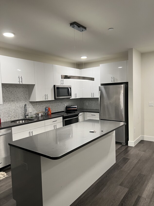
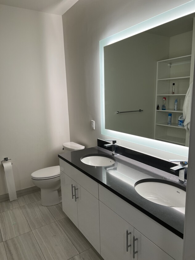
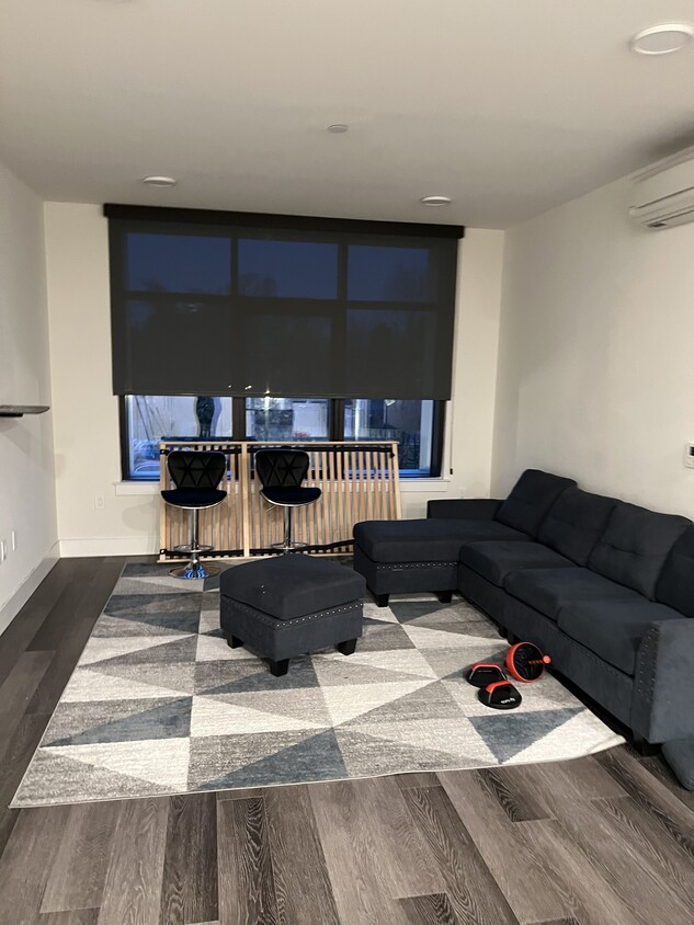
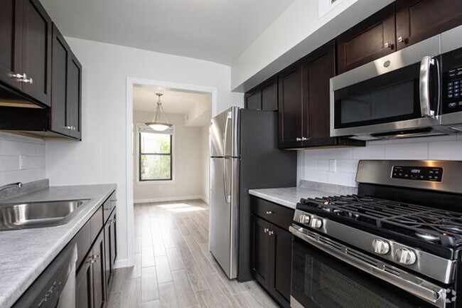
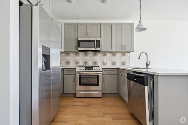
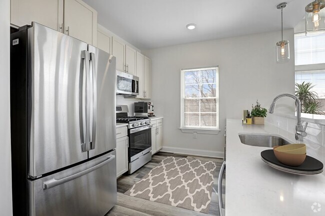
Beautiful, luxury 2 bedroom apartment!
-
-
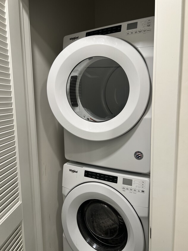
In unit washer and dryer
-
$3,200 / Month
1 Vermella Way Unit 2034
Union, NJ 07083
2 Weeks Ago
Favorites
1 Vermella Way Unit 2034

Favorites
Check Back Soon for Upcoming Availability
| Beds | Baths | Average SF |
|---|---|---|
| 2 Bedrooms 2 Bedrooms 2 Br | 2 Baths 2 Baths 2 Ba | 800 SF |
1 Vermella Way is an apartment community located in Union County and the 07083 ZIP Code.
Apartment Features
- Washer/Dryer
Fees and Policies
The fees below are based on community-supplied data and may exclude additional fees and utilities.
- Parking
-
Garage$100/mo
Property Address:
1 Vermella Way,
Union,
NJ
07083
The large township of Union is a thriving northeastern New Jersey suburb, sitting adjacent to Elizabeth and less than five miles from Newark Liberty International Airport. The majority of the community’s landscape is covered by residential neighborhoods, with lush trees and upscale homes, apartments, and condos lining the streets.
The Downtown area surrounding Morris and Stuyvesant Avenues serves as a major hangout for locals, with everything from specialty shops and unique cafes to the historic Union Theater occupying the cozy storefronts. Kean University on the east end serves around 16,000 students and employs hundreds of locals as faculty and staff members.
Learn more about living in Union
Amenities
- Washer/Dryer
Expenses
Recurring
Unassigned Garage Parking
$100
Education
| Colleges & Universities | Distance | ||
|---|---|---|---|
| Colleges & Universities | Distance | ||
| Walk: | 11 min | 0.6 mi | |
| Drive: | 7 min | 1.9 mi | |
| Drive: | 16 min | 7.4 mi | |
| Drive: | 14 min | 7.6 mi |
1 Vermella Way Unit 2034 is within 11 minutes or 0.6 mile from Kean University. It is also near Union County Coll., Elizabeth and Essex County College.
Transportation options available in Union include Warren Street, located 6.6 miles from 1 Vermella Way Unit 2034. 1 Vermella Way Unit 2034 is near Newark Liberty International, located 8.3 miles or 14 minutes away, and Laguardia, located 27.6 miles or 49 minutes away.
| Transit / Subway | Distance | ||
|---|---|---|---|
| Transit / Subway | Distance | ||
|
|
Drive: | 15 min | 6.6 mi |
|
|
Drive: | 13 min | 7.4 mi |
|
|
Drive: | 14 min | 7.9 mi |
|
|
Drive: | 15 min | 8.2 mi |
|
|
Drive: | 15 min | 8.2 mi |
| Commuter Rail | Distance | ||
|---|---|---|---|
| Commuter Rail | Distance | ||
|
|
Walk: | 7 min | 0.4 mi |
|
|
Drive: | 6 min | 1.8 mi |
|
|
Drive: | 6 min | 2.2 mi |
|
|
Drive: | 9 min | 3.0 mi |
|
|
Drive: | 14 min | 4.9 mi |
| Airports | Distance | ||
|---|---|---|---|
| Airports | Distance | ||
|
Newark Liberty International
|
Drive: | 14 min | 8.3 mi |
|
Laguardia
|
Drive: | 49 min | 27.6 mi |
Time and distance from 1 Vermella Way Unit 2034.
| Shopping Centers | Distance | ||
|---|---|---|---|
| Shopping Centers | Distance | ||
| Walk: | 4 min | 0.3 mi | |
| Drive: | 5 min | 1.3 mi | |
| Drive: | 5 min | 1.6 mi |
1 Vermella Way Unit 2034 has 3 shopping centers within 1.6 miles, which is about a 5-minute walk. The miles and minutes will be for the farthest away property.
| Parks and Recreation | Distance | ||
|---|---|---|---|
| Parks and Recreation | Distance | ||
|
Hawk Rise Sanctuary
|
Drive: | 17 min | 7.0 mi |
|
Greenwood Gardens
|
Drive: | 19 min | 7.2 mi |
|
William Miller Sperry Observatory
|
Drive: | 15 min | 7.3 mi |
|
Newark Museum and Dreyfuss Planetarium
|
Drive: | 14 min | 8.1 mi |
|
G. Thomas DiDomenico Park
|
Drive: | 21 min | 10.6 mi |
1 Vermella Way Unit 2034 has 5 parks within 10.6 miles, including William Miller Sperry Observatory, Newark Museum and Dreyfuss Planetarium, and Hawk Rise Sanctuary.
| Hospitals | Distance | ||
|---|---|---|---|
| Hospitals | Distance | ||
| Drive: | 8 min | 2.4 mi | |
| Drive: | 9 min | 3.3 mi | |
| Drive: | 13 min | 7.4 mi |
1 Vermella Way Unit 2034 has 3 hospitals within 7.4 miles, the nearest is Trinitas Regional Medical Center which is 2.4 miles away and a 8 minute drive.
| Military Bases | Distance | ||
|---|---|---|---|
| Military Bases | Distance | ||
| Drive: | 22 min | 10.4 mi | |
| Drive: | 20 min | 10.8 mi | |
| Drive: | 20 min | 12.2 mi |
1 Vermella Way Unit 2034 has 3 military bases within 12.2 miles, the nearest is Tamdques Reservation which is 10.4 miles away and a 22 minute drive.
You May Also Like
Similar Rentals Nearby


What Are Walk Score®, Transit Score®, and Bike Score® Ratings?
Walk Score® measures the walkability of any address. Transit Score® measures access to public transit. Bike Score® measures the bikeability of any address.
What is a Sound Score Rating?
A Sound Score Rating aggregates noise caused by vehicle traffic, airplane traffic and local sources

1 Vermella Way
Union, NJ 07083