
$2,800 / Month
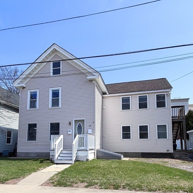
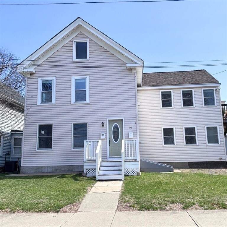
10 Neil St Unit 2
Marlborough, MA 01752
Today
Favorites
508-450-2341
-
Bedrooms
2
-
Bathrooms
1
-
Square Feet
1,076 sq ft
-
Available
Available Now
Highlights
- Medical Services
- Custom Closet System
- Wood Flooring
- Bonus Room
- Jogging Path
- Stainless Steel Appliances
10 Neil St Unit 2

Favorites
About This Home
$2,800 deposit,
Available Now
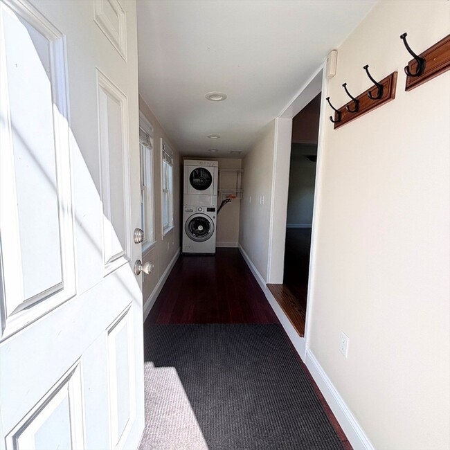
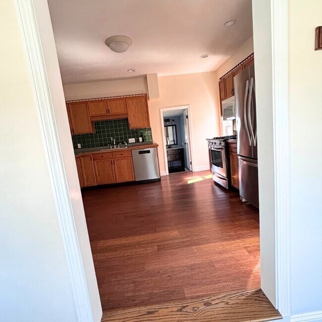
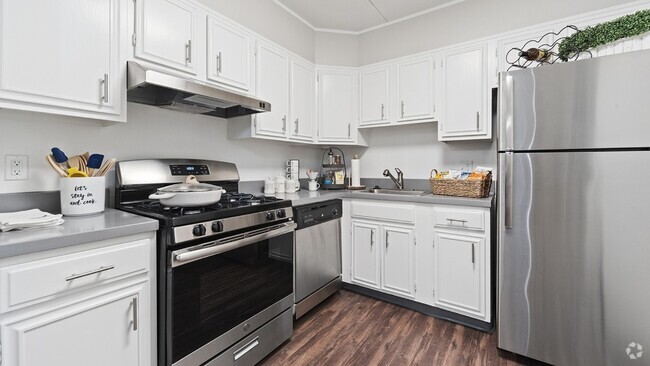
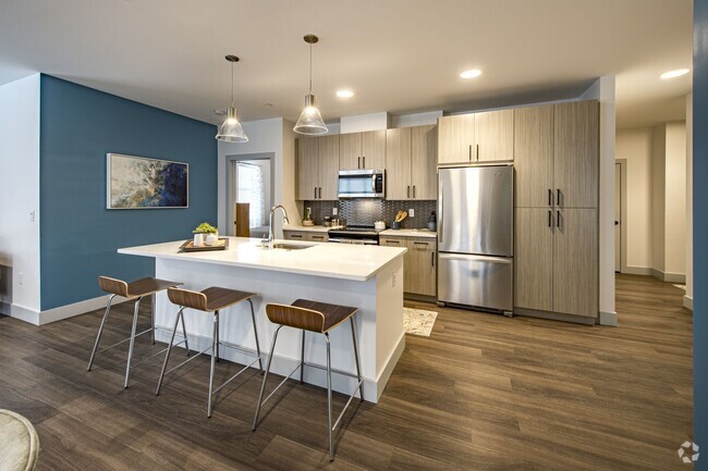
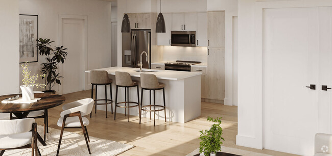
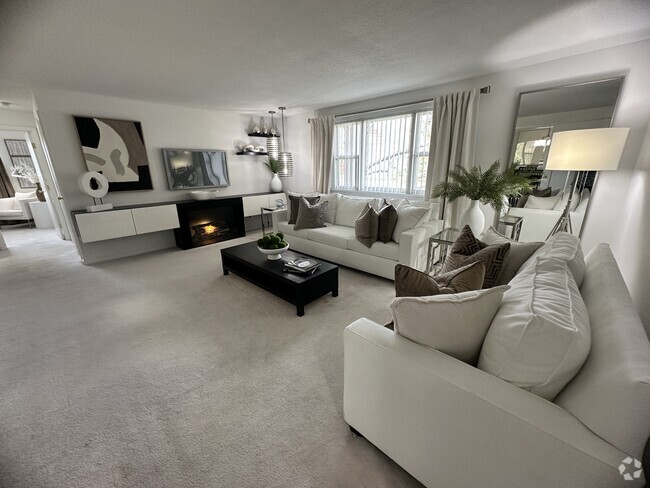
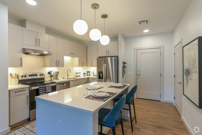
Beautiful,fully renovated 2 bed,1 bath apartment in downtown Marlborough. Features hardwood floors,fresh paint,gas heat,central AC,and a finished attic for bonus living/storage! Enjoy in-unit (FREE) laundry (washer/dryer provided),a modern kitchen with stainless steel appliances and gas stove. Bright living area,common fenced yard with patio. Rent includes snow removal,landscaping,water,and sewer. Extra storage in shed/basement. Walk to downtown amenities!
10 Neil St is an apartment community located in Middlesex County and the 01752 ZIP Code.
* Price shown is base rent and may not include non-optional fees and utilities.
Price, availability, fees, and any applicable rent special are subject to change without notice.
* Square footage definitions vary. Displayed square footage is approximate.
Home Details
Year Built
Built in 1860 | Remodeled
Accessible Home Design
Entry on the 2nd floor
Bedrooms and Bathrooms
Custom Closet System
Bathtub with Shower
Primary bedroom located on second floor
1 Full Bathroom
2 Bedrooms
Flooring
Wood
Carpet
Home Design
Apartment
Interior Spaces
Bonus Room
Recessed Lighting
Dining Area
1,076 Sq Ft Home
Kitchen
Stainless Steel Appliances
Range
Dishwasher
Disposal
Laundry
Dryer
Laundry on main level
Washer
Listing and Financial Details
Security Deposit $2,800
Assessor Parcel Number 614758
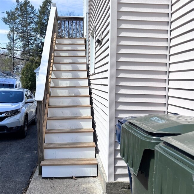
Rent includes water, sewer, snow removal, gardener, extra storage, laundry facilities, parking
Location
Property is near schools
Lot Details
Fenced Yard
Fenced
Outdoor Features
Patio
Outdoor Storage
Parking
2 Car Parking Spaces
Schools
Richer Elementary School
Whitcomb Middle School
Marlborough High School
Utilities
Cooling Available
Heating System Uses Natural Gas
Internet Available
Community Details
Amenities
Medical Services
Shops
Coin Laundry
Common Area
Overview
No Home Owners Association
Pet Policy
No Pets Allowed
Recreation
Jogging Path
Park
Contact
- Listed by Monica Danaher | RE/MAX Executive Realty
- Phone Number
-
Source
 MLS Property Information Network
The property listing data and information set forth herein were provided to MLS Property Information Network, Inc. from third party sources, including sellers, lessors and public records, and were compiled by MLS Property Information Network, Inc. The property listing data and information are for the personal, non-commercial use of consumers having a good faith interest in purchasing or leasing listed properties of the type displayed to them and may not be used for any purpose other than to identify prospective properties which such consumers may have a good faith interest in purchasing or leasing. MLS Property Information Network, Inc. and its subscribers disclaim any and all representations and warranties as to the accuracy of the property listing data and information set forth herein. All properties are subject to prior sale, change or withdrawal. Copyright © 2025 MLS Property Information Network, Inc. All rights reserved.
Location
Get Directions
Amenities
- Dishwasher
- Disposal
- Range
- Refrigerator
- Fenced Lot
- Patio
Just west of Boston and East of Worcester sits Metro West, a region that houses a group of towns and cities with significant historical backgrounds. A total of 19 municipalities make up the core of this community, but other municipalities are considered to be a part of the Interstate 495/Metro West Corridor.
Learn more about living in Metro West
Education
| Colleges & Universities | Distance | ||
|---|---|---|---|
| Colleges & Universities | Distance | ||
| Drive: | 15 min | 8.2 mi | |
| Drive: | 25 min | 13.4 mi | |
| Drive: | 24 min | 16.2 mi | |
| Drive: | 27 min | 18.5 mi |
10 Neil St Unit 2 is within 15 minutes or 8.2 miles from Framingham State College. It is also near Tufts University, Grafton and Stillman College.
Transportation options available in Marlborough include Riverside Station, located 20.1 miles from 10 Neil St Unit 2. 10 Neil St Unit 2 is near Worcester Regional, located 22.7 miles or 35 minutes away, and General Edward Lawrence Logan International, located 33.2 miles or 48 minutes away.
| Transit / Subway | Distance | ||
|---|---|---|---|
| Transit / Subway | Distance | ||
|
|
Drive: | 31 min | 20.1 mi |
|
|
Drive: | 31 min | 20.4 mi |
|
|
Drive: | 32 min | 21.1 mi |
|
|
Drive: | 34 min | 22.7 mi |
|
|
Drive: | 35 min | 22.9 mi |
| Commuter Rail | Distance | ||
|---|---|---|---|
| Commuter Rail | Distance | ||
|
|
Drive: | 13 min | 5.9 mi |
|
|
Drive: | 23 min | 9.7 mi |
|
|
Drive: | 20 min | 10.2 mi |
|
|
Drive: | 21 min | 10.3 mi |
|
|
Drive: | 19 min | 11.6 mi |
| Airports | Distance | ||
|---|---|---|---|
| Airports | Distance | ||
|
Worcester Regional
|
Drive: | 35 min | 22.7 mi |
|
General Edward Lawrence Logan International
|
Drive: | 48 min | 33.2 mi |
Time and distance from 10 Neil St Unit 2.
| Shopping Centers | Distance | ||
|---|---|---|---|
| Shopping Centers | Distance | ||
| Walk: | 6 min | 0.3 mi | |
| Walk: | 19 min | 1.0 mi | |
| Drive: | 3 min | 1.3 mi |
10 Neil St Unit 2 has 3 shopping centers within 1.3 miles, which is about a 3-minute walk. The miles and minutes will be for the farthest away property.
| Parks and Recreation | Distance | ||
|---|---|---|---|
| Parks and Recreation | Distance | ||
|
Felton Conservation Area
|
Drive: | 6 min | 3.0 mi |
|
Cedar Hill and Sawink Farm Reservation
|
Drive: | 11 min | 4.8 mi |
|
Wilfred J. Turenne Wildlife Habitat
|
Drive: | 9 min | 4.9 mi |
|
Memorial Forest
|
Drive: | 11 min | 5.6 mi |
|
Hop Brook Natural Area
|
Drive: | 13 min | 6.3 mi |
10 Neil St Unit 2 has 5 parks within 6.3 miles, including Felton Conservation Area, Cedar Hill and Sawink Farm Reservation, and Wilfred J. Turenne Wildlife Habitat.
| Hospitals | Distance | ||
|---|---|---|---|
| Hospitals | Distance | ||
| Walk: | 20 min | 1.1 mi | |
| Drive: | 18 min | 9.6 mi |
10 Neil St Unit 2 is 1.1 miles from UMass Memorial Healthcare - Marlborough Hospital, and is convenient to other hospitals, including MetroWest Medical Center.
| Military Bases | Distance | ||
|---|---|---|---|
| Military Bases | Distance | ||
| Drive: | 23 min | 13.0 mi |
10 Neil St Unit 2 is 13.0 miles and a 23 minute drive from US Military Reservation.
You May Also Like
Similar Rentals Nearby

What Are Walk Score®, Transit Score®, and Bike Score® Ratings?
Walk Score® measures the walkability of any address. Transit Score® measures access to public transit. Bike Score® measures the bikeability of any address.
What is a Sound Score Rating?
A Sound Score Rating aggregates noise caused by vehicle traffic, airplane traffic and local sources
10 Neil St
Marlborough, MA 01752