$38,000 / Month
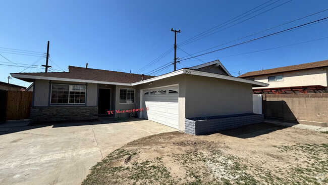
100 Los Altos Dr
Pasadena, CA 91105
2 Weeks Ago
Favorites
100 Los Altos Dr

Favorites
Check Back Soon for Upcoming Availability
| Beds | Baths | Average SF |
|---|---|---|
| 4 Bedrooms 4 Bedrooms 4 Br | 6 Baths 6 Baths 6 Ba | 10,277 SF |
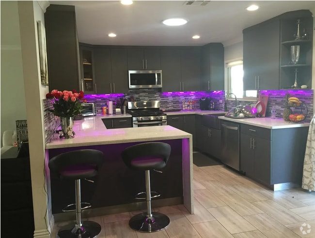
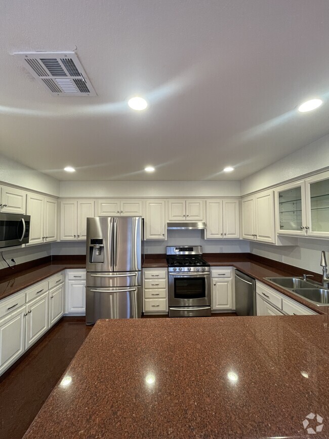
About This Property
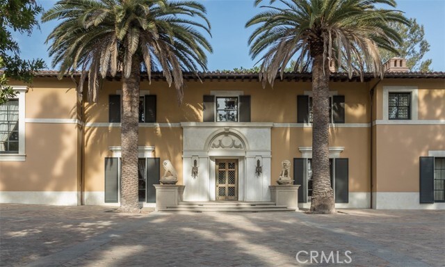
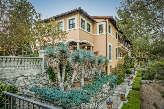
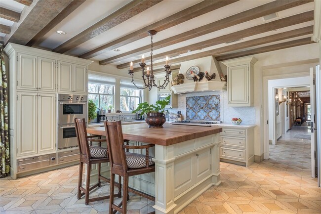
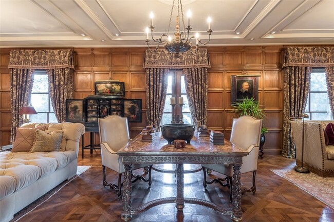
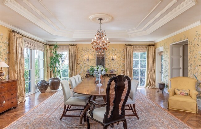
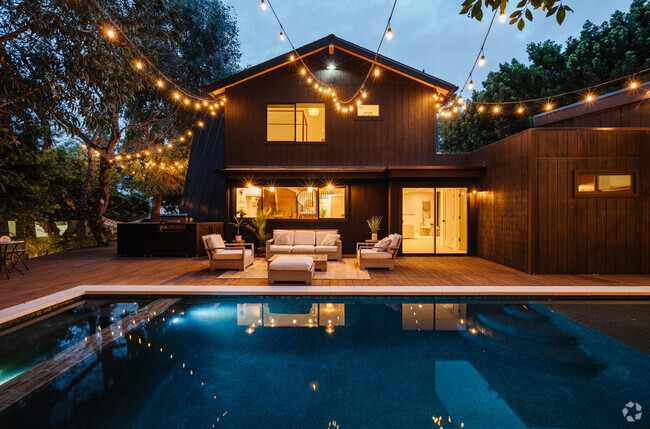
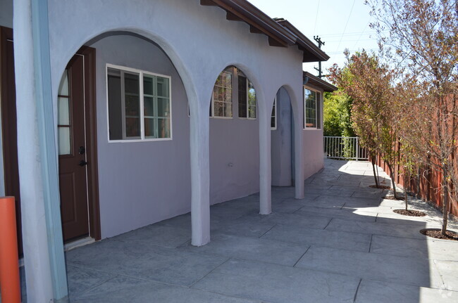
100 Los Altos was built in 1928 by one of Pasadena's most revered historic architects, Myron Hubbard Hunt. Sited on nearly two acres and in a prominent position overlooking the iconic Colorado Street Bridge, the estate is located at the gateway to Pasadena between the Arroyo Seco and Annandale Golf Club. Entering off the private drive, past the iron gates and into the motor court, the grandeur of the architecture is immediately evident in the impressive facade. A solid bronze front door welcomes guests into a dramatic walnut paneled gallery and conveys the old world opulence found throughout.
100 Los Altos Dr is a house located in Los Angeles County and the 91105 ZIP Code. This area is served by the Pasadena Unified attendance zone.
House Features
Air Conditioning
Fireplace
Heating
Views
- Air Conditioning
- Heating
- Fireplace
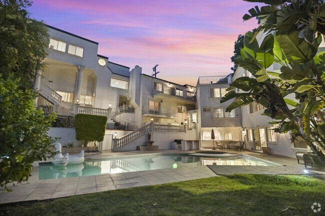
- Views
- Pool
Fees and Policies
The fees below are based on community-supplied data and may exclude additional fees and utilities.
- Dogs Allowed
-
Fees not specified
- Cats Allowed
-
Fees not specified
Location
Get Directions
Nestled in the foothills of the San Gabriel Mountains, the city of Pasadena sits about ten miles northeast of Downtown Los Angeles. Known as the City of Roses, Pasadena hosts the annual Rose Parade, where a variety of floats covered in flowers file through the streets. And to add to the rose theme, Pasadena is also home to Rose Bowl Stadium, which hosts a yearly championship college football game in addition to a monthly flea market.
As a resident of Pasadena, you’ll live near the California Institute of Technology and where Albert Einstein lived while he taught at the university. You can tour NASA’s Jet Propulsion Laboratory, view the vast collection of art at the Norton Simon Museum, and enjoy the festivities at the whimsical Doo Dah Parade. Historic sites are a major attraction in Pasadena.
Learn more about living in PasadenaBelow are rent ranges for similar nearby apartments
Amenities
- Air Conditioning
- Heating
- Fireplace
- Views
- Pool
Education
| Colleges & Universities | Distance | ||
|---|---|---|---|
| Colleges & Universities | Distance | ||
| Drive: | 5 min | 2.6 mi | |
| Drive: | 7 min | 3.2 mi | |
| Drive: | 8 min | 3.2 mi | |
| Drive: | 9 min | 3.9 mi |
100 Los Altos Dr is within 5 minutes or 2.6 miles from Fuller Theological Seminary. It is also near Art Center College of Design and Art Center College of Design.
Schools


Charter Elementary School
Grades K-5
75 Students
Nearby
Public Elementary School
Grades K-5
284 Students
Attendance Zone
Public Middle School
Grades 6-8
513 Students
Attendance Zone
Public High School
Grades 9-12
1,012 Students
Attendance Zone
Private Elementary & Middle School
Grades PK-8
237 Students
Nearby
Private Elementary & Middle School
Grades K-8
153 Students
Nearby
Private Elementary, Middle & High School
Grades 1-12
270 Students
Nearby
School data provided by
 The GreatSchools Rating helps parents compare schools within a state based on a variety of school quality indicators and provides a helpful picture of how effectively each school serves all of its students. Ratings are on a scale of 1 (below average) to 10 (above average) and can include test scores, college readiness, academic progress, advanced courses, equity, discipline and attendance data. We also advise parents to visit schools, consider other information on school performance and programs, and consider family needs as part of the school selection process.
View GreatSchools Rating Methodology
View GreatSchools Rating Methodology
Transportation options available in Pasadena include Memorial Park Station, located 2.0 miles from 100 Los Altos Dr. 100 Los Altos Dr is near Bob Hope, located 15.3 miles or 21 minutes away, and Los Angeles International, located 24.4 miles or 40 minutes away.
| Transit / Subway | Distance | ||
|---|---|---|---|
| Transit / Subway | Distance | ||
|
|
Drive: | 4 min | 2.0 mi |
|
|
Drive: | 5 min | 2.0 mi |
|
|
Drive: | 5 min | 2.6 mi |
|
|
Drive: | 4 min | 2.9 mi |
|
|
Drive: | 7 min | 3.4 mi |
| Commuter Rail | Distance | ||
|---|---|---|---|
| Commuter Rail | Distance | ||
|
|
Drive: | 11 min | 7.8 mi |
|
|
Drive: | 17 min | 9.3 mi |
|
|
Drive: | 19 min | 9.4 mi |
|
|
Drive: | 13 min | 9.9 mi |
| Drive: | 21 min | 13.4 mi |
| Airports | Distance | ||
|---|---|---|---|
| Airports | Distance | ||
|
Bob Hope
|
Drive: | 21 min | 15.3 mi |
|
Los Angeles International
|
Drive: | 40 min | 24.4 mi |
Time and distance from 100 Los Altos Dr.
| Shopping Centers | Distance | ||
|---|---|---|---|
| Shopping Centers | Distance | ||
| Drive: | 3 min | 1.6 mi | |
| Drive: | 5 min | 2.2 mi | |
| Drive: | 5 min | 2.2 mi |
100 Los Altos Dr has 3 shopping centers within 2.2 miles, which is about a 5-minute drive. The miles and minutes will be for the farthest away property.
| Parks and Recreation | Distance | ||
|---|---|---|---|
| Parks and Recreation | Distance | ||
|
Kidspace Children's Museum
|
Drive: | 4 min | 1.8 mi |
|
Jet Propulsion Laboratory
|
Drive: | 7 min | 4.4 mi |
|
Audubon Center at Debs Park
|
Drive: | 11 min | 5.4 mi |
|
Huntington Botanical Gardens
|
Drive: | 11 min | 5.5 mi |
|
Elyria Canyon Park
|
Drive: | 13 min | 7.6 mi |
100 Los Altos Dr has 5 parks within 7.6 miles, including Kidspace Children's Museum, Jet Propulsion Laboratory, and Audubon Center at Debs Park.
| Hospitals | Distance | ||
|---|---|---|---|
| Hospitals | Distance | ||
| Drive: | 5 min | 2.5 mi | |
| Drive: | 8 min | 4.4 mi | |
| Drive: | 9 min | 5.8 mi |
100 Los Altos Dr has 3 hospitals within 5.8 miles, the nearest is Huntington Memorial Hospital which is 2.5 miles away and a 5 minute drive.
| Military Bases | Distance | ||
|---|---|---|---|
| Military Bases | Distance | ||
| Drive: | 37 min | 26.0 mi | |
| Drive: | 48 min | 31.1 mi |
100 Los Altos Dr is 26.0 miles from Los Angeles Air Force Base, and is convenient to other military bases, including Los Alamitos Army Airfield.
You May Also Like
Similar Rentals Nearby


What Are Walk Score®, Transit Score®, and Bike Score® Ratings?
Walk Score® measures the walkability of any address. Transit Score® measures access to public transit. Bike Score® measures the bikeability of any address.
What is a Sound Score Rating?
A Sound Score Rating aggregates noise caused by vehicle traffic, airplane traffic and local sources

100 Los Altos Dr
Pasadena, CA 91105