

$1,350 / Month
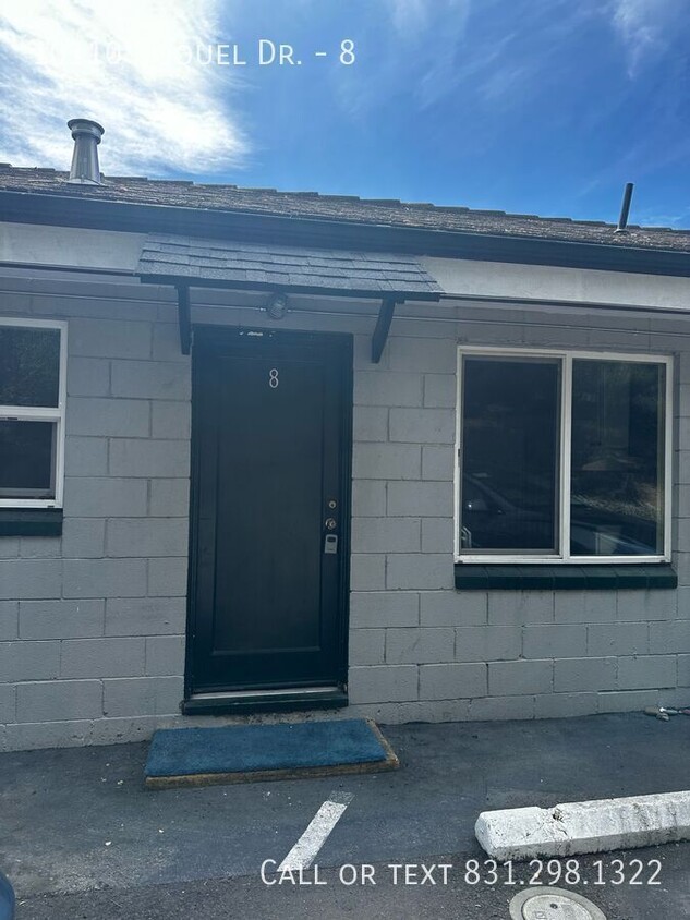
10110 Soquel Dr Unit 8
Aptos, CA 95003
Today
Favorites
831-298-1322
-
Bedrooms
1
-
Bathrooms
1
-
Square Feet
--
-
Available
Available Now
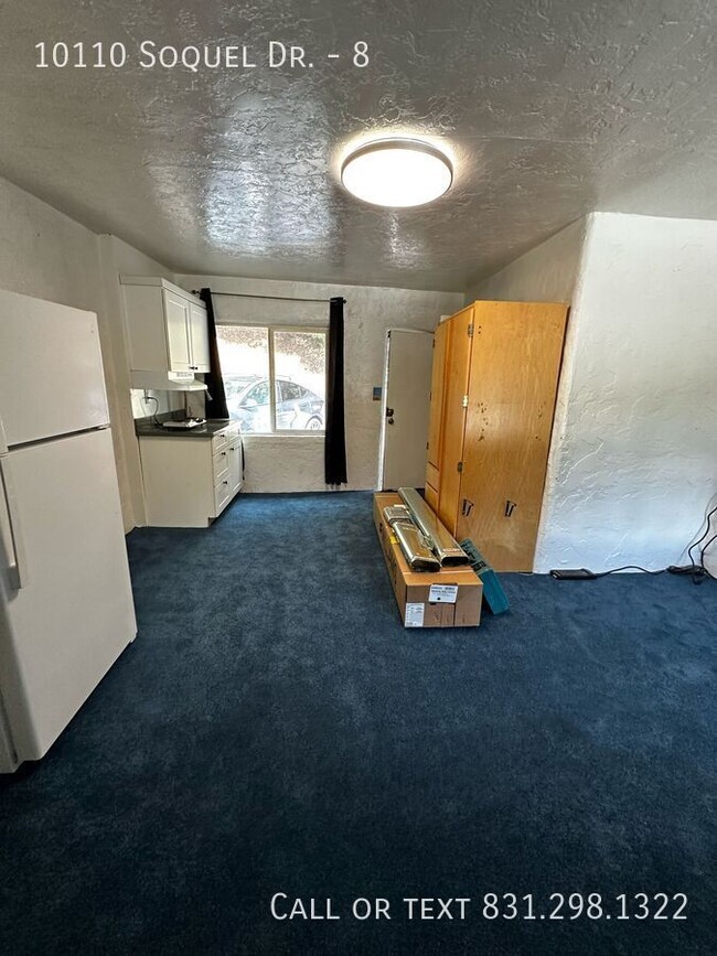
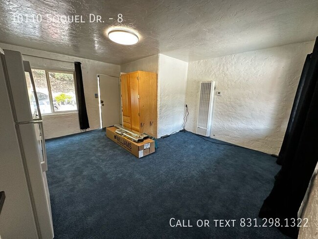
10110 Soquel Dr Unit 8

Favorites
About This Home
Available Now
---- SCHEDULE A SHOWING ONLINE AT: ---- *One-year lease. No cosigners. 690+ credit score. No pets. No smoking. This cozy studio has 1 bedroom and 1 bathroom and is conveniently located near major roads, offering easy access to transportation, with restaurants and bars just steps away.
10110 Soquel Dr is an apartment community located in Santa Cruz County and the 95003 ZIP Code.
* Price shown is base rent and may not include non-optional fees and utilities.
Price, availability, fees, and any applicable rent special are subject to change without notice.
* Square footage definitions vary. Displayed square footage is approximate.
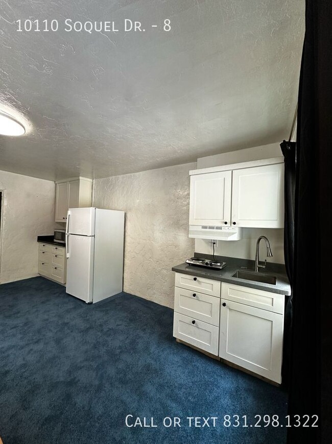
Features
- Microwave
- Refrigerator
Fees and Policies
Contact
- Listed by Logan
- Phone Number
- Contact
Location
Get Directions
Amenities
- Microwave
- Refrigerator
Overlooking Monterey Bay and home to the gorgeous Seacliff State Beach, Aptos provides amazing ocean views -- or the forest if you prefer, bordered on northeast side by the Forest of Nisene Marks State Park. This redwood forest begins at sea level and extends into the coastal mountains, providing 30 miles of hiking trails. The park is also terrific for camping, picnicking, and wildlife viewing.
At the other side of Aptos, Seacliff State Beach is perfect for surfing, beachcombing, swimming, and fishing. It also features a fishing pier with an unusual feature -- a concrete ship named the SS Palo Alto, a WWI ship that was built toward the end of the war -- too late for use. It was towed to its current location and allowed to sink where it now serves as an artificial reef. Aptos is located about seven miles east of Santa Cruz and roughly one hour south of San Jose.
Learn more about living in Aptos
Education
| Colleges & Universities | Distance | ||
|---|---|---|---|
| Colleges & Universities | Distance | ||
| Drive: | 6 min | 3.8 mi | |
| Drive: | 24 min | 14.1 mi | |
| Drive: | 45 min | 31.7 mi | |
| Drive: | 47 min | 32.6 mi |
10110 Soquel Dr Unit 8 is within 6 minutes or 3.8 miles from Cabrillo College. It is also near UC Santa Cruz and Gavilan College, Gilroy.
Transportation options available in Aptos include Ohlone/Chynoweth Station, located 37.1 miles from 10110 Soquel Dr Unit 8. 10110 Soquel Dr Unit 8 is near Monterey Regional, located 34.0 miles or 42 minutes away, and Norman Y Mineta San Jose International, located 39.6 miles or 52 minutes away.
| Transit / Subway | Distance | ||
|---|---|---|---|
| Transit / Subway | Distance | ||
|
|
Drive: | 50 min | 37.1 mi |
|
|
Drive: | 50 min | 37.9 mi |
|
|
Drive: | 55 min | 40.6 mi |
|
|
Drive: | 53 min | 41.1 mi |
|
|
Drive: | 55 min | 42.2 mi |
| Commuter Rail | Distance | ||
|---|---|---|---|
| Commuter Rail | Distance | ||
| Drive: | 43 min | 25.9 mi | |
| Drive: | 48 min | 29.4 mi | |
| Drive: | 52 min | 30.0 mi | |
| Drive: | 53 min | 39.8 mi | |
| Drive: | 54 min | 40.0 mi |
| Airports | Distance | ||
|---|---|---|---|
| Airports | Distance | ||
|
Monterey Regional
|
Drive: | 42 min | 34.0 mi |
|
Norman Y Mineta San Jose International
|
Drive: | 52 min | 39.6 mi |
Time and distance from 10110 Soquel Dr Unit 8.
| Shopping Centers | Distance | ||
|---|---|---|---|
| Shopping Centers | Distance | ||
| Drive: | 3 min | 1.2 mi | |
| Drive: | 3 min | 1.7 mi | |
| Drive: | 3 min | 1.8 mi |
10110 Soquel Dr Unit 8 has 3 shopping centers within 1.8 miles, which is about a 3-minute drive. The miles and minutes will be for the farthest away property.
| Parks and Recreation | Distance | ||
|---|---|---|---|
| Parks and Recreation | Distance | ||
|
Seacliff State Beach
|
Drive: | 7 min | 3.4 mi |
|
The Forest of Nisene Marks State Park
|
Drive: | 11 min | 3.9 mi |
|
Manresa State Beach
|
Drive: | 10 min | 4.9 mi |
|
New Brighton State Beach
|
Drive: | 10 min | 5.1 mi |
|
Sunset State Beach
|
Drive: | 19 min | 8.6 mi |
10110 Soquel Dr Unit 8 has 5 parks within 8.6 miles, including Seacliff State Beach, The Forest of Nisene Marks State Park, and New Brighton State Beach.
| Hospitals | Distance | ||
|---|---|---|---|
| Hospitals | Distance | ||
| Drive: | 8 min | 6.2 mi | |
| Drive: | 8 min | 6.9 mi | |
| Drive: | 9 min | 7.3 mi |
10110 Soquel Dr Unit 8 has 3 hospitals within 7.3 miles, the nearest is Watsonville Community Hospital which is 6.2 miles away and a 8 minute drive.
| Military Bases | Distance | ||
|---|---|---|---|
| Military Bases | Distance | ||
| Drive: | 44 min | 34.3 mi | |
| Drive: | 49 min | 36.6 mi |
10110 Soquel Dr Unit 8 is 34.3 miles from Presidio of Monterey, and is convenient to other military bases, including Coast Guard Facilities.
You May Also Like
Similar Rentals Nearby


What Are Walk Score®, Transit Score®, and Bike Score® Ratings?
Walk Score® measures the walkability of any address. Transit Score® measures access to public transit. Bike Score® measures the bikeability of any address.
What is a Sound Score Rating?
A Sound Score Rating aggregates noise caused by vehicle traffic, airplane traffic and local sources
10110 Soquel Dr
Aptos, CA 95003