1015 NW 42nd St
Miami, FL 33127
-
Bedrooms
3
-
Bathrooms
2
-
Square Feet
1,400 sq ft
-
Available
Available Now
Highlights
- Pets Allowed
- Yard
- Den

About This Home
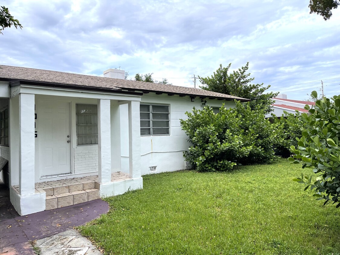
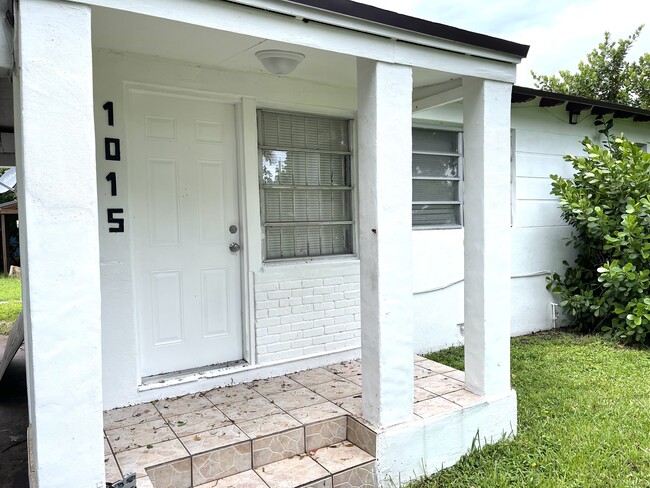
LARGE VERY COMFORTABLE 3 BEDROOMS 2 BATHROOMS HOUSE IN THE HEART OF MIDTOWN MIAMI! LARGE FRONT AND BACK YARDS, COVERED PARKING AND PLENTY OF ADDITIONAL PARKING SPACE, DRIVEWAY ENTRY, REMODELED, CENTRAL A/C, TILE FLOORS, NEW KITCHEN, LAUNDRY AREA, GAZEBO IN BACK YARD. LIVING ROOM, DEN KITCHEN AND 3 BEDROOMS MAKE THIS A GRET HOME CLOSE TO DOWNTOWN MIAMI, WYNWOOD, DESIGN DISTRICT, MIAMI INTERNATIONAL AIRPORT AND MORE!
1015 NW 42nd St is a house located in Miami/Dade County and the 33127 ZIP Code. This area is served by the Miami-Dade County Public Schools attendance zone.
House Features
Air Conditioning
Washer/Dryer Hookup
Tub/Shower
Tile Floors
- Washer/Dryer Hookup
- Air Conditioning
- Ceiling Fans
- Cable Ready
- Storage Space
- Tub/Shower
- Kitchen
- Tile Floors
- Den
- Yard
Fees and Policies
The fees below are based on community-supplied data and may exclude additional fees and utilities.
- Dogs Allowed
-
Fees not specified
- Cats Allowed
-
Fees not specified
- Parking
-
Covered--
Contact
- Phone Number
Liberty City is a Miami neighborhood on the rise that’s just six miles north of downtown. Here, you’ll find a hardworking, close-knit community that enjoys a slightly lower cost of living than the rest of the Miami area to the south. The neighborhood’s location directly west of Interstate 95 makes it convenient for the commuting crowd. A vibrant dining scene can be found in Liberty City. Creole food, Jamaican food, seafood, Thai, and so much more makes this area an unsung foodie’s hotspot. With Downtown Miami so close, living in Liberty City puts you close to all the action without the bigger price tags of living closer to the dazzling beaches.
Learn more about living in Liberty City| Colleges & Universities | Distance | ||
|---|---|---|---|
| Colleges & Universities | Distance | ||
| Drive: | 3 min | 1.4 mi | |
| Drive: | 5 min | 2.0 mi | |
| Drive: | 7 min | 3.1 mi | |
| Drive: | 9 min | 3.8 mi |
 The GreatSchools Rating helps parents compare schools within a state based on a variety of school quality indicators and provides a helpful picture of how effectively each school serves all of its students. Ratings are on a scale of 1 (below average) to 10 (above average) and can include test scores, college readiness, academic progress, advanced courses, equity, discipline and attendance data. We also advise parents to visit schools, consider other information on school performance and programs, and consider family needs as part of the school selection process.
View GreatSchools Rating Methodology
Transportation options available in Miami include School Board, located 2.9 miles from 1015 NW 42nd St. 1015 NW 42nd St is near Miami International, located 8.3 miles or 19 minutes away, and Fort Lauderdale/Hollywood International, located 20.5 miles or 30 minutes away.
| Transit / Subway | Distance | ||
|---|---|---|---|
| Transit / Subway | Distance | ||
|
|
Drive: | 6 min | 2.9 mi |
|
|
Drive: | 7 min | 3.2 mi |
|
|
Drive: | 7 min | 3.4 mi |
|
|
Drive: | 8 min | 3.5 mi |
|
|
Drive: | 8 min | 3.6 mi |
| Commuter Rail | Distance | ||
|---|---|---|---|
| Commuter Rail | Distance | ||
|
|
Walk: | 11 min | 0.6 mi |
|
|
Drive: | 4 min | 1.7 mi |
|
|
Drive: | 5 min | 2.0 mi |
|
|
Drive: | 5 min | 2.6 mi |
|
|
Drive: | 7 min | 3.6 mi |
| Airports | Distance | ||
|---|---|---|---|
| Airports | Distance | ||
|
Miami International
|
Drive: | 19 min | 8.3 mi |
|
Fort Lauderdale/Hollywood International
|
Drive: | 30 min | 20.5 mi |
Time and distance from 1015 NW 42nd St.
| Shopping Centers | Distance | ||
|---|---|---|---|
| Shopping Centers | Distance | ||
| Walk: | 15 min | 0.8 mi | |
| Drive: | 3 min | 1.5 mi | |
| Drive: | 4 min | 1.5 mi |
| Parks and Recreation | Distance | ||
|---|---|---|---|
| Parks and Recreation | Distance | ||
|
Miami Children's Museum
|
Drive: | 10 min | 4.9 mi |
|
Jungle Island
|
Drive: | 11 min | 5.2 mi |
|
Miami Science Museum - Closed
|
Drive: | 12 min | 5.6 mi |
|
Vizcaya Museum and Gardens
|
Drive: | 14 min | 5.8 mi |
|
Virginia Key Beach and Park
|
Drive: | 17 min | 8.4 mi |
| Hospitals | Distance | ||
|---|---|---|---|
| Hospitals | Distance | ||
| Drive: | 4 min | 1.9 mi | |
| Drive: | 4 min | 2.0 mi | |
| Drive: | 7 min | 4.1 mi |
- Washer/Dryer Hookup
- Air Conditioning
- Ceiling Fans
- Cable Ready
- Storage Space
- Tub/Shower
- Kitchen
- Tile Floors
- Den
- Yard
1015 NW 42nd St Photos
What Are Walk Score®, Transit Score®, and Bike Score® Ratings?
Walk Score® measures the walkability of any address. Transit Score® measures access to public transit. Bike Score® measures the bikeability of any address.
What is a Sound Score Rating?
A Sound Score Rating aggregates noise caused by vehicle traffic, airplane traffic and local sources


