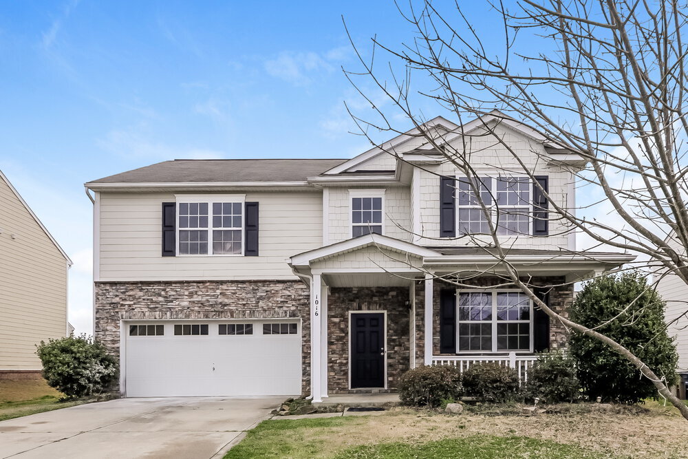
1016 Yellow Bee Rd
Indian Trail, NC 28079
-
Bedrooms
4
-
Bathrooms
3
-
Square Feet
2,611 sq ft
-
Available
Available Apr 3
Highlight
- Pets Allowed
About This Home
Please note, our homes are available on a first-come, first-serve basis and are not reserved until the holding fee agreement is signed and the holding fee is paid by the primary applicant. This home features Progress Smart Home - Progress Residential's smart home app, which allows you to control the home securely from any of your devices. Learn more at This home is priced to rent and won't be around for long. Apply now, while we make this home ready for you, or call to arrange a meeting with your local Progress Residential leasing specialist today. Interested in this home? You clearly have exceptional taste. Like all our homes, this one features: a great location in a desirable neighborhood, a comfortable layout with good-sized bedrooms and bathrooms, a great kitchen with plenty of counter and cabinet space, many updated and upgraded features, central HVAC and programmable thermostat, garage and a spacious yard, and it's pet friendly. Call or click to schedule a tour or submit your application online at today! At Progress Residential® we're here to serve you and make your time in the home as convenient as possible. We offer: a safe and secure online portal where you can place maintenance requests and pay online, multiple payment options, 24/7 Emergency maintenance response team available even on weekends, and well-maintained homes with regular preventative maintenance. Utilities must be transferred into the resident’s name.
1016 Yellow Bee Rd is a house located in Union County and the 28079 ZIP Code. This area is served by the Union County Public attendance zone.
Contact
- Phone Number (833) 252-8444
- Website View Property Website
- Contact
-
Source

Indian Trail is filled with residential areas and open land in North Carolina with relatively affordable apartment and condo rentals. Located just 16 miles southeast of Charlotte, Indian Trail’s residents enjoy a calm lifestyle while still having a quick commute to all of Charlotte’s major attractions.
Great schools reside in this area, such as Indian Trail Elementary School and Sun Valley High School, zoned into Union County Public Schools. Indian Trail offers community parks, grocery stores, a variety of restaurants, and an upscale multiplex theater. Experience local eats at the Trail House, one of the best local restaurants in Indian Trail with a wide range of menu items. This spot has something for everyone with a lively atmosphere and outdoor patio.
Learn more about living in Indian Trail| Colleges & Universities | Distance | ||
|---|---|---|---|
| Colleges & Universities | Distance | ||
| Drive: | 16 min | 8.4 mi | |
| Drive: | 22 min | 14.7 mi | |
| Drive: | 31 min | 17.5 mi | |
| Drive: | 33 min | 22.0 mi |
Transportation options available in Indian Trail include Hawthorne Ln & 8Th St Citylynx, located 19.7 miles from 1016 Yellow Bee Rd. 1016 Yellow Bee Rd is near Concord-Padgett Regional, located 25.8 miles or 36 minutes away, and Charlotte/Douglas International, located 28.0 miles or 44 minutes away.
| Transit / Subway | Distance | ||
|---|---|---|---|
| Transit / Subway | Distance | ||
| Drive: | 28 min | 19.7 mi | |
| Drive: | 28 min | 19.7 mi | |
| Drive: | 29 min | 19.9 mi | |
| Drive: | 29 min | 19.9 mi | |
| Drive: | 32 min | 21.2 mi |
| Commuter Rail | Distance | ||
|---|---|---|---|
| Commuter Rail | Distance | ||
|
|
Drive: | 31 min | 21.2 mi |
| Drive: | 49 min | 36.4 mi | |
|
|
Drive: | 57 min | 41.6 mi |
| Airports | Distance | ||
|---|---|---|---|
| Airports | Distance | ||
|
Concord-Padgett Regional
|
Drive: | 36 min | 25.8 mi |
|
Charlotte/Douglas International
|
Drive: | 44 min | 28.0 mi |
Time and distance from 1016 Yellow Bee Rd.
| Shopping Centers | Distance | ||
|---|---|---|---|
| Shopping Centers | Distance | ||
| Drive: | 9 min | 4.5 mi | |
| Drive: | 9 min | 4.8 mi | |
| Drive: | 9 min | 4.9 mi |
| Parks and Recreation | Distance | ||
|---|---|---|---|
| Parks and Recreation | Distance | ||
|
Fred Kirby Park
|
Drive: | 8 min | 4.1 mi |
|
Blair Mills Park
|
Drive: | 13 min | 6.6 mi |
|
Stallings Municipal Park
|
Drive: | 14 min | 8.0 mi |
|
Mint Hill Veteran's Park
|
Drive: | 14 min | 8.2 mi |
|
Campbell Creek Greenway
|
Drive: | 19 min | 12.8 mi |
| Hospitals | Distance | ||
|---|---|---|---|
| Hospitals | Distance | ||
| Drive: | 19 min | 11.7 mi |
| Military Bases | Distance | ||
|---|---|---|---|
| Military Bases | Distance | ||
| Drive: | 147 min | 98.4 mi |
You May Also Like
What Are Walk Score®, Transit Score®, and Bike Score® Ratings?
Walk Score® measures the walkability of any address. Transit Score® measures access to public transit. Bike Score® measures the bikeability of any address.
What is a Sound Score Rating?
A Sound Score Rating aggregates noise caused by vehicle traffic, airplane traffic and local sources

1016 Yellow Bee Rd
Indian Trail, NC 28079