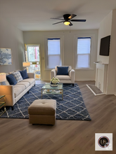
102 Cedar Ave / Month
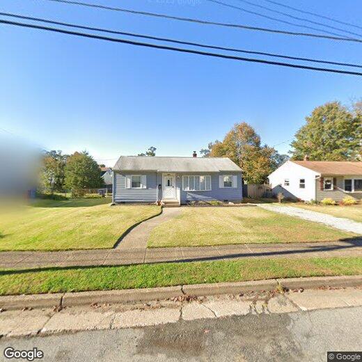
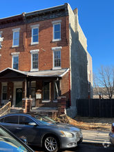
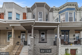
102 Cedar Ave
Somerdale, NJ 08083
2 Weeks Ago
Favorites
102 Cedar Ave

Favorites
Check Back Soon for Upcoming Availability
Property Address:
102 Cedar Ave,
Somerdale,
NJ
08083
Roughly 34 miles southwest of Trenton and 12 miles southeast of Philadelphia, Somerdale provides fast access to a wide variety of history, attractions, theaters, and museums. Minutes from the Philadelphia International Airport, Clementon Park and Splash World, Adventure Aquarium, and several golf courses, Somerdale is considered the "Crossroads of South Jersey."
Consisting of tree-filled neighborhoods lined with single-family homes on large lots, Somerdale offers a much more rural feel than many of its neighboring suburbs. White Horse Pike, which runs the length of the neighborhood and beyond, offers a variety of shops, restaurants, and specialty stores. Mores shops and restaurants are available just outside the borough at Voorhees Town Center and Eagle Plaza.
Learn more about living in Somerdale
Education
| Colleges & Universities | Distance | ||
|---|---|---|---|
| Colleges & Universities | Distance | ||
| Drive: | 11 min | 5.8 mi | |
| Drive: | 18 min | 10.3 mi | |
| Drive: | 16 min | 11.3 mi | |
| Drive: | 16 min | 11.7 mi |
102 Cedar Ave is within 11 minutes or 5.8 miles from Camden Co. Coll., Blackwood. It is also near Gloucester County College and Camden Co. Coll., Camden City.
Transportation options available in Somerdale include Lindenwold (Patco), located 1.9 miles from 102 Cedar Ave. 102 Cedar Ave is near Philadelphia International, located 17.6 miles or 29 minutes away, and Trenton Mercer, located 41.4 miles or 57 minutes away.
| Transit / Subway | Distance | ||
|---|---|---|---|
| Transit / Subway | Distance | ||
|
|
Drive: | 3 min | 1.9 mi |
|
|
Drive: | 4 min | 2.1 mi |
|
|
Drive: | 7 min | 3.3 mi |
|
|
Drive: | 7 min | 4.4 mi |
|
|
Drive: | 9 min | 5.7 mi |
| Commuter Rail | Distance | ||
|---|---|---|---|
| Commuter Rail | Distance | ||
|
|
Drive: | 3 min | 1.8 mi |
|
|
Drive: | 12 min | 7.6 mi |
|
|
Drive: | 12 min | 8.8 mi |
| Drive: | 19 min | 11.2 mi | |
|
|
Drive: | 20 min | 13.7 mi |
| Airports | Distance | ||
|---|---|---|---|
| Airports | Distance | ||
|
Philadelphia International
|
Drive: | 29 min | 17.6 mi |
|
Trenton Mercer
|
Drive: | 57 min | 41.4 mi |
Time and distance from 102 Cedar Ave.
| Shopping Centers | Distance | ||
|---|---|---|---|
| Shopping Centers | Distance | ||
| Walk: | 7 min | 0.4 mi | |
| Walk: | 10 min | 0.5 mi | |
| Walk: | 12 min | 0.6 mi |
102 Cedar Ave has 3 shopping centers within 0.6 mile, which is about a 12-minute walk. The miles and minutes will be for the farthest away property.
| Parks and Recreation | Distance | ||
|---|---|---|---|
| Parks and Recreation | Distance | ||
|
Downs Farms Trails
|
Drive: | 5 min | 2.8 mi |
|
Kresson Nature Trails
|
Drive: | 9 min | 4.5 mi |
|
Croft Farm Nature Trail
|
Drive: | 9 min | 5.4 mi |
|
Erlton North Trails
|
Drive: | 11 min | 7.0 mi |
|
Barclay Farmstead Nature Trail
|
Drive: | 13 min | 7.4 mi |
102 Cedar Ave has 5 parks within 7.4 miles, including Downs Farms Trails, Croft Farm Nature Trail, and Kresson Nature Trails.
| Hospitals | Distance | ||
|---|---|---|---|
| Hospitals | Distance | ||
| Drive: | 2 min | 1.6 mi | |
| Drive: | 12 min | 6.2 mi | |
| Drive: | 15 min | 7.1 mi |
102 Cedar Ave has 3 hospitals within 7.1 miles, the nearest is Jefferson Stratford Hospital which is 1.6 miles away and a 2 minutes drive.
| Military Bases | Distance | ||
|---|---|---|---|
| Military Bases | Distance | ||
| Drive: | 19 min | 12.7 mi |
102 Cedar Ave is 12.7 miles and a 19 minutes from Philadelphia Naval Busi Center.
You May Also Like
Similar Rentals Nearby
-
-
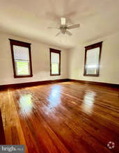
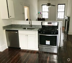
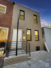 $1,8752 Beds, 1 Bath, 1,084 sq ftHouse for Rent
 -
-
-
-
-
 $1,4003 Beds, 1 Bath, 1,040 sq ftHouse for Rent
 -
-
 $2,1003 Beds, 2.5 Baths, 1,700 sq ftHouse for Rent
 -

What Are Walk Score®, Transit Score®, and Bike Score® Ratings?
Walk Score® measures the walkability of any address. Transit Score® measures access to public transit. Bike Score® measures the bikeability of any address.
What is a Sound Score Rating?
A Sound Score Rating aggregates noise caused by vehicle traffic, airplane traffic and local sources