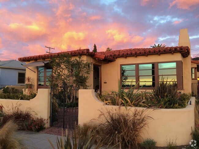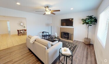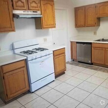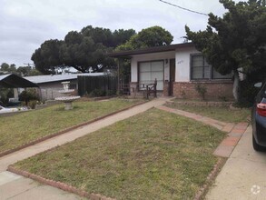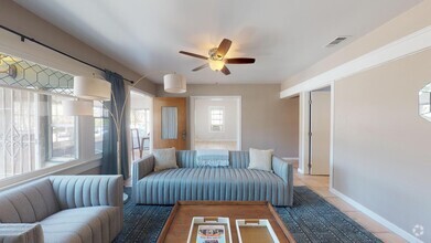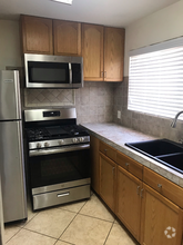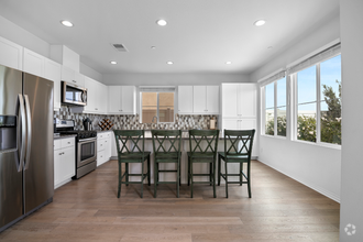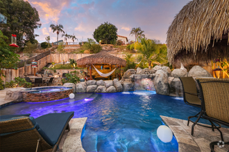

Check Back Soon for Upcoming Availability
 This Property
 Available Property
Stretching from Silver Strand State Beach to the mountains of the Otay Open Space Preserve, Chula Vista lives up to its name, which is Spanish for “beautiful view.” In between the Pacific coast and the mountains, you’ll discover hills, canyons, and miles of hiking trails. This city celebrates its diversity and its history, which dates back before Spanish exploration in the 1500s. The area that is now Chula Vista was part of a land grant in 1795, and eventually became a part of the US (with the rest of California) in the mid-1800s. The city finally incorporated in 1911.
Lemons play a role in Chula Vista’s history, as it became the world’s lemon-growing hub in the late 1800s and is still known as the “Lemon Capital of the World.” While you likely won’t find too many lemon trees today, you will discover more than 60 beautiful parks and a variety of outdoor activities ranging from swimming and surfing to hiking and mountain biking.
Learn more about living in Chula Vista| Colleges & Universities | Distance | ||
|---|---|---|---|
| Colleges & Universities | Distance | ||
| Drive: | 15 min | 6.6 mi | |
| Drive: | 12 min | 9.5 mi | |
| Drive: | 14 min | 9.9 mi | |
| Drive: | 14 min | 10.6 mi |
Transportation options available in Chula Vista include Palomar Street, located 1.0 miles from 1030 Jefferson Ave. 1030 Jefferson Ave is near San Diego International, located 13.1 miles or 18 minutes away.
| Transit / Subway | Distance | ||
|---|---|---|---|
| Transit / Subway | Distance | ||
|
|
Walk: | 18 min | 1.0 mi |
|
|
Drive: | 4 min | 2.0 mi |
|
|
Drive: | 4 min | 2.4 mi |
|
|
Drive: | 6 min | 3.1 mi |
|
|
Drive: | 7 min | 3.6 mi |
| Commuter Rail | Distance | ||
|---|---|---|---|
| Commuter Rail | Distance | ||
|
|
Drive: | 16 min | 10.6 mi |
|
|
Drive: | 18 min | 13.7 mi |
|
|
Drive: | 31 min | 25.3 mi |
|
|
Drive: | 40 min | 32.5 mi |
|
|
Drive: | 44 min | 36.1 mi |
| Airports | Distance | ||
|---|---|---|---|
| Airports | Distance | ||
|
San Diego International
|
Drive: | 18 min | 13.1 mi |
Time and distance from 1030 Jefferson Ave.
| Shopping Centers | Distance | ||
|---|---|---|---|
| Shopping Centers | Distance | ||
| Walk: | 4 min | 0.3 mi | |
| Walk: | 5 min | 0.3 mi | |
| Walk: | 7 min | 0.4 mi |
| Parks and Recreation | Distance | ||
|---|---|---|---|
| Parks and Recreation | Distance | ||
|
Otay Valley Regional Park
|
Drive: | 4 min | 2.2 mi |
|
Living Coast Discovery Center
|
Drive: | 5 min | 2.6 mi |
|
San Diego Bay National Wildlife Refuge
|
Drive: | 8 min | 3.4 mi |
|
Tijuana River National Estuarine Research Reserve
|
Drive: | 11 min | 5.3 mi |
|
Tijuana Slough National Wildlife Refuge
|
Drive: | 11 min | 5.3 mi |
| Hospitals | Distance | ||
|---|---|---|---|
| Hospitals | Distance | ||
| Drive: | 9 min | 4.8 mi | |
| Drive: | 11 min | 7.6 mi | |
| Drive: | 13 min | 10.0 mi |
| Military Bases | Distance | ||
|---|---|---|---|
| Military Bases | Distance | ||
| Drive: | 8 min | 5.1 mi | |
| Drive: | 19 min | 13.6 mi |
You May Also Like
Similar Rentals Nearby
-
-
-
$2,8953 Beds, 1 Bath, 1,044 sq ftHouse for Rent
-
-
-
-
$4,9952 Beds, 2 Baths, 1,200 sq ftHouse for Rent
-
$8,5004 Beds, 4 Baths, 2,496 sq ftHouse for Rent
-
$7,2006 Beds, 3.5 Baths, 2,741 sq ftHouse for Rent
-
$4,5002 Beds, 2 Baths, 1,100 sq ftHouse for Rent
What Are Walk Score®, Transit Score®, and Bike Score® Ratings?
Walk Score® measures the walkability of any address. Transit Score® measures access to public transit. Bike Score® measures the bikeability of any address.
What is a Sound Score Rating?
A Sound Score Rating aggregates noise caused by vehicle traffic, airplane traffic and local sources

