
$1,400 / Month
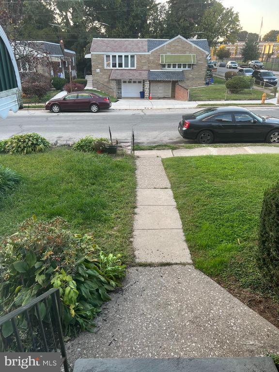
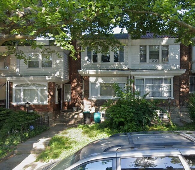
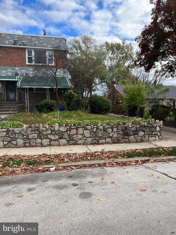
1036 E Gorgas Ln
Philadelphia, PA 19150
Today
Favorites
215-848-6030
-
Bedrooms
2
-
Bathrooms
1
-
Square Feet
--
-
Available
Available Now
Highlight
- Basement
1036 E Gorgas Ln

Favorites
About This Home
Available Now
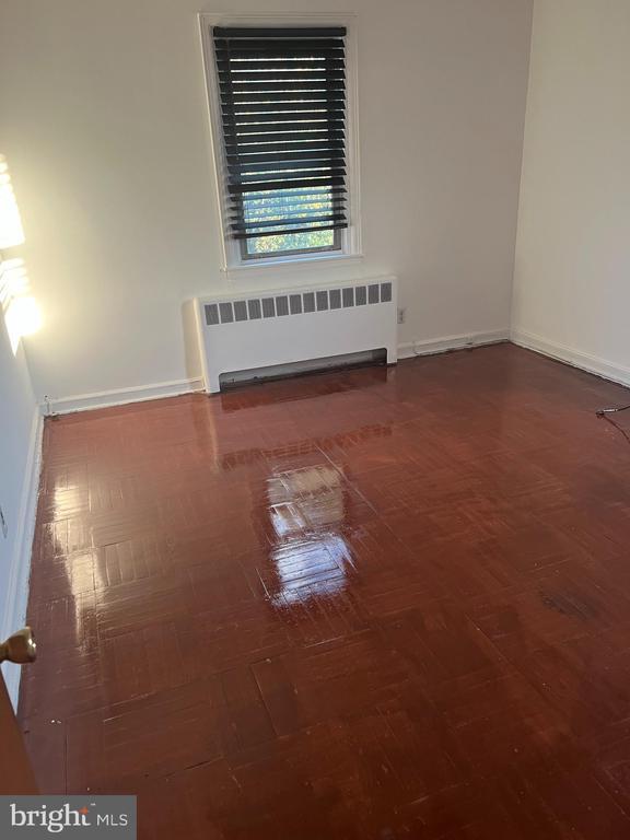
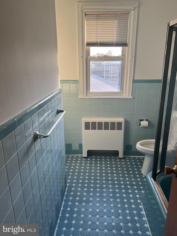
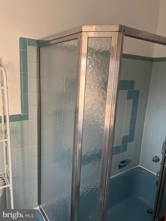
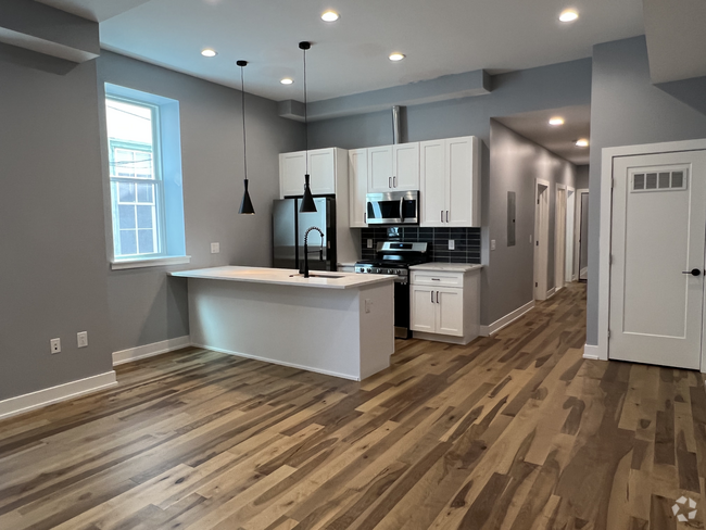
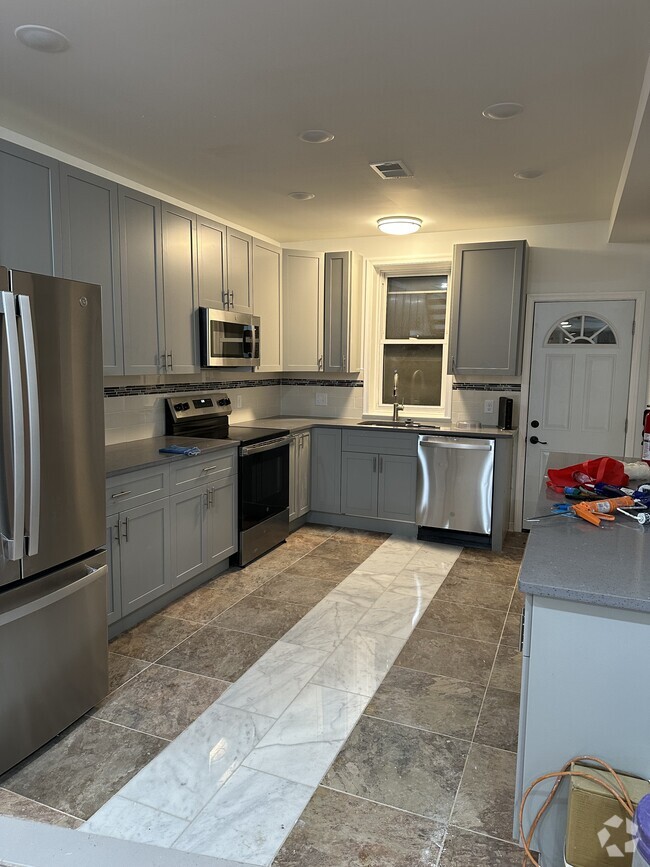
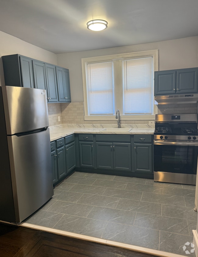
TENANT WILL BE OUT May 15th. WILL START SHOWING June 1st. Modern -Twin- Duplex Located In the Heart of East Mt Airy- Front Patio- Conveniently located near Public Transportation, Restaurants and Shopping -2nd Floor- Hardwood flooring- 2 Nice sized bedrooms- Bath and Kitchen with Stainless Steel Appliances ready to move in. For an exclusive viewing please contact us today! Needs copy of income (3 Last pay stubs, Photo ID, Credit 600+Applications)
1036 E Gorgas Ln is a house located in Philadelphia County and the 19150 ZIP Code. This area is served by the The School District of Philadelphia attendance zone.
* Price shown is base rent and may not include non-optional fees and utilities.
Price, availability, fees, and any applicable rent special are subject to change without notice.
* Square footage definitions vary. Displayed square footage is approximate.
Home Details
Home Type
Semi-Detached or Twin Home
Year Built
Built in 1950
Bedrooms and Bathrooms
En-Suite Primary Bedroom
1 Full Bathroom
2 Bedrooms
Interior Spaces
Wood Flooring
Living Room
1,914 Sq Ft Home
Property has 2 Levels
Listing and Financial Details
Security Deposit $2,800
12-Month Min and 60-Month Max Lease Term
Available 3/14/25
$50 Application Fee
Assessor Parcel Number 502414900
No Smoking Allowed
Lot Details
5,544 Sq Ft Lot
Property is in very good condition
Lot Dimensions are 34.00 x 165.00
Utilities
Radiator
Natural Gas Water Heater
100 Amp Service
Community Details
Overview
No Home Owners Association
Property Manager
West Oak Lane Subdivision
Pet Policy
No Pets Allowed
Fees and Policies
Contact
- Listed by William Qaadir Logan | Mount Airy Real Estate
- Phone Number
- Contact
-
Source
 Bright MLS, Inc.
Copyright © 2025 Bright MLS, Inc.
Location
Get Directions
Amenities
- Basement
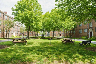
Located in the northwestern stretches of Philadelphia, Cedarbrook-Stenton is a historic community boasting suburban amenities along with quick urban access. Cedarbrook-Stenton is primarily residential, offering an array of apartments, townhomes, and houses available for rent in a laid-back locale.
Shopping and dining options in the neighborhood are largely clustered on Cheltenham Avenue, including at popular venues like Cedarbrook Plaza Shopping Center and Greenleaf at Cheltenham. All that Center City Philadelphia has to offer is within close reach of the community via Septa’s Chestnut Hill East Line as well.
Learn more about living in Cedarbrook-Stenton
Education
| Colleges & Universities | Distance | ||
|---|---|---|---|
| Colleges & Universities | Distance | ||
| Drive: | 6 min | 2.1 mi | |
| Drive: | 5 min | 2.6 mi | |
| Drive: | 7 min | 3.0 mi | |
| Drive: | 8 min | 3.4 mi |
1036 E Gorgas Ln is within 6 minutes or 2.1 miles from Arcadia University. It is also near C.C. of Philadelphia, NW Ctr and La Salle University.
Schools


Public Elementary & Middle School
Grades PK-8
476 Students
Attendance Zone
Public Middle & High School
Grades 6-12
638 Students
Nearby
Public High School
Grades 9-12
498 Students
Attendance Zone
Private Elementary, Middle & High School
Grades K-12
73 Students
Nearby
Private Elementary & Middle School
Grades PK-8
Nearby
School data provided by
 The GreatSchools Rating helps parents compare schools within a state based on a variety of school quality indicators and provides a helpful picture of how effectively each school serves all of its students. Ratings are on a scale of 1 (below average) to 10 (above average) and can include test scores, college readiness, academic progress, advanced courses, equity, discipline and attendance data. We also advise parents to visit schools, consider other information on school performance and programs, and consider family needs as part of the school selection process.
View GreatSchools Rating Methodology
View GreatSchools Rating Methodology
Transportation options available in Philadelphia include Olney, located 3.0 miles from 1036 E Gorgas Ln. 1036 E Gorgas Ln is near Philadelphia International, located 20.1 miles or 36 minutes away, and Trenton Mercer, located 30.5 miles or 51 minutes away.
| Transit / Subway | Distance | ||
|---|---|---|---|
| Transit / Subway | Distance | ||
|
|
Drive: | 6 min | 3.0 mi |
|
|
Drive: | 7 min | 3.2 mi |
|
|
Drive: | 8 min | 3.6 mi |
|
|
Drive: | 8 min | 4.1 mi |
|
|
Drive: | 9 min | 4.6 mi |
| Commuter Rail | Distance | ||
|---|---|---|---|
| Commuter Rail | Distance | ||
|
|
Walk: | 15 min | 0.8 mi |
|
|
Walk: | 17 min | 0.9 mi |
|
|
Drive: | 3 min | 1.3 mi |
|
|
Drive: | 4 min | 1.7 mi |
|
|
Drive: | 4 min | 1.7 mi |
| Airports | Distance | ||
|---|---|---|---|
| Airports | Distance | ||
|
Philadelphia International
|
Drive: | 36 min | 20.1 mi |
|
Trenton Mercer
|
Drive: | 51 min | 30.5 mi |
Time and distance from 1036 E Gorgas Ln.
| Shopping Centers | Distance | ||
|---|---|---|---|
| Shopping Centers | Distance | ||
| Walk: | 18 min | 0.9 mi | |
| Walk: | 19 min | 1.0 mi | |
| Drive: | 3 min | 1.1 mi |
1036 E Gorgas Ln has 3 shopping centers within 1.1 miles, which is about a 3-minute walk. The miles and minutes will be for the farthest away property.
| Parks and Recreation | Distance | ||
|---|---|---|---|
| Parks and Recreation | Distance | ||
|
Awbury Arboretum
|
Drive: | 5 min | 2.1 mi |
|
The Morris Arboretum
|
Drive: | 11 min | 3.9 mi |
|
Wissahickon Environmental Center
|
Drive: | 10 min | 4.2 mi |
|
Wissahickon Valley Park
|
Drive: | 10 min | 5.6 mi |
|
Schuylkill Center for Environmental Education
|
Drive: | 17 min | 5.6 mi |
1036 E Gorgas Ln has 5 parks within 5.6 miles, including Awbury Arboretum, The Morris Arboretum, and Wissahickon Environmental Center.
| Hospitals | Distance | ||
|---|---|---|---|
| Hospitals | Distance | ||
| Drive: | 7 min | 2.8 mi | |
| Drive: | 7 min | 3.2 mi | |
| Drive: | 11 min | 4.6 mi |
1036 E Gorgas Ln has 3 hospitals within 4.6 miles, the nearest is Chestnut Hill Hospital which is 2.8 miles away and a 7 minute drive.
| Military Bases | Distance | ||
|---|---|---|---|
| Military Bases | Distance | ||
| Drive: | 25 min | 15.0 mi |
1036 E Gorgas Ln is 15.0 miles and a 25 minute drive from Willow Grove Naval Air Station.
You May Also Like
Similar Rentals Nearby

What Are Walk Score®, Transit Score®, and Bike Score® Ratings?
Walk Score® measures the walkability of any address. Transit Score® measures access to public transit. Bike Score® measures the bikeability of any address.
What is a Sound Score Rating?
A Sound Score Rating aggregates noise caused by vehicle traffic, airplane traffic and local sources
1036 E Gorgas Ln
Philadelphia, PA 19150