-
Monthly Rent
$2,850
-
Bedrooms
3 bd
-
Bathrooms
2 ba
-
Square Feet
1,200 sq ft
Details

About This Property
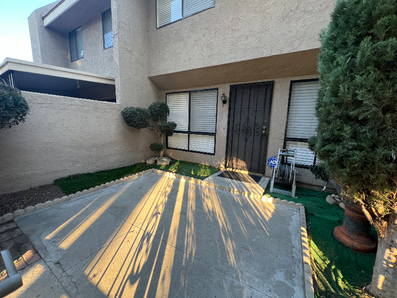
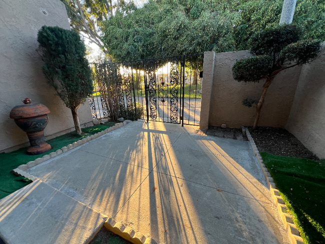
Property Id: 1714688 Freshly painted home with new carpet steps. Near supermarket. Near Cypress school/Oxford academy.
10400 Owen Way is a townhome located in Orange County and the 90680 ZIP Code.
Townhome Features
Disposal
Tile Floors
Oven
Vinyl Flooring
- Disposal
- Oven
- Tile Floors
- Vinyl Flooring
- Pool
- Fenced Lot
Fees and Policies
The fees below are based on community-supplied data and may exclude additional fees and utilities.
 This Property
 Available Property
- Disposal
- Oven
- Tile Floors
- Vinyl Flooring
- Fenced Lot
- Pool
Situated in northwestern Orange County, Stanton exudes a small-town atmosphere, covering a total land area of 3.1 square miles. Stanton residents enjoy being a part of an active and engaged community, living out the city motto of "Community Pride and Forward Vision."
While Stanton touts an overall laidback vibe, the city is within minutes of numerous theme parks and amusement centers like Adventure City, Knott’s Berry Farm, and Disneyland in nearby Anaheim. Shopping destinations such as the Outlets at Orange, MainPlace Mall, and Westminster Mall are also just a short drive from Stanton.
Joint Forces Training Base Los Alamitos is convenient to Stanton as well, affording many residents easy commutes. Quick access to State Route 39 and the 405 freeway makes getting around from Stanton simple.
Learn more about living in Stanton| Colleges & Universities | Distance | ||
|---|---|---|---|
| Colleges & Universities | Distance | ||
| Drive: | 6 min | 2.4 mi | |
| Drive: | 13 min | 6.1 mi | |
| Drive: | 15 min | 8.2 mi | |
| Drive: | 16 min | 9.8 mi |
Transportation options available in Stanton include Pacific Coast Highway Station, located 11.8 miles from 10400 Owen Way. 10400 Owen Way is near Long Beach (Daugherty Field), located 11.3 miles or 18 minutes away, and John Wayne/Orange County, located 14.4 miles or 22 minutes away.
| Transit / Subway | Distance | ||
|---|---|---|---|
| Transit / Subway | Distance | ||
|
|
Drive: | 22 min | 11.8 mi |
|
|
Drive: | 17 min | 12.2 mi |
|
|
Drive: | 23 min | 12.3 mi |
|
|
Drive: | 20 min | 12.5 mi |
|
|
Drive: | 21 min | 14.5 mi |
| Commuter Rail | Distance | ||
|---|---|---|---|
| Commuter Rail | Distance | ||
|
|
Drive: | 11 min | 5.9 mi |
|
|
Drive: | 14 min | 8.0 mi |
| Drive: | 14 min | 8.2 mi | |
|
|
Drive: | 16 min | 9.4 mi |
|
|
Drive: | 17 min | 10.4 mi |
| Airports | Distance | ||
|---|---|---|---|
| Airports | Distance | ||
|
Long Beach (Daugherty Field)
|
Drive: | 18 min | 11.3 mi |
|
John Wayne/Orange County
|
Drive: | 22 min | 14.4 mi |
Time and distance from 10400 Owen Way.
| Shopping Centers | Distance | ||
|---|---|---|---|
| Shopping Centers | Distance | ||
| Walk: | 4 min | 0.2 mi | |
| Walk: | 12 min | 0.6 mi | |
| Walk: | 13 min | 0.7 mi |
| Parks and Recreation | Distance | ||
|---|---|---|---|
| Parks and Recreation | Distance | ||
|
El Dorado Nature Center
|
Drive: | 11 min | 5.9 mi |
|
El Dorado East Regional Park
|
Drive: | 13 min | 6.8 mi |
|
Earl Burns Miller Japanese Garden
|
Drive: | 15 min | 8.6 mi |
|
Anaheim Equestrian Center
|
Drive: | 16 min | 9.3 mi |
|
Mile Square Regional Park
|
Drive: | 15 min | 9.9 mi |
| Hospitals | Distance | ||
|---|---|---|---|
| Hospitals | Distance | ||
| Drive: | 3 min | 1.4 mi | |
| Drive: | 7 min | 4.4 mi | |
| Drive: | 8 min | 4.6 mi |
| Military Bases | Distance | ||
|---|---|---|---|
| Military Bases | Distance | ||
| Drive: | 8 min | 3.7 mi |
You May Also Like
What Are Walk Score®, Transit Score®, and Bike Score® Ratings?
Walk Score® measures the walkability of any address. Transit Score® measures access to public transit. Bike Score® measures the bikeability of any address.
What is a Sound Score Rating?
A Sound Score Rating aggregates noise caused by vehicle traffic, airplane traffic and local sources


