
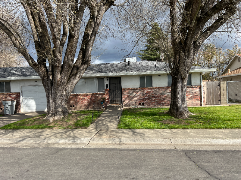
1041 Clarendon St
West Sacramento, CA 95691
-
Bedrooms
3
-
Bathrooms
1
-
Square Feet
1,100 sq ft
-
Available
Available Apr 30
Highlights
- Pets Allowed
- Hardwood Floors
- Fenced Lot

About This Home
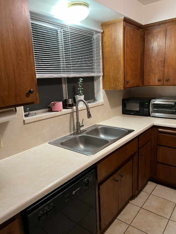
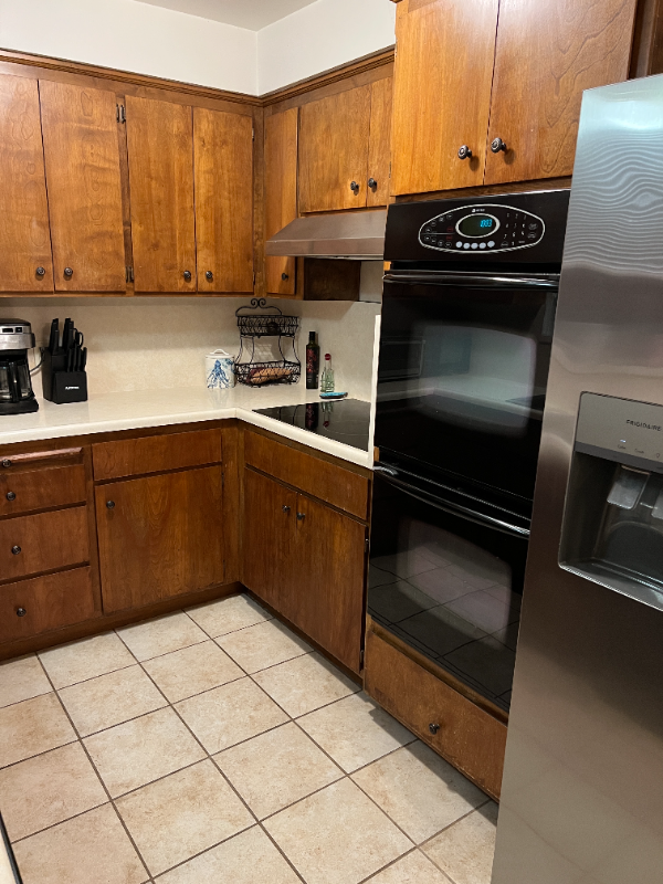
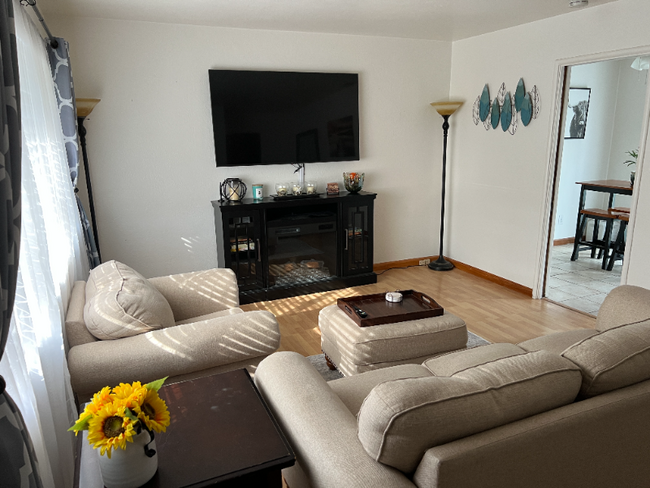
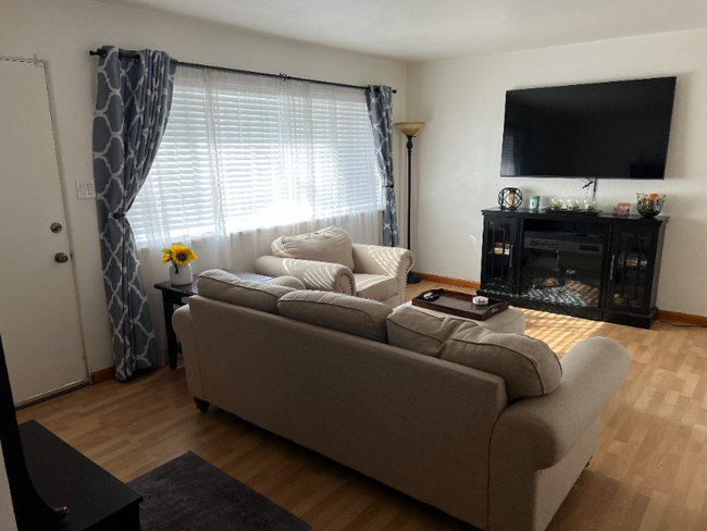
Property Id: 797021 Property is 3 bedroom 1 bath house, in a quiet up-and-coming neighborhood in West Sac. Close to the I-80 freeway, and 5-10min drive to downtown/midtown. Property has a garage, backyard and owner pays for water, and lawn maintenance.
1041 Clarendon St is a house located in Yolo County and the 95691 ZIP Code. This area is served by the Washington Unified attendance zone.
House Features
Dishwasher
Hardwood Floors
Microwave
Refrigerator
- Cable Ready
- Dishwasher
- Disposal
- Microwave
- Oven
- Refrigerator
- Freezer
- Hardwood Floors
- Bicycle Storage
- Fenced Lot
- Lawn
Fees and Policies
The fees below are based on community-supplied data and may exclude additional fees and utilities.
- Dogs Allowed
-
Fees not specified
- Cats Allowed
-
Fees not specified
- Parking
-
Garage--
Details
Utilities Included
-
Water
-
Trash Removal
-
Sewer
Contact
- Phone Number
- Contact
-
Source

- Cable Ready
- Dishwasher
- Disposal
- Microwave
- Oven
- Refrigerator
- Freezer
- Hardwood Floors
- Fenced Lot
- Lawn
- Bicycle Storage
West Sacramento enjoys the unique privilege of being a fairly quiet residential community right next door to a thriving metropolis. Separated from the state capital only by the Sacramento River, West Sac (as the locals call it) shares virtually all of Sacramento’s resources, cultural and otherwise. The I Street Bridge and Tower Bridge both feed straight into Sacramento’s historic district and downtown entertainment district. On West Sacramento’s side of the river, one of the biggest attractions is the shopping, but scenic areas like River Walk Park and venues like Raley Field give folks plenty to do in their own neighborhood.
Learn more about living in West Sacramento| Colleges & Universities | Distance | ||
|---|---|---|---|
| Colleges & Universities | Distance | ||
| Drive: | 10 min | 4.8 mi | |
| Drive: | 14 min | 8.2 mi | |
| Drive: | 20 min | 12.6 mi | |
| Drive: | 22 min | 14.7 mi |


View GreatSchools Rating Methodology
Transportation options available in West Sacramento include 8Th & Capitol, located 2.9 miles from 1041 Clarendon St. 1041 Clarendon St is near Sacramento International, located 13.6 miles or 21 minutes away.
| Transit / Subway | Distance | ||
|---|---|---|---|
| Transit / Subway | Distance | ||
|
|
Drive: | 7 min | 2.9 mi |
|
|
Drive: | 7 min | 2.9 mi |
|
|
Drive: | 7 min | 3.0 mi |
|
|
Drive: | 7 min | 3.0 mi |
|
|
Drive: | 7 min | 3.0 mi |
| Commuter Rail | Distance | ||
|---|---|---|---|
| Commuter Rail | Distance | ||
|
|
Drive: | 18 min | 13.2 mi |
|
|
Drive: | 32 min | 23.3 mi |
|
|
Drive: | 32 min | 25.5 mi |
|
|
Drive: | 48 min | 36.7 mi |
|
|
Drive: | 46 min | 37.7 mi |
| Airports | Distance | ||
|---|---|---|---|
| Airports | Distance | ||
|
Sacramento International
|
Drive: | 21 min | 13.6 mi |
Time and distance from 1041 Clarendon St.
| Shopping Centers | Distance | ||
|---|---|---|---|
| Shopping Centers | Distance | ||
| Walk: | 16 min | 0.9 mi | |
| Walk: | 18 min | 1.0 mi | |
| Drive: | 4 min | 1.2 mi |
| Parks and Recreation | Distance | ||
|---|---|---|---|
| Parks and Recreation | Distance | ||
|
Old Sacramento Historic District
|
Drive: | 6 min | 2.5 mi |
|
California Native Plant Demonstration Garden
|
Drive: | 7 min | 2.7 mi |
|
California State Railroad Museum
|
Drive: | 7 min | 2.7 mi |
|
California State Capitol Museum
|
Drive: | 7 min | 3.3 mi |
|
Natomas Oaks Park
|
Drive: | 10 min | 5.5 mi |
| Hospitals | Distance | ||
|---|---|---|---|
| Hospitals | Distance | ||
| Drive: | 8 min | 5.0 mi | |
| Drive: | 9 min | 5.0 mi | |
| Drive: | 9 min | 5.9 mi |
| Military Bases | Distance | ||
|---|---|---|---|
| Military Bases | Distance | ||
| Drive: | 29 min | 15.0 mi |
You May Also Like
What Are Walk Score®, Transit Score®, and Bike Score® Ratings?
Walk Score® measures the walkability of any address. Transit Score® measures access to public transit. Bike Score® measures the bikeability of any address.
What is a Sound Score Rating?
A Sound Score Rating aggregates noise caused by vehicle traffic, airplane traffic and local sources
1041 Clarendon St
West Sacramento, CA 95691