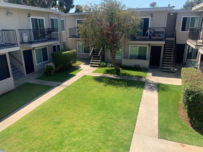
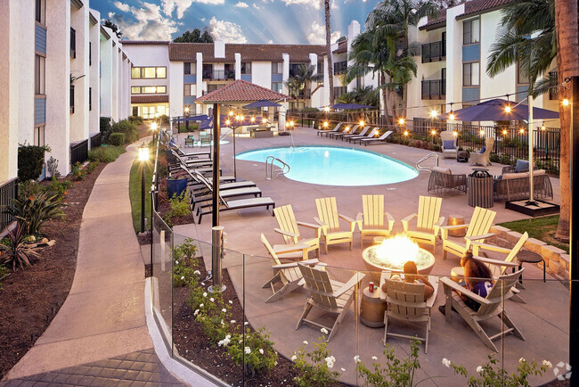
1042 15th St Unit Del Coronado Villas 1 bedroom
San Diego, CA 92154
-
Bedrooms
1
-
Bathrooms
1
-
Square Feet
700 sq ft
-
Available
Available Now

Adjacent to the Bay and about 13 miles south of Downtown San Diego, Egger Highlands was named after the Eggers, a family who donated plots of land to build the neighborhood Catholic church. The South Bay Recreation Center pays tribute to Robert Egger, Sr. and provides activities for kids of all ages. Locals who want to spend some time in the California sun should head over to nearby Imperial Beach for a day of swimming, surfing, and beachcombing.
Egger Highlands has the vibe of a laid-back beach town, and has vibrant single-family homes and townhouses for rent. Palm Avenue serves as the busiest street in the neighborhood and has a plethora of restaurants and amenities. Casual dining options include fast and friendly NY Pizzeria to the popular Thai restaurant, Noodles Noodles.
Learn more about living in Egger Highlands| Colleges & Universities | Distance | ||
|---|---|---|---|
| Colleges & Universities | Distance | ||
| Drive: | 21 min | 10.7 mi | |
| Drive: | 16 min | 12.1 mi | |
| Drive: | 17 min | 12.5 mi | |
| Drive: | 17 min | 13.3 mi |
Transportation options available in San Diego include Palm Avenue, located 1.6 miles from 1042 15th St Unit Del Coronado Villas 1 bedroom. 1042 15th St Unit Del Coronado Villas 1 bedroom is near San Diego International, located 15.8 miles or 22 minutes away.
| Transit / Subway | Distance | ||
|---|---|---|---|
| Transit / Subway | Distance | ||
|
|
Drive: | 5 min | 1.6 mi |
|
|
Drive: | 7 min | 2.9 mi |
|
|
Drive: | 7 min | 3.0 mi |
|
|
Drive: | 9 min | 4.0 mi |
|
|
Drive: | 9 min | 4.7 mi |
| Commuter Rail | Distance | ||
|---|---|---|---|
| Commuter Rail | Distance | ||
|
|
Drive: | 19 min | 13.2 mi |
|
|
Drive: | 21 min | 16.4 mi |
|
|
Drive: | 35 min | 28.0 mi |
|
|
Drive: | 44 min | 35.1 mi |
|
|
Drive: | 48 min | 38.8 mi |
| Airports | Distance | ||
|---|---|---|---|
| Airports | Distance | ||
|
San Diego International
|
Drive: | 22 min | 15.8 mi |
Time and distance from 1042 15th St Unit Del Coronado Villas 1 bedroom.
| Shopping Centers | Distance | ||
|---|---|---|---|
| Shopping Centers | Distance | ||
| Walk: | 7 min | 0.4 mi | |
| Walk: | 10 min | 0.5 mi | |
| Walk: | 10 min | 0.5 mi |
| Parks and Recreation | Distance | ||
|---|---|---|---|
| Parks and Recreation | Distance | ||
|
Tijuana River National Estuarine Research Reserve
|
Drive: | 5 min | 1.8 mi |
|
Tijuana Slough National Wildlife Refuge
|
Drive: | 5 min | 1.8 mi |
|
Otay Valley Regional Park
|
Drive: | 6 min | 2.6 mi |
|
Tijuana River Valley Regional Park
|
Drive: | 11 min | 4.0 mi |
|
Border Field State Park
|
Drive: | 16 min | 5.4 mi |
| Hospitals | Distance | ||
|---|---|---|---|
| Hospitals | Distance | ||
| Drive: | 14 min | 7.2 mi | |
| Drive: | 15 min | 10.3 mi | |
| Drive: | 18 min | 10.8 mi |
| Military Bases | Distance | ||
|---|---|---|---|
| Military Bases | Distance | ||
| Drive: | 12 min | 7.8 mi | |
| Drive: | 14 min | 9.5 mi |
You May Also Like
Similar Rentals Nearby
What Are Walk Score®, Transit Score®, and Bike Score® Ratings?
Walk Score® measures the walkability of any address. Transit Score® measures access to public transit. Bike Score® measures the bikeability of any address.
What is a Sound Score Rating?
A Sound Score Rating aggregates noise caused by vehicle traffic, airplane traffic and local sources

