
11 Flagg Rd
Shrewsbury, MA 01545
-
Bedrooms
3
-
Bathrooms
1
-
Square Feet
--
-
Available
Available May 1
About This Home
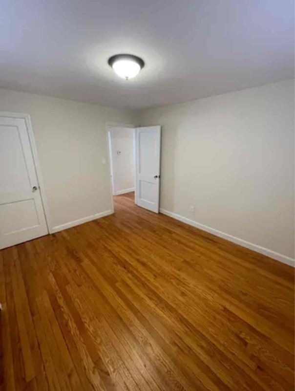
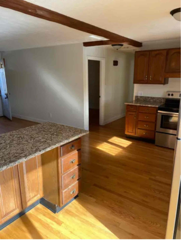
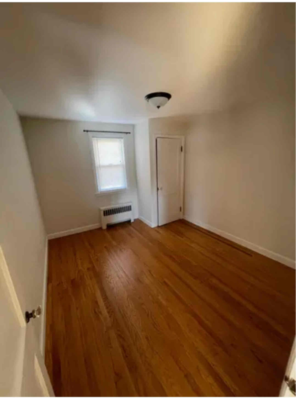
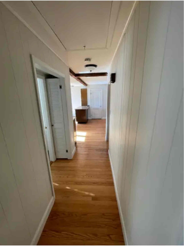
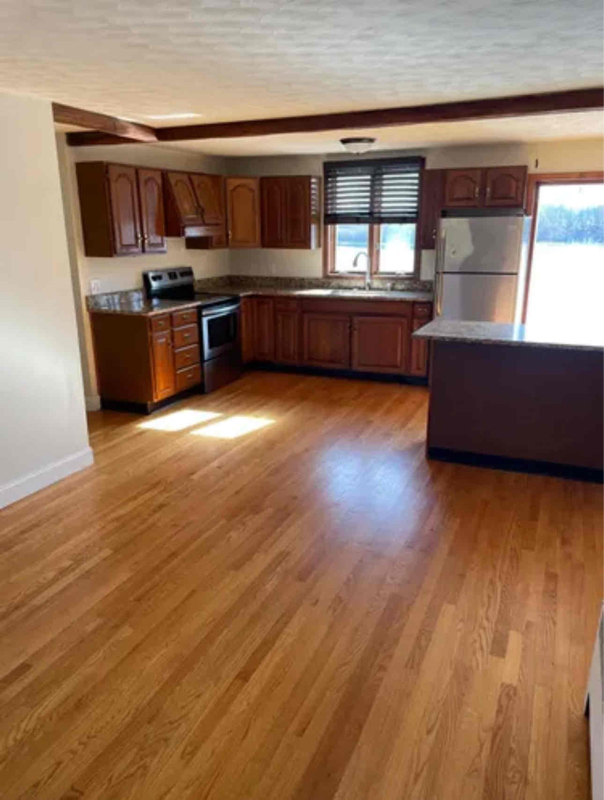
Property Id: 1769475 Nice single-family house right on the lake. Comes with the boat slip. Driveway, laundry hook ups, yard. Basement is partially finished on one side could be a good TV room. The other side of the basement is a garage that's good for storage, kayaks, etc. To view please text Wally RE Agent .
11 Flagg Rd is a house located in Worcester County and the 01545 ZIP Code.
Contact
- Listed by Walter Aldrich
- Phone Number (508) 450-0620
- Contact
-
Source

Situated just moments east of Worcester is the Route 9 Corridor, a large neighborhood compiled of several communities including Shrewsbury, Westborough, Northborough, and Southborough. Not only is Worcester at residents’ fingertips, but Downtown Boston is less than 40 miles east. The Route 9 Corridor is a commuter’s dream, offering easy city access and entry onto Interstates 290, 495, and 90.
The suburb is dotted with ponds, reservoirs, brooks, and rivers, providing ample outdoor recreation. Renters craving a beach day can bask on the sunny shores of Lake Chauncy Beach. Route 9 Corridor’s Prospect Park allows locals to take their dog for a stroll while Assabet Park gives children ample space to play on the playground. Those looking for winter recreation won’t want to miss the powdery slopes of Ski Ward Ski Area. No matter the season, renters settling in this diverse community can choose from gorgeous apartments ranging in price and amenities.
Learn more about living in Route 9 Corridor| Colleges & Universities | Distance | ||
|---|---|---|---|
| Colleges & Universities | Distance | ||
| Drive: | 8 min | 4.0 mi | |
| Drive: | 7 min | 4.0 mi | |
| Drive: | 8 min | 4.9 mi | |
| Drive: | 12 min | 6.0 mi |
Transportation options available in Shrewsbury include Riverside Station, located 28.4 miles from 11 Flagg Rd. 11 Flagg Rd is near Worcester Regional, located 10.1 miles or 19 minutes away.
| Transit / Subway | Distance | ||
|---|---|---|---|
| Transit / Subway | Distance | ||
|
|
Drive: | 42 min | 28.4 mi |
|
|
Drive: | 42 min | 28.7 mi |
|
|
Drive: | 43 min | 29.4 mi |
|
|
Drive: | 46 min | 31.0 mi |
|
|
Drive: | 46 min | 31.2 mi |
| Commuter Rail | Distance | ||
|---|---|---|---|
| Commuter Rail | Distance | ||
|
|
Drive: | 6 min | 3.5 mi |
|
|
Drive: | 7 min | 4.4 mi |
|
|
Drive: | 7 min | 4.4 mi |
|
|
Drive: | 11 min | 6.3 mi |
|
|
Drive: | 22 min | 13.4 mi |
| Airports | Distance | ||
|---|---|---|---|
| Airports | Distance | ||
|
Worcester Regional
|
Drive: | 19 min | 10.1 mi |
Time and distance from 11 Flagg Rd.
| Shopping Centers | Distance | ||
|---|---|---|---|
| Shopping Centers | Distance | ||
| Drive: | 2 min | 1.1 mi | |
| Drive: | 2 min | 1.4 mi | |
| Drive: | 3 min | 1.7 mi |
| Parks and Recreation | Distance | ||
|---|---|---|---|
| Parks and Recreation | Distance | ||
|
Mass Audubon's Broad Meadow Brook Conservation Center and Wildlife Sanctuary
|
Drive: | 5 min | 2.7 mi |
|
Quinsigamond State Park
|
Drive: | 6 min | 3.9 mi |
|
EcoTarium
|
Drive: | 9 min | 4.1 mi |
|
Ward Hill Ski Area
|
Drive: | 12 min | 7.1 mi |
|
Upton State Forest
|
Drive: | 24 min | 11.3 mi |
| Hospitals | Distance | ||
|---|---|---|---|
| Hospitals | Distance | ||
| Drive: | 6 min | 3.7 mi | |
| Drive: | 6 min | 4.0 mi | |
| Drive: | 7 min | 4.5 mi |
| Military Bases | Distance | ||
|---|---|---|---|
| Military Bases | Distance | ||
| Drive: | 35 min | 21.4 mi |
You May Also Like
What Are Walk Score®, Transit Score®, and Bike Score® Ratings?
Walk Score® measures the walkability of any address. Transit Score® measures access to public transit. Bike Score® measures the bikeability of any address.
What is a Sound Score Rating?
A Sound Score Rating aggregates noise caused by vehicle traffic, airplane traffic and local sources
11 Flagg Rd
Shrewsbury, MA 01545