
$1,550 / Month
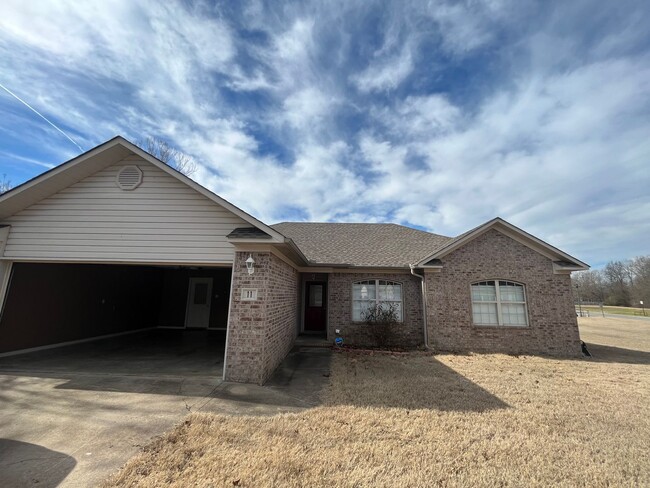
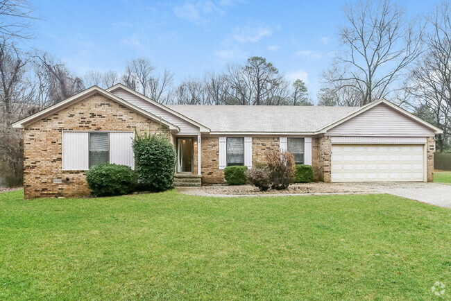
11 Stonewood Dr
Cabot, AR 72023
Today
Favorites
501-834-6225
-
Bedrooms
3
-
Bathrooms
2
-
Square Feet
1,502 sq ft
-
Available
Available May 10
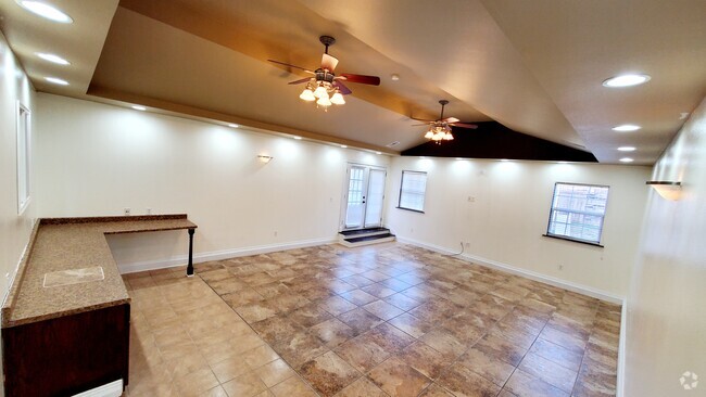
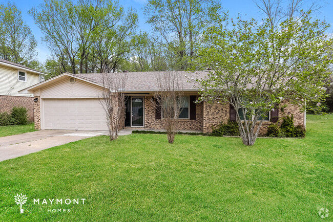
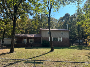
11 Stonewood Dr

Favorites
About This Home
$1,500 deposit,
Available May 10
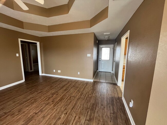
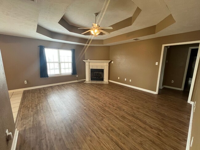
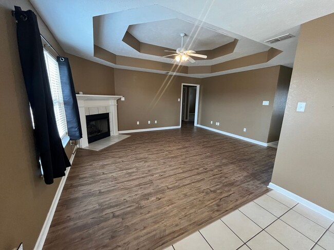
3/2 on huge corner lot in a well established Cabot neighborhood! Double garage/ laundry hookups/ large master with double vanity sinks & his/her closets. 2 good size guest rooms. Fridge provided "as is". NO cats To schedule your SHOWING, please visit our website, and complete your online application. We do not charge an Application Fee; we charge a Background Screening Fee of $45 per person age 18 and older. North on hwy 167 to Exit 16A, merge onto AR321 E/Bill Foster Memorial Hwy W/ left onto S Pine St/ right onto Campground Rd/ left onto Linda Ln/ right onto Woodbridge Dr/ right onto Stonewood Dr.
11 Stonewood Dr is a house located in Lonoke County and the 72023 ZIP Code. This area is served by the Cabot attendance zone.
* Price shown is base rent and may not include non-optional fees and utilities.
Price, availability, fees, and any applicable rent special are subject to change without notice.
* Square footage definitions vary. Displayed square footage is approximate.
Contact
- Listed by Michele
- Phone Number
- Contact
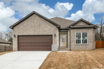
$1,523 / month
$254,900 Listing Price
3 Beds
•2 Baths
•
1,674 Sq Ft
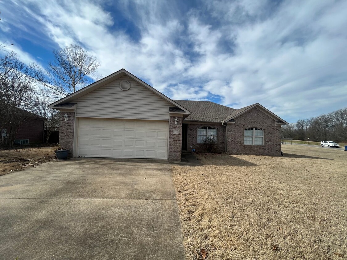
$1,475 / month
$244,950 Listing Price
4 Beds
•2 Baths
•
1,720 Sq Ft
$1,303 / month
$219,900 Listing Price
3 Beds
•2 Baths
•
1,694 Sq Ft
Location
Get Directions
Located about 25 miles northeast of Little Rock, bordering the Little Rock Air Force Base, Cabot continues to draw families for its top-ranked public schools, friendly small-town atmosphere, and close proximity to Little Rock. A host of city parks, athletic fields, and walking trails provide space for all kinds of outdoor recreation in Cabot as well as the dynamic Community Center. Cabot hosts a range of special events for the community, including the annual Strawberry Festival, Cabot Fest, and the Lonoke County Fair. Commuting and traveling from Cabot is easy with access to U.S. 167 and the Bill and Hillary Clinton National Airport.
Learn more about living in Cabot
Education
| Colleges & Universities | Distance | ||
|---|---|---|---|
| Colleges & Universities | Distance | ||
| Drive: | 37 min | 26.2 mi | |
| Drive: | 37 min | 27.3 mi | |
| Drive: | 40 min | 29.1 mi | |
| Drive: | 38 min | 30.2 mi |
11 Stonewood Dr is within 37 minutes or 26.2 miles from Pulaski Technical College. It is also near Philander Smith College and Univ. of Ark. Medical Scis..
Schools


Public Elementary School
Grades PK-4
446 Students
Nearby
Public Elementary School
Grades 5-6
717 Students
Attendance Zone
Public Elementary School
Grades K-4 & 6
544 Students
Attendance Zone
Public Middle School
Grades 7-8
710 Students
Attendance Zone
Public High School
Grades 9-10
784 Students
Nearby
Public High School
Grades 9-12
2,198 Students
Attendance Zone
Private Elementary School
Grades PK-4
Nearby
Private Elementary, Middle & High School
Grades K-10
18 Students
Nearby
Private Elementary School
Grades PK
Nearby
School data provided by
 The GreatSchools Rating helps parents compare schools within a state based on a variety of school quality indicators and provides a helpful picture of how effectively each school serves all of its students. Ratings are on a scale of 1 (below average) to 10 (above average) and can include test scores, college readiness, academic progress, advanced courses, equity, discipline and attendance data. We also advise parents to visit schools, consider other information on school performance and programs, and consider family needs as part of the school selection process.
View GreatSchools Rating Methodology
View GreatSchools Rating Methodology
Transportation options available in Cabot include Main St & Bishop Lindsey Ave, located 24.9 miles from 11 Stonewood Dr. 11 Stonewood Dr is near Bill and Hillary Clinton Ntl/Adams Field, located 28.2 miles or 37 minutes away.
| Transit / Subway | Distance | ||
|---|---|---|---|
| Transit / Subway | Distance | ||
| Drive: | 33 min | 24.9 mi | |
| Drive: | 33 min | 25.0 mi | |
| Drive: | 33 min | 25.2 mi | |
| Drive: | 33 min | 25.3 mi | |
| Drive: | 33 min | 25.3 mi |
| Commuter Rail | Distance | ||
|---|---|---|---|
| Commuter Rail | Distance | ||
|
|
Drive: | 36 min | 26.7 mi |
| Airports | Distance | ||
|---|---|---|---|
| Airports | Distance | ||
|
Bill and Hillary Clinton Ntl/Adams Field
|
Drive: | 37 min | 28.2 mi |
Time and distance from 11 Stonewood Dr.
| Shopping Centers | Distance | ||
|---|---|---|---|
| Shopping Centers | Distance | ||
| Drive: | 4 min | 1.2 mi | |
| Drive: | 4 min | 1.7 mi | |
| Drive: | 5 min | 1.7 mi |
11 Stonewood Dr has 3 shopping centers within 1.7 miles, which is about a 5-minute drive. The miles and minutes will be for the farthest away property.
| Hospitals | Distance | ||
|---|---|---|---|
| Hospitals | Distance | ||
| Drive: | 19 min | 12.8 mi |
11 Stonewood Dr is 12.8 miles and a 19 minute drive from North Metro Medical Center.
| Military Bases | Distance | ||
|---|---|---|---|
| Military Bases | Distance | ||
| Drive: | 31 min | 18.5 mi | |
| Drive: | 51 min | 22.3 mi | |
| Drive: | 56 min | 35.7 mi |
11 Stonewood Dr has 3 military bases within 35.7 miles, the nearest is Little Rock Air Force Base which is 18.5 miles away and a 31 minute drive.
You May Also Like
Similar Rentals Nearby
What Are Walk Score®, Transit Score®, and Bike Score® Ratings?
Walk Score® measures the walkability of any address. Transit Score® measures access to public transit. Bike Score® measures the bikeability of any address.
What is a Sound Score Rating?
A Sound Score Rating aggregates noise caused by vehicle traffic, airplane traffic and local sources
11 Stonewood Dr
Cabot, AR 72023