

$4,350 / Month
11 Strathmore Rd
Brookline, MA 02445
Today
Favorites
-
Bedrooms
3
-
Bathrooms
1
-
Square Feet
1,450 sq ft
11 Strathmore Rd

Favorites
About This Home
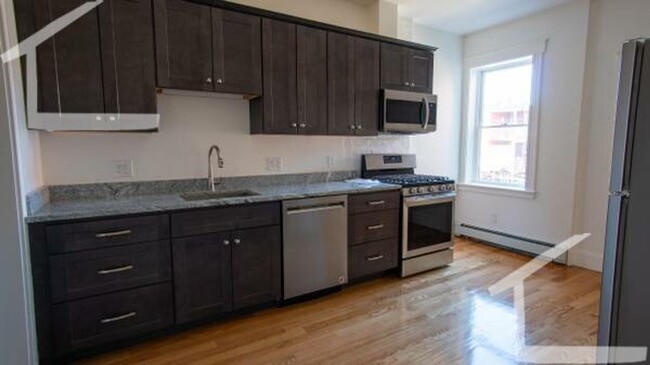
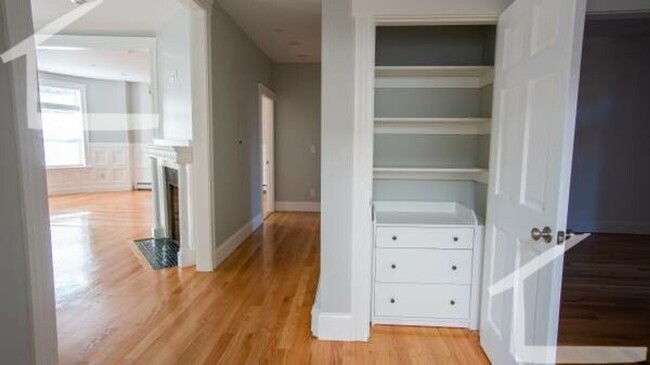
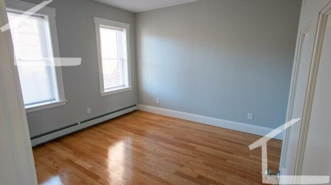
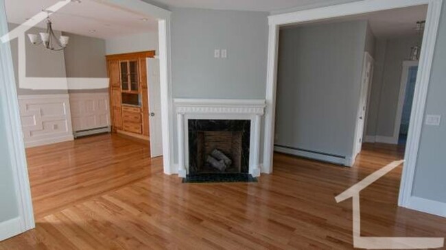
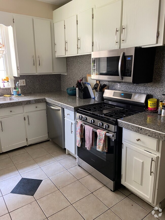
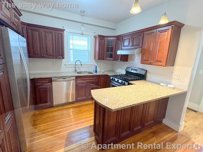
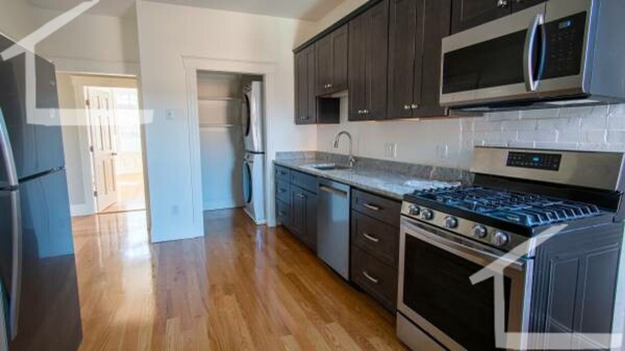
Hardwood Floors New/Renovated Bath Parking for Rent Study/Bonus Room no pets Recently renovated (2021) no utilities- Designated parking $225/Mo - 2 spots Washer/dryer in unit stainless steel appliances new floors fully insulated full eat in kitchen/ living room/ dining room back deck 5 min away from beacon on one side 5 min from riverside on the other side heat gas cooking gas NOT A PARTY HOUSE
11 Strathmore Rd is a townhome located in Norfolk County and the 02445 ZIP Code. This area is served by the Brookline attendance zone.
* Price shown is base rent and may not include non-optional fees and utilities.
Price, availability, fees, and any applicable rent special are subject to change without notice.
* Square footage definitions vary. Displayed square footage is approximate.
Location
Get Directions
Cleveland Circle is a colorful neighborhood in western Brookline. Home to plenty of restaurants and stores along its main thoroughfare, Beacon Street, Cleveland Circle is a buzzing and convenient locale for Massachusetts residents who don’t want to be in the heart of the action in Boston, but still want plenty of entertainment options just outside their front door. You’ll find charming apartments of the long-standing variety here. All residents enjoy proximity to the C Line on Boston’s light rail transit. This is a perfect spot for those who work and play in the city but want a little more bang for their buck, but not at the sake of convenience.
Learn more about living in Cleveland Circle
Education
| Colleges & Universities | Distance | ||
|---|---|---|---|
| Colleges & Universities | Distance | ||
| Drive: | 4 min | 1.5 mi | |
| Drive: | 4 min | 1.6 mi | |
| Drive: | 6 min | 2.8 mi | |
| Drive: | 5 min | 2.8 mi |
11 Strathmore Rd is within 4 minutes or 1.5 miles from Boston College, Brighton. It is also near Boston College and Boston University.
Schools


Public Elementary & Middle School
Grades PK-8
508 Students
Attendance Zone
Public Elementary & Middle School
Grades K-8
456 Students
Attendance Zone
Public High School
Grades 9-12
2,087 Students
Attendance Zone
Private Elementary & Middle School
Grades PK-8
274 Students
Nearby
Private Elementary School
Grades K-5
450 Students
Nearby
School data provided by
 The GreatSchools Rating helps parents compare schools within a state based on a variety of school quality indicators and provides a helpful picture of how effectively each school serves all of its students. Ratings are on a scale of 1 (below average) to 10 (above average) and can include test scores, college readiness, academic progress, advanced courses, equity, discipline and attendance data. We also advise parents to visit schools, consider other information on school performance and programs, and consider family needs as part of the school selection process.
View GreatSchools Rating Methodology
View GreatSchools Rating Methodology
Transportation options available in Brookline include Englewood Avenue Station, located 0.2 mile from 11 Strathmore Rd. 11 Strathmore Rd is near General Edward Lawrence Logan International, located 8.6 miles or 18 minutes away.
| Transit / Subway | Distance | ||
|---|---|---|---|
| Transit / Subway | Distance | ||
|
|
Walk: | 3 min | 0.2 mi |
|
|
Walk: | 5 min | 0.3 mi |
|
|
Walk: | 5 min | 0.3 mi |
|
|
Walk: | 7 min | 0.4 mi |
|
|
Walk: | 7 min | 0.4 mi |
| Commuter Rail | Distance | ||
|---|---|---|---|
| Commuter Rail | Distance | ||
|
|
Drive: | 7 min | 3.6 mi |
|
|
Drive: | 8 min | 4.1 mi |
|
|
Drive: | 10 min | 4.4 mi |
|
|
Drive: | 9 min | 4.9 mi |
| Drive: | 11 min | 5.3 mi |
| Airports | Distance | ||
|---|---|---|---|
| Airports | Distance | ||
|
General Edward Lawrence Logan International
|
Drive: | 18 min | 8.6 mi |
Time and distance from 11 Strathmore Rd.
| Shopping Centers | Distance | ||
|---|---|---|---|
| Shopping Centers | Distance | ||
| Walk: | 12 min | 0.6 mi | |
| Walk: | 13 min | 0.7 mi | |
| Drive: | 6 min | 2.0 mi |
11 Strathmore Rd has 3 shopping centers within 2.0 miles, which is about a 6-minute walk. The miles and minutes will be for the farthest away property.
| Parks and Recreation | Distance | ||
|---|---|---|---|
| Parks and Recreation | Distance | ||
|
Chestnut Hill Reservation
|
Walk: | 6 min | 0.3 mi |
|
Frederick Law Olmsted National Historic Site
|
Drive: | 4 min | 1.6 mi |
|
John Fitzgerald Kennedy National Historic Site
|
Drive: | 4 min | 1.8 mi |
|
Hammond Pond Reservation
|
Drive: | 5 min | 2.5 mi |
|
Coit Observatory
|
Drive: | 6 min | 3.3 mi |
11 Strathmore Rd has 5 parks within 3.3 miles, including Chestnut Hill Reservation, Frederick Law Olmsted National Historic Site, and John Fitzgerald Kennedy National Historic Site.
| Hospitals | Distance | ||
|---|---|---|---|
| Hospitals | Distance | ||
| Drive: | 4 min | 1.4 mi | |
| Drive: | 4 min | 1.6 mi | |
| Drive: | 5 min | 2.2 mi |
11 Strathmore Rd has 3 hospitals within 2.2 miles, the nearest is Franciscan Children's Hospital & Rehab Center which is 1.4 miles away and a 4 minute drive.
| Military Bases | Distance | ||
|---|---|---|---|
| Military Bases | Distance | ||
| Drive: | 23 min | 13.1 mi | |
| Drive: | 29 min | 16.0 mi |
11 Strathmore Rd is 13.1 miles from US Military Reservation, and is convenient to other military bases, including Hanscom Air Force Base.
You May Also Like
Similar Rentals Nearby


What Are Walk Score®, Transit Score®, and Bike Score® Ratings?
Walk Score® measures the walkability of any address. Transit Score® measures access to public transit. Bike Score® measures the bikeability of any address.
What is a Sound Score Rating?
A Sound Score Rating aggregates noise caused by vehicle traffic, airplane traffic and local sources
11 Strathmore Rd
Brookline, MA 02445