
$1,800 / Month
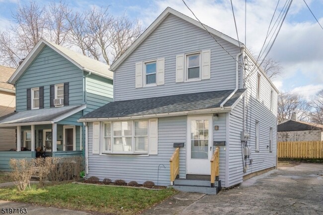
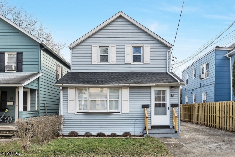
11 Thomas St Unit 2
Bloomfield, NJ 07003
2 Weeks Ago
Favorites
11 Thomas St Unit 2

Favorites
Check Back Soon for Upcoming Availability
| Beds | Baths | Average SF |
|---|---|---|
| 2 Bedrooms 2 Bedrooms 2 Br | 1 Bath 1 Bath 1 Ba | — |
About This Property
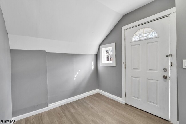
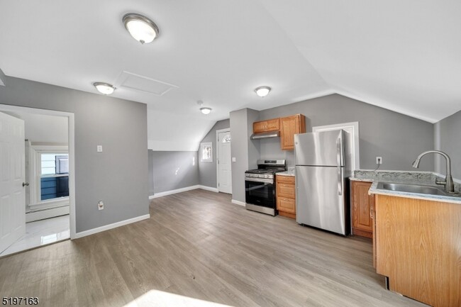
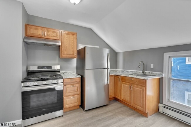
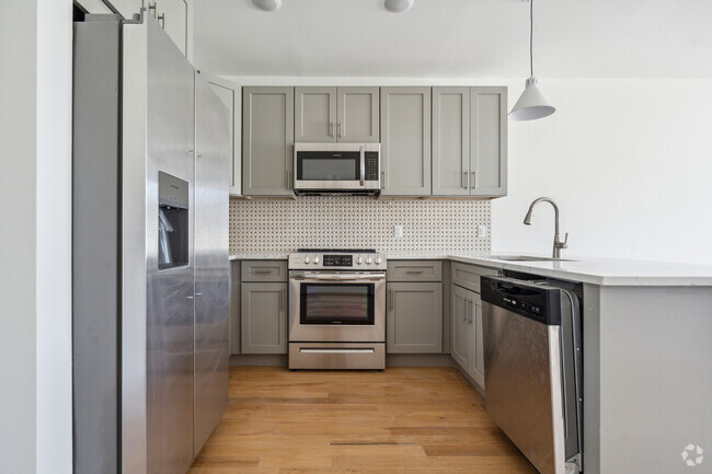
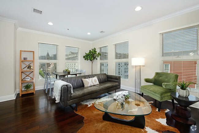
A commuters delight! A beautiful 2nd floor spacious and sun-filled apartment on a residential street in the heart of Bloomfield. Located so close to all that Bloomfield Center has to offer: fabulous restaurants and boutiques, grocery store, Laundromat, and walking to NYC Train and bus. Freshly renovated, cleaned and painted, this apartment is set for entertaining. Bright LR opens to DR, updated spacious kitchen w/ oak cabinets, granite counter tops and stainless-steel appliances. 2 BRs with spacious closets. Completely renovated bathroom with marble tile. Separate entrance in the back of the house. Shared yard for use.
11 Thomas St is an apartment community located in Essex County and the 07003 ZIP Code.
Features
- Range
Fees and Policies
The fees below are based on community-supplied data and may exclude additional fees and utilities.
Location
Get Directions
Stretched along the Garden State Parkway, the Township of Bloomfield sits in Essex County adjacent to the Township of Montclair. Bloomfield is regarded as an up-and-coming area, boasting convenient access to New York City via major roadways, highways, buses, trains, commuter rail, and light rail. Bloomfield is also close to two major airports, Newark Liberty International and LaGuardia.
In addition to its central locale, Bloomfield offers residents access to a wide range of amenities and services. Quaint shops, cafes, and restaurants line the downtown area on Broad Street in Bloomfield. Large local parks such as Brookdale and Watsessing provide plenty of options for outdoor recreation as well as the behemoth neighbors of South Mountain Reservation and Eagle Rock Reservation. Bloomfield’s appeal is as diverse as its population and offerings, with the township experiencing record growth in residential, retail, and entertainment venues.
Learn more about living in Bloomfield
Amenities
- Range
Education
| Colleges & Universities | Distance | ||
|---|---|---|---|
| Colleges & Universities | Distance | ||
| Walk: | 14 min | 0.8 mi | |
| Drive: | 8 min | 4.3 mi | |
| Drive: | 9 min | 4.5 mi | |
| Drive: | 9 min | 4.8 mi |
11 Thomas St Unit 2 is within 14 minutes or 0.8 mile from Bloomfield College. It is also near Rutgers, Newark Campus and N.J. Inst. of Technology.
Transportation options available in Bloomfield include Grove Street, located 1.6 miles from 11 Thomas St Unit 2. 11 Thomas St Unit 2 is near Newark Liberty International, located 10.2 miles or 18 minutes away, and Laguardia, located 26.0 miles or 45 minutes away.
| Transit / Subway | Distance | ||
|---|---|---|---|
| Transit / Subway | Distance | ||
|
|
Drive: | 4 min | 1.6 mi |
|
|
Drive: | 5 min | 2.1 mi |
|
|
Drive: | 5 min | 2.2 mi |
|
|
Drive: | 5 min | 2.3 mi |
|
|
Drive: | 5 min | 2.5 mi |
| Commuter Rail | Distance | ||
|---|---|---|---|
| Commuter Rail | Distance | ||
|
|
Walk: | 8 min | 0.5 mi |
|
|
Drive: | 3 min | 1.1 mi |
|
|
Drive: | 3 min | 1.3 mi |
|
|
Drive: | 4 min | 1.9 mi |
|
|
Drive: | 6 min | 2.4 mi |
| Airports | Distance | ||
|---|---|---|---|
| Airports | Distance | ||
|
Newark Liberty International
|
Drive: | 18 min | 10.2 mi |
|
Laguardia
|
Drive: | 45 min | 26.0 mi |
Time and distance from 11 Thomas St Unit 2.
| Shopping Centers | Distance | ||
|---|---|---|---|
| Shopping Centers | Distance | ||
| Walk: | 8 min | 0.5 mi | |
| Drive: | 4 min | 1.6 mi | |
| Drive: | 4 min | 1.7 mi |
11 Thomas St Unit 2 has 3 shopping centers within 1.7 miles, which is about a 4-minute walk. The miles and minutes will be for the farthest away property.
| Parks and Recreation | Distance | ||
|---|---|---|---|
| Parks and Recreation | Distance | ||
|
Edison National Historic Site
|
Drive: | 8 min | 3.2 mi |
|
Branch Brook Park
|
Drive: | 7 min | 3.2 mi |
|
Van Vleck House & Gardens
|
Drive: | 7 min | 3.4 mi |
|
Newark Museum and Dreyfuss Planetarium
|
Drive: | 8 min | 4.4 mi |
|
Kearny Marsh
|
Drive: | 13 min | 6.2 mi |
11 Thomas St Unit 2 has 5 parks within 6.2 miles, including Edison National Historic Site, Branch Brook Park, and Van Vleck House & Gardens.
| Hospitals | Distance | ||
|---|---|---|---|
| Hospitals | Distance | ||
| Drive: | 7 min | 3.5 mi | |
| Drive: | 9 min | 4.3 mi | |
| Drive: | 8 min | 4.3 mi |
11 Thomas St Unit 2 has 3 hospitals within 4.3 miles, the nearest is East Orange General Hospital which is 3.5 miles away and a 7 minute drive.
| Military Bases | Distance | ||
|---|---|---|---|
| Military Bases | Distance | ||
| Drive: | 23 min | 14.0 mi | |
| Drive: | 33 min | 16.0 mi | |
| Drive: | 39 min | 22.1 mi |
11 Thomas St Unit 2 has 3 military bases within 22.1 miles, the nearest is Military Ocean Terminal which is 14.0 miles away and a 23 minute drive.
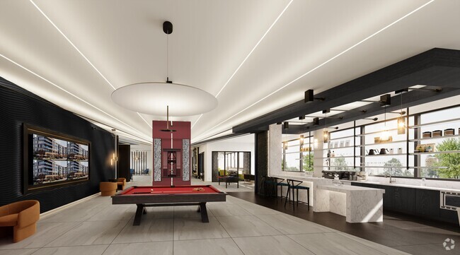
You May Also Like
Similar Rentals Nearby


What Are Walk Score®, Transit Score®, and Bike Score® Ratings?
Walk Score® measures the walkability of any address. Transit Score® measures access to public transit. Bike Score® measures the bikeability of any address.
What is a Sound Score Rating?
A Sound Score Rating aggregates noise caused by vehicle traffic, airplane traffic and local sources
11 Thomas St
Bloomfield, NJ 07003