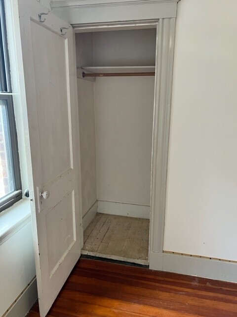
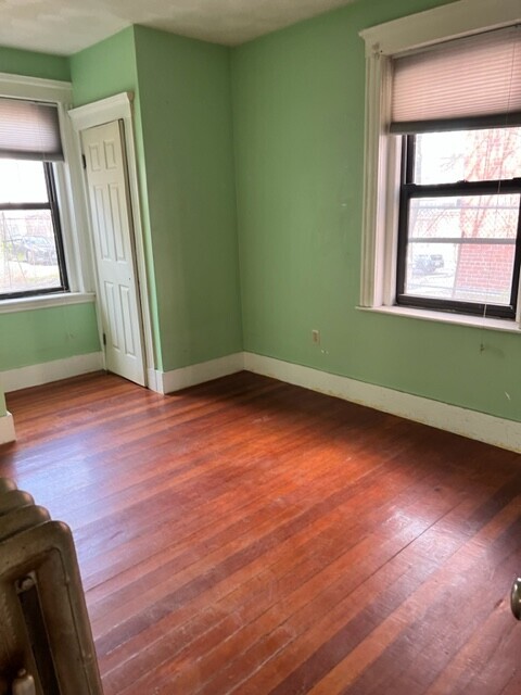
110 Central St
Somerville, MA 02143
-
Bedrooms
3
-
Bathrooms
1
-
Square Feet
1,000 sq ft
-
Available
Available Now

Fees and Policies
The fees below are based on community-supplied data and may exclude additional fees and utilities.
Details
Property Information
-
3 units
Contact
- Contact
Powder House Square neighborhood sits within Somerville a few miles north of Cambridge and Boston. The community derives its name from an 18th century windmill that was later transformed into a gunpowder storage depot that played a major role in the American Revolution. This urban community features apartments in New England style multi-family units. Just a few walkable blocks from the neighborhood's northern border sits Tufts University's primary campus. The neighborhood is also defined by its traffic circle, which contains an island park with benches, pathways, and landscaped shrubbery. While it is largely a residential area, it is home to a number of restaurants and several medical and dental clinics.
Many students and neighborhood residents visit Nathan Tufts Park, where the iconic Powder House is located. Here you can walk your dog or have a picnic under the shade cast by trees hundreds of years old.
Learn more about living in Powder House Square| Colleges & Universities | Distance | ||
|---|---|---|---|
| Colleges & Universities | Distance | ||
| Drive: | 4 min | 1.2 mi | |
| Drive: | 5 min | 1.7 mi | |
| Drive: | 5 min | 1.8 mi | |
| Drive: | 6 min | 2.0 mi |
 The GreatSchools Rating helps parents compare schools within a state based on a variety of school quality indicators and provides a helpful picture of how effectively each school serves all of its students. Ratings are on a scale of 1 (below average) to 10 (above average) and can include test scores, college readiness, academic progress, advanced courses, equity, discipline and attendance data. We also advise parents to visit schools, consider other information on school performance and programs, and consider family needs as part of the school selection process.
View GreatSchools Rating Methodology
Transportation options available in Somerville include Gilman Square, located 0.4 mile from 110 Central St. 110 Central St is near General Edward Lawrence Logan International, located 6.4 miles or 14 minutes away.
| Transit / Subway | Distance | ||
|---|---|---|---|
| Transit / Subway | Distance | ||
| Walk: | 7 min | 0.4 mi | |
| Walk: | 8 min | 0.5 mi | |
| Drive: | 3 min | 1.2 mi | |
|
|
Drive: | 3 min | 1.2 mi |
| Drive: | 4 min | 1.4 mi |
| Commuter Rail | Distance | ||
|---|---|---|---|
| Commuter Rail | Distance | ||
|
|
Drive: | 4 min | 1.3 mi |
|
|
Drive: | 8 min | 3.3 mi |
|
|
Drive: | 7 min | 3.4 mi |
|
|
Drive: | 8 min | 4.3 mi |
|
|
Drive: | 11 min | 4.5 mi |
| Airports | Distance | ||
|---|---|---|---|
| Airports | Distance | ||
|
General Edward Lawrence Logan International
|
Drive: | 14 min | 6.4 mi |
Time and distance from 110 Central St.
| Shopping Centers | Distance | ||
|---|---|---|---|
| Shopping Centers | Distance | ||
| Walk: | 13 min | 0.7 mi | |
| Walk: | 17 min | 0.9 mi | |
| Drive: | 4 min | 1.2 mi |
| Parks and Recreation | Distance | ||
|---|---|---|---|
| Parks and Recreation | Distance | ||
|
Harvard Museum of Natural History
|
Drive: | 5 min | 1.7 mi |
|
Mineralogical and Geological Museum
|
Drive: | 5 min | 1.7 mi |
|
Harvard-Smithsonian Center for Astrophysics
|
Drive: | 7 min | 2.0 mi |
|
Mystic River Reservation
|
Drive: | 5 min | 2.2 mi |
|
Longfellow National Historic Site
|
Drive: | 6 min | 2.3 mi |
| Hospitals | Distance | ||
|---|---|---|---|
| Hospitals | Distance | ||
| Drive: | 4 min | 1.6 mi | |
| Drive: | 8 min | 2.8 mi | |
| Drive: | 7 min | 3.3 mi |
| Military Bases | Distance | ||
|---|---|---|---|
| Military Bases | Distance | ||
| Drive: | 23 min | 11.6 mi | |
| Drive: | 34 min | 18.3 mi |
110 Central St Photos
What Are Walk Score®, Transit Score®, and Bike Score® Ratings?
Walk Score® measures the walkability of any address. Transit Score® measures access to public transit. Bike Score® measures the bikeability of any address.
What is a Sound Score Rating?
A Sound Score Rating aggregates noise caused by vehicle traffic, airplane traffic and local sources


