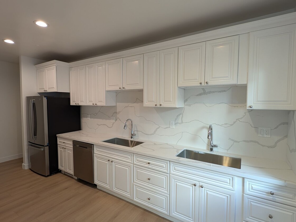
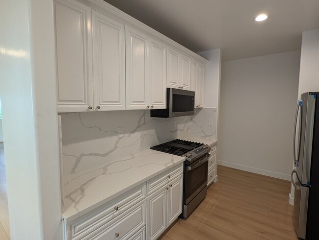
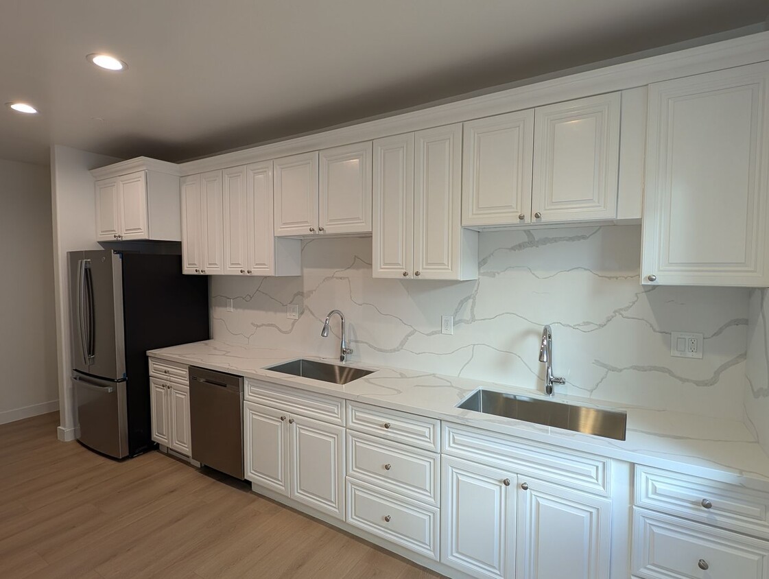
1109 La Peer Dr Unidad Lower
Los Angeles, CA 90035
-
Habitaciones
4
-
Baños
3
-
Pies cuadrados
2,250 pies²
-
Disponible
Disp. ahora

Contactar
- Listado Por Rosh Property Management Inc. | Rosh Property Management Inc.
- Número de Teléfono
- Contactar
Beverlywood es un vecindario cómodo ubicado justo al sur de Beverly Hills en los Ángeles. Los residentes aquí tienden a ser más cómodo que en el resto del área de los Ángeles, y a muchos han vivido en el vecindario durante años o incluso décadas. Gran parte de Beverlywood es un complejo que se incorporen, y vivienda deben registrarse y pagar los montos adeudados a la Asociación de Propietarios de Viviendas. A cambio, el vecindario tiene acceso a parques privados y disfruta de un alto nivel de vida con las calles bien cuidados y paisajes en todo el vecindario. Aquellos el alquiler de apartamentos en Beverlywood tienen fácil acceso a toda la zona oeste de los Ángeles, con tus excelentes comercios y opciones de entretenimiento.
Obtén más información sobre la vida en Beverlywood| Institutos y Universidades | Distancia de | ||
|---|---|---|---|
| Institutos y Universidades | Dist. | ||
| En coche: | 12 minutos | 4.6 mi | |
| En coche: | 11 minutos | 4.8 mi | |
| En coche: | 12 minutos | 6.1 mi | |
| En coche: | 13 minutos | 6.7 mi |
Las opciones de transporte disponibles en Los Angeles incluyen Culver City, a 2.4 millas de 1109 La Peer Dr Unidad Lower. 1109 La Peer Dr Unidad Lower está cerca de Los Angeles International, a 9.8 millas o 20 minutos de distancia, y de Bob Hope, a 14.4 millas o 27 minutos de distancia.
| Tránsito / metro | Distancia de | ||
|---|---|---|---|
| Tránsito / metro | Dist. | ||
|
|
En coche: | 6 minutos | 2.4 mi |
|
|
En coche: | 6 minutos | 2.8 mi |
|
|
En coche: | 6 minutos | 2.9 mi |
|
|
En coche: | 8 minutos | 3.2 mi |
|
|
En coche: | 8 minutos | 4.4 mi |
| Tren suburbano | Distancia de | ||
|---|---|---|---|
| Tren suburbano | Dist. | ||
|
|
En coche: | 18 minutos | 9.6 mi |
|
|
En coche: | 20 minutos | 9.9 mi |
|
|
En coche: | 21 minutos | 12.0 mi |
|
|
En coche: | 24 minutos | 12.3 mi |
|
|
En coche: | 26 minutos | 13.3 mi |
| Aeropuertos | Distancia de | ||
|---|---|---|---|
| Aeropuertos | Dist. | ||
|
Los Angeles International
|
En coche: | 20 minutos | 9.8 mi |
|
Bob Hope
|
En coche: | 27 minutos | 14.4 mi |
Tiempo y distancia desde 1109 La Peer Dr Unidad Lower.
| Centros comerciales | Distancia de | ||
|---|---|---|---|
| Centros comerciales | Dist. | ||
| A pie: | 3 minutos | 0.2 mi | |
| A pie: | 5 minutos | 0.3 mi | |
| A pie: | 6 minutos | 0.3 mi |
| Parques y recreación | Distancia de | ||
|---|---|---|---|
| Parques y recreación | Dist. | ||
|
Zimmer Children's Museum
|
En coche: | 4 minutos | 1.9 mi |
|
La Brea Tar Pits
|
En coche: | 4 minutos | 2.2 mi |
|
Virginia Robinson Gardens
|
En coche: | 8 minutos | 3.1 mi |
|
Mathias Botanical Garden
|
En coche: | 10 minutos | 4.3 mi |
|
Kenneth Hahn State Recreation Area
|
En coche: | 13 minutos | 4.9 mi |
| Medico | Distancia de | ||
|---|---|---|---|
| Medico | Dist. | ||
| En coche: | 3 minutos | 1.6 mi | |
| En coche: | 4 minutos | 1.7 mi | |
| En coche: | 3 minutos | 1.7 mi |
| Bases militares | Distancia de | ||
|---|---|---|---|
| Bases militares | Dist. | ||
| En coche: | 20 minutos | 11.5 mi |
También te puede gustar
Alquileres Similares Cercanos
¿Qué son las clasificaciones Walk Score®, Transit Score® y Bike Score®?
Walk Score® mide la viabilidad peatonal de cualquier dirección. Transit Score® mide el acceso a transporte público. Bike Score® mide la infraestructura de rutas para bicicletas de cualquier dirección.
¿Qué es una clasificación de puntaje de ruido?
La clasificación de puntaje de ruido es el conjunto del ruido provocado por el transito de vehículos o de aviones y de fuentes locales.
