
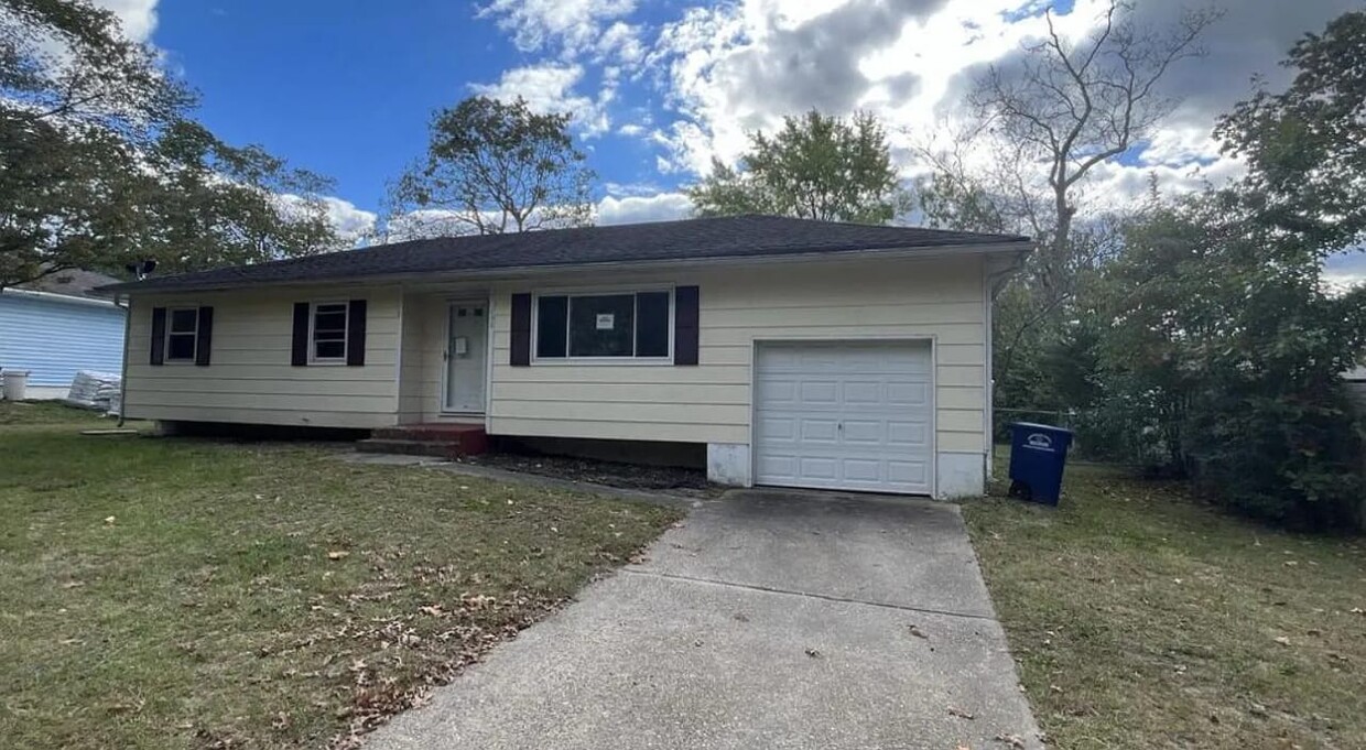
112 Adams Ave
Browns Mills, NJ 08015
-
Bedrooms
3
-
Bathrooms
1
-
Square Feet
1,080 sq ft
-
Available
Available Now

Browns Mills is a central New Jersey suburb located within Pemberton Township, adjacent to Joint Base McGuire-Dix-Lakehurst. The community is almost entirely residential, with residential neighborhoods full of single-family homes occupying much of the landscape. The long and narrow Mirror Lake bisects the town, with the north side being much more densely populated than the south side.
Thanks to the close proximity to the Joint Base, Browns Mill is a popular spot among armed service members seeking off-base housing, as well as civilian military employees and support personnel. Living in Browns Mill also offers terrific access to the natural beauty of the region, with the vast Brendan T. Byrne State Forest just minutes to the south.
Learn more about living in Browns Mills| Colleges & Universities | Distance | ||
|---|---|---|---|
| Colleges & Universities | Distance | ||
| Drive: | 9 min | 4.4 mi | |
| Drive: | 30 min | 18.5 mi | |
| Drive: | 41 min | 25.3 mi | |
| Drive: | 49 min | 29.1 mi |


View GreatSchools Rating Methodology
Transportation options available in Browns Mills include Bordentown, located 18.6 miles from 112 Adams Ave. 112 Adams Ave is near Trenton Mercer, located 31.7 miles or 51 minutes away.
| Transit / Subway | Distance | ||
|---|---|---|---|
| Transit / Subway | Distance | ||
|
|
Drive: | 30 min | 18.6 mi |
|
|
Drive: | 33 min | 18.9 mi |
|
|
Drive: | 35 min | 19.6 mi |
|
|
Drive: | 33 min | 20.4 mi |
|
|
Drive: | 34 min | 20.7 mi |
| Commuter Rail | Distance | ||
|---|---|---|---|
| Commuter Rail | Distance | ||
|
|
Drive: | 41 min | 22.2 mi |
|
|
Drive: | 41 min | 22.7 mi |
|
|
Drive: | 44 min | 24.6 mi |
|
|
Drive: | 42 min | 25.6 mi |
|
|
Drive: | 45 min | 27.3 mi |
| Airports | Distance | ||
|---|---|---|---|
| Airports | Distance | ||
|
Trenton Mercer
|
Drive: | 51 min | 31.7 mi |
Time and distance from 112 Adams Ave.
| Shopping Centers | Distance | ||
|---|---|---|---|
| Shopping Centers | Distance | ||
| Walk: | 15 min | 0.8 mi | |
| Drive: | 2 min | 1.1 mi | |
| Drive: | 3 min | 1.3 mi |
| Parks and Recreation | Distance | ||
|---|---|---|---|
| Parks and Recreation | Distance | ||
|
Brendan T. Byrne State Forest
|
Drive: | 13 min | 4.5 mi |
|
Historic Smithville Park
|
Drive: | 19 min | 11.1 mi |
| Hospitals | Distance | ||
|---|---|---|---|
| Hospitals | Distance | ||
| Drive: | 3 min | 1.3 mi | |
| Drive: | 7 min | 4.0 mi |
| Military Bases | Distance | ||
|---|---|---|---|
| Military Bases | Distance | ||
| Drive: | 13 min | 4.7 mi | |
| Drive: | 19 min | 9.7 mi | |
| Drive: | 42 min | 9.8 mi |
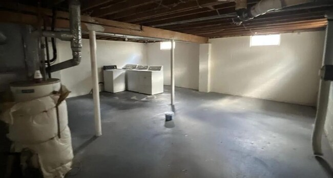
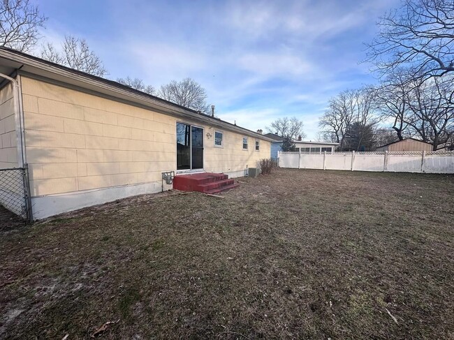
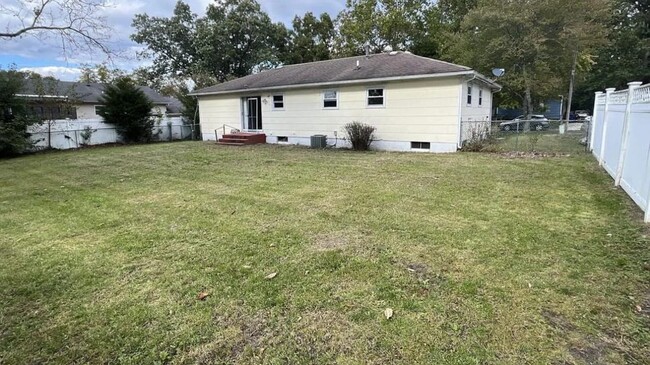
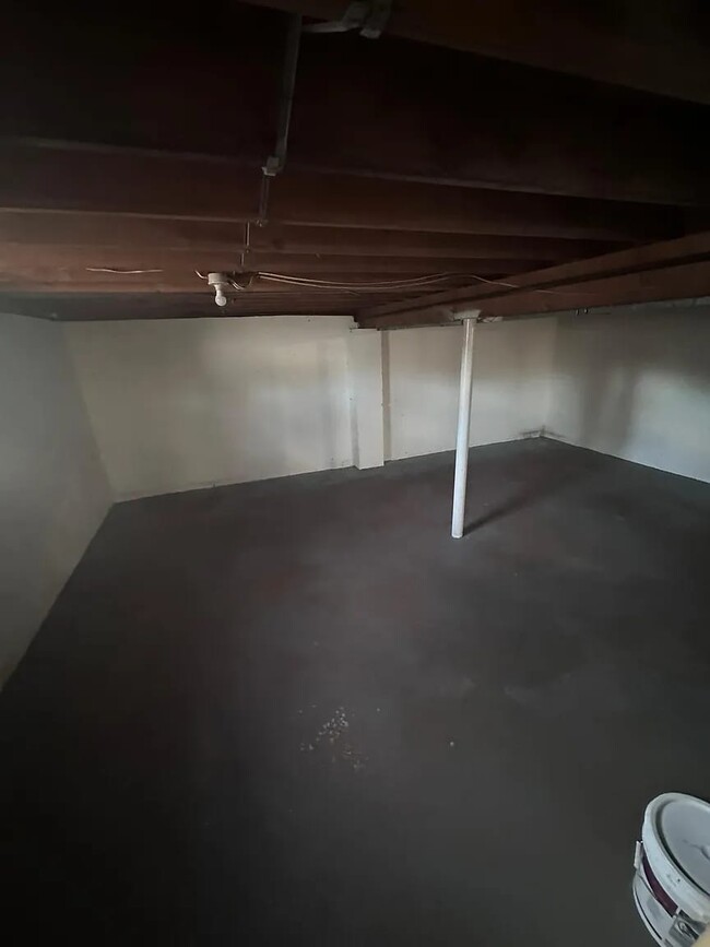
112 Adams Ave Photos
What Are Walk Score®, Transit Score®, and Bike Score® Ratings?
Walk Score® measures the walkability of any address. Transit Score® measures access to public transit. Bike Score® measures the bikeability of any address.
What is a Sound Score Rating?
A Sound Score Rating aggregates noise caused by vehicle traffic, airplane traffic and local sources
112 Adams Ave
Browns Mills, NJ 08015