
$8,750 / Month
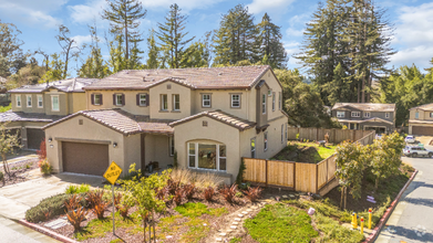
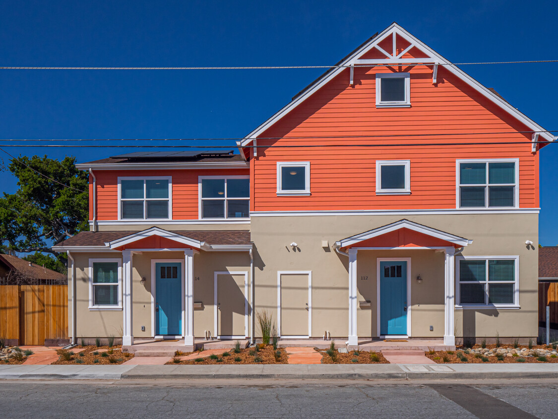
112 Sunnyside Ave
Santa Cruz, CA 95062
Today
Favorites
831-332-4661
-
Bedrooms
7
-
Bathrooms
4.5
-
Square Feet
--
-
Available
Available Jun 20
112 Sunnyside Ave

Favorites
About This Home
$8,750 deposit,
Available Jun 20
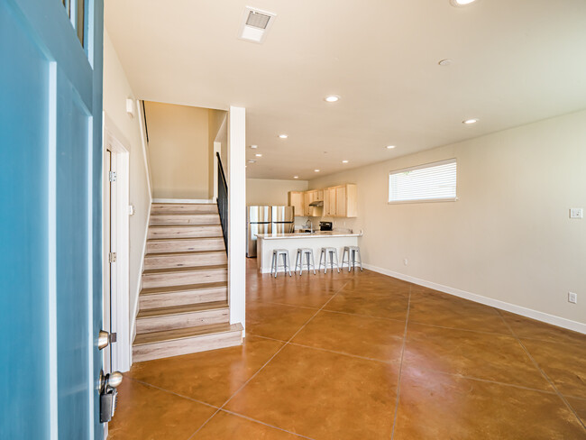
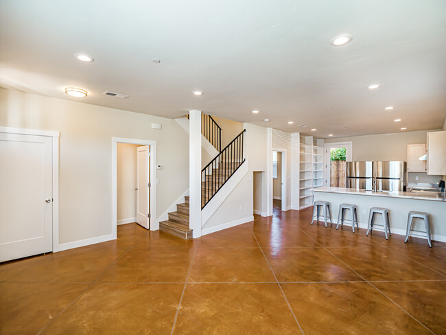
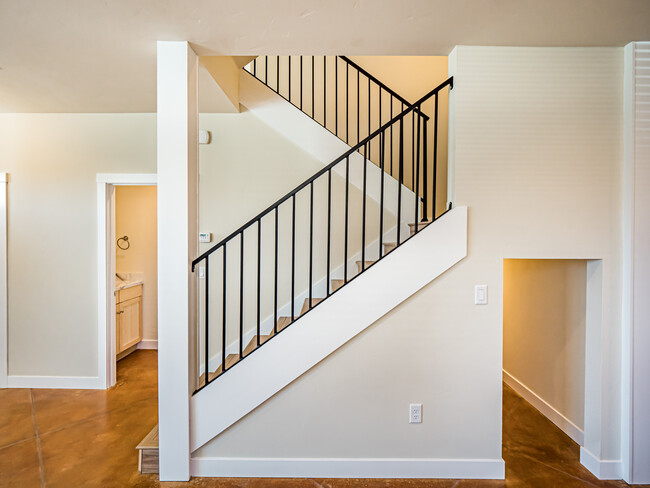
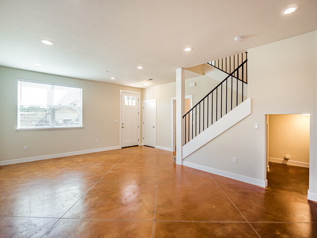
****Beautiful 7 bedroom, 4 full bathrooms plus ½ bath. High ceilings, two fridges, two sets of wash/dry, quartz countertops, large storage room. Super-efficient all electric home with solar panels, dual pane windows, heat pump water heater, and energy star appliances. Central heating and air conditioning. Includes two tandem off street parking spaces and small rear yard/storage area. Located near Whole Foods, the Buttery, Shoppers Corner and Downtown Santa Cruz. Limited street parking, less cars would be ideal. Tenants pay all utilities. Please send me an email when responding to this ad!
112 Sunnyside Ave is a house located in Santa Cruz County and the 95062 ZIP Code. This area is served by the Santa Cruz City High attendance zone.
* Price shown is base rent and may not include non-optional fees and utilities.
Price, availability, fees, and any applicable rent special are subject to change without notice.
* Square footage definitions vary. Displayed square footage is approximate.
Contact
- Listed by Listing Contact
- Phone Number
- Contact
Location
Get Directions
Nestled on the shores of Monterey Bay, Seabright is a highly sought-after neighborhood in Santa Cruz. This upscale community has gorgeous beach houses, elegant single-family homes, and Spanish-style apartments available for rent, complemented by palm tree-lined streets. The neighborhood is best known for Seabright State Beach, one of the largest white-sand beaches in the city that is also dog and bonfire-friendly. Seabright is also home to the Santa Cruz Museum of Natural History, which neighbors the beach. Along with a scenic shoreline, Seabright also has several waterfront parks like Frederick Street Park & Dog Park, two commercial hubs, schools, and medical offices. Along Seabright Avenue, you’ll find laid-back eateries, cafés, and specialty shops while Soquel Avenue has even more variety.
Learn more about living in Seabright
Education
| Colleges & Universities | Distance | ||
|---|---|---|---|
| Colleges & Universities | Distance | ||
| Drive: | 12 min | 5.0 mi | |
| Drive: | 9 min | 5.8 mi | |
| Drive: | 38 min | 25.1 mi | |
| Drive: | 44 min | 31.2 mi |
112 Sunnyside Ave is within 12 minutes or 5.0 miles from UC Santa Cruz. It is also near Cabrillo College and West Valley College.
Schools


Public Elementary School
Grades K-5
464 Students
Nearby
Public Elementary School
Grades K-5
488 Students
Attendance Zone
Public Middle School
Grades 6-8
544 Students
Attendance Zone
Public High School
Grades 9-12
1,023 Students
Attendance Zone
Public High School
Grades 9-12
1,092 Students
Attendance Zone
Private Elementary & Middle School
Grades PK-8
191 Students
Nearby
Private Elementary School
Grades K-6
45 Students
Nearby
Private Middle & High School
Grades 7-12
Nearby
Private High School
Grades 9-12
24 Students
Nearby
School data provided by
 The GreatSchools Rating helps parents compare schools within a state based on a variety of school quality indicators and provides a helpful picture of how effectively each school serves all of its students. Ratings are on a scale of 1 (below average) to 10 (above average) and can include test scores, college readiness, academic progress, advanced courses, equity, discipline and attendance data. We also advise parents to visit schools, consider other information on school performance and programs, and consider family needs as part of the school selection process.
View GreatSchools Rating Methodology
View GreatSchools Rating Methodology
Transportation options available in Santa Cruz include Winchester Station, located 25.2 miles from 112 Sunnyside Ave. 112 Sunnyside Ave is near Norman Y Mineta San Jose International, located 32.1 miles or 44 minutes away, and Monterey Regional, located 42.1 miles or 52 minutes away.
| Transit / Subway | Distance | ||
|---|---|---|---|
| Transit / Subway | Distance | ||
|
|
Drive: | 36 min | 25.2 mi |
|
|
Drive: | 37 min | 26.1 mi |
|
|
Drive: | 42 min | 29.6 mi |
|
|
Drive: | 42 min | 30.4 mi |
|
|
Drive: | 45 min | 33.6 mi |
| Commuter Rail | Distance | ||
|---|---|---|---|
| Commuter Rail | Distance | ||
| Drive: | 44 min | 30.8 mi | |
| Drive: | 45 min | 32.3 mi | |
| Drive: | 46 min | 32.5 mi | |
| Drive: | 59 min | 37.5 mi | |
| Drive: | 60 min | 44.7 mi |
| Airports | Distance | ||
|---|---|---|---|
| Airports | Distance | ||
|
Norman Y Mineta San Jose International
|
Drive: | 44 min | 32.1 mi |
|
Monterey Regional
|
Drive: | 52 min | 42.1 mi |
Time and distance from 112 Sunnyside Ave.
| Shopping Centers | Distance | ||
|---|---|---|---|
| Shopping Centers | Distance | ||
| Walk: | 2 min | 0.1 mi | |
| Walk: | 2 min | 0.2 mi | |
| Walk: | 4 min | 0.2 mi |
112 Sunnyside Ave has 3 shopping centers within 0.2 mile, which is about a 4-minute walk. The miles and minutes will be for the farthest away property.
| Parks and Recreation | Distance | ||
|---|---|---|---|
| Parks and Recreation | Distance | ||
|
Arana Gulch
|
Drive: | 3 min | 1.1 mi |
|
Santa Cruz Mission State Historic Park
|
Drive: | 2 min | 1.1 mi |
|
Santa Cruz Museum of Natural History
|
Drive: | 4 min | 1.5 mi |
|
DeLaveaga Park
|
Drive: | 5 min | 1.6 mi |
|
Neary Lagoon
|
Drive: | 4 min | 1.7 mi |
112 Sunnyside Ave has 5 parks within 1.7 miles, including Santa Cruz Mission State Historic Park, Arana Gulch, and Santa Cruz Museum of Natural History.
| Hospitals | Distance | ||
|---|---|---|---|
| Hospitals | Distance | ||
| Drive: | 3 min | 1.3 mi | |
| Drive: | 4 min | 2.0 mi | |
| Drive: | 5 min | 2.4 mi |
112 Sunnyside Ave has 3 hospitals within 2.4 miles, the nearest is Santa Cruz County Psychiatric Health Facility which is 1.3 miles away and a 3 minute drive.
| Military Bases | Distance | ||
|---|---|---|---|
| Military Bases | Distance | ||
| Drive: | 60 min | 44.7 mi |
112 Sunnyside Ave is 44.7 miles and a 60 minute drive from Coast Guard Facilities.
You May Also Like
Similar Rentals Nearby


What Are Walk Score®, Transit Score®, and Bike Score® Ratings?
Walk Score® measures the walkability of any address. Transit Score® measures access to public transit. Bike Score® measures the bikeability of any address.
What is a Sound Score Rating?
A Sound Score Rating aggregates noise caused by vehicle traffic, airplane traffic and local sources
112 Sunnyside Ave
Santa Cruz, CA 95062