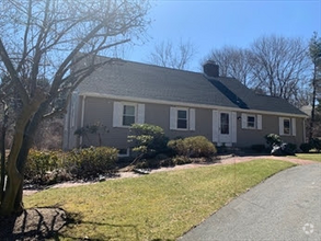
$3,550 / Month
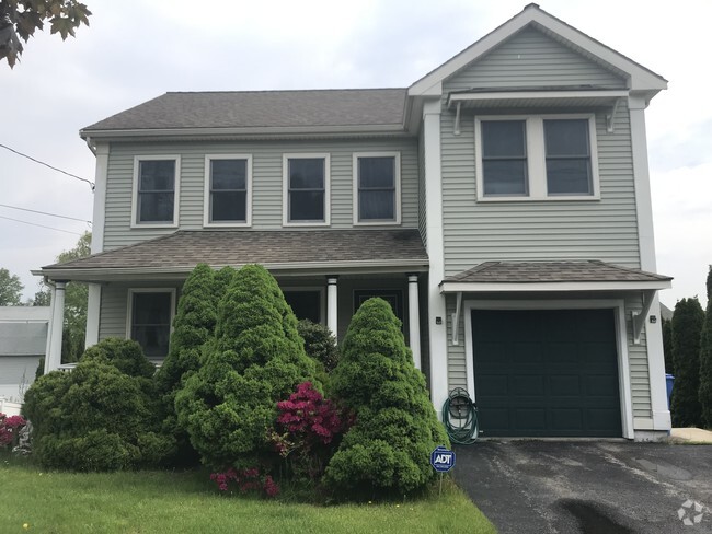
113 Riverside St
Watertown, MA 02472
2 Weeks Ago
Favorites
-
Bedrooms
5
-
Bathrooms
3
-
Square Feet
2,400 sq ft
113 Riverside St

Favorites
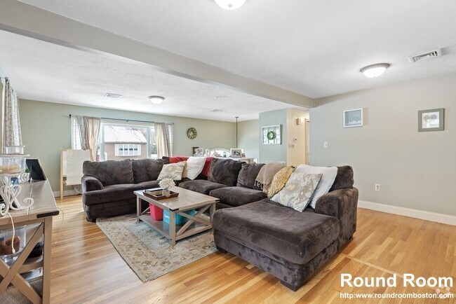
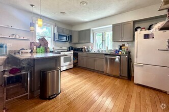
About This Home
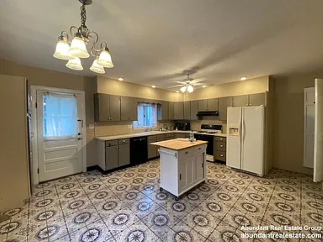
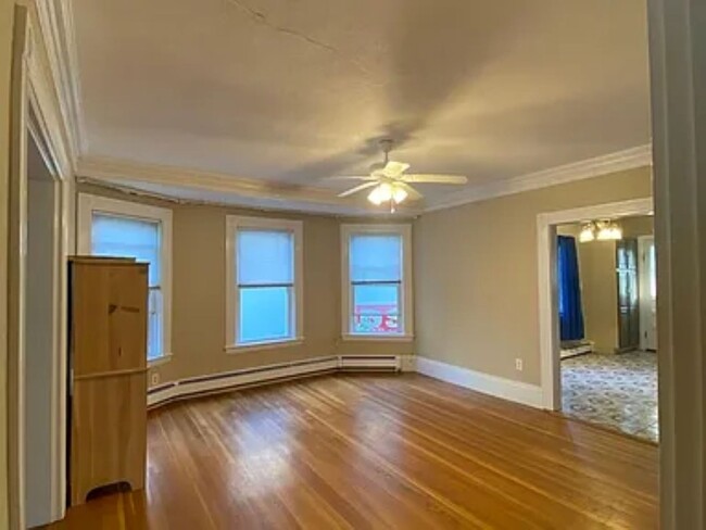
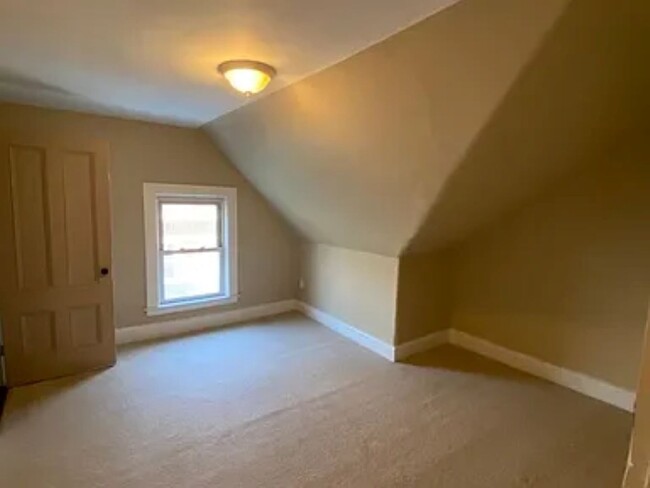
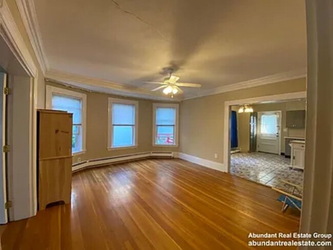
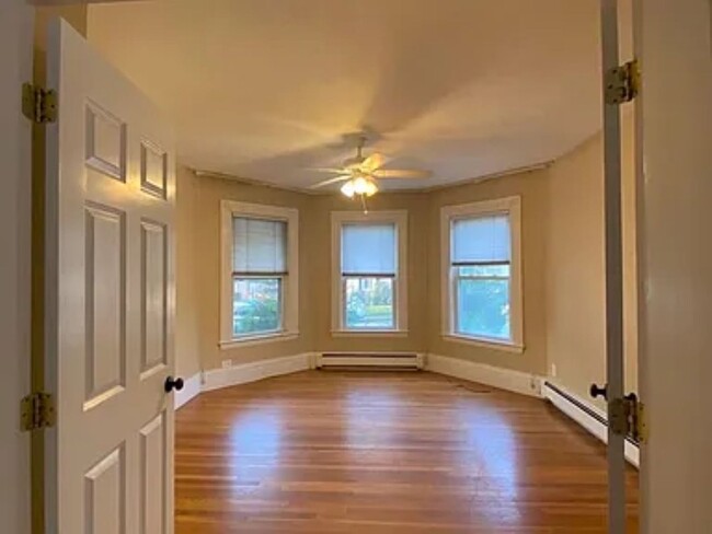
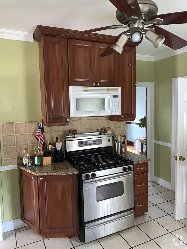
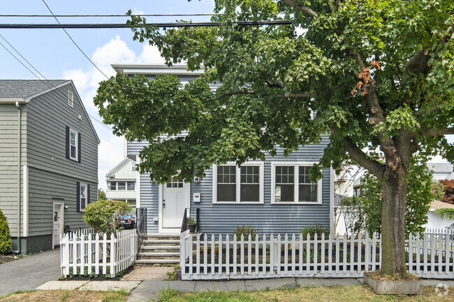
Huge townhouse with laundry and 2 parking spots This is a 5 bedroom but LL prefers only 3 tenants
113 Riverside St is a house located in Middlesex County and the 02472 ZIP Code. This area is served by the Watertown attendance zone.
* Price shown is base rent and may not include non-optional fees and utilities.
Price, availability, fees, and any applicable rent special are subject to change without notice.
* Square footage definitions vary. Displayed square footage is approximate.
Location
Get Directions
East Watertown is a great option for renters who want to be near other metro cities. The neighborhood is seven miles from Boston and just four miles from Cambridge, providing easy access for work, school, or entertainment. Boston University and Harvard University are just two schools convenient to East Watertown. Although residents enjoy proximity to Boston, East Watertown has plenty to offer. The neighborhood is home to Watertown Mall along with several big-box stores and popular retailers. This wooded locale has multiple parks like Arsenal Community Park and Skate Park, which provides great views of the Charles River. East Watertown merges the old and new with rental options available for every budget. Renovated historic buildings neighbor modern, high-rise apartments standing side-by-side with small, brick buildings that add extra charm.
Learn more about living in East Watertown
Education
| Colleges & Universities | Distance | ||
|---|---|---|---|
| Colleges & Universities | Distance | ||
| Drive: | 8 min | 2.7 mi | |
| Drive: | 9 min | 3.3 mi | |
| Drive: | 8 min | 3.5 mi | |
| Drive: | 8 min | 3.9 mi |
113 Riverside St is within 8 minutes or 2.7 miles from Boston College, Brighton. It is also near Boston College and Bentley University.
Schools


Public Elementary School
Grades PK-5
716 Students
Attendance Zone
Public Middle School
Grades 6-8
532 Students
Attendance Zone
Public High School
Grades 9-12
733 Students
Attendance Zone
Private Elementary, Middle & High School
Grades K-12
178 Students
Nearby
School data provided by
 The GreatSchools Rating helps parents compare schools within a state based on a variety of school quality indicators and provides a helpful picture of how effectively each school serves all of its students. Ratings are on a scale of 1 (below average) to 10 (above average) and can include test scores, college readiness, academic progress, advanced courses, equity, discipline and attendance data. We also advise parents to visit schools, consider other information on school performance and programs, and consider family needs as part of the school selection process.
View GreatSchools Rating Methodology
View GreatSchools Rating Methodology
Transportation options available in Watertown include Warren Street Station, located 2.5 miles from 113 Riverside St. 113 Riverside St is near General Edward Lawrence Logan International, located 10.7 miles or 20 minutes away.
| Transit / Subway | Distance | ||
|---|---|---|---|
| Transit / Subway | Distance | ||
|
|
Drive: | 7 min | 2.5 mi |
|
|
Drive: | 8 min | 2.8 mi |
|
|
Drive: | 9 min | 3.0 mi |
|
|
Drive: | 8 min | 3.1 mi |
|
|
Drive: | 9 min | 3.1 mi |
| Commuter Rail | Distance | ||
|---|---|---|---|
| Commuter Rail | Distance | ||
|
|
Drive: | 4 min | 2.2 mi |
|
|
Drive: | 5 min | 2.4 mi |
|
|
Drive: | 6 min | 2.6 mi |
|
|
Drive: | 6 min | 3.5 mi |
| Drive: | 7 min | 3.8 mi |
| Airports | Distance | ||
|---|---|---|---|
| Airports | Distance | ||
|
General Edward Lawrence Logan International
|
Drive: | 20 min | 10.7 mi |
Time and distance from 113 Riverside St.
| Shopping Centers | Distance | ||
|---|---|---|---|
| Shopping Centers | Distance | ||
| Walk: | 7 min | 0.4 mi | |
| Walk: | 8 min | 0.4 mi | |
| Walk: | 16 min | 0.8 mi |
113 Riverside St has 3 shopping centers within 0.8 mile, which is about a 16-minute walk. The miles and minutes will be for the farthest away property.
| Parks and Recreation | Distance | ||
|---|---|---|---|
| Parks and Recreation | Distance | ||
|
Beaver Brook Reservation
|
Drive: | 7 min | 3.1 mi |
|
Chestnut Hill Reservation
|
Drive: | 9 min | 3.2 mi |
|
Longfellow National Historic Site
|
Drive: | 7 min | 3.3 mi |
|
Mass Audubon's Habitat Education Center and Wildlife Sanctuary
|
Drive: | 10 min | 3.8 mi |
|
Hammond Pond Reservation
|
Drive: | 10 min | 4.2 mi |
113 Riverside St has 5 parks within 4.2 miles, including Beaver Brook Reservation, Chestnut Hill Reservation, and Longfellow National Historic Site.
| Hospitals | Distance | ||
|---|---|---|---|
| Hospitals | Distance | ||
| Drive: | 6 min | 2.2 mi | |
| Drive: | 7 min | 2.5 mi | |
| Drive: | 6 min | 3.0 mi |
113 Riverside St has 3 hospitals within 3.0 miles, the nearest is St. Elizabeth's Medical Center which is 2.2 miles away and a 6 minute drive.
| Military Bases | Distance | ||
|---|---|---|---|
| Military Bases | Distance | ||
| Drive: | 22 min | 10.2 mi | |
| Drive: | 23 min | 13.0 mi |
113 Riverside St is 10.2 miles from Hanscom Air Force Base, and is convenient to other military bases, including US Military Reservation.
You May Also Like
Similar Rentals Nearby

What Are Walk Score®, Transit Score®, and Bike Score® Ratings?
Walk Score® measures the walkability of any address. Transit Score® measures access to public transit. Bike Score® measures the bikeability of any address.
What is a Sound Score Rating?
A Sound Score Rating aggregates noise caused by vehicle traffic, airplane traffic and local sources

113 Riverside St
Watertown, MA 02472