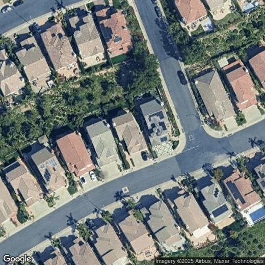
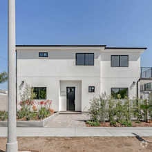
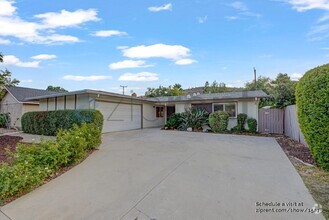
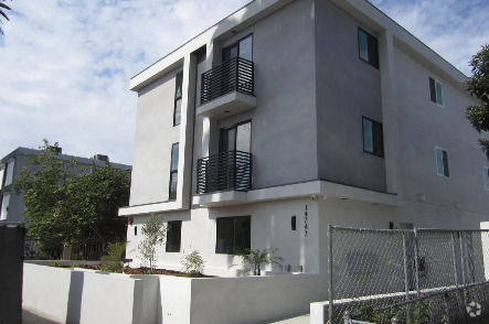
11359 Modena Ln
Porter Ranch, CA 91326
Favorites

11359 Modena Ln
Favorites
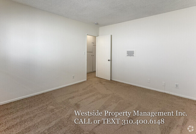
Check Back Soon for Upcoming Availability
Property Address:
11359 Modena Ln,
Porter Ranch,
CA
91326
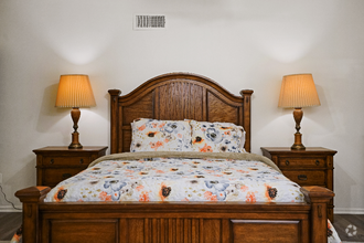
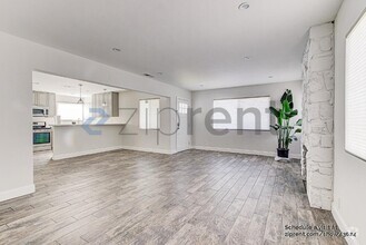
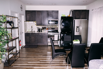
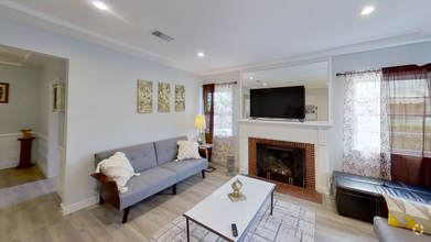
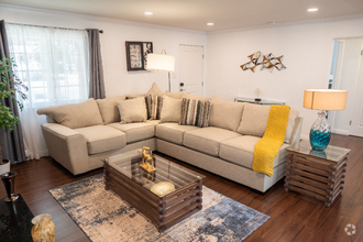
 This Property
 Available Property
Porter Ranch is a large suburban neighborhood in northwestern Los Angeles, positioned right where the San Fernando Valley begins to rise into the Santa Susana foothills. Winding residential streets cover most of the landscape, interspersed with huge parks like Moonshine Canyon and Wilbur Tampa, with the Limekiln Canyon Trail passing through the neighborhood. Residents also enjoy prime access to the mountainous nature preserves to the north.
The rental market features a wide range of upscale accommodations, from resort-style apartment communities to spacious single-family homes. With one of the lowest population densities and one of the lowest crime rates in Los Angeles, Porter Ranch is an ideal location for folks seeking suburban tranquility within one of America’s biggest cities.
Learn more about living in Porter Ranch
Education
| Colleges & Universities | Distance | ||
|---|---|---|---|
| Colleges & Universities | Distance | ||
| Drive: | 12 min | 5.9 mi | |
| Drive: | 17 min | 7.8 mi | |
| Drive: | 20 min | 11.6 mi | |
| Drive: | 28 min | 17.2 mi |
11359 Modena Ln is within 12 minutes or 5.9 miles from Cal State Northridge. It is also near Pierce College and Mission College.
Transportation options available in Porter Ranch include North Hollywood Station, located 17.1 miles from 11359 Modena Ln. 11359 Modena Ln is near Bob Hope, located 16.2 miles or 24 minutes away, and Los Angeles International, located 32.1 miles or 43 minutes away.
| Transit / Subway | Distance | ||
|---|---|---|---|
| Transit / Subway | Distance | ||
|
|
Drive: | 23 min | 17.1 mi |
|
|
Drive: | 26 min | 19.5 mi |
|
|
Drive: | 31 min | 22.4 mi |
|
|
Drive: | 35 min | 26.6 mi |
|
|
Drive: | 36 min | 27.1 mi |
| Commuter Rail | Distance | ||
|---|---|---|---|
| Commuter Rail | Distance | ||
|
|
Drive: | 7 min | 3.0 mi |
|
|
Drive: | 12 min | 5.8 mi |
|
|
Drive: | 16 min | 9.4 mi |
|
|
Drive: | 14 min | 9.6 mi |
|
|
Drive: | 25 min | 13.9 mi |
| Airports | Distance | ||
|---|---|---|---|
| Airports | Distance | ||
|
Bob Hope
|
Drive: | 24 min | 16.2 mi |
|
Los Angeles International
|
Drive: | 43 min | 32.1 mi |
Time and distance from 11359 Modena Ln.
| Shopping Centers | Distance | ||
|---|---|---|---|
| Shopping Centers | Distance | ||
| Walk: | 18 min | 1.0 mi | |
| Drive: | 5 min | 1.4 mi | |
| Drive: | 4 min | 1.7 mi |
11359 Modena Ln has 3 shopping centers within 1.7 miles, which is about a 4-minute drive. The miles and minutes will be for the farthest away property.
| Parks and Recreation | Distance | ||
|---|---|---|---|
| Parks and Recreation | Distance | ||
|
Limekiln State Park
|
Drive: | 5 min | 2.5 mi |
|
Aliso Canyon Park
|
Drive: | 10 min | 4.5 mi |
|
Cal State Northridge Botanic Garden
|
Drive: | 12 min | 6.1 mi |
|
Orcutt Ranch Horticultural Center
|
Drive: | 15 min | 7.7 mi |
|
Ed Davis Park in Towsley Canyon
|
Drive: | 21 min | 12.6 mi |
11359 Modena Ln has 5 parks within 12.6 miles, including Limekiln State Park, Aliso Canyon Park, and Cal State Northridge Botanic Garden.
| Hospitals | Distance | ||
|---|---|---|---|
| Hospitals | Distance | ||
| Drive: | 12 min | 6.9 mi | |
| Drive: | 13 min | 7.8 mi | |
| Drive: | 16 min | 8.1 mi |
11359 Modena Ln has 3 hospitals within 8.1 miles, the nearest is Northridge Hospital Medical Center which is 6.9 miles away and a 12 minutes drive.
| Military Bases | Distance | ||
|---|---|---|---|
| Military Bases | Distance | ||
| Drive: | 44 min | 34.7 mi |
11359 Modena Ln is 34.7 miles and a 44 minutes from Los Angeles Air Force Base.
You May Also Like
Similar Rentals Nearby
-
-
-
-
 $5,9954 Beds, 3 Baths, 2,800 sq ftHouse for Rent
 -
 $4,5003 Beds, 2.5 Baths, 2,000 sq ftHouse for Rent
 -
 $5,1003 Beds, 4 Baths, 1,765 sq ftHouse for Rent
 -
 $4,8004 Beds, 2 Baths, 1,850 sq ftHouse for Rent
 -
 $5,5002 Beds, 1 Bath, 1,000 sq ftHouse for Rent
 -
 $7,0003 Beds, 2 Baths, 1,800 sq ftHouse for Rent
 -
 $6,4002 Beds, 1 Bath, 909 sq ftHouse for Rent

What Are Walk Score®, Transit Score®, and Bike Score® Ratings?
Walk Score® measures the walkability of any address. Transit Score® measures access to public transit. Bike Score® measures the bikeability of any address.
What is a Sound Score Rating?
A Sound Score Rating aggregates noise caused by vehicle traffic, airplane traffic and local sources