
$2,250 / Month
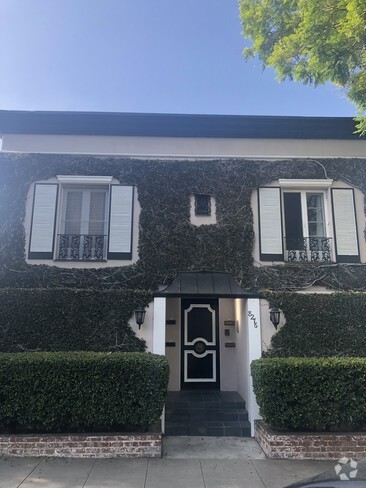
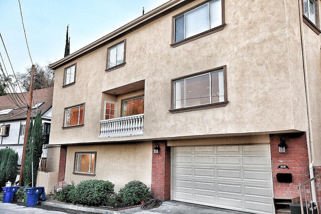
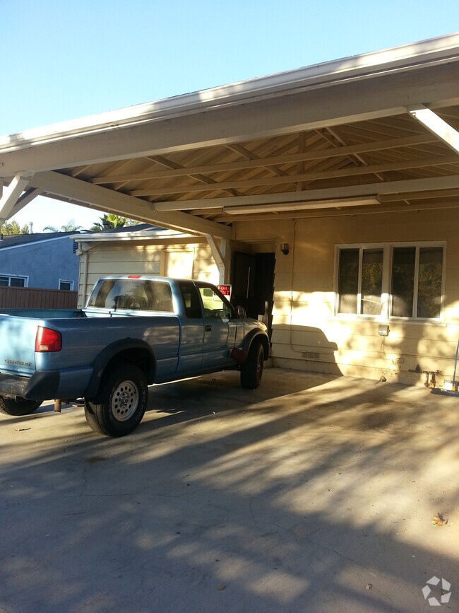
1146 S Wooster St
Los Angeles, CA 90035
1 Day Ago
Favorites
310-801-1333
-
Bedrooms
1
-
Bathrooms
1
-
Square Feet
--
-
Available
Available Now
1146 S Wooster St

Favorites
About This Home
$2,250 deposit,
Available Now
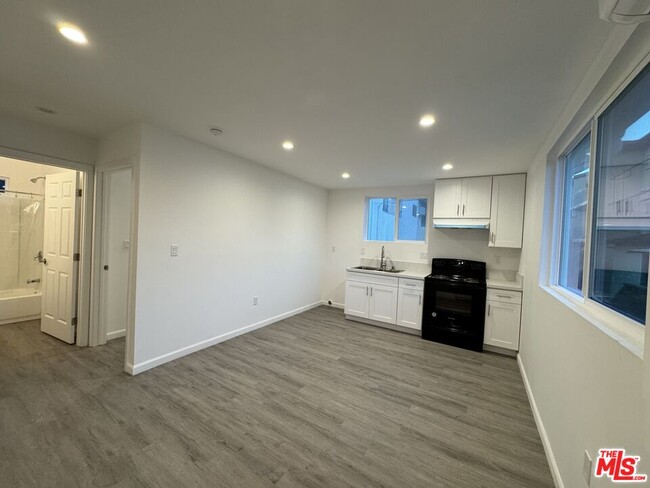
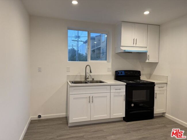
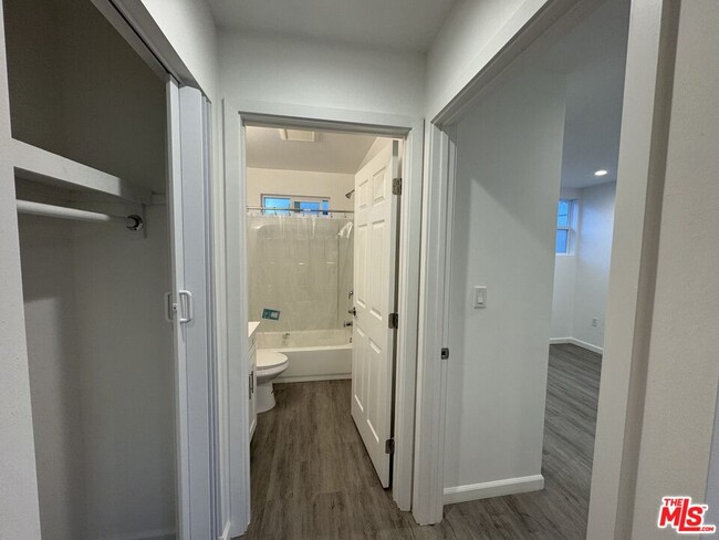
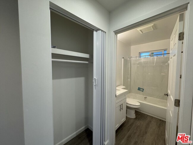
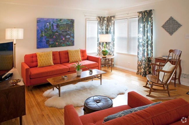
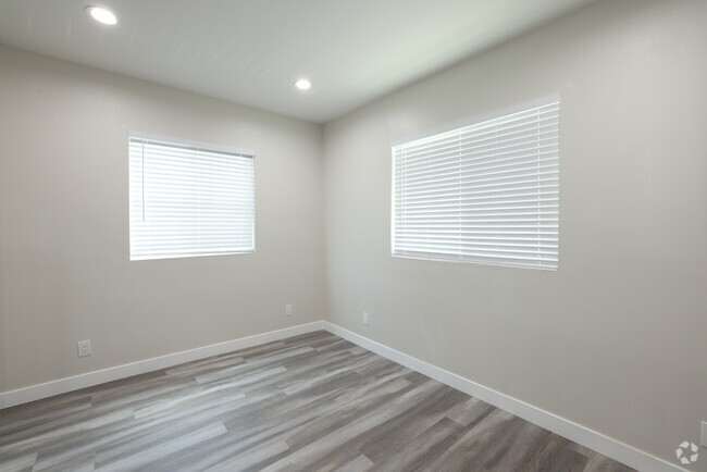
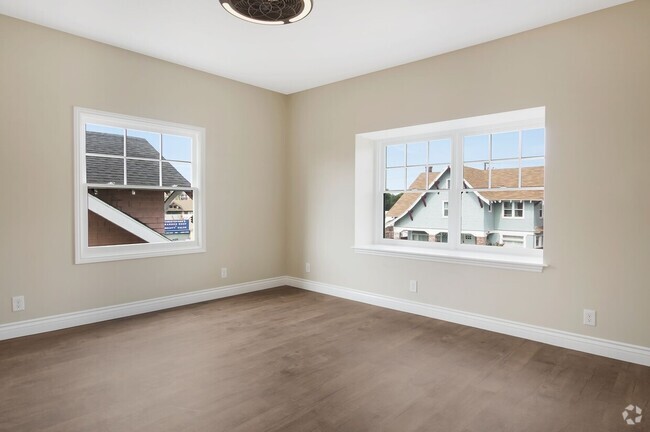
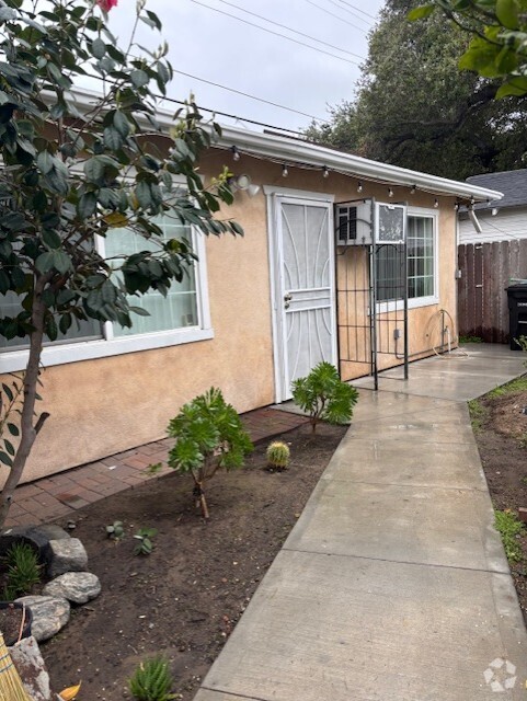
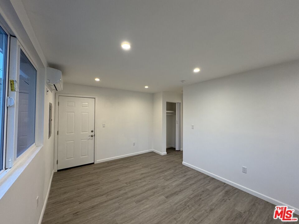
Newly built upstairs one bedroom in the back of an occupied duplex in prime Pico / Robertson neighborhood. This spacious one bedroom has natural sunlight shining in both the bedroom and kitchen, living room areas. The bathroom has a bathtub / shower combo with all new appliances. Enjoy a newly built and designed place in the heart of Pico Robertson. One uncovered parking space available.
1146 S Wooster St is a house located in Los Angeles County and the 90035 ZIP Code. This area is served by the Los Angeles Unified attendance zone.
* Price shown is base rent and may not include non-optional fees and utilities.
Price, availability, fees, and any applicable rent special are subject to change without notice.
* Square footage definitions vary. Displayed square footage is approximate.
House Features
- Air Conditioning
- Vinyl Flooring
- Views
Fees and Policies
The fees below are based on community-supplied data and may exclude additional fees and utilities.
Pet policies are negotiable.
Contact
- Listed by Brandon Douglas | Rodeo Realty
- Phone Number
- Contact
-
Source
 MLS(TM)/CLAW
Copyright 2025 TheMLS/CLAW. All rights reserved. Information is deemed reliable but not guaranteed.
Location
Get Directions
Amenities
- Air Conditioning
- Vinyl Flooring
- Views
Pico-Robertson is a popular Los Angeles neighborhood situated directly south of Beverly Hills and east of Century City. Despite its location in the heart of glittery West Los Angeles near the Miracle Mile, Beverlywood, Carthay, and Cheviot Hills, Pico-Robertson is much more low-key. You won't find trendy hotspots and wild nightlife in Pico-Robertson, but you will find a strong sense of community and a quiet setting.
Pico-Robertson offers a unique collection of delis, bakeries, and more. It is named for the intersection of Pico Boulevard and Robertson Boulevard, and that's where you'll find the majority of the neighborhood's shops, restaurants, and cafes.
Learn more about living in Pico-Robertson
Education
| Colleges & Universities | Distance | ||
|---|---|---|---|
| Colleges & Universities | Distance | ||
| Drive: | 12 min | 4.4 mi | |
| Drive: | 12 min | 5.2 mi | |
| Drive: | 11 min | 5.9 mi | |
| Drive: | 12 min | 6.3 mi |
1146 S Wooster St is within 12 minutes or 4.4 miles from West Los Angeles College. It is also near UCLA and Musicians Institute.
Schools


Public Elementary School
Grades K-5
542 Students
Nearby
Public Elementary School
Grades K-5
334 Students
Attendance Zone
Public Middle School
Grades 6-8
442 Students
Attendance Zone
Public High School
Grades 9-12
2,259 Students
Attendance Zone
Private Elementary & Middle School
Grades K-8
312 Students
Nearby
Private Elementary & Middle School
Grades 5-8
71 Students
Nearby
Private Elementary & Middle School
Grades PK-7
106 Students
Nearby
Private High School
Grades 9-12
12 Students
Nearby
School data provided by
 The GreatSchools Rating helps parents compare schools within a state based on a variety of school quality indicators and provides a helpful picture of how effectively each school serves all of its students. Ratings are on a scale of 1 (below average) to 10 (above average) and can include test scores, college readiness, academic progress, advanced courses, equity, discipline and attendance data. We also advise parents to visit schools, consider other information on school performance and programs, and consider family needs as part of the school selection process.
View GreatSchools Rating Methodology
View GreatSchools Rating Methodology
Transportation options available in Los Angeles include Culver City, located 2.2 miles from 1146 S Wooster St. 1146 S Wooster St is near Los Angeles International, located 9.6 miles or 19 minutes away, and Bob Hope, located 14.2 miles or 27 minutes away.
| Transit / Subway | Distance | ||
|---|---|---|---|
| Transit / Subway | Distance | ||
|
|
Drive: | 5 min | 2.2 mi |
|
|
Drive: | 6 min | 2.5 mi |
|
|
Drive: | 6 min | 3.3 mi |
|
|
Drive: | 8 min | 3.4 mi |
|
|
Drive: | 8 min | 4.1 mi |
| Commuter Rail | Distance | ||
|---|---|---|---|
| Commuter Rail | Distance | ||
|
|
Drive: | 18 min | 11.1 mi |
|
|
Drive: | 20 min | 11.2 mi |
|
|
Drive: | 21 min | 11.8 mi |
|
|
Drive: | 24 min | 12.1 mi |
|
|
Drive: | 26 min | 13.1 mi |
| Airports | Distance | ||
|---|---|---|---|
| Airports | Distance | ||
|
Los Angeles International
|
Drive: | 19 min | 9.6 mi |
|
Bob Hope
|
Drive: | 27 min | 14.2 mi |
Time and distance from 1146 S Wooster St.
| Shopping Centers | Distance | ||
|---|---|---|---|
| Shopping Centers | Distance | ||
| Walk: | 2 min | 0.1 mi | |
| Walk: | 6 min | 0.3 mi | |
| Walk: | 9 min | 0.5 mi |
1146 S Wooster St has 3 shopping centers within 0.5 mile, which is about a 9-minute walk. The miles and minutes will be for the farthest away property.
| Parks and Recreation | Distance | ||
|---|---|---|---|
| Parks and Recreation | Distance | ||
|
Zimmer Children's Museum
|
Drive: | 4 min | 1.6 mi |
|
La Brea Tar Pits
|
Drive: | 4 min | 2.1 mi |
|
Virginia Robinson Gardens
|
Drive: | 9 min | 3.6 mi |
|
Kenneth Hahn State Recreation Area
|
Drive: | 12 min | 4.6 mi |
|
Mathias Botanical Garden
|
Drive: | 11 min | 4.8 mi |
1146 S Wooster St has 5 parks within 4.8 miles, including Zimmer Children's Museum, La Brea Tar Pits, and Virginia Robinson Gardens.
| Hospitals | Distance | ||
|---|---|---|---|
| Hospitals | Distance | ||
| Drive: | 3 min | 1.5 mi | |
| Drive: | 3 min | 1.6 mi | |
| Drive: | 4 min | 1.6 mi |
1146 S Wooster St has 3 hospitals within 1.6 miles, the nearest is Docs Surgical Hospital which is 1.5 miles away and a 3 minute drive.
| Military Bases | Distance | ||
|---|---|---|---|
| Military Bases | Distance | ||
| Drive: | 19 min | 11.2 mi |
1146 S Wooster St is 11.2 miles and a 19 minute drive from Los Angeles Air Force Base.
You May Also Like
Similar Rentals Nearby

What Are Walk Score®, Transit Score®, and Bike Score® Ratings?
Walk Score® measures the walkability of any address. Transit Score® measures access to public transit. Bike Score® measures the bikeability of any address.
What is a Sound Score Rating?
A Sound Score Rating aggregates noise caused by vehicle traffic, airplane traffic and local sources
1146 S Wooster St
Los Angeles, CA 90035