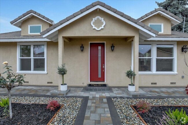
$5,150 / Month
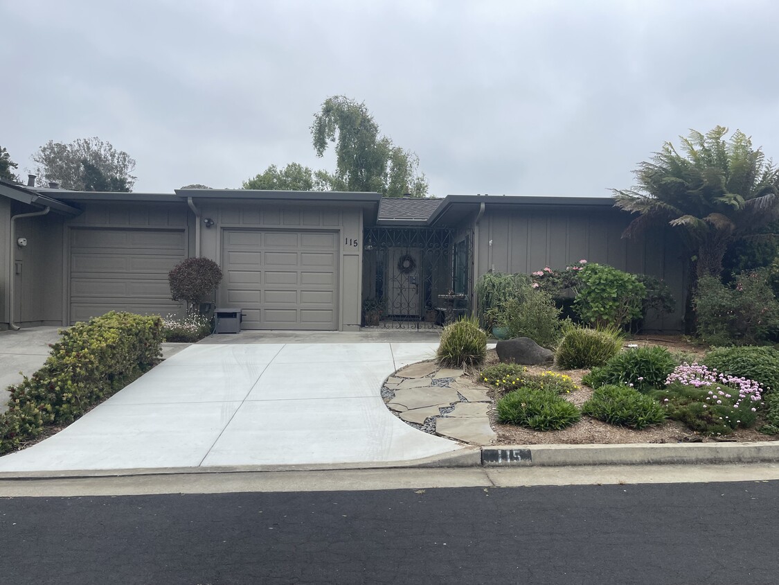
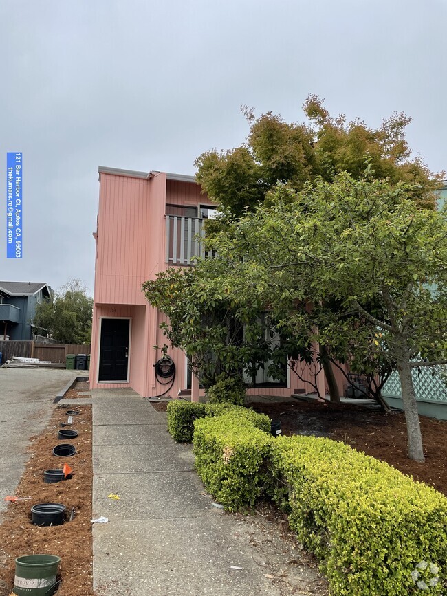
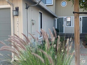
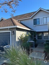
115 Vía La Jolla
Aptos, CA 95003
Today
Favorites
408-828-3480
-
Bedrooms
2
-
Bathrooms
2
-
Square Feet
1,175 sq ft
-
Available
Available Mar 1
115 Vía La Jolla

Favorites
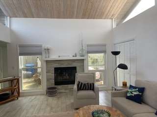
About This Home
$6,500 deposit,
Available Mar 1
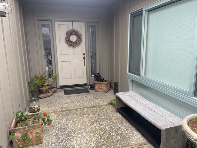
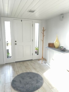
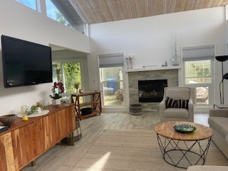
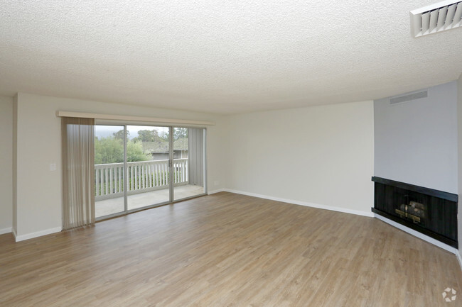
Open to 6 month or 1 year option. Unit can be furnished or semi-furnished to your liking. Amenities included: New in-unit Washer & Dryer Microwave Coffeemaker Pots, pans, silverware, cooking utensils 1 King Bed 1 Full Bed 1 Queen Sofa pull out in Living Room BBQ (propane tank included) Firepit (propane tank included) Patio furniture Private One garage for car + storage Access to Clubhouse w/ game room for social events Access to Pool Parking: 1 car garage + 1 car can fit in driveway. Plenty of street parking In Proximity to: Hidden Beach (7 min walk) Golf (10 min walk) Park for kids (10 min walk) Seascape Resort (10 min walk) Capitola ( 15 min drive) This is a unique opportunity to live in an exclusive, peaceful, safe, Rio Del Mar community steps from the beach. Bring your golf clubs, beach gear and walking shoes - everything else is provided! *Up to 1 small pet preferably hypoallergenic * *Renter responsible for electricity, etc, etc. Owner will be responsible for fees associated w/ clubhouse, garbage, etc. ***Serious Inquiries Only!***
115 Vía La Jolla is a townhome located in Santa Cruz County and the 95003 ZIP Code. This area is served by the Pajaro Valley Unified attendance zone.
* Price shown is base rent and may not include non-optional fees and utilities.
Price, availability, fees, and any applicable rent special are subject to change without notice.
* Square footage definitions vary. Displayed square footage is approximate.
Townhome Features
- Washer/Dryer
- Washer/Dryer Hookup
- Dishwasher
Contact
- Listed by Jaime and Rose Zarate
- Phone Number (408) 828-3480
- Contact
Location
Get Directions
Amenities
- Washer/Dryer
- Washer/Dryer Hookup
- Dishwasher
Overlooking Monterey Bay and home to the gorgeous Seacliff State Beach, Aptos provides amazing ocean views -- or the forest if you prefer, bordered on northeast side by the Forest of Nisene Marks State Park. This redwood forest begins at sea level and extends into the coastal mountains, providing 30 miles of hiking trails. The park is also terrific for camping, picnicking, and wildlife viewing.
At the other side of Aptos, Seacliff State Beach is perfect for surfing, beachcombing, swimming, and fishing. It also features a fishing pier with an unusual feature -- a concrete ship named the SS Palo Alto, a WWI ship that was built toward the end of the war -- too late for use. It was towed to its current location and allowed to sink where it now serves as an artificial reef. Aptos is located about seven miles east of Santa Cruz and roughly one hour south of San Jose.
Learn more about living in Aptos
Education
| Colleges & Universities | Distance | ||
|---|---|---|---|
| Colleges & Universities | Distance | ||
| Drive: | 9 min | 3.8 mi | |
| Drive: | 27 min | 14.9 mi | |
| Drive: | 38 min | 27.9 mi | |
| Drive: | 48 min | 32.4 mi |
115 Vía La Jolla is within 9 minutes or 3.8 miles from Cabrillo College. It is also near UC Santa Cruz and Gavilan College, Gilroy.
Schools
Public Elementary & Middle School
Grades K-8
3 Students
Nearby
Public Elementary School
Grades K-6
404 Students
Attendance Zone
6
Out of 10
Public Middle School
Grades 7-8
594 Students
Attendance Zone
5
Out of 10
Public High School
Grades 9-12
1,360 Students
Attendance Zone
7
Out of 10
Private Elementary, Middle & High School
Grades PK-12
Nearby
Private Elementary & Middle School
Grades PK-8
95 Students
Nearby
Private Elementary, Middle & High School
Grades K-12
166 Students
Nearby
School data provided by
GreatSchools
The GreatSchools Rating helps parents compare schools within a state based on a variety of school quality indicators and provides a helpful picture of how effectively each school serves all of its students. Ratings are on a scale of 1 (below average) to 10 (above average) and can include test scores, college readiness, academic progress, advanced courses, equity, discipline and attendance data. We also advise parents to visit schools, consider other information on school performance and programs, and consider family needs as part of the school selection process.
Transportation options available in Aptos include Ohlone/Chynoweth Station, located 37.9 miles from 115 Vía La Jolla. 115 Vía La Jolla is near Monterey Regional, located 34.8 miles or 45 minutes away, and Norman Y Mineta San Jose International, located 40.4 miles or 55 minutes away.
| Transit / Subway | Distance | ||
|---|---|---|---|
| Transit / Subway | Distance | ||
|
|
Drive: | 53 min | 37.9 mi |
|
|
Drive: | 53 min | 38.7 mi |
|
|
Drive: | 58 min | 41.4 mi |
|
|
Drive: | 57 min | 41.9 mi |
|
|
Drive: | 58 min | 42.9 mi |
| Commuter Rail | Distance | ||
|---|---|---|---|
| Commuter Rail | Distance | ||
| Drive: | 46 min | 26.7 mi | |
| Drive: | 51 min | 30.2 mi | |
| Drive: | 55 min | 30.8 mi | |
| Drive: | 56 min | 40.6 mi | |
| Drive: | 57 min | 40.8 mi |
| Airports | Distance | ||
|---|---|---|---|
| Airports | Distance | ||
|
Monterey Regional
|
Drive: | 45 min | 34.8 mi |
|
Norman Y Mineta San Jose International
|
Drive: | 55 min | 40.4 mi |
Time and distance from 115 Vía La Jolla.
| Shopping Centers | Distance | ||
|---|---|---|---|
| Shopping Centers | Distance | ||
| Walk: | 14 min | 0.7 mi | |
| Drive: | 6 min | 2.0 mi | |
| Drive: | 7 min | 3.0 mi |
115 Vía La Jolla has 3 shopping centers within 3.0 miles, which is about a 7-minute drive. The miles and minutes will be for the farthest away property.
| Parks and Recreation | Distance | ||
|---|---|---|---|
| Parks and Recreation | Distance | ||
|
Seacliff State Beach
|
Drive: | 8 min | 2.6 mi |
|
Manresa State Beach
|
Drive: | 10 min | 4.4 mi |
|
The Forest of Nisene Marks State Park
|
Drive: | 15 min | 5.1 mi |
|
New Brighton State Beach
|
Drive: | 13 min | 5.8 mi |
|
Sunset State Beach
|
Drive: | 19 min | 8.1 mi |
115 Vía La Jolla has 5 parks within 8.1 miles, including Seacliff State Beach, The Forest of Nisene Marks State Park, and Manresa State Beach.
| Hospitals | Distance | ||
|---|---|---|---|
| Hospitals | Distance | ||
| Drive: | 11 min | 7.0 mi | |
| Drive: | 12 min | 7.7 mi | |
| Drive: | 13 min | 8.1 mi |
115 Vía La Jolla has 3 hospitals within 8.1 miles, the nearest is Watsonville Community Hospital which is 7.0 miles away and a 11 minutes drive.
| Military Bases | Distance | ||
|---|---|---|---|
| Military Bases | Distance | ||
| Drive: | 47 min | 35.1 mi | |
| Drive: | 52 min | 37.3 mi |
115 Vía La Jolla is 35.1 miles from Presidio of Monterey, and is convenient to other military bases, including Coast Guard Facilities.
You May Also Like
Similar Rentals Nearby
-
-
 $3,7502 Beds, 1.5 Baths, 1,000 sq ftTownhome for Rent
 -
 $3,9003 Beds, 2 Baths, 1,250 sq ftTownhome for Rent
 -
-
-
-
-
-
-
What Are Walk Score®, Transit Score®, and Bike Score® Ratings?
Walk Score® measures the walkability of any address. Transit Score® measures access to public transit. Bike Score® measures the bikeability of any address.
What is a Sound Score Rating?
A Sound Score Rating aggregates noise caused by vehicle traffic, airplane traffic and local sources

115 Vía La Jolla
Aptos, CA 95003