
$3,700 / Month
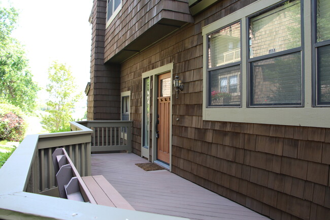
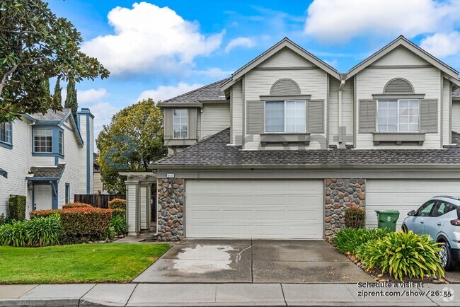
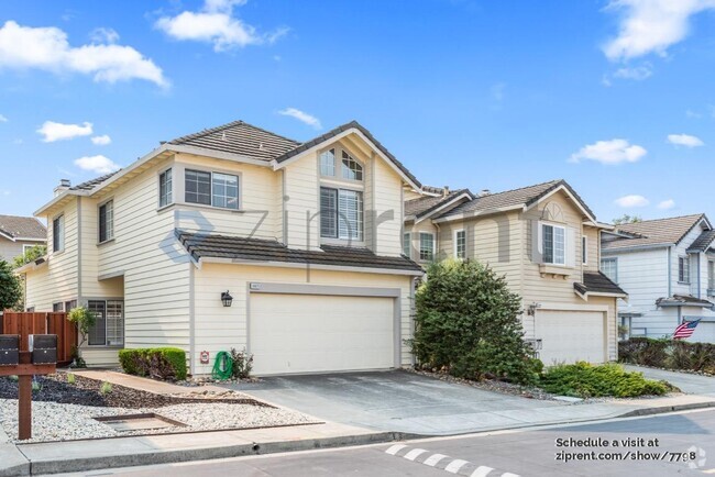
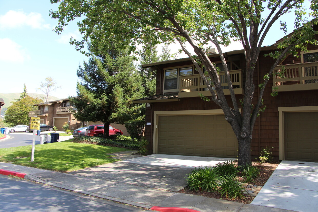
1172 Ocaso Camino
Fremont, CA 94539
2 Weeks Ago
Favorites
1172 Ocaso Camino

Favorites
Check Back Soon for Upcoming Availability
| Beds | Baths | Average SF |
|---|---|---|
| 3 Bedrooms 3 Bedrooms 3 Br | 2.5 Baths 2.5 Baths 2.5 Ba | 2,058 SF |
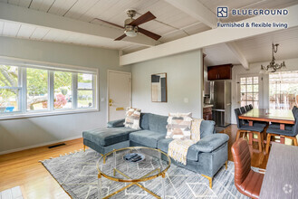
About This Property
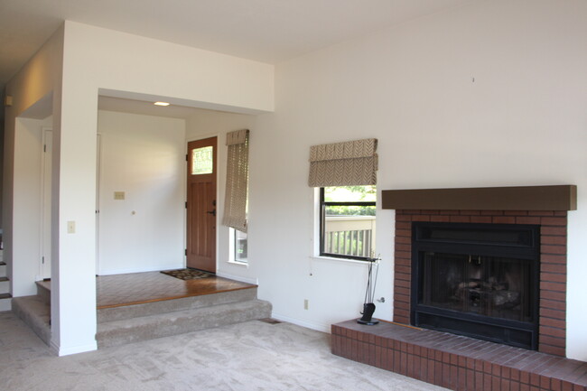
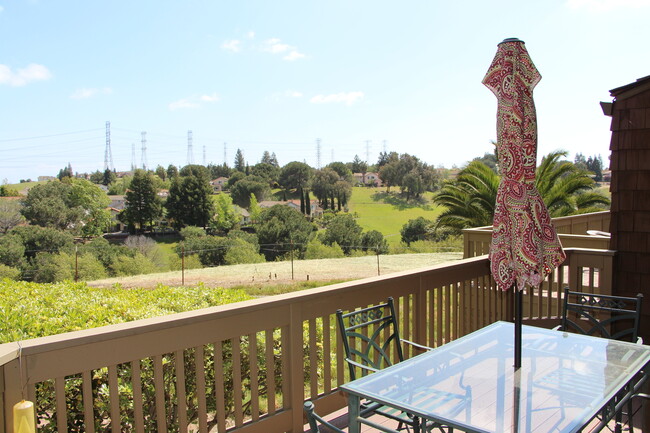
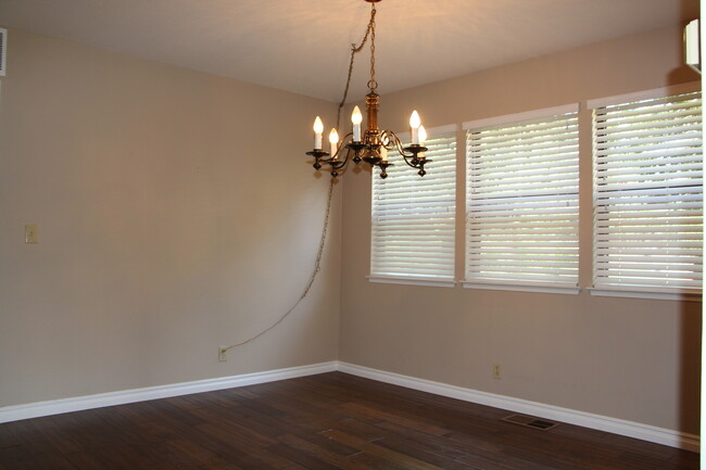
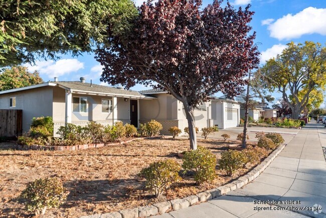
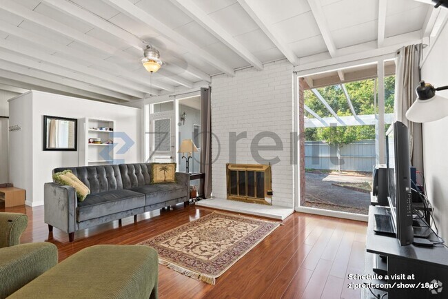
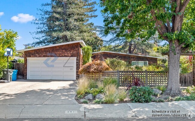
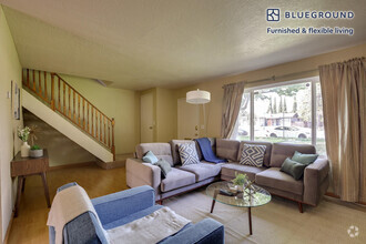
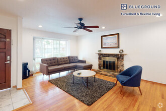
Welcome to Antelope Hills, a stunning residence nestled in the desirable location of Fremont, CA. This charming house boasts 3 bedrooms and 2.5 bathrooms, providing ample space for comfortable living. The picturesque surroundings offer breathtaking views, perfect for nature enthusiasts and those seeking tranquility. With easy access to major highways 680 and 880, commuting becomes a breeze, ensuring convenience for all residents. Antelope Hills also offers a community pool, allowing you to relax and unwind in style. The house has been recently updated with new paint and carpet, providing a fresh and modern ambiance. Immerse yourself in the local hiking trails, allowing you to explore the beauty of the area firsthand. Antelope Hills is the perfect place to call home, offering a harmonious blend of natural beauty and modern amenities. Don't miss out on this incredible opportunity to experience the best of Fremont living.
1172 Ocaso Camino is a house located in Alameda County and the 94539 ZIP Code. This area is served by the Fremont Unified attendance zone.
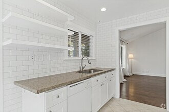
House Features
- Dishwasher
- Microwave
- Refrigerator
- Pool
Fees and Policies
The fees below are based on community-supplied data and may exclude additional fees and utilities.
Location
Get Directions
Fremont is a charming city in the San Francisco Bay Area that sits across the Bay from the Silicon Valley. It is known as an ideal destination for families, offering kid-friendly attractions and excellent public schools like the Children’s Natural History Museum and Washington High School. The rapid expansion of the tech industry in recent years has boosted Fremont’s reputation as a commuter-friendly city for those working in the Silicon Valley. Fremont is located directly north of San Jose, and Palo Alto is a short drive across the Dumbarton Bridge on the Bay.
Fremont’s local culture incorporates the area’s rich history and thriving arts scene. Check out the Old Town Niles region that features a popular art walk, antique fair, and a museum celebrating the town’s role in the early days of motion picture production. Exquisite historic architecture is on display around the city, so be sure to explore Fremont’s picturesque streets that blend urban amenities and suburban neighborhoods.
Learn more about living in FremontBelow are rent ranges for similar nearby apartments
Amenities
- Dishwasher
- Microwave
- Refrigerator
- Pool
Education
| Colleges & Universities | Distance | ||
|---|---|---|---|
| Colleges & Universities | Distance | ||
| Drive: | 4 min | 1.2 mi | |
| Drive: | 11 min | 5.9 mi | |
| Drive: | 17 min | 11.1 mi | |
| Drive: | 26 min | 18.0 mi |
1172 Ocaso Camino is within 4 minutes or 1.2 miles from Ohlone College, Fremont Campus. It is also near Ohlone College, Newark and Palmer College of Chiropractic West Campus.
Schools


Public Elementary School
Grades K-5
343 Students
Nearby
Public Elementary School
Grades K-5
478 Students
Attendance Zone
Public Middle School
Grades 6-8
909 Students
Attendance Zone
Public High School
Grades 9-12
1,878 Students
Attendance Zone
Private Elementary & Middle School
Grades K-8
217 Students
Nearby
Private Elementary School
Grades PK-6
231 Students
Nearby
Private High School
Grades 9-12
49 Students
Nearby
School data provided by
 The GreatSchools Rating helps parents compare schools within a state based on a variety of school quality indicators and provides a helpful picture of how effectively each school serves all of its students. Ratings are on a scale of 1 (below average) to 10 (above average) and can include test scores, college readiness, academic progress, advanced courses, equity, discipline and attendance data. We also advise parents to visit schools, consider other information on school performance and programs, and consider family needs as part of the school selection process.
View GreatSchools Rating Methodology
View GreatSchools Rating Methodology
Transportation options available in Fremont include Warm Springs / South Fremont, located 2.9 miles from 1172 Ocaso Camino. 1172 Ocaso Camino is near Norman Y Mineta San Jose International, located 15.2 miles or 21 minutes away, and Metro Oakland International, located 25.9 miles or 34 minutes away.
| Transit / Subway | Distance | ||
|---|---|---|---|
| Transit / Subway | Distance | ||
|
|
Drive: | 5 min | 2.9 mi |
|
|
Drive: | 9 min | 4.1 mi |
|
|
Drive: | 18 min | 8.7 mi |
|
|
Drive: | 15 min | 9.8 mi |
|
|
Drive: | 15 min | 9.9 mi |
| Commuter Rail | Distance | ||
|---|---|---|---|
| Commuter Rail | Distance | ||
| Drive: | 11 min | 5.3 mi | |
| Drive: | 18 min | 12.8 mi | |
| Drive: | 17 min | 12.9 mi | |
| Drive: | 24 min | 15.9 mi | |
| Drive: | 24 min | 16.4 mi |
| Airports | Distance | ||
|---|---|---|---|
| Airports | Distance | ||
|
Norman Y Mineta San Jose International
|
Drive: | 21 min | 15.2 mi |
|
Metro Oakland International
|
Drive: | 34 min | 25.9 mi |
Time and distance from 1172 Ocaso Camino.
| Shopping Centers | Distance | ||
|---|---|---|---|
| Shopping Centers | Distance | ||
| Walk: | 15 min | 0.8 mi | |
| Drive: | 4 min | 1.5 mi | |
| Drive: | 3 min | 1.6 mi |
1172 Ocaso Camino has 3 shopping centers within 1.6 miles, which is about a 3-minute walk. The miles and minutes will be for the farthest away property.
| Parks and Recreation | Distance | ||
|---|---|---|---|
| Parks and Recreation | Distance | ||
|
Central Park (Lake Elizabeth)
|
Drive: | 10 min | 4.2 mi |
|
Niles Canyon Railway
|
Drive: | 11 min | 5.7 mi |
|
Mission Peak Regional Preserve
|
Drive: | 19 min | 6.1 mi |
|
Niles Community Park
|
Drive: | 13 min | 6.2 mi |
|
Sunol Regional Wilderness
|
Drive: | 26 min | 12.5 mi |
1172 Ocaso Camino has 5 parks within 12.5 miles, including Central Park (Lake Elizabeth), Mission Peak Regional Preserve, and Niles Canyon Railway.
| Hospitals | Distance | ||
|---|---|---|---|
| Hospitals | Distance | ||
| Drive: | 7 min | 3.5 mi | |
| Drive: | 10 min | 4.4 mi |
1172 Ocaso Camino is 3.5 miles from Kaiser Foundation Hospital - Fremont, and is convenient to other hospitals, including Washington Hospital.
| Military Bases | Distance | ||
|---|---|---|---|
| Military Bases | Distance | ||
| Drive: | 27 min | 18.0 mi |
1172 Ocaso Camino is 18.0 miles and a 27 minute drive from Ames Research Center.
You May Also Like
Similar Rentals Nearby

What Are Walk Score®, Transit Score®, and Bike Score® Ratings?
Walk Score® measures the walkability of any address. Transit Score® measures access to public transit. Bike Score® measures the bikeability of any address.
What is a Sound Score Rating?
A Sound Score Rating aggregates noise caused by vehicle traffic, airplane traffic and local sources
1172 Ocaso Camino
Fremont, CA 94539