
$2,600 / Month
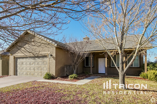
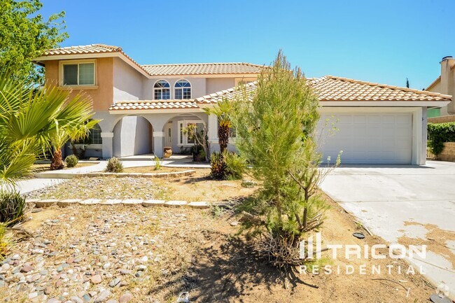
11857 Fort Tejon Rd
Pearblossom, CA 93553
2 Weeks Ago
Favorites
11857 Fort Tejon Rd

Favorites
Check Back Soon for Upcoming Availability
| Beds | Baths | Average SF |
|---|---|---|
| 3 Bedrooms 3 Bedrooms 3 Br | 3 Baths 3 Baths 3 Ba | 1,736 SF |
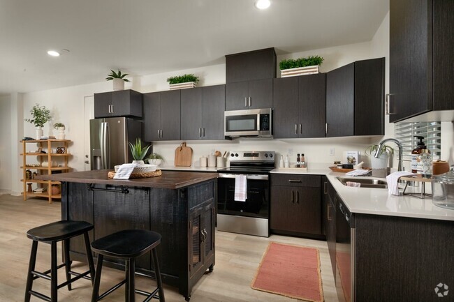
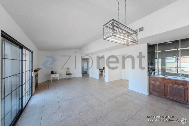
About This Property
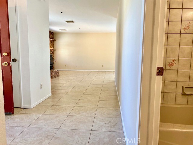
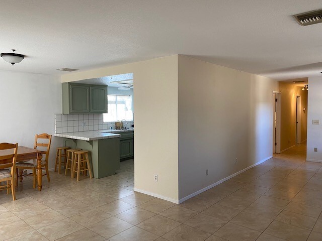
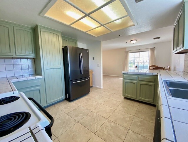
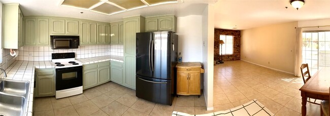
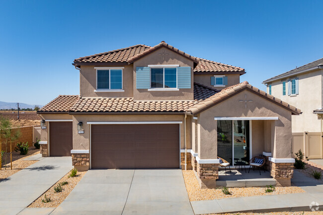
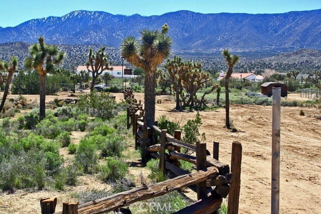
Nestled on the eastern foothills of the San Gabriel Mountains, this ranch home is ideal for peaceful country living. The house sits on 2.5 acres and, is surrounded by amazing views of the mountains, desert and valley. This home features privacy and tranquility w/3 spacious bedrooms/3 bathrooms; 2 HVAC(s), living room with wood burning stove; charming kitchen with pantry; dining area opens to a covered patio; ample storage space; a separate laundry room w/W&D; 2 car garage; and, separate port for larger vehicle. Enjoy the morning view and amazing sunsets from the second master bedroom’s balcony. This room is approx. 360 sq ft. and has a separate wood burning stove, HVAC and bathroom. It can be used as a family room, in-law’s suite, home office or, you decide. This property is far enough from the city to provide a quiet lifestyle in a rural setting, yet near enough to commute to civilization in Los Angeles, the Inland Empire, and Orange County. Just miles from St. Andrews Abby and Devils Punch Bowl, cycling, hiking and horse trails are abundant. It’s part of the Keppel Union School District, 10 miles from Vallarta Supermarkets, Walmart, the USPS, Home Depot, schools, churches and more. AVAILABLE HORSE PROPERTY on adjoining 2.5 acre lot (2nd parcel); animals subject to approval. Total Acres: 5.0
11857 Fort Tejon Rd is a house located in Los Angeles County and the 93553 ZIP Code. This area is served by the Keppel Union Elementary attendance zone.
House Features
Washer/Dryer
Air Conditioning
Refrigerator
Fireplace
- Washer/Dryer
- Air Conditioning
- Heating
- Fireplace
- Pantry
- Refrigerator
- Breakfast Nook
- Carpet
- Tile Floors
- Views
- Balcony
- Patio
Fees and Policies
The fees below are based on community-supplied data and may exclude additional fees and utilities.
- Parking
-
Covered--
-
Other--
-
Garage--
Details
Lease Options
-
12 Months
Location
Get Directions
The Antelope Valley region sits in the northernmost stretches of Los Angeles County. Antelope Valley also constitutes the western portion of the Mojave Desert, located between the Tehachapi, Sierra Pelona, and San Gabriel Mountains, which all lend stunning mountain vistas to the rentals in the region.
Antelope Valley’s largest cities include Lancaster and Palmdale, in addition to a slew of smaller cities and towns that each boast their own unique identity and sense of character. The region’s more affordable cost of living draws plenty of Los Angeles area commuters who don’t mind a longer commute time.
The rental options are just as diverse as the region itself, with an array of apartments, condos, townhomes, and houses available for rent throughout Antelope Valley. Popular spots for outdoor recreation include Angeles National Forest and Castaic Lake State Recreation Area, as well as Greater Los Angeles’ renowned beaches, which are about a two-hour drive away.
Learn more about living in Antelope ValleyBelow are rent ranges for similar nearby apartments
| Beds | Average Size | Lowest | Typical | Premium |
|---|---|---|---|---|
| Studio Studio Studio | 470-473 Sq Ft | $1,295 | $1,964 | $3,794 |
| 1 Bed 1 Bed 1 Bed | 733-736 Sq Ft | $1,000 | $2,595 | $6,115 |
| 2 Beds 2 Beds 2 Beds | 1058-1059 Sq Ft | $2,000 | $3,345 | $8,162 |
| 3 Beds 3 Beds 3 Beds | 1552 Sq Ft | $2,800 | $5,001 | $25,000 |
| 4 Beds 4 Beds 4 Beds | 2727 Sq Ft | $2,163 | $10,490 | $42,000 |
Amenities
- Washer/Dryer
- Air Conditioning
- Heating
- Fireplace
- Pantry
- Refrigerator
- Breakfast Nook
- Carpet
- Tile Floors
- Views
- Balcony
- Patio
Education
| Colleges & Universities | Distance | ||
|---|---|---|---|
| Colleges & Universities | Distance | ||
| Drive: | 38 min | 25.7 mi | |
| Drive: | 81 min | 50.8 mi | |
| Drive: | 94 min | 72.4 mi | |
| Drive: | 95 min | 73.0 mi |
11857 Fort Tejon Rd is within 38 minutes or 25.7 miles from Antelope Valley College. It is also near Citrus College and Azusa Pacific University.
Schools


Public Elementary & Middle School
Grades K-8
393 Students
Attendance Zone
Public Elementary & Middle School
Grades 5-8
233 Students
Attendance Zone
Public High School
Grades 9-12
1,565 Students
Attendance Zone
Private Elementary, Middle & High School
Grades 1-12
9 Students
Nearby
Private Elementary, Middle & High School
Grades K-12
Nearby
Private Elementary School
Grades PK-2
Nearby
School data provided by
 The GreatSchools Rating helps parents compare schools within a state based on a variety of school quality indicators and provides a helpful picture of how effectively each school serves all of its students. Ratings are on a scale of 1 (below average) to 10 (above average) and can include test scores, college readiness, academic progress, advanced courses, equity, discipline and attendance data. We also advise parents to visit schools, consider other information on school performance and programs, and consider family needs as part of the school selection process.
View GreatSchools Rating Methodology
View GreatSchools Rating Methodology
Transportation options available in Pearblossom include Arcadia Station, located 55.8 miles from 11857 Fort Tejon Rd. 11857 Fort Tejon Rd is near Bob Hope, located 57.2 miles or 70 minutes away, and Ontario International, located 58.6 miles or 78 minutes away.
| Transit / Subway | Distance | ||
|---|---|---|---|
| Transit / Subway | Distance | ||
| Drive: | 86 min | 55.8 mi | |
| Drive: | 91 min | 59.7 mi | |
| Drive: | 93 min | 61.8 mi | |
| Drive: | 96 min | 73.4 mi | |
| Drive: | 95 min | 73.9 mi |
| Commuter Rail | Distance | ||
|---|---|---|---|
| Commuter Rail | Distance | ||
|
|
Drive: | 22 min | 15.2 mi |
|
|
Drive: | 24 min | 16.3 mi |
|
|
Drive: | 35 min | 23.7 mi |
|
|
Drive: | 97 min | 64.4 mi |
|
|
Drive: | 96 min | 74.0 mi |
| Airports | Distance | ||
|---|---|---|---|
| Airports | Distance | ||
|
Bob Hope
|
Drive: | 70 min | 57.2 mi |
|
Ontario International
|
Drive: | 78 min | 58.6 mi |
Time and distance from 11857 Fort Tejon Rd.
| Shopping Centers | Distance | ||
|---|---|---|---|
| Shopping Centers | Distance | ||
| Drive: | 16 min | 10.0 mi | |
| Drive: | 16 min | 10.0 mi | |
| Drive: | 16 min | 10.1 mi |
11857 Fort Tejon Rd has 3 shopping centers within 10.1 miles, which is about a 16-minute drive. The miles and minutes will be for the farthest away property.
| Parks and Recreation | Distance | ||
|---|---|---|---|
| Parks and Recreation | Distance | ||
|
Devil's Punchbowl Natural Area
|
Drive: | 15 min | 6.8 mi |
11857 Fort Tejon Rd has a nearby park, Devil's Punchbowl Natural Area , located 6.8 miles or 15 minutes away.
| Military Bases | Distance | ||
|---|---|---|---|
| Military Bases | Distance | ||
| Drive: | 57 min | 24.7 mi | |
| Drive: | 72 min | 54.2 mi | |
| Drive: | 152 min | 58.9 mi |
11857 Fort Tejon Rd has 3 military bases within 58.9 miles, the nearest is Edwards Air Force Base North Antelope Valley which is 24.7 miles away and a 57 minute drive.
You May Also Like
Similar Rentals Nearby
-
-
1 / 11
-
1 / 26

-
-
-
-
-
-
-
What Are Walk Score®, Transit Score®, and Bike Score® Ratings?
Walk Score® measures the walkability of any address. Transit Score® measures access to public transit. Bike Score® measures the bikeability of any address.
What is a Sound Score Rating?
A Sound Score Rating aggregates noise caused by vehicle traffic, airplane traffic and local sources
11857 Fort Tejon Rd
Pearblossom, CA 93553