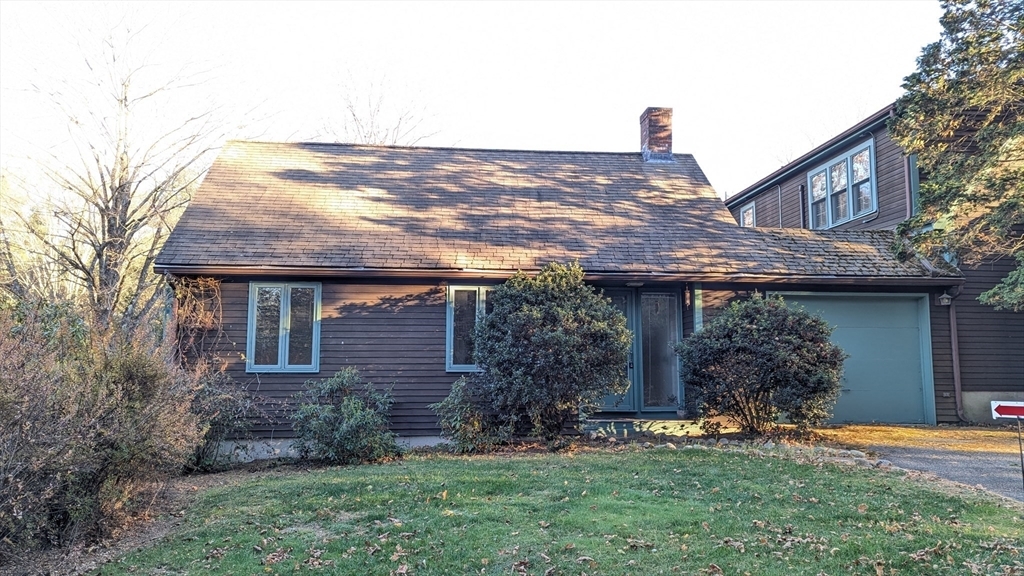
12-12 Longmeadow Rd Unit 12 1/2
Lincoln, MA 01773
-
Bedrooms
1
-
Bathrooms
1
-
Square Feet
567 sq ft
-
Available
Available Now
Highlights
- Community Stables
- Open Floorplan
- Deck
- Property is near public transit
- Wood Flooring
- Main Floor Primary Bedroom

About This Home
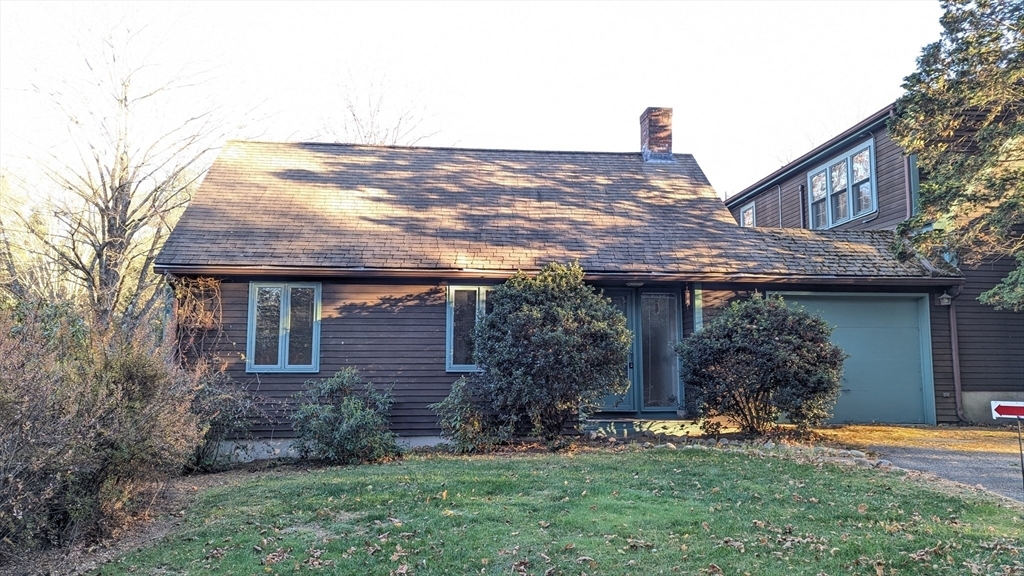
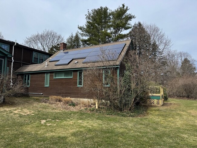
Excellent opportunity for nature lovers and a commuter's dream! This spacious apartment has a sunny living room with big casement windows and slider to new deck overlooking an enormous fenced rear yard. Great kitchen with hardwood floor,Silestone countertops,maple cabinets,gas range,DW,and white appliances. Well-proportioned bedroom with wall of closets & loads of storage with built-in shelving. Laundry closet with newer stackable unit. It even has central air! Close to Lincoln MBTA Commuter Rail & routes 126 and 117,the location can't be beat near the Wayland/Weston Line. Conservation land and walking trails nearby,Drumlin Farm,etc. UTILITIES THAT ARE INCLUDED: electricity,heat,hot water,gas,WI-FI,water,and yard maintenance. The entrance to the apartment is on the left side and the left side yard is for the tenant's use. NO SMOKING.
12-12 Longmeadow Rd is an apartment community located in Middlesex County and the 01773 ZIP Code.
Home Details
Year Built
Accessible Home Design
Bedrooms and Bathrooms
Flooring
Home Design
Interior Spaces
Kitchen
Laundry
Listing and Financial Details
Location
Lot Details
Outdoor Features
Parking
Utilities
Community Details
Amenities
Overview
Pet Policy
Recreation
Fees and Policies
The fees below are based on community-supplied data and may exclude additional fees and utilities.
Pet policies are negotiable.
Contact
- Listed by Suzanne Taylor | N. B. Taylor & Co. Inc.
- Phone Number
-
Source
 MLS Property Information Network
- Dishwasher
- Disposal
- Microwave
- Range
- Refrigerator
- Deck
| Colleges & Universities | Distance | ||
|---|---|---|---|
| Colleges & Universities | Distance | ||
| Drive: | 16 min | 7.3 mi | |
| Drive: | 17 min | 8.3 mi | |
| Drive: | 24 min | 11.6 mi | |
| Drive: | 25 min | 12.9 mi |
Transportation options available in Lincoln include Riverside Station, located 9.6 miles from 12-12 Longmeadow Rd Unit 12 1/2. 12-12 Longmeadow Rd Unit 12 1/2 is near General Edward Lawrence Logan International, located 21.3 miles or 37 minutes away, and Worcester Regional, located 36.2 miles or 59 minutes away.
| Transit / Subway | Distance | ||
|---|---|---|---|
| Transit / Subway | Distance | ||
|
|
Drive: | 18 min | 9.6 mi |
|
|
Drive: | 18 min | 10.0 mi |
|
|
Drive: | 19 min | 10.6 mi |
|
|
Drive: | 22 min | 12.2 mi |
|
|
Drive: | 22 min | 12.4 mi |
| Commuter Rail | Distance | ||
|---|---|---|---|
| Commuter Rail | Distance | ||
|
|
Walk: | 19 min | 1.0 mi |
|
|
Drive: | 8 min | 4.3 mi |
|
|
Drive: | 11 min | 4.7 mi |
|
|
Drive: | 13 min | 6.4 mi |
|
|
Drive: | 14 min | 7.2 mi |
| Airports | Distance | ||
|---|---|---|---|
| Airports | Distance | ||
|
General Edward Lawrence Logan International
|
Drive: | 37 min | 21.3 mi |
|
Worcester Regional
|
Drive: | 59 min | 36.2 mi |
Time and distance from 12-12 Longmeadow Rd Unit 12 1/2.
| Shopping Centers | Distance | ||
|---|---|---|---|
| Shopping Centers | Distance | ||
| Walk: | 19 min | 1.0 mi | |
| Drive: | 9 min | 4.1 mi | |
| Drive: | 11 min | 4.7 mi |
| Parks and Recreation | Distance | ||
|---|---|---|---|
| Parks and Recreation | Distance | ||
|
Mass Audubon's Drumlin Farm Wildlife Sanctuary
|
Walk: | 11 min | 0.6 mi |
|
Codman Community Farms
|
Walk: | 17 min | 0.9 mi |
|
Hazel Brook Conservation Area
|
Drive: | 5 min | 2.0 mi |
|
Assabet River National Wildlife Refuge
|
Drive: | 8 min | 3.0 mi |
|
Great Meadows National Wildlife Refuge
|
Drive: | 8 min | 3.0 mi |
| Hospitals | Distance | ||
|---|---|---|---|
| Hospitals | Distance | ||
| Drive: | 11 min | 5.4 mi | |
| Drive: | 13 min | 6.6 mi | |
| Drive: | 18 min | 9.5 mi |
| Military Bases | Distance | ||
|---|---|---|---|
| Military Bases | Distance | ||
| Drive: | 14 min | 6.2 mi | |
| Drive: | 17 min | 9.2 mi |
You May Also Like
Similar Rentals Nearby
What Are Walk Score®, Transit Score®, and Bike Score® Ratings?
Walk Score® measures the walkability of any address. Transit Score® measures access to public transit. Bike Score® measures the bikeability of any address.
What is a Sound Score Rating?
A Sound Score Rating aggregates noise caused by vehicle traffic, airplane traffic and local sources
