
12 Davis St Unit 2
Marlborough, MA 01752
-
Bedrooms
1
-
Bathrooms
1
-
Square Feet
--
-
Available
Available Jun 1
Highlight
- Fenced Lot

About This Home
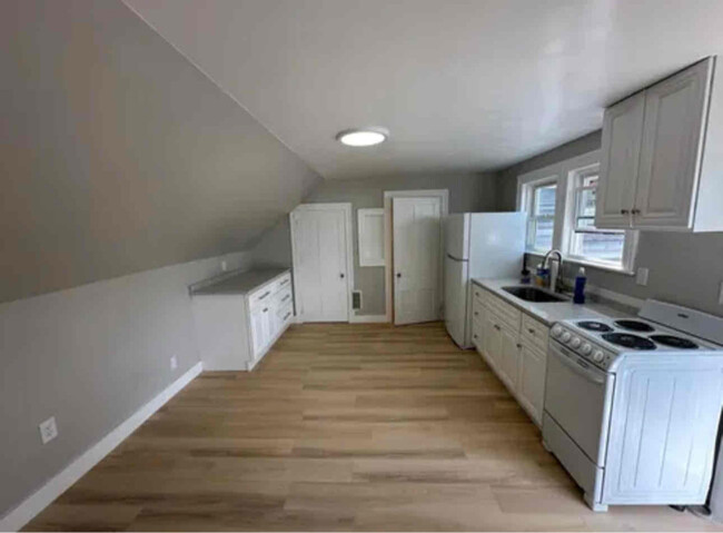
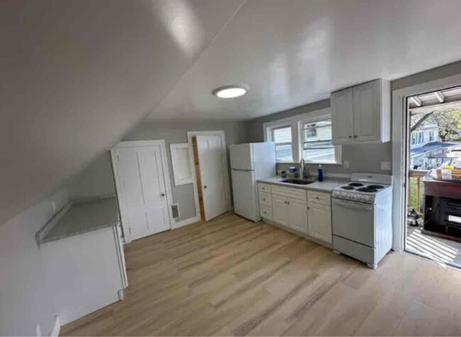
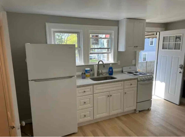
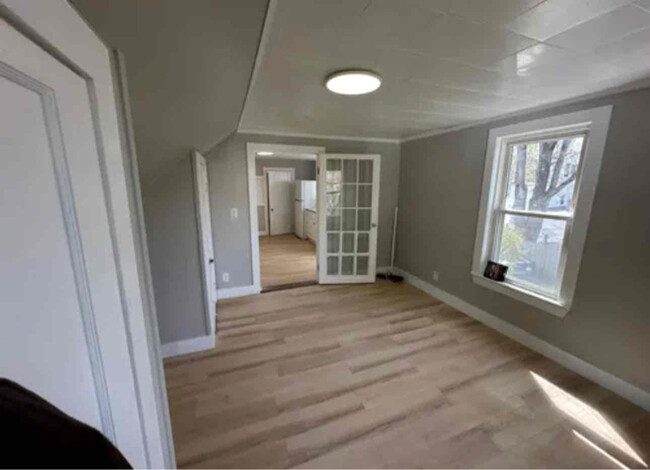
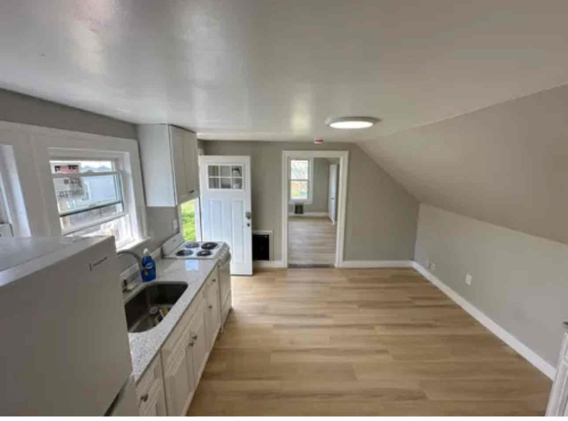
Property Id: 1840777 Cozy studio/1 Bedroom apartment. Completely renovated, granite countertops, new appliances, off street parking for 1 car, large back yard, free washer and dryer on site. Close to downtown, right near shopping and E Main Street. Energy efficient heat/ac and brand new high efficiency water heater. No smokers, No pets, 675+ credit required. Proof of income, first, last and security deposit required
12 Davis St is an apartment community located in Middlesex County and the 01752 ZIP Code.
Features
Washer/Dryer
Refrigerator
Freezer
Tile Floors
- Washer/Dryer
- Oven
- Refrigerator
- Freezer
- Tile Floors
- Vinyl Flooring
- Fenced Lot
- Lawn
Fees and Policies
The fees below are based on community-supplied data and may exclude additional fees and utilities.
Details
Utilities Included
-
Water
-
Trash Removal
-
Sewer
Contact
- Phone Number
- Contact
-
Source

- Washer/Dryer
- Oven
- Refrigerator
- Freezer
- Tile Floors
- Vinyl Flooring
- Fenced Lot
- Lawn
Just west of Boston and East of Worcester sits Metro West, a region that houses a group of towns and cities with significant historical backgrounds. A total of 19 municipalities make up the core of this community, but other municipalities are considered to be a part of the Interstate 495/Metro West Corridor.
Learn more about living in Metro West| Colleges & Universities | Distance | ||
|---|---|---|---|
| Colleges & Universities | Distance | ||
| Drive: | 16 min | 8.9 mi | |
| Drive: | 25 min | 13.6 mi | |
| Drive: | 23 min | 16.4 mi | |
| Drive: | 32 min | 17.3 mi |
Transportation options available in Marlborough include Riverside Station, located 20.7 miles from 12 Davis St Unit 2. 12 Davis St Unit 2 is near Worcester Regional, located 22.9 miles or 34 minutes away, and General Edward Lawrence Logan International, located 33.8 miles or 49 minutes away.
| Transit / Subway | Distance | ||
|---|---|---|---|
| Transit / Subway | Distance | ||
|
|
Drive: | 32 min | 20.7 mi |
|
|
Drive: | 32 min | 21.0 mi |
|
|
Drive: | 33 min | 21.7 mi |
|
|
Drive: | 35 min | 23.3 mi |
|
|
Drive: | 36 min | 23.5 mi |
| Commuter Rail | Distance | ||
|---|---|---|---|
| Commuter Rail | Distance | ||
|
|
Drive: | 14 min | 6.5 mi |
|
|
Drive: | 21 min | 10.3 mi |
|
|
Drive: | 23 min | 10.3 mi |
|
|
Drive: | 22 min | 10.4 mi |
|
|
Drive: | 18 min | 11.8 mi |
| Airports | Distance | ||
|---|---|---|---|
| Airports | Distance | ||
|
Worcester Regional
|
Drive: | 34 min | 22.9 mi |
|
General Edward Lawrence Logan International
|
Drive: | 49 min | 33.8 mi |
Time and distance from 12 Davis St Unit 2.
| Shopping Centers | Distance | ||
|---|---|---|---|
| Shopping Centers | Distance | ||
| Walk: | 6 min | 0.3 mi | |
| Walk: | 9 min | 0.5 mi | |
| Walk: | 11 min | 0.6 mi |
| Parks and Recreation | Distance | ||
|---|---|---|---|
| Parks and Recreation | Distance | ||
|
Felton Conservation Area
|
Drive: | 6 min | 3.2 mi |
|
Memorial Forest
|
Drive: | 9 min | 4.9 mi |
|
Cedar Hill and Sawink Farm Reservation
|
Drive: | 12 min | 5.4 mi |
|
Hop Brook Natural Area
|
Drive: | 11 min | 5.7 mi |
|
Honey Pot Hill Orchards
|
Drive: | 13 min | 5.9 mi |
| Hospitals | Distance | ||
|---|---|---|---|
| Hospitals | Distance | ||
| Walk: | 19 min | 1.0 mi | |
| Drive: | 19 min | 9.7 mi |
| Military Bases | Distance | ||
|---|---|---|---|
| Military Bases | Distance | ||
| Drive: | 24 min | 13.7 mi |
You May Also Like
What Are Walk Score®, Transit Score®, and Bike Score® Ratings?
Walk Score® measures the walkability of any address. Transit Score® measures access to public transit. Bike Score® measures the bikeability of any address.
What is a Sound Score Rating?
A Sound Score Rating aggregates noise caused by vehicle traffic, airplane traffic and local sources
12 Davis St
Marlborough, MA 01752