$2,000 / Month
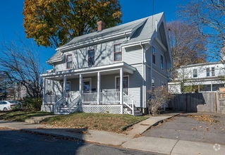
12 King St
Northborough, MA 01532
Today
Favorites
774-258-1615
-
Bedrooms
2
-
Bathrooms
1
-
Square Feet
1,000 sq ft
-
Available
Available Now
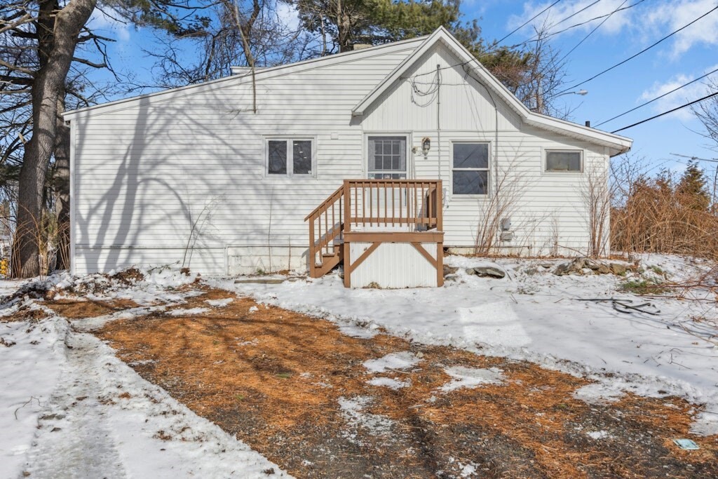
12 King St

Favorites
About This Home
$2,000 deposit,
Available Now
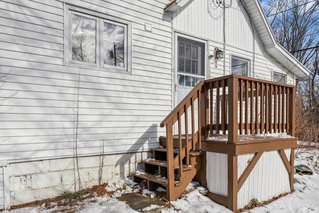
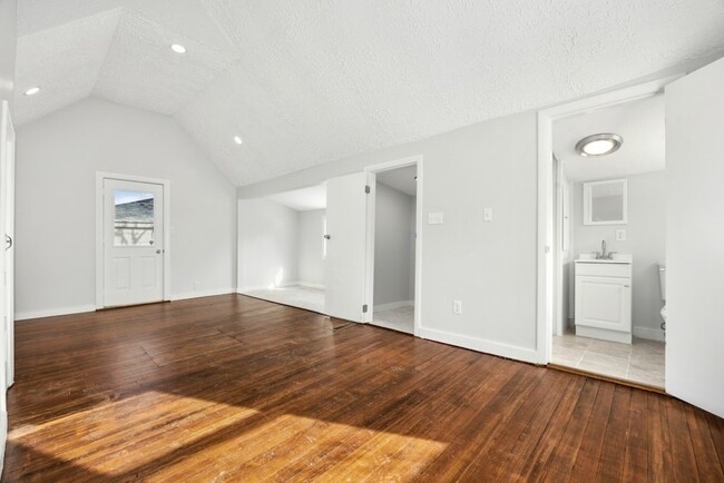
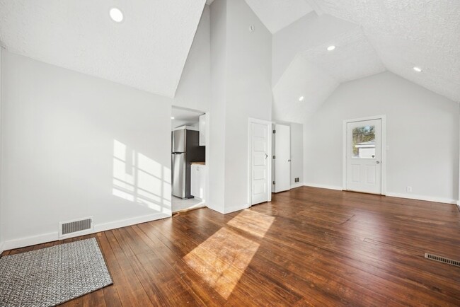
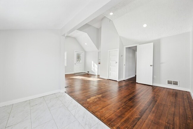
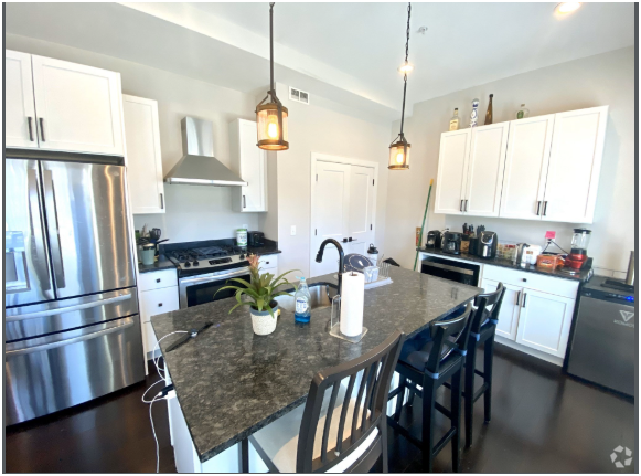
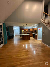
New range,microwave and refrigerator installed. Hardwood floors in most rooms. Rental has 3 off street parking spaces. Master bedroom has a walk in closet.
12 King St is a house located in Worcester County and the 01532 ZIP Code.
* Price shown is base rent and may not include non-optional fees and utilities.
Price, availability, fees, and any applicable rent special are subject to change without notice.
* Square footage definitions vary. Displayed square footage is approximate.
House Features
- Microwave
- Range
- Refrigerator
Contact
- Listed by David Gillespie
- Phone Number (774) 258-1615
-
Source

$2,294 / month
$349,900 Listing Price
2 Beds
•1 Baths
•
896 Sq Ft
$2,223 / month
$355,000 Listing Price
2 Beds
•1 Baths
•
816 Sq Ft
$2,192 / month
$359,000 Listing Price
2 Beds
•1 Baths
•
1,616 Sq Ft
Location
Get Directions
Amenities
- Microwave
- Range
- Refrigerator
Situated just moments east of Worcester is the Route 9 Corridor, a large neighborhood compiled of several communities including Shrewsbury, Westborough, Northborough, and Southborough. Not only is Worcester at residents’ fingertips, but Downtown Boston is less than 40 miles east. The Route 9 Corridor is a commuter’s dream, offering easy city access and entry onto Interstates 290, 495, and 90.
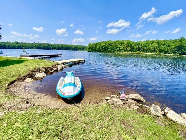
The suburb is dotted with ponds, reservoirs, brooks, and rivers, providing ample outdoor recreation. Renters craving a beach day can bask on the sunny shores of Lake Chauncy Beach. Route 9 Corridor’s Prospect Park allows locals to take their dog for a stroll while Assabet Park gives children ample space to play on the playground. Those looking for winter recreation won’t want to miss the powdery slopes of Ski Ward Ski Area. No matter the season, renters settling in this diverse community can choose from gorgeous apartments ranging in price and amenities.
Learn more about living in Route 9 Corridor
Education
| Colleges & Universities | Distance | ||
|---|---|---|---|
| Colleges & Universities | Distance | ||
| Drive: | 12 min | 6.3 mi | |
| Drive: | 13 min | 6.8 mi | |
| Drive: | 16 min | 8.7 mi | |
| Drive: | 20 min | 10.4 mi |
12 King St is within 12 minutes or 6.3 miles from Tufts University, Grafton. It is also near Stillman College and Quinsigamond Community College.
Transportation options available in Northborough include Riverside Station, located 25.9 miles from 12 King St. 12 King St is near Worcester Regional, located 13.6 miles or 27 minutes away, and General Edward Lawrence Logan International, located 39.0 miles or 57 minutes away.
| Transit / Subway | Distance | ||
|---|---|---|---|
| Transit / Subway | Distance | ||
|
|
Drive: | 39 min | 25.9 mi |
|
|
Drive: | 40 min | 26.2 mi |
|
|
Drive: | 41 min | 26.9 mi |
|
|
Drive: | 43 min | 28.5 mi |
|
|
Drive: | 43 min | 28.7 mi |
| Commuter Rail | Distance | ||
|---|---|---|---|
| Commuter Rail | Distance | ||
|
|
Drive: | 9 min | 3.8 mi |
|
|
Drive: | 11 min | 5.9 mi |
|
|
Drive: | 16 min | 8.3 mi |
|
|
Drive: | 16 min | 8.4 mi |
|
|
Drive: | 20 min | 10.9 mi |
| Airports | Distance | ||
|---|---|---|---|
| Airports | Distance | ||
|
Worcester Regional
|
Drive: | 27 min | 13.6 mi |
|
General Edward Lawrence Logan International
|
Drive: | 57 min | 39.0 mi |
Time and distance from 12 King St.
| Shopping Centers | Distance | ||
|---|---|---|---|
| Shopping Centers | Distance | ||
| Walk: | 2 min | 0.1 mi | |
| Walk: | 3 min | 0.2 mi | |
| Walk: | 4 min | 0.2 mi |
12 King St has 3 shopping centers within 0.2 mile, which is about a 4-minute walk. The miles and minutes will be for the farthest away property.
| Parks and Recreation | Distance | ||
|---|---|---|---|
| Parks and Recreation | Distance | ||
|
Ward Hill Ski Area
|
Drive: | 2 min | 1.4 mi |
|
Felton Conservation Area
|
Drive: | 10 min | 4.4 mi |
|
Mount Pisgah Conservation Area
|
Drive: | 16 min | 5.6 mi |
|
Walkup And Robinson Memorial Reservation
|
Drive: | 13 min | 7.1 mi |
|
Cedar Hill and Sawink Farm Reservation
|
Drive: | 15 min | 7.2 mi |
12 King St has 5 parks within 7.2 miles, including Ward Hill Ski Area, Felton Conservation Area, and Mount Pisgah Conservation Area.
| Hospitals | Distance | ||
|---|---|---|---|
| Hospitals | Distance | ||
| Drive: | 13 min | 6.5 mi | |
| Drive: | 13 min | 6.7 mi | |
| Drive: | 14 min | 7.3 mi |
12 King St has 3 hospitals within 7.3 miles, the nearest is Worcester Recovery Center and Hospital which is 6.5 miles away and a 13 minutes drive.
| Military Bases | Distance | ||
|---|---|---|---|
| Military Bases | Distance | ||
| Drive: | 32 min | 18.8 mi |
12 King St is 18.8 miles and a 32 minutes from US Military Reservation.
You May Also Like
Similar Rentals Nearby
-
-
 $3,2992 Beds, 1 Bath, 1,000 sq ftHouse for Rent
 -
-
 $3,5004 Beds, 2 Baths, 2,000 sq ftHouse for Rent
 -
$3,5004 Beds, 2 Baths, 2,000 sq ftHouse for Rent
-
$1,3004 Beds, 2 Baths, 2,000 sq ftHouse for Rent
-
 $3,5003 Beds, 2 Baths, 1,600 sq ftHouse for Rent
 -
 $3,0003 Beds, 2 Baths, 1,880 sq ftHouse for Rent
 -
 $2,8003 Beds, 1 Bath, 1,300 sq ftHouse for Rent
 -

What Are Walk Score®, Transit Score®, and Bike Score® Ratings?
Walk Score® measures the walkability of any address. Transit Score® measures access to public transit. Bike Score® measures the bikeability of any address.
What is a Sound Score Rating?
A Sound Score Rating aggregates noise caused by vehicle traffic, airplane traffic and local sources

12 King St
Northborough, MA 01532