

$2,395 / Month
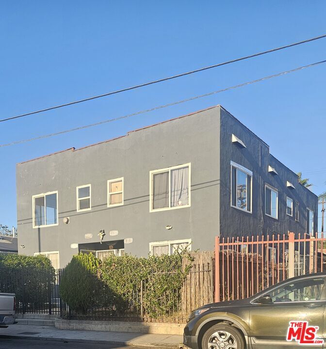
120 N Ave 25
Los Angeles, CA 90031
Today
Favorites
626-200-5708
-
Bedrooms
2
-
Bathrooms
1
-
Square Feet
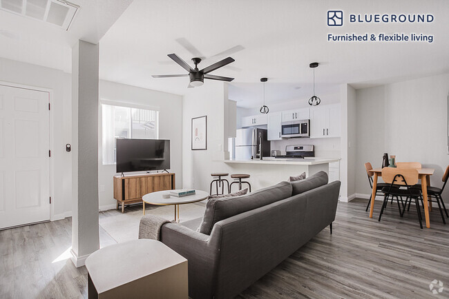
910 sq ft
-
Available
Available Now
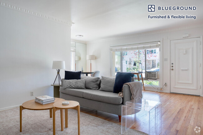
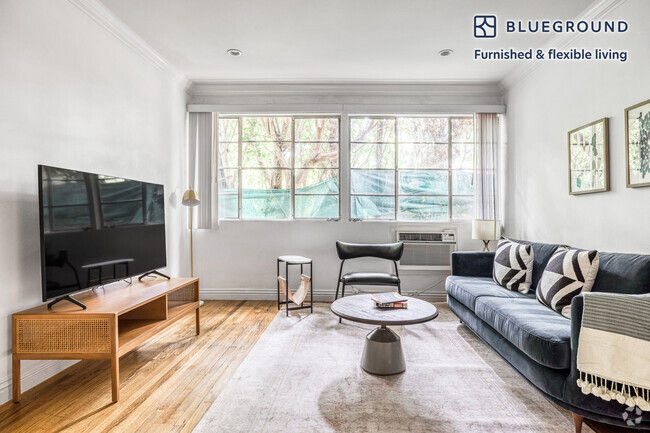
Highlights
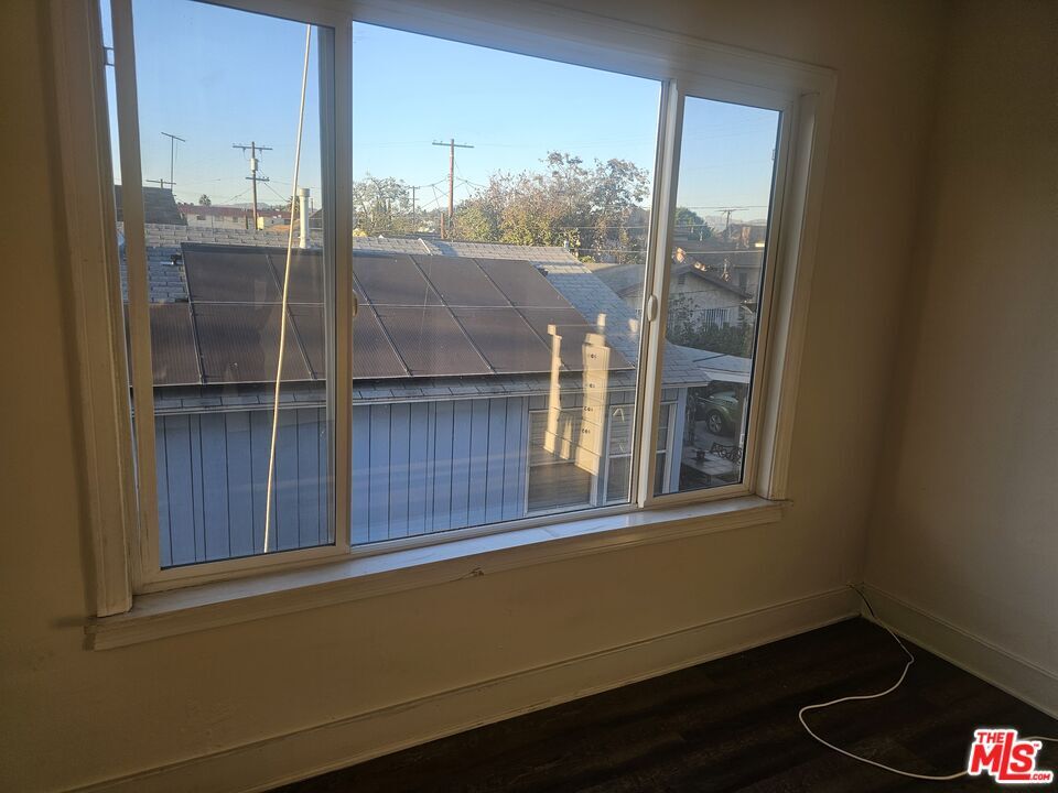
- City View
- End Unit
- Double Pane Windows
- Bungalow
- South Facing Home
- Converted Bedroom
120 N Ave 25

Favorites
120 N Ave 25 is a condo located in Los Angeles County and the 90031 ZIP Code.
* Price shown is base rent and may not include non-optional fees and utilities.
Price, availability, fees, and any applicable rent special are subject to change without notice.
* Square footage definitions vary. Displayed square footage is approximate.
Home Details
Home Type
Condominium
Year Built
Built in 1922
Bedrooms and Bathrooms
Converted Bedroom
1 Full Bathroom
2 Bedrooms
Home Design
Bungalow
Interior Spaces
Double Pane Windows
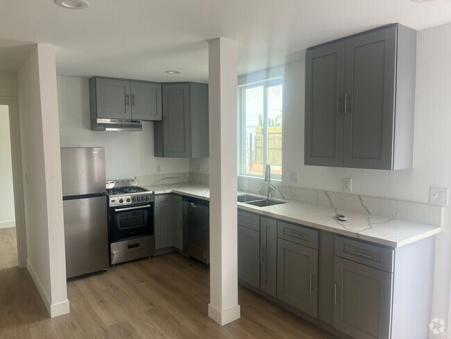
Laminate Flooring
910 Sq Ft Home
2-Story Property
Laundry
Laundry in unit
Listing and Financial Details
Security Deposit $2,500
12 Month Lease Term
Assessor Parcel Number 5205-022-007
Tenant pays for gas, insurance, electricity, cable TV
Rent includes trash collection, water
Lot Details
5,288 Sq Ft Lot
End Unit
South Facing Home
Parking
Assigned Parking
1 Car Garage
Utilities
Gas Water Heater
Sewer in Street
Property is located within a water district
Views
City Views
Community Details
Pet Policy
Call for details about the types of pets allowed
Contact
- Listed by Antonio Aguilera | VIP Premier Realty Corp
- Phone Number
- Contact
-
Source
 MLS(TM)/CLAW
Copyright 2025 TheMLS/CLAW. All rights reserved. Information is deemed reliable but not guaranteed.
$2,669 / month
$359,900 Listing Price
2 Beds
•1 Baths
•
722 Sq Ft
$2,497 / month
$399,999 Listing Price
2 Beds
•1 Baths
•
861 Sq Ft
$2,624 / month
$420,000 Listing Price
2 Beds
•2 Baths
•
835 Sq Ft
Location
Get Directions
Amenities
- Washer/Dryer
- Vinyl Flooring
- Views
Situated in northeast Los Angeles, just four miles from downtown, Montecito Heights sits atop a hilly landscape separating LA from the San Gabriel Valley. From the neighborhood’s steep hills, you can catch stunning views of downtown and the San Gabriel Valley in addition to the Arroyo Seco and even the Pacific Ocean (on a clear day).
Montecito Heights is known for its secluded feel despite being minutes away from Downtown LA. Natural beauty and lush parks abound in Montecito Heights. Ernest E. Debs Regional Park is one of the neighborhood’s defining features, touting 300 acres of scenic hiking trails, biking paths, picnic tables, a peaceful pond, and the striking panoramic views the neighborhood is revered for.
Montecito Heights is also home to the Heritage Square Museum, a living history museum that details life in 19th-century Southern California.
Learn more about living in Montecito Heights
Education
| Colleges & Universities | Distance | ||
|---|---|---|---|
| Colleges & Universities | Distance | ||
| Drive: | 4 min | 1.6 mi | |
| Drive: | 7 min | 3.7 mi | |
| Drive: | 7 min | 4.2 mi | |
| Drive: | 9 min | 4.6 mi |
120 N Ave 25 is within 4 minutes or 1.6 miles from USC, Health Sciences Campus. It is also near Golden Gate Univ, Los Angeles and The Fashion Institute.
Transportation options available in Los Angeles include Lincoln Heights/Cypress Park Station, located 0.4 mile from 120 N Ave 25. 120 N Ave 25 is near Bob Hope, located 15.1 miles or 20 minutes away, and Los Angeles International, located 18.2 miles or 29 minutes away.
| Transit / Subway | Distance | ||
|---|---|---|---|
| Transit / Subway | Distance | ||
|
|
Walk: | 8 min | 0.4 mi |
|
|
Walk: | 18 min | 1.0 mi |
|
|
Drive: | 3 min | 1.6 mi |
|
|
Drive: | 3 min | 1.7 mi |
|
|
Drive: | 7 min | 2.2 mi |
| Commuter Rail | Distance | ||
|---|---|---|---|
| Commuter Rail | Distance | ||
|
|
Drive: | 5 min | 2.1 mi |
|
|
Drive: | 7 min | 2.2 mi |
|
|
Drive: | 7 min | 4.4 mi |
| Drive: | 9 min | 6.2 mi | |
|
|
Drive: | 16 min | 10.4 mi |
| Airports | Distance | ||
|---|---|---|---|
| Airports | Distance | ||
|
Bob Hope
|
Drive: | 20 min | 15.1 mi |
|
Los Angeles International
|
Drive: | 29 min | 18.2 mi |
Time and distance from 120 N Ave 25.
| Shopping Centers | Distance | ||
|---|---|---|---|
| Shopping Centers | Distance | ||
| Walk: | 2 min | 0.0 mi | |
| Walk: | 2 min | 0.0 mi | |
| Walk: | 2 min | 0.1 mi |
120 N Ave 25 has 3 shopping centers within 0.1 mile, which is about a 2-minute drive. The miles and minutes will be for the farthest away property.
| Parks and Recreation | Distance | ||
|---|---|---|---|
| Parks and Recreation | Distance | ||
|
Audubon Center at Debs Park
|
Drive: | 4 min | 2.3 mi |
|
Chavez Ravine Arboretum
|
Drive: | 5 min | 2.7 mi |
|
Elysian Park
|
Drive: | 8 min | 2.7 mi |
|
Elyria Canyon Park
|
Drive: | 6 min | 3.1 mi |
|
Echo Park Lake
|
Drive: | 6 min | 3.8 mi |
120 N Ave 25 has 5 parks within 3.8 miles, including Audubon Center at Debs Park, Elysian Park, and Elyria Canyon Park.
| Hospitals | Distance | ||
|---|---|---|---|
| Hospitals | Distance | ||
| Drive: | 3 min | 1.7 mi | |
| Drive: | 4 min | 1.8 mi | |
| Drive: | 7 min | 3.4 mi |
120 N Ave 25 has 3 hospitals within 3.4 miles, the nearest is LAC + USC Medical Center which is 1.7 miles away and a 3 minute drive.
| Military Bases | Distance | ||
|---|---|---|---|
| Military Bases | Distance | ||
| Drive: | 26 min | 19.8 mi |
120 N Ave 25 is 19.8 miles and a 26 minute drive from Los Angeles Air Force Base.
You May Also Like
Similar Rentals Nearby


What Are Walk Score®, Transit Score®, and Bike Score® Ratings?
Walk Score® measures the walkability of any address. Transit Score® measures access to public transit. Bike Score® measures the bikeability of any address.
What is a Sound Score Rating?
A Sound Score Rating aggregates noise caused by vehicle traffic, airplane traffic and local sources
120 N Ave 25
Los Angeles, CA 90031