
Check Back Soon for Upcoming Availability
| Beds | Baths | Average SF |
|---|---|---|
| 3 Bedrooms 3 Bedrooms 3 Br | 2 Baths 2 Baths 2 Ba | 1,448 SF |
About This Property
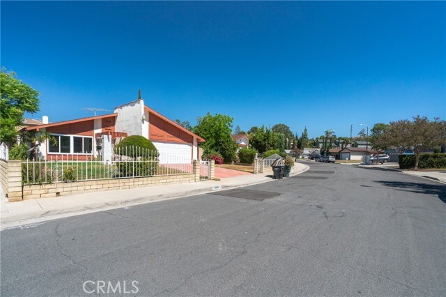
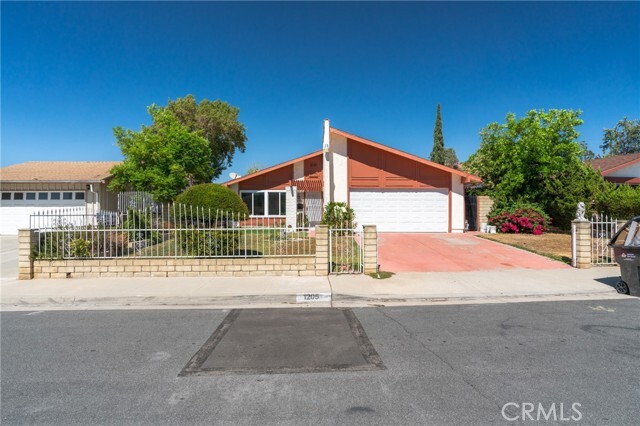
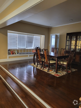
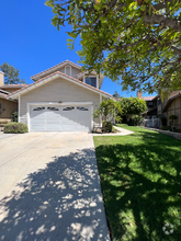
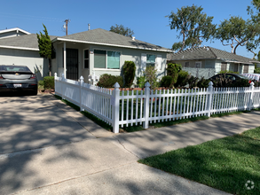
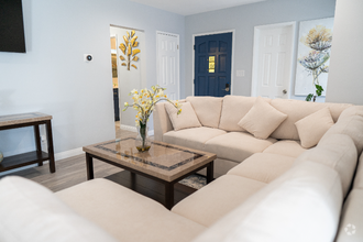
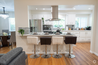
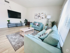
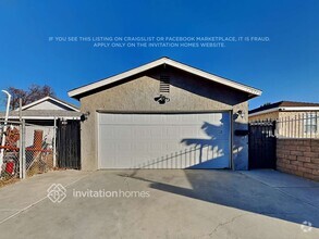
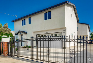
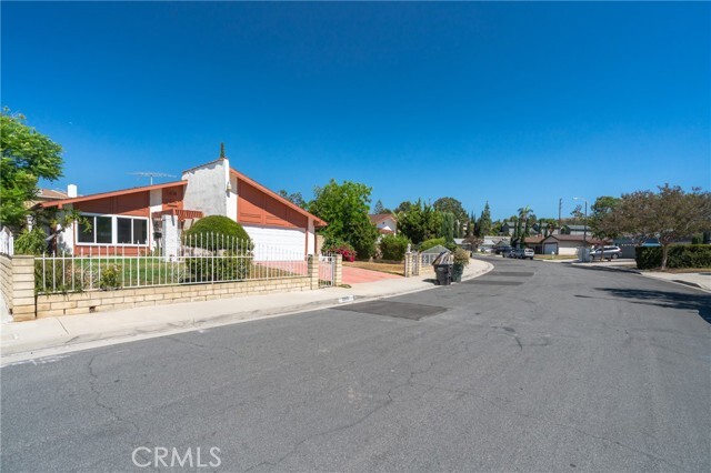
Welcome to this charming single story home. This completed remodeled sweet home offers a modern lifestyle and easy maintenance. The home features 3 bedrooms and 2 full bathrooms with 1448 sqft living space. As you enter, the spacious and bright living room. The new open kitchen with popular quartz countertops, wood cabinets and top of stainless steel appliances. Also the home features a large size family room. New double pane windows, new lighting futures, new kitchen and bathrooms, new paint and flooring. Two-car garage attached and driveway can park more cars.Enjoy this lovely paved backyard and a covered patio at the side yard. Conveniently located close to restaurants , home Depot, supermarkets, banks. Come to see this home and your dream house is right here.
1205 Merryl Ln is a house located in Los Angeles County and the 91792 ZIP Code. This area is served by the Hacienda la Puente Unified attendance zone.
House Features
- Air Conditioning
- Heating
- Fireplace
Fees and Policies
The fees below are based on community-supplied data and may exclude additional fees and utilities.
- Parking
-
Other--
Details
Lease Options
-
12 Months
 This Property
 Available Property
Located about 18 miles east of Los Angeles, Valinda is a large neighborhood located south of West Covina and north of La Puente. The Dwight D. Eisenhower Golf Course starts at its southern edge, with Francisquito Avenue on the north end. This cozy, residential neighborhood features wide sidewalks, palm trees, and a scenic view of the mountains. A variety of shops and restaurants line North Hacienda Boulevard, and Woodside Village Shopping Center is located on Azusa Avenue, near the intersection with Amar Road.
Valinda features one large park, Rimgrove Park, in the neighborhood. This park includes a splash pad, a playground, picnic areas, a baseball diamond, a fitness station, and a basketball court. Other parks are located just outside the neighborhood, including Galster Wilderness Park and Woodgrove Park. La Puente City Park, just outside the neighborhood on its southeastern corner, provides lighted ball fields, basketball courts, and a playground.
Learn more about living in ValindaBelow are rent ranges for similar nearby apartments
- Air Conditioning
- Heating
- Fireplace
| Colleges & Universities | Distance | ||
|---|---|---|---|
| Colleges & Universities | Distance | ||
| Drive: | 10 min | 5.7 mi | |
| Drive: | 15 min | 8.1 mi | |
| Drive: | 15 min | 9.3 mi | |
| Drive: | 16 min | 9.4 mi |
Transportation options available in West Covina include Irwindale Station, located 7.0 miles from 1205 Merryl Ln. 1205 Merryl Ln is near Ontario International, located 22.1 miles or 30 minutes away, and Long Beach (Daugherty Field), located 28.3 miles or 40 minutes away.
| Transit / Subway | Distance | ||
|---|---|---|---|
| Transit / Subway | Distance | ||
| Drive: | 15 min | 7.0 mi | |
| Drive: | 13 min | 7.4 mi | |
| Drive: | 17 min | 8.5 mi | |
| Drive: | 19 min | 11.3 mi | |
| Drive: | 20 min | 12.8 mi |
| Commuter Rail | Distance | ||
|---|---|---|---|
| Commuter Rail | Distance | ||
|
|
Drive: | 11 min | 5.4 mi |
|
|
Drive: | 10 min | 5.5 mi |
|
|
Drive: | 13 min | 6.5 mi |
|
|
Drive: | 15 min | 9.4 mi |
|
|
Drive: | 19 min | 13.4 mi |
| Airports | Distance | ||
|---|---|---|---|
| Airports | Distance | ||
|
Ontario International
|
Drive: | 30 min | 22.1 mi |
|
Long Beach (Daugherty Field)
|
Drive: | 40 min | 28.3 mi |
Time and distance from 1205 Merryl Ln.
| Shopping Centers | Distance | ||
|---|---|---|---|
| Shopping Centers | Distance | ||
| Walk: | 11 min | 0.6 mi | |
| Walk: | 18 min | 1.0 mi | |
| Drive: | 3 min | 1.2 mi |
| Parks and Recreation | Distance | ||
|---|---|---|---|
| Parks and Recreation | Distance | ||
|
Galster Wilderness Park Nature Center
|
Drive: | 5 min | 1.9 mi |
|
Covina Park
|
Drive: | 9 min | 4.8 mi |
|
Schabarum Regional Park
|
Drive: | 11 min | 5.1 mi |
|
Santa Fe Dam Recreation Area
|
Drive: | 22 min | 7.8 mi |
|
Santa Fe Dam Nature Center
|
Drive: | 22 min | 7.8 mi |
| Hospitals | Distance | ||
|---|---|---|---|
| Hospitals | Distance | ||
| Drive: | 7 min | 3.1 mi | |
| Drive: | 9 min | 4.9 mi | |
| Drive: | 9 min | 5.0 mi |
| Military Bases | Distance | ||
|---|---|---|---|
| Military Bases | Distance | ||
| Drive: | 39 min | 22.3 mi |
You May Also Like
Similar Rentals Nearby
-
$7,5006 Beds, 5 Baths, 4,901 sq ftHouse for Rent
-
$3,5494 Beds, 3 Baths, 2,060 sq ftHouse for Rent
-
-
$3,9003 Beds, 2.5 Baths, 1,449 sq ftHouse for Rent
-
$3,5003 Beds, 1 Bath, 1,250 sq ftHouse for Rent
-
$7,5005 Beds, 2 Baths, 1,600 sq ftHouse for Rent
-
$7,0003 Beds, 2.5 Baths, 1,750 sq ftHouse for Rent
-
-
-
$3,6804 Beds, 2.5 Baths, 1,650 sq ftHouse for Rent
What Are Walk Score®, Transit Score®, and Bike Score® Ratings?
Walk Score® measures the walkability of any address. Transit Score® measures access to public transit. Bike Score® measures the bikeability of any address.
What is a Sound Score Rating?
A Sound Score Rating aggregates noise caused by vehicle traffic, airplane traffic and local sources
