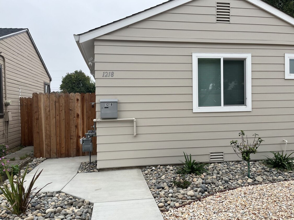
-
Monthly Rent
$2,595
-
Bedrooms
2 bd
-
Bathrooms
1 ba
-
Square Feet
1,000 sq ft
Details

 This Property
 Available Property
San Leandro’s Lower Bal neighborhood sits between Interstate 880 and 580 just two miles southeast of the center of the city. The area is popular with Bay Area residents as it provides a relatively affordable locale that’s still bursting with character. With ranch-style single-family houses, tech-laden apartments, and proximity to shopping at Bayfair Center, Lower Bal has it all. There are restaurants galore on Halcyon Drive, and the Lower Bal neighborhood remains relatively walkable. Because the neighborhood is just 20 minutes from Oakland and 30 minutes from San Francisco, residents can easily access Bay Area Rapid Transit (BART) to get around the always growing Bay Area.
Learn more about living in Lower Bal| Colleges & Universities | Distance | ||
|---|---|---|---|
| Colleges & Universities | Distance | ||
| Drive: | 13 min | 6.1 mi | |
| Drive: | 12 min | 7.1 mi | |
| Drive: | 15 min | 8.6 mi | |
| Drive: | 15 min | 10.6 mi |
Transportation options available in San Leandro include Bay Fair Station, located 1.4 miles from 1218-1216 148th Ave Unit 1218. 1218-1216 148th Ave Unit 1218 is near Metro Oakland International, located 6.7 miles or 12 minutes away, and San Francisco International, located 26.5 miles or 35 minutes away.
| Transit / Subway | Distance | ||
|---|---|---|---|
| Transit / Subway | Distance | ||
|
|
Drive: | 4 min | 1.4 mi |
|
|
Drive: | 5 min | 2.3 mi |
|
|
Drive: | 8 min | 4.1 mi |
|
|
Drive: | 6 min | 4.3 mi |
|
|
Drive: | 12 min | 6.4 mi |
| Commuter Rail | Distance | ||
|---|---|---|---|
| Commuter Rail | Distance | ||
|
|
Drive: | 9 min | 4.7 mi |
| Drive: | 9 min | 4.7 mi | |
|
|
Drive: | 16 min | 10.9 mi |
| Drive: | 21 min | 13.7 mi | |
|
|
Drive: | 21 min | 16.1 mi |
| Airports | Distance | ||
|---|---|---|---|
| Airports | Distance | ||
|
Metro Oakland International
|
Drive: | 12 min | 6.7 mi |
|
San Francisco International
|
Drive: | 35 min | 26.5 mi |
Time and distance from 1218-1216 148th Ave Unit 1218.
| Shopping Centers | Distance | ||
|---|---|---|---|
| Shopping Centers | Distance | ||
| Walk: | 6 min | 0.3 mi | |
| Walk: | 11 min | 0.6 mi | |
| Walk: | 18 min | 0.9 mi |
| Parks and Recreation | Distance | ||
|---|---|---|---|
| Parks and Recreation | Distance | ||
|
Lake Chabot Regional Park
|
Drive: | 7 min | 3.2 mi |
|
Dunsmuir Hellman Historic Estate
|
Drive: | 9 min | 4.4 mi |
|
Hayward Regional Shoreline
|
Drive: | 12 min | 4.8 mi |
|
Arroyo Viejo Creek at the Oakland Zoo
|
Drive: | 9 min | 4.9 mi |
|
Oakland Zoo
|
Drive: | 10 min | 5.0 mi |
| Hospitals | Distance | ||
|---|---|---|---|
| Hospitals | Distance | ||
| Drive: | 7 min | 3.1 mi | |
| Drive: | 11 min | 6.9 mi | |
| Drive: | 17 min | 10.0 mi |
| Military Bases | Distance | ||
|---|---|---|---|
| Military Bases | Distance | ||
| Drive: | 24 min | 14.3 mi |
You May Also Like
Similar Rentals Nearby
What Are Walk Score®, Transit Score®, and Bike Score® Ratings?
Walk Score® measures the walkability of any address. Transit Score® measures access to public transit. Bike Score® measures the bikeability of any address.
What is a Sound Score Rating?
A Sound Score Rating aggregates noise caused by vehicle traffic, airplane traffic and local sources
