$2,300 / Month
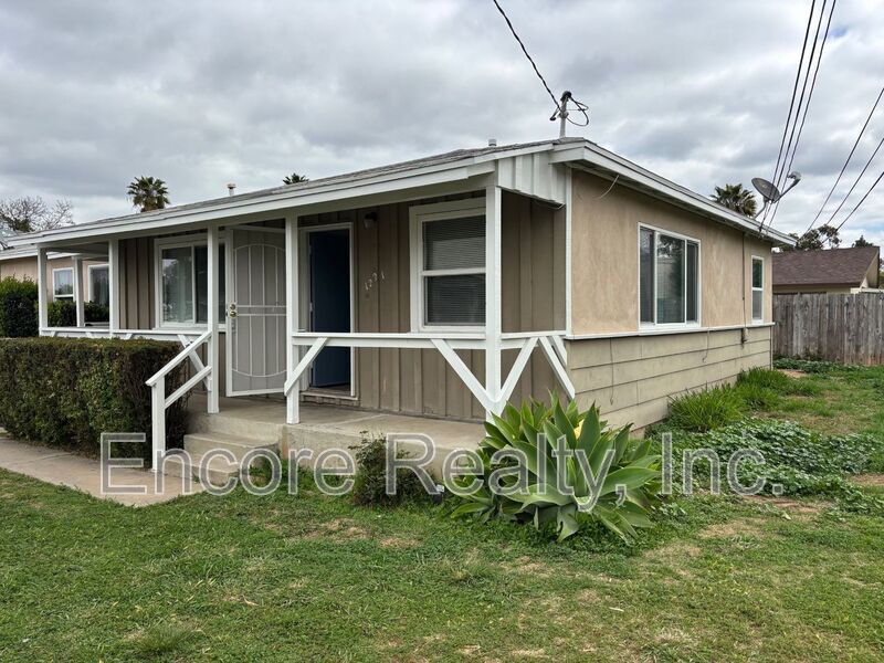
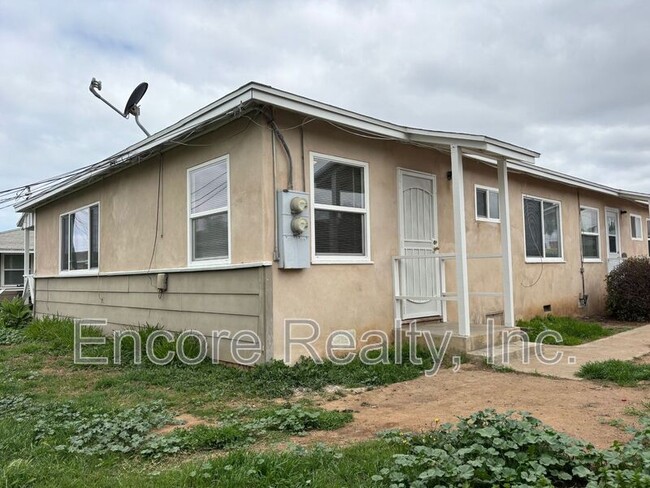
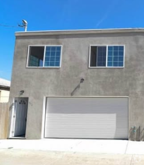
1221 4th Ave
Chula Vista, CA 91911
Today
Favorites
831-498-4401
-
Bedrooms
2
-
Bathrooms
1
-
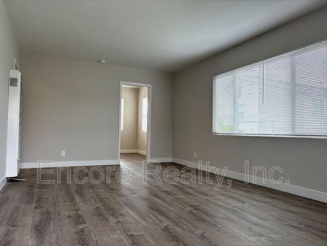
Square Feet
600 sq ft
-
Available
Available Now
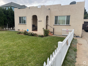
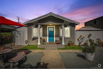
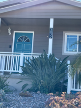
1221 4th Ave

Favorites
About This Home
$2,300 deposit,
Available Now
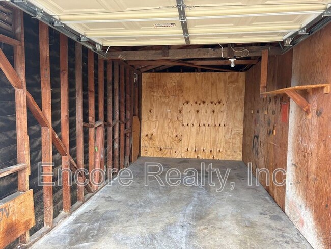
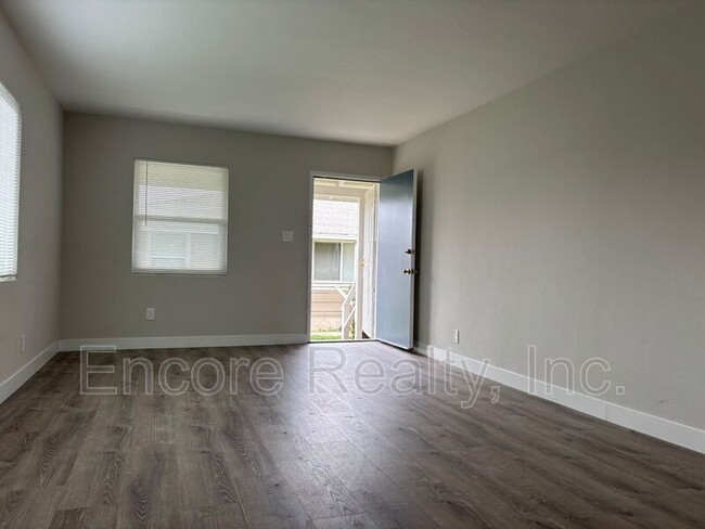
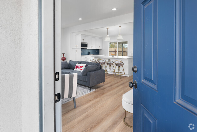
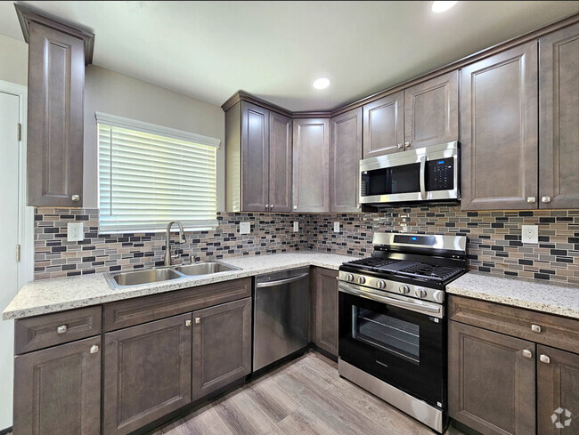
2 bedroom, 1 bathroom apartment with a garage.
1221 4th Ave is a house located in San Diego County and the 91911 ZIP Code. This area is served by the Sweetwater Union High attendance zone.
* Price shown is base rent and may not include non-optional fees and utilities.
Price, availability, fees, and any applicable rent special are subject to change without notice.
* Square footage definitions vary. Displayed square footage is approximate.
Contact
- Phone Number
- Contact
Location
Get Directions
The Harborside neighborhood, just a 15-minute drive from downtown San Diego, is located at the western end of Chula Vista near the San Diego bay. Residents can avoid traffic and easily reach downtown by taking the San Diego Trolley's blue line. The neighborhood has a large number of apartments and wraps around a park of the same name.
Harborside is located between L Street to the north, Palomar Street and Orange Avenue to the south, the bay to the west, and Third Avenue to the east. I-5 runs along the west side of the neighborhood, providing fast commutes to nearby San Diego.
Learn more about living in Harborside
Education
| Colleges & Universities | Distance | ||
|---|---|---|---|
| Colleges & Universities | Distance | ||
| Drive: | 14 min | 6.3 mi | |
| Drive: | 14 min | 10.4 mi | |
| Drive: | 15 min | 10.8 mi | |
| Drive: | 15 min | 11.5 mi |
1221 4th Ave is within 14 minutes or 6.3 miles from Southwestern Coll, Chula Vista. It is also near San Diego City College and Thomas Jefferson School of Law.
Schools


Public Elementary School
Grades K-6
747 Students
Attendance Zone
Public Elementary & Middle School
Grades K-8
27 Students
Nearby
Public Middle School
Grades 7-8
724 Students
Attendance Zone
Public High School
Grades 9-12
1,433 Students
Attendance Zone
Private Elementary & Middle School
Grades K-7
Nearby
Private Elementary, Middle & High School
Grades K-12
Nearby
Private Elementary & Middle School
Grades PK-8
364 Students
Nearby
School data provided by
 The GreatSchools Rating helps parents compare schools within a state based on a variety of school quality indicators and provides a helpful picture of how effectively each school serves all of its students. Ratings are on a scale of 1 (below average) to 10 (above average) and can include test scores, college readiness, academic progress, advanced courses, equity, discipline and attendance data. We also advise parents to visit schools, consider other information on school performance and programs, and consider family needs as part of the school selection process.
View GreatSchools Rating Methodology
View GreatSchools Rating Methodology
Transportation options available in Chula Vista include Palomar Street, located 1.1 miles from 1221 4th Ave. 1221 4th Ave is near San Diego International, located 14.0 miles or 20 minutes away.
| Transit / Subway | Distance | ||
|---|---|---|---|
| Transit / Subway | Distance | ||
|
|
Drive: | 3 min | 1.1 mi |
|
|
Drive: | 5 min | 2.7 mi |
|
|
Drive: | 6 min | 3.0 mi |
|
|
Drive: | 5 min | 3.4 mi |
|
|
Drive: | 6 min | 3.4 mi |
| Commuter Rail | Distance | ||
|---|---|---|---|
| Commuter Rail | Distance | ||
|
|
Drive: | 17 min | 11.5 mi |
|
|
Drive: | 19 min | 14.6 mi |
|
|
Drive: | 32 min | 26.2 mi |
|
|
Drive: | 41 min | 33.4 mi |
|
|
Drive: | 45 min | 37.0 mi |
| Airports | Distance | ||
|---|---|---|---|
| Airports | Distance | ||
|
San Diego International
|
Drive: | 20 min | 14.0 mi |
Time and distance from 1221 4th Ave.
| Shopping Centers | Distance | ||
|---|---|---|---|
| Shopping Centers | Distance | ||
| Walk: | 4 min | 0.2 mi | |
| Walk: | 7 min | 0.4 mi | |
| Walk: | 7 min | 0.4 mi |
1221 4th Ave has 3 shopping centers within 0.4 mile, which is about a 7-minute walk. The miles and minutes will be for the farthest away property.
| Parks and Recreation | Distance | ||
|---|---|---|---|
| Parks and Recreation | Distance | ||
|
Otay Valley Regional Park
|
Drive: | 4 min | 2.1 mi |
|
Living Coast Discovery Center
|
Drive: | 6 min | 3.6 mi |
|
San Diego Bay National Wildlife Refuge
|
Drive: | 9 min | 4.3 mi |
|
Tijuana River National Estuarine Research Reserve
|
Drive: | 11 min | 5.6 mi |
|
Tijuana Slough National Wildlife Refuge
|
Drive: | 11 min | 5.6 mi |
1221 4th Ave has 5 parks within 5.6 miles, including Otay Valley Regional Park, Living Coast Discovery Center, and San Diego Bay National Wildlife Refuge.
| Hospitals | Distance | ||
|---|---|---|---|
| Hospitals | Distance | ||
| Drive: | 7 min | 3.4 mi | |
| Drive: | 11 min | 6.4 mi | |
| Drive: | 15 min | 10.9 mi |
1221 4th Ave has 3 hospitals within 10.9 miles, the nearest is Sharp Chula Vista Medical Center which is 3.4 miles away and a 7 minute drive.
| Military Bases | Distance | ||
|---|---|---|---|
| Military Bases | Distance | ||
| Drive: | 9 min | 6.1 mi | |
| Drive: | 19 min | 12.7 mi |
1221 4th Ave is 6.1 miles from San Diego Naval Air Station, and is convenient to other military bases, including US Naval Amphibious Base.
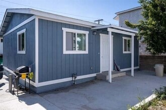
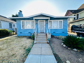
You May Also Like
Similar Rentals Nearby

What Are Walk Score®, Transit Score®, and Bike Score® Ratings?
Walk Score® measures the walkability of any address. Transit Score® measures access to public transit. Bike Score® measures the bikeability of any address.
What is a Sound Score Rating?
A Sound Score Rating aggregates noise caused by vehicle traffic, airplane traffic and local sources

1221 4th Ave
Chula Vista, CA 91911