

$1,350 / Month
1223 Lenox Ave Unit 2
Plainfield, NJ 07060
2 Weeks Ago
Favorites
-
Bedrooms
Studio
-
Bathrooms
1
-
Square Feet
650 sq ft
-
Available
Available Now
Highlights
- Yard
- Smoke Free
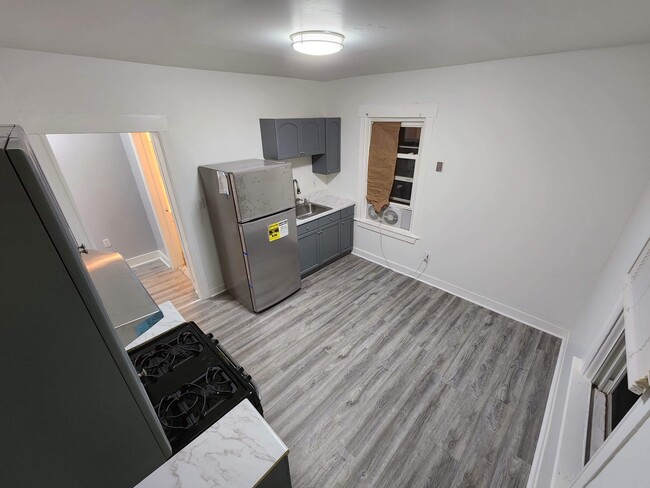
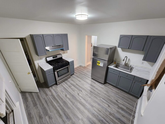
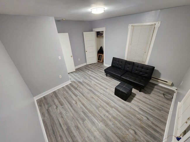
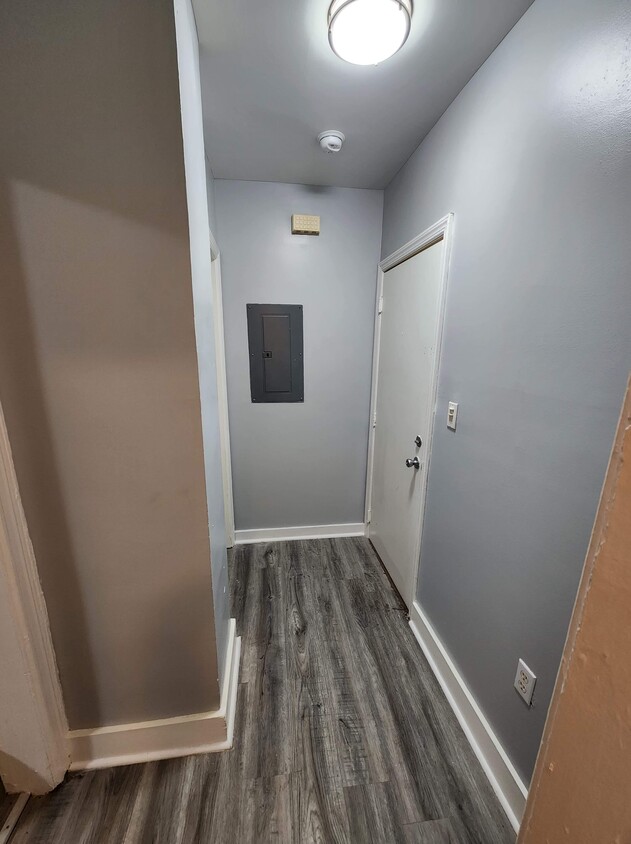
1223 Lenox Ave Unit 2

Favorites
About This Home
12 Month Lease,
$3,375 deposit,
Available Now
New renovated 3 Bedroom No pets No Smoking. Pictures available soon.
1223 Lenox Ave is an apartment community located in Union County and the 07060 ZIP Code.
* Price shown is base rent and may not include non-optional fees and utilities.
Price, availability, fees, and any applicable rent special are subject to change without notice.
* Square footage definitions vary. Displayed square footage is approximate.
Apartment Features
Refrigerator
Tile Floors
Smoke Free
Heating
- Heating
- Smoke Free
- Cable Ready
- Refrigerator
- Tile Floors
- Yard
Fees and Policies
The fees below are based on community-supplied data and may exclude additional fees and utilities.
- Parking
-
Surface Lot--
Details
Utilities Included
-
Water
-
Trash Removal
-
Sewer
Property Information
-
3 units
Contact
- Contact
Location
Get Directions
The second largest municipality in Union County, Plainfield is nicknamed “The Queen City” because of early comparisons to Denver, Colorado for its proximity to natural springs and the Watchung Mountains. Just a short train ride from Manhattan today, Plainfield is considered to be a New York City suburb, boasting the diverse benefits of urban and suburban living.
Primarily a residential area, Plainfield offers plenty of things to do. Residents and visitors can stroll through wide tree-lined streets, admire Victorian architecture in ten historic districts, attend Plainfield Symphony Orchestra concerts, stop by an award-winning public library, and visit the Shakespeare Garden in the expansive Cedar Brook Park. Plainfield also presents a variety of markets, shops, and restaurants in its commercial district stretched along Front Street.
Getting around from Plainfield is easy with access to multiple NJ Transit railroad stations, the Garden State Parkway, and Interstates 78 and 287.
Learn more about living in Plainfield
Education
| Colleges & Universities | Distance | ||
|---|---|---|---|
| Colleges & Universities | Distance | ||
| Drive: | 4 min | 1.6 mi | |
| Drive: | 23 min | 10.1 mi | |
| Drive: | 20 min | 10.5 mi | |
| Drive: | 21 min | 11.0 mi |
1223 Lenox Ave Unit 2 is within 4 minutes or 1.6 miles from Union Co. Coll., Plainfield. It is also near Union County College, Cranford and Rutgers University, Livingston.
Transportation options available in Plainfield include Warren Street, located 19.0 miles from 1223 Lenox Ave Unit 2. 1223 Lenox Ave Unit 2 is near Newark Liberty International, located 22.5 miles or 32 minutes away, and Laguardia, located 41.8 miles or 66 minutes away.
| Transit / Subway | Distance | ||
|---|---|---|---|
| Transit / Subway | Distance | ||
|
|
Drive: | 32 min | 19.0 mi |
|
|
Drive: | 32 min | 19.1 mi |
|
|
Drive: | 32 min | 19.5 mi |
| Drive: | 36 min | 19.6 mi | |
|
|
Drive: | 32 min | 19.9 mi |
| Commuter Rail | Distance | ||
|---|---|---|---|
| Commuter Rail | Distance | ||
|
|
Drive: | 3 min | 1.3 mi |
|
|
Drive: | 6 min | 2.4 mi |
|
|
Drive: | 10 min | 3.7 mi |
|
|
Drive: | 10 min | 4.3 mi |
|
|
Drive: | 15 min | 6.6 mi |
| Airports | Distance | ||
|---|---|---|---|
| Airports | Distance | ||
|
Newark Liberty International
|
Drive: | 32 min | 22.5 mi |
|
Laguardia
|
Drive: | 66 min | 41.8 mi |
Time and distance from 1223 Lenox Ave Unit 2.
| Shopping Centers | Distance | ||
|---|---|---|---|
| Shopping Centers | Distance | ||
| Drive: | 4 min | 2.1 mi | |
| Drive: | 6 min | 2.6 mi | |
| Drive: | 5 min | 2.6 mi |
1223 Lenox Ave Unit 2 has 3 shopping centers within 2.6 miles, which is about a 5-minute drive. The miles and minutes will be for the farthest away property.
| Parks and Recreation | Distance | ||
|---|---|---|---|
| Parks and Recreation | Distance | ||
|
Spring Lake Park
|
Drive: | 6 min | 2.6 mi |
|
Washington Rock State Park
|
Drive: | 11 min | 5.6 mi |
|
Edison Park
|
Drive: | 12 min | 6.3 mi |
|
Merrill Park
|
Drive: | 15 min | 7.0 mi |
|
Ambrose & Doty's Brooks Park
|
Drive: | 13 min | 7.3 mi |
1223 Lenox Ave Unit 2 has 5 parks within 7.3 miles, including Spring Lake Park, Washington Rock State Park, and Edison Park.
| Hospitals | Distance | ||
|---|---|---|---|
| Hospitals | Distance | ||
| Drive: | 11 min | 5.5 mi | |
| Drive: | 15 min | 7.4 mi | |
| Drive: | 17 min | 8.1 mi |
1223 Lenox Ave Unit 2 has 3 hospitals within 8.1 miles, the nearest is JFK Medical Center which is 5.5 miles away and a 11 minute drive.
| Military Bases | Distance | ||
|---|---|---|---|
| Military Bases | Distance | ||
| Drive: | 17 min | 5.5 mi | |
| Drive: | 14 min | 6.5 mi | |
| Drive: | 37 min | 26.4 mi |
1223 Lenox Ave Unit 2 has 3 military bases within 26.4 miles, the nearest is Tamdques Reservation which is 5.5 miles away and a 17 minute drive.
Amenities
- Heating
- Smoke Free
- Cable Ready
- Refrigerator
- Tile Floors
- Yard
1223 Lenox Ave Unit 2 Photos
What Are Walk Score®, Transit Score®, and Bike Score® Ratings?
Walk Score® measures the walkability of any address. Transit Score® measures access to public transit. Bike Score® measures the bikeability of any address.
What is a Sound Score Rating?
A Sound Score Rating aggregates noise caused by vehicle traffic, airplane traffic and local sources
1223 Lenox Ave
Plainfield, NJ 07060