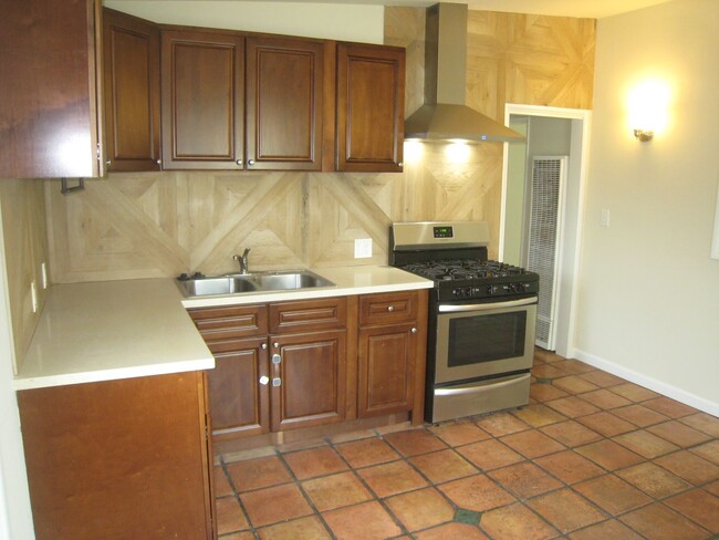
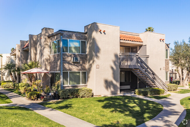
$2,500 / Month
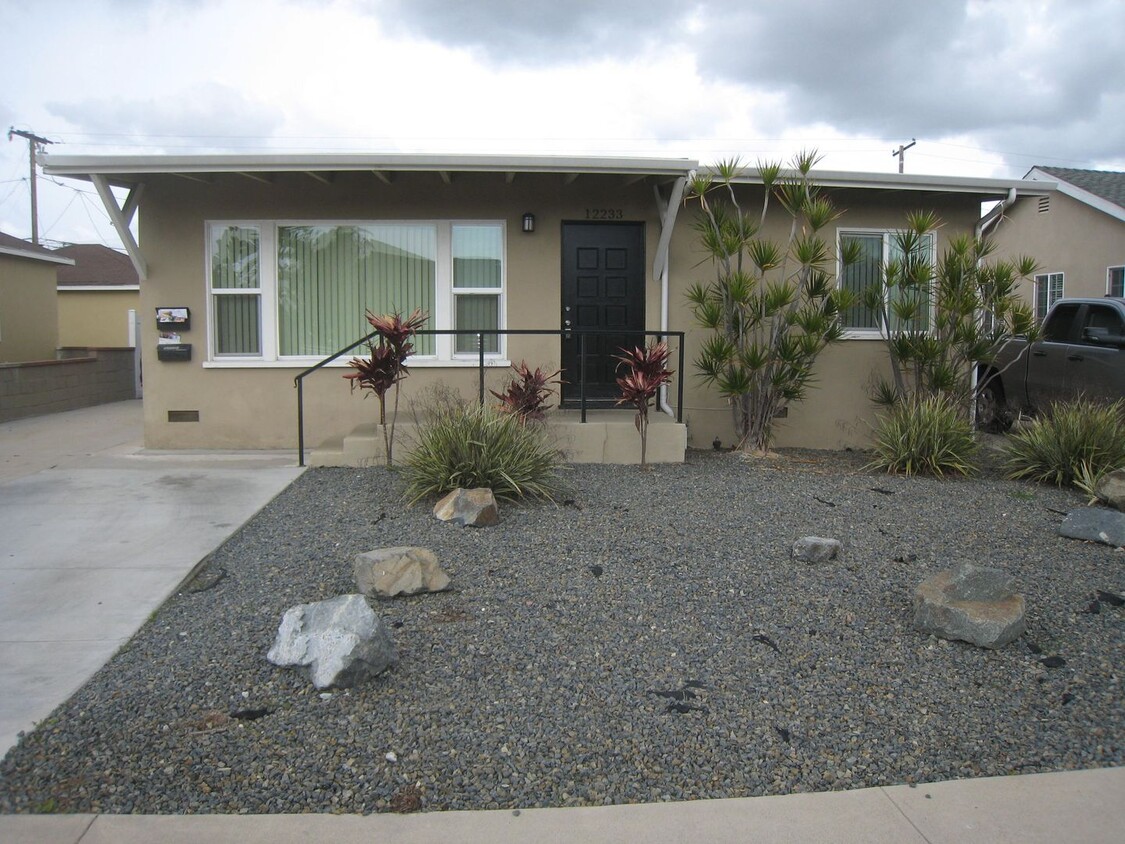
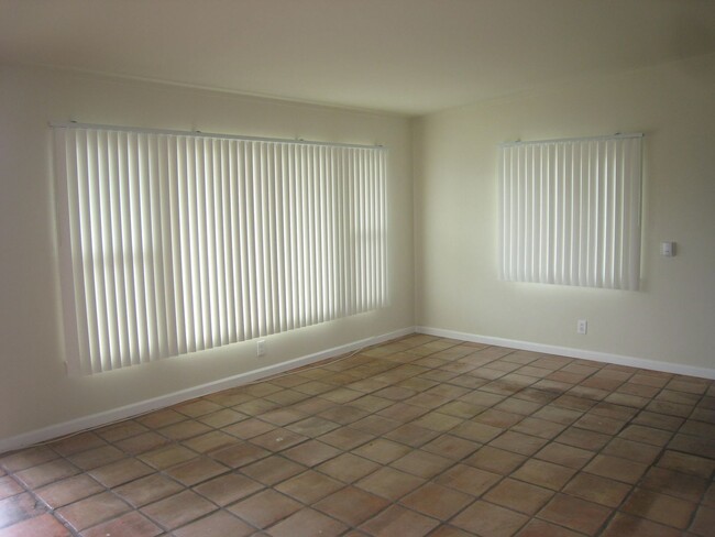
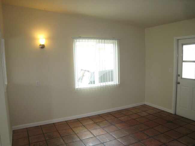
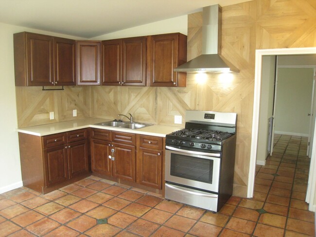
12233-12235 215th St Unit 12233
Hawaiian Gardens, CA 90716
Today
Favorites
714-378-1366
-
Bedrooms
2
-
Bathrooms
1
-
Square Feet
--
-
Available
Available Now
12233-12235 215th St Unit 12233

Favorites
Contact
- Listed by Pacific City Properties, Inc. | Pacific City Properties, Inc.
- Phone Number
- Contact
Location
Get Directions
ABC is a lively neighborhood conveniently located 15 miles north of Long Beach and 20 miles south of Los Angeles. The area has a dense population with an abundance of apartments and single-family homes for rent, as well as premier shopping destinations. The Los Cerritos Center, conveniently situated off Interstate 605, attracts shoppers from the surrounding areas. On the other side of town off Highway 91, Cerritos Towne Center provides more retail and dining choices. Quaint boutiques and local eateries are located off Pioneer Boulevard, offering a nice contrast to the large retail centers. More great amenities in town include a few peaceful parks and trails that dot the neighborhood like Liberty Park and Fitness Center.
Learn more about living in ABC
Education
| Colleges & Universities | Distance | ||
|---|---|---|---|
| Colleges & Universities | Distance | ||
| Drive: | 7 min | 3.8 mi | |
| Drive: | 8 min | 4.3 mi | |
| Drive: | 10 min | 5.8 mi | |
| Drive: | 10 min | 7.1 mi |
12233-12235 215th St Unit 12233 is within 7 minutes or 3.8 miles from Cypress College. It is also near Long Beach City Coll. and Cerritos College.
Transportation options available in Hawaiian Gardens include Norwalk, located 6.8 miles from 12233-12235 215th St Unit 12233. 12233-12235 215th St Unit 12233 is near Long Beach (Daugherty Field), located 7.3 miles or 13 minutes away, and John Wayne/Orange County, located 19.1 miles or 26 minutes away.
| Transit / Subway | Distance | ||
|---|---|---|---|
| Transit / Subway | Distance | ||
|
|
Drive: | 8 min | 6.8 mi |
|
|
Drive: | 17 min | 8.5 mi |
|
|
Drive: | 12 min | 9.2 mi |
|
|
Drive: | 15 min | 9.2 mi |
|
|
Drive: | 15 min | 9.5 mi |
| Commuter Rail | Distance | ||
|---|---|---|---|
| Commuter Rail | Distance | ||
|
|
Drive: | 13 min | 6.7 mi |
|
|
Drive: | 14 min | 8.2 mi |
|
|
Drive: | 18 min | 11.6 mi |
|
|
Drive: | 21 min | 12.9 mi |
| Drive: | 21 min | 13.0 mi |
| Airports | Distance | ||
|---|---|---|---|
| Airports | Distance | ||
|
Long Beach (Daugherty Field)
|
Drive: | 13 min | 7.3 mi |
|
John Wayne/Orange County
|
Drive: | 26 min | 19.1 mi |
Time and distance from 12233-12235 215th St Unit 12233.
| Shopping Centers | Distance | ||
|---|---|---|---|
| Shopping Centers | Distance | ||
| Walk: | 5 min | 0.3 mi | |
| Walk: | 8 min | 0.4 mi | |
| Walk: | 9 min | 0.5 mi |
12233-12235 215th St Unit 12233 has 3 shopping centers within 0.5 mile, which is about a 9-minute walk. The miles and minutes will be for the farthest away property.
| Parks and Recreation | Distance | ||
|---|---|---|---|
| Parks and Recreation | Distance | ||
|
El Dorado Nature Center
|
Drive: | 6 min | 3.5 mi |
|
El Dorado East Regional Park
|
Drive: | 9 min | 4.6 mi |
|
Earl Burns Miller Japanese Garden
|
Drive: | 11 min | 6.4 mi |
|
Colorado Lagoon
|
Drive: | 12 min | 8.0 mi |
|
Los Cerritos Wetlands Trust
|
Drive: | 12 min | 8.3 mi |
12233-12235 215th St Unit 12233 has 5 parks within 8.3 miles, including El Dorado Nature Center, El Dorado East Regional Park, and Earl Burns Miller Japanese Garden.
| Hospitals | Distance | ||
|---|---|---|---|
| Hospitals | Distance | ||
| Drive: | 5 min | 2.6 mi | |
| Drive: | 5 min | 3.0 mi | |
| Drive: | 9 min | 5.4 mi |
12233-12235 215th St Unit 12233 has 3 hospitals within 5.4 miles, the nearest is Los Alamitos Medical Center which is 2.6 miles away and a 5 minute drive.
| Military Bases | Distance | ||
|---|---|---|---|
| Military Bases | Distance | ||
| Drive: | 12 min | 6.3 mi | |
| Drive: | 33 min | 17.2 mi |
12233-12235 215th St Unit 12233 is 6.3 miles from Los Alamitos Army Airfield, and is convenient to other military bases, including Long Beach Naval Station.
You May Also Like
Similar Rentals Nearby


What Are Walk Score®, Transit Score®, and Bike Score® Ratings?
Walk Score® measures the walkability of any address. Transit Score® measures access to public transit. Bike Score® measures the bikeability of any address.
What is a Sound Score Rating?
A Sound Score Rating aggregates noise caused by vehicle traffic, airplane traffic and local sources

12233-12235 215th St
Hawaiian Gardens, CA 90716