
$2,895 / Month
1228 S 56th St
Richmond, CA 94804
1 Day Ago
Favorites
510-900-4839
-
Bedrooms
2
-
Bathrooms
1
-
Square Feet
965 sq ft
-
Available
Available Now
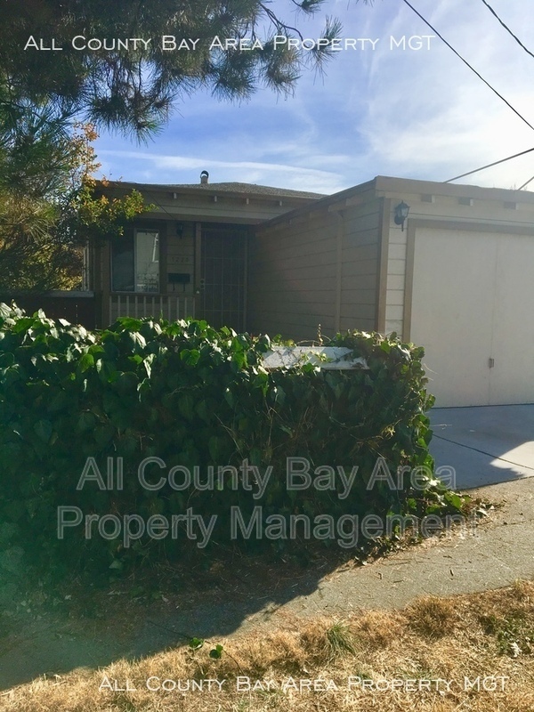
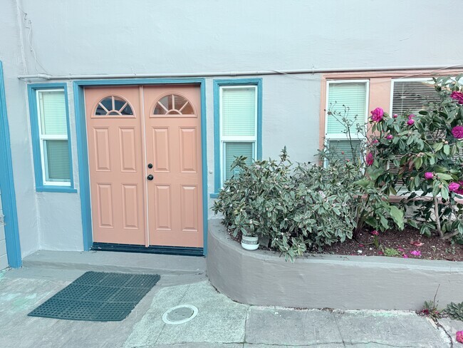
1228 S 56th St

Favorites
About This Home
$2,895 deposit,
Available Now
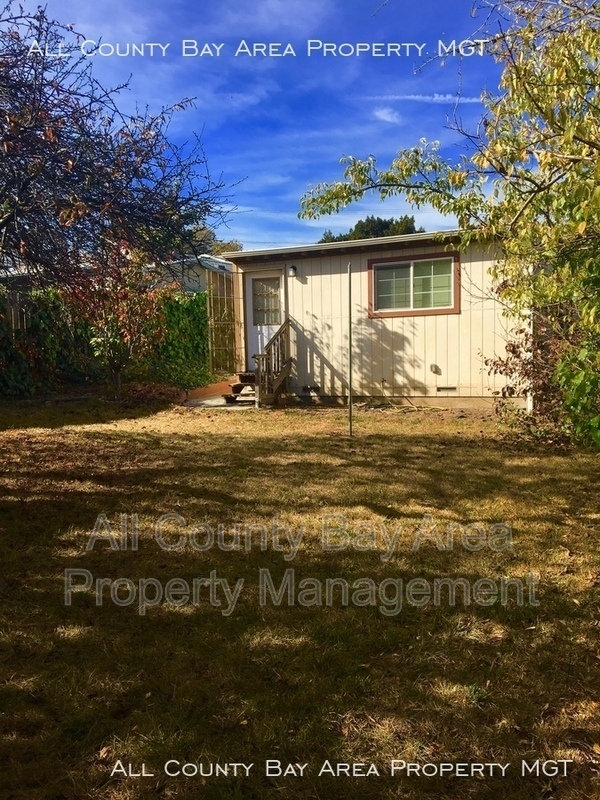
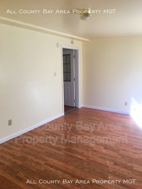
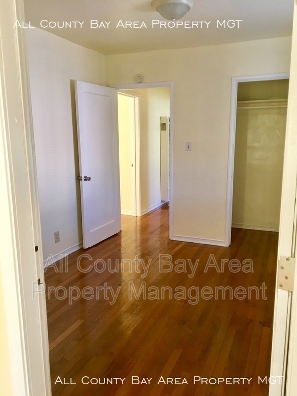
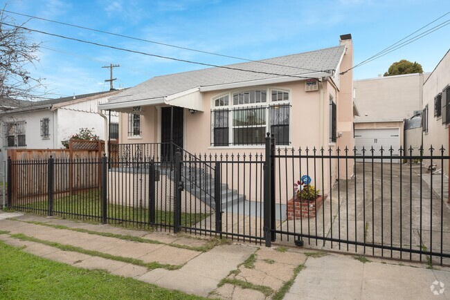
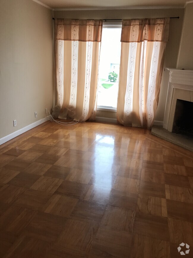
Ready to Rent Very close to the freeway with a convenient location and a big private yard. This home is listed as a two bedroom because one of the bedroom is a thoroughfare to the third bedroom. Depending on your living situation it could function as a three-bedroom home. The home was recently remodeled and has hardwood floor throughout the home and fresh paint! It is great for a family. There is a Washer and dryer and lots of closet space, a detached garage, an updated kitchen with stove, microwave, refrigerator, and garbage disposal included. It is located within .75 mile of the Del Norte Bart station and close to the El Cerrito High School,. The location provides for an easy commute to San Rafael or San Francisco with an Express bus and to UC Berkeley via BART. The Tenant is responsible for all utilities. This is a rare vacancy! Available NOW.
1228 S 56th St is a house located in Contra Costa County and the 94804 ZIP Code. This area is served by the West Contra Costa Unified attendance zone.
* Price shown is base rent and may not include non-optional fees and utilities.
Price, availability, fees, and any applicable rent special are subject to change without notice.
* Square footage definitions vary. Displayed square footage is approximate.
House Features
- Dishwasher
- Refrigerator
Contact
- Phone Number
- Contact
$3,299 / month
$499,000 Listing Price
2 Beds
•1 Baths
•
784 Sq Ft
$3,104 / month
$535,000 Listing Price
3 Beds
•1 Baths
•
1,124 Sq Ft
$2,606 / month
$445,000 Listing Price
3 Beds
•1.5 Baths
•
1,230 Sq Ft
Location
Get Directions
Amenities
- Dishwasher
- Refrigerator
Rent an apartment in the Richmond Annex and enjoy easy access to I-80, which takes you into San Francisco. Central Avenue leads to Point Isabel, a small peninsula in San Francisco Bay.
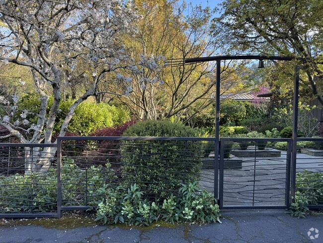
Just across the Richmond Annex's southern border sits Albany Hill Park. Hike to the top of Albany Hill, and take in a panoramic view of the Bay Area. More trails await at the Albany Mudflats State Marine Park, just west of I-580.
Explore Playland-Not-at-the-Beach at the northern end of the neighborhood. This local hangout, with a museum and community center, features games and events for all ages. San Pablo Avenue, the hotspot for local restaurants, features international cuisine for a wide range taste buds.
Learn more about living in Richmond Annex
Education
| Colleges & Universities | Distance | ||
|---|---|---|---|
| Colleges & Universities | Distance | ||
| Drive: | 10 min | 5.7 mi | |
| Drive: | 13 min | 6.0 mi | |
| Drive: | 16 min | 7.0 mi | |
| Drive: | 13 min | 8.6 mi |
1228 S 56th St is within 10 minutes or 5.7 miles from Contra Costa College. It is also near Berkeley City College and UC Berkeley.
Schools


Public Elementary School
Grades K-5
270 Students
Nearby
Public Elementary School
Grades K-6
503 Students
Attendance Zone
Public Middle School
Grades 7-8
681 Students
Attendance Zone
Public High School
Grades 9-12
1,522 Students
Attendance Zone
Private Elementary, Middle & High School
Grades PK-12
Nearby
Private Elementary, Middle & High School
Grades K-11
31 Students
Nearby
Private Elementary, Middle & High School
Grades K-11
Nearby
Private Elementary & Middle School
Grades K-8
189 Students
Nearby
School data provided by
 The GreatSchools Rating helps parents compare schools within a state based on a variety of school quality indicators and provides a helpful picture of how effectively each school serves all of its students. Ratings are on a scale of 1 (below average) to 10 (above average) and can include test scores, college readiness, academic progress, advanced courses, equity, discipline and attendance data. We also advise parents to visit schools, consider other information on school performance and programs, and consider family needs as part of the school selection process.
View GreatSchools Rating Methodology
View GreatSchools Rating Methodology
Transportation options available in Richmond include El Cerrito Del Norte Station, located 1.1 miles from 1228 S 56th St. 1228 S 56th St is near Metro Oakland International, located 19.0 miles or 27 minutes away, and San Francisco International, located 26.6 miles or 40 minutes away.
| Transit / Subway | Distance | ||
|---|---|---|---|
| Transit / Subway | Distance | ||
|
|
Drive: | 4 min | 1.1 mi |
|
|
Drive: | 4 min | 1.8 mi |
|
|
Drive: | 7 min | 3.5 mi |
|
|
Drive: | 10 min | 4.1 mi |
|
|
Drive: | 13 min | 6.1 mi |
| Commuter Rail | Distance | ||
|---|---|---|---|
| Commuter Rail | Distance | ||
|
|
Drive: | 8 min | 4.6 mi |
|
|
Drive: | 10 min | 6.4 mi |
|
|
Drive: | 16 min | 10.5 mi |
| Drive: | 20 min | 12.3 mi | |
| Drive: | 21 min | 14.2 mi |
| Airports | Distance | ||
|---|---|---|---|
| Airports | Distance | ||
|
Metro Oakland International
|
Drive: | 27 min | 19.0 mi |
|
San Francisco International
|
Drive: | 40 min | 26.6 mi |
Time and distance from 1228 S 56th St.
| Shopping Centers | Distance | ||
|---|---|---|---|
| Shopping Centers | Distance | ||
| Walk: | 12 min | 0.6 mi | |
| Walk: | 14 min | 0.7 mi | |
| Walk: | 14 min | 0.7 mi |
1228 S 56th St has 3 shopping centers within 0.7 mile, which is about a 14-minute walk. The miles and minutes will be for the farthest away property.
| Parks and Recreation | Distance | ||
|---|---|---|---|
| Parks and Recreation | Distance | ||
|
Point Isabel Regional Shoreline
|
Drive: | 8 min | 2.3 mi |
|
Eddy Arboretum
|
Drive: | 5 min | 2.5 mi |
|
Blake Garden
|
Drive: | 7 min | 2.9 mi |
|
Marina Park & Green
|
Drive: | 7 min | 3.3 mi |
|
Shimada Friendship Park
|
Drive: | 9 min | 3.8 mi |
1228 S 56th St has 5 parks within 3.8 miles, including Point Isabel Regional Shoreline, Blake Garden, and Eddy Arboretum.
| Hospitals | Distance | ||
|---|---|---|---|
| Hospitals | Distance | ||
| Drive: | 15 min | 7.6 mi | |
| Drive: | 13 min | 8.5 mi | |
| Drive: | 13 min | 8.5 mi |
1228 S 56th St has 3 hospitals within 8.5 miles, the nearest is Alta Bates Summit Medical Center - Alta Bates Campus which is 7.6 miles away and a 15 minute drive.
| Military Bases | Distance | ||
|---|---|---|---|
| Military Bases | Distance | ||
| Drive: | 6 min | 2.4 mi | |
| Drive: | 9 min | 4.6 mi | |
| Drive: | 18 min | 9.6 mi |
1228 S 56th St has 3 military bases within 9.6 miles, the nearest is Military Reservation which is 2.4 miles away and a 6 minute drive.
You May Also Like
Similar Rentals Nearby
What Are Walk Score®, Transit Score®, and Bike Score® Ratings?
Walk Score® measures the walkability of any address. Transit Score® measures access to public transit. Bike Score® measures the bikeability of any address.
What is a Sound Score Rating?
A Sound Score Rating aggregates noise caused by vehicle traffic, airplane traffic and local sources

1228 S 56th St
Richmond, CA 94804