$2,295
/ Month
1233 California St
San Francisco, CA 94109
2 Weeks Ago
Favorites
1233 California St

Favorites
Check Back Soon for Upcoming Availability
| Beds | Baths | Average SF |
|---|---|---|
| Studio Studio 0 Br | 1 Bath 1 Bath 1 Ba | — |
About This Property
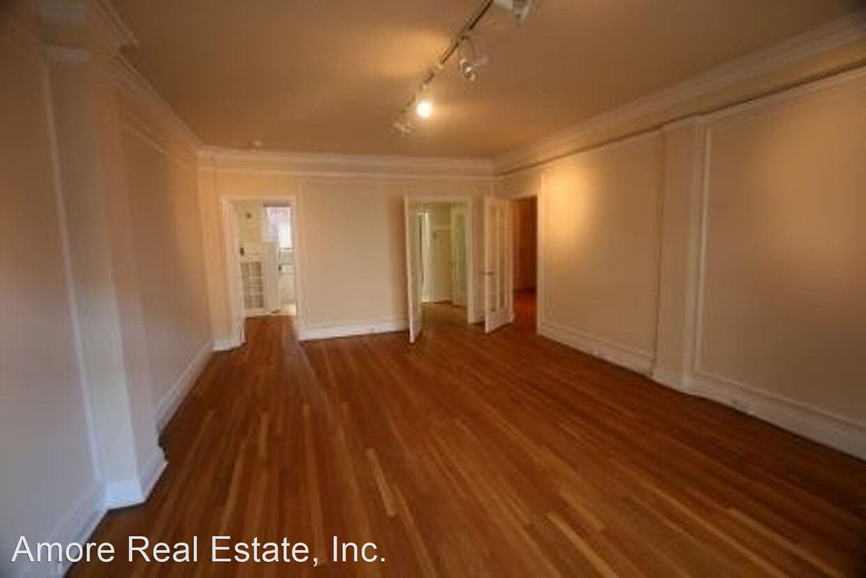
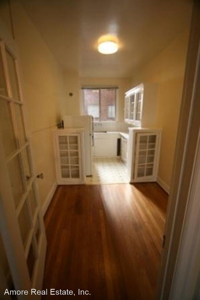
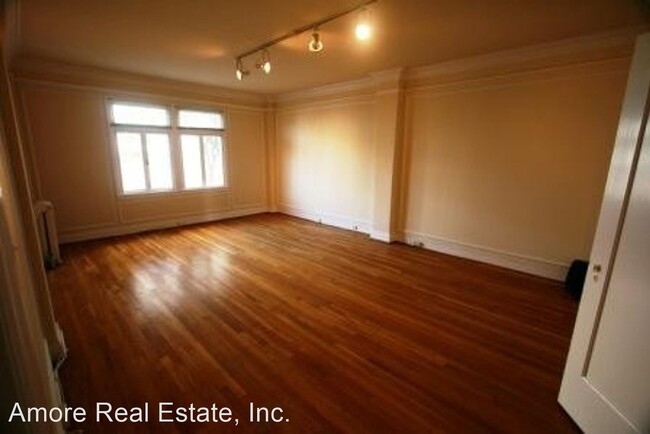
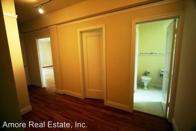
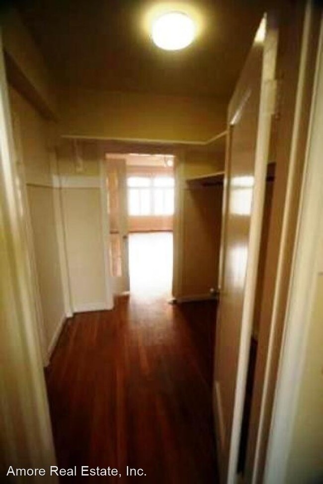
(415) 939-6696 - Large Studio with Hardwood Floors, Lots Light, Atop of Nob Hill - Located in prime Nob Hill location corner unit faces California Street. Nice floor plan with entrance hallway, large living area & separate kitchen with dinette Large walk through closet / dressing area. Includes utilities: electricity, water, garbage & steam heat, Rent Controlled Building Contact Robbie Diaz at 510-326-3900 for more information All information deemed reliable but not guaranteed (RLNE5599352)
1233 California St is an apartment community located in San Francisco County and the 94109 ZIP Code.
Location
Get Directions
San Francisco’s Lower Nob Hill sits in the heart of Downtown, offering residents a premier location in one of California’s most popular cities. Situated between Union Square and US-101, locals can easily travel through the city, but why leave when there are so many conveniences right in this neighborhood? Union Square is San Francisco’s expansive and famous shopping plaza known for its upscale shops, restaurants, hotels, and nightlife spots.
Lower Nob’s light rail and bus stations are abundant, making commuting as easy as ever. This neighborhood is a great place for job opportunities due to the vast number of businesses in the area. Lower Nob is home to Saint Francis Memorial Hospital, the Masonic, and Dragon’s Gate, a landmark arch that’s the iconic gateway to Chinatown, Lower Nob’s neighbor. This neighborhood features an array of upscale apartments, houses, and condos that will fit any renter’s preferences and style.
Learn more about living in Lower NobBelow are rent ranges for similar nearby apartments
| Beds | Average Size | Lowest | Typical | Premium |
|---|---|---|---|---|
| Studio Studio Studio | 333-339 Sq Ft | $900 | $2,799 | $5,970 |
| 1 Bed 1 Bed 1 Bed | 623-640 Sq Ft | $1,000 | $3,366 | $7,030 |
| 2 Beds 2 Beds 2 Beds | 1130-1143 Sq Ft | $1,000 | $6,898 | $18,000 |
| 3 Beds 3 Beds 3 Beds | 2117 Sq Ft | $4,500 | $16,371 | $26,000 |
| 4 Beds 4 Beds 4 Beds | 1440 Sq Ft | $1,380 | $10,568 | $35,000 |
Education
| Colleges & Universities | Distance | ||
|---|---|---|---|
| Colleges & Universities | Distance | ||
| Walk: | 5 min | 0.3 mi | |
| Drive: | 3 min | 1.3 mi | |
| Drive: | 5 min | 1.6 mi | |
| Drive: | 7 min | 2.4 mi |
1233 California St is within 5 minutes or 0.3 mile from Academy of Art University. It is also near Golden Gate Univ., San Fran. and UC San Francisco, Mount Zion.
Transportation options available in San Francisco include California And Jones, located 0.0 mile from 1233 California St. 1233 California St is near San Francisco International, located 14.8 miles or 24 minutes away, and Metro Oakland International, located 19.7 miles or 30 minutes away.
| Transit / Subway | Distance | ||
|---|---|---|---|
| Transit / Subway | Distance | ||
|
|
Walk: | 2 min | 0.0 mi |
|
|
Walk: | 1 min | 0.1 mi |
| Walk: | 2 min | 0.1 mi | |
|
|
Walk: | 2 min | 0.1 mi |
|
|
Walk: | 3 min | 0.2 mi |
| Commuter Rail | Distance | ||
|---|---|---|---|
| Commuter Rail | Distance | ||
| Drive: | 5 min | 1.7 mi | |
| Drive: | 5 min | 1.8 mi | |
| Drive: | 7 min | 3.2 mi | |
| Drive: | 7 min | 3.3 mi | |
| Drive: | 12 min | 6.9 mi |
| Airports | Distance | ||
|---|---|---|---|
| Airports | Distance | ||
|
San Francisco International
|
Drive: | 24 min | 14.8 mi |
|
Metro Oakland International
|
Drive: | 30 min | 19.7 mi |
Time and distance from 1233 California St.
| Shopping Centers | Distance | ||
|---|---|---|---|
| Shopping Centers | Distance | ||
| Walk: | 10 min | 0.5 mi | |
| Walk: | 15 min | 0.8 mi | |
| Drive: | 4 min | 1.3 mi |
1233 California St has 3 shopping centers within 1.3 miles, which is about a 4-minute walk. The miles and minutes will be for the farthest away property.
| Parks and Recreation | Distance | ||
|---|---|---|---|
| Parks and Recreation | Distance | ||
|
Children's Creativity Museum
|
Drive: | 3 min | 1.1 mi |
|
San Francisco Maritime National Historical Park
|
Drive: | 3 min | 1.4 mi |
|
Aquarium of The Bay
|
Drive: | 5 min | 1.9 mi |
|
Exploratorium
|
Drive: | 7 min | 3.0 mi |
|
Buena Vista Park
|
Drive: | 9 min | 3.0 mi |
1233 California St has 5 parks within 3.0 miles, including Children's Creativity Museum, San Francisco Maritime National Historical Park, and Aquarium of The Bay.
| Hospitals | Distance | ||
|---|---|---|---|
| Hospitals | Distance | ||
| Walk: | 4 min | 0.2 mi | |
| Walk: | 11 min | 0.6 mi | |
| Walk: | 13 min | 0.7 mi |
1233 California St has 3 hospitals within 0.7 mile, the nearest is Saint Francis Memorial Hospital which is 0.2 mile away and a 4 minute walk.
| Military Bases | Distance | ||
|---|---|---|---|
| Military Bases | Distance | ||
| Drive: | 14 min | 5.0 mi | |
| Drive: | 13 min | 5.8 mi | |
| Drive: | 27 min | 14.3 mi |
1233 California St has 3 military bases within 14.3 miles, the nearest is East Fort Miley which is 5.0 miles away and a 14 minute drive.
You May Also Like
Similar Rentals Nearby


What Are Walk Score®, Transit Score®, and Bike Score® Ratings?
Walk Score® measures the walkability of any address. Transit Score® measures access to public transit. Bike Score® measures the bikeability of any address.
What is a Sound Score Rating?
A Sound Score Rating aggregates noise caused by vehicle traffic, airplane traffic and local sources

1233 California St
San Francisco, CA 94109