$2,100 / Month
1243 26th St
Santa Monica, CA 90404
2 Weeks Ago
Favorites
1243 26th St

Favorites
Check Back Soon for Upcoming Availability
| Beds | Baths | Average SF |
|---|---|---|
| 1 Bedroom 1 Bedroom 1 Br | 1 Bath 1 Bath 1 Ba | — |
About This Property
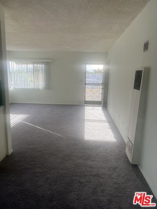
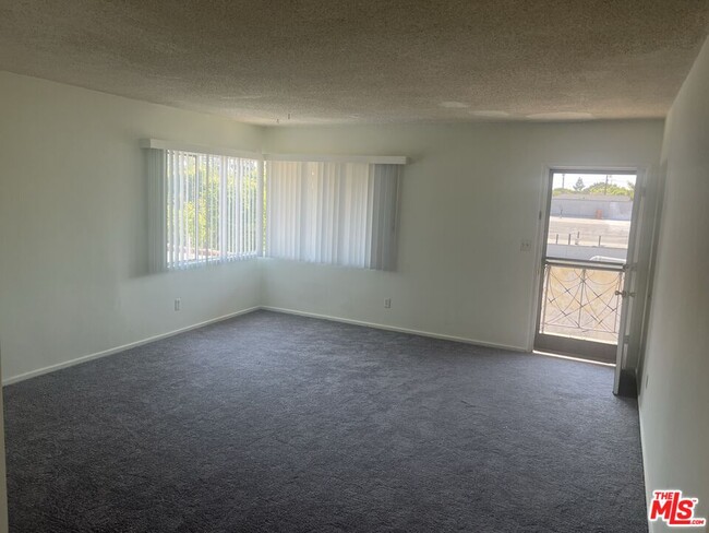
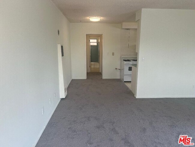
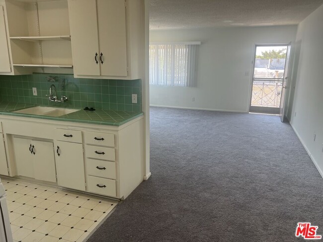
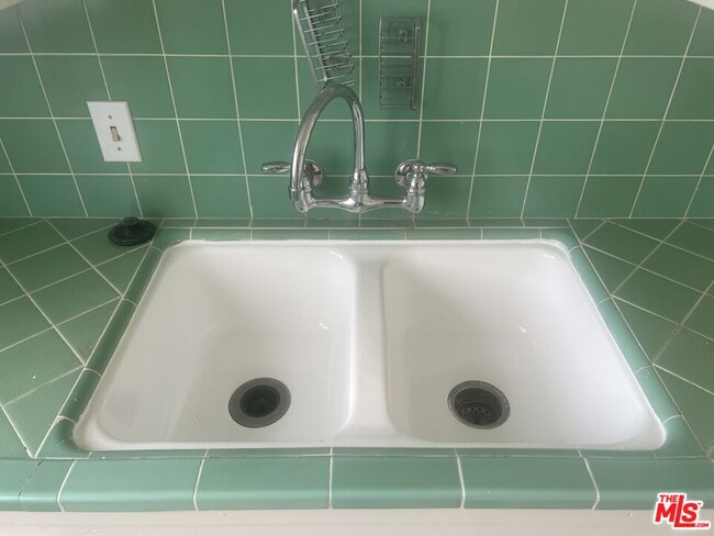
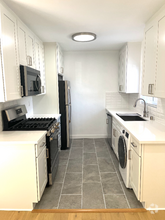
Location, location TURN KEY-MOVE IN READY...1st come-1st serve, located on the 2nd floor (1) bed with large closet (1) full bath, great size kitchen with stove and refrigerator, breakfast area, Livingroom, plenty of storage, freshly painted, new carpet, assigned parking space, service pet wellcom. New way to experience coastal life at this Santa Monica amazing Westside location combine to give you everything you need, close to Starbucks, CVS, park, trader Joe's, wholefood, restaurants, shopping center and walking distance to the beach....................Other listings available other areas. ******Hurry won't last
1243 26th St is a house located in Los Angeles County and the 90404 ZIP Code. This area is served by the Santa Monica-Malibu Unified attendance zone.
House Features
Washer/Dryer Hookup
Refrigerator
Disposal
Ceiling Fans
- Washer/Dryer Hookup
- Ceiling Fans
- Disposal
- Refrigerator
- Carpet
- Views
Fees and Policies
The fees below are based on community-supplied data and may exclude additional fees and utilities.
Pet policies are negotiable.
Property Address:
1243 26th St,
Santa Monica,
CA
90404
Aptly named, Mid-City is in the heart of it all. This Santa Monica neighborhood is flanked by Pacific Palisades to the north and Ocean Park to the south. The western edge of the neighborhood is a mere block from the famous Santa Monica Pier, a fantastic destination where something is always happening, from live concerts to festivals to events like Odd Market at Santa Monica Pier Holiday Show. Mid-City is located between Wilshire Boulevard and Santa Monica Boulevard. Santa Monica Boulevard -- part of historic Route 66 -- is lined with shops, restaurants, and office buildings.
In addition to the Santa Monica Pier, residents of Mid-City enjoy fast access to the Original Muscle Beach, the Santa Monica Pier Aquarium, and Santa Monica State Beach, an iconic three-mile stretch of beach with mountain views and walking paths. Pacific Park, located near the Pier, is home to Santa Monica's famous Ferris wheel as well as roller coasters, amusement rides, food stands, and games.
Learn more about living in Mid-City Santa MonicaBelow are rent ranges for similar nearby apartments
Amenities
- Washer/Dryer Hookup
- Ceiling Fans
- Disposal
- Refrigerator
- Carpet
- Views
Education
| Colleges & Universities | Distance | ||
|---|---|---|---|
| Colleges & Universities | Distance | ||
| Walk: | 13 min | 0.7 mi | |
| Drive: | 4 min | 1.4 mi | |
| Drive: | 5 min | 1.8 mi | |
| Drive: | 6 min | 2.1 mi |
1243 26th St is within 13 minutes or 0.7 mile from Santa Monica Coll., Academy. It is also near Santa Monica College, Madison and Santa Monica Coll..
Schools


Public Elementary School
Grades K-5
403 Students
Attendance Zone
Public Middle School
Grades 6-8
854 Students
Attendance Zone
Public High School
Grades 9-12
2,678 Students
Attendance Zone
Private Elementary & Middle School
Grades PK-8
193 Students
Nearby
Private Elementary, Middle & High School
Grades K-12
126 Students
Nearby
Private High School
Grades 9-12
53 Students
Nearby
School data provided by
 The GreatSchools Rating helps parents compare schools within a state based on a variety of school quality indicators and provides a helpful picture of how effectively each school serves all of its students. Ratings are on a scale of 1 (below average) to 10 (above average) and can include test scores, college readiness, academic progress, advanced courses, equity, discipline and attendance data. We also advise parents to visit schools, consider other information on school performance and programs, and consider family needs as part of the school selection process.
View GreatSchools Rating Methodology
View GreatSchools Rating Methodology
Transportation options available in Santa Monica include 17 St/ Smc, located 1.2 miles from 1243 26th St. 1243 26th St is near Los Angeles International, located 10.8 miles or 18 minutes away, and Bob Hope, located 19.3 miles or 30 minutes away.
| Transit / Subway | Distance | ||
|---|---|---|---|
| Transit / Subway | Distance | ||
|
|
Drive: | 3 min | 1.2 mi |
|
|
Drive: | 4 min | 1.3 mi |
|
|
Drive: | 4 min | 1.8 mi |
|
|
Drive: | 5 min | 2.1 mi |
| Drive: | 7 min | 3.0 mi |
| Commuter Rail | Distance | ||
|---|---|---|---|
| Commuter Rail | Distance | ||
|
|
Drive: | 24 min | 15.7 mi |
|
|
Drive: | 23 min | 15.8 mi |
|
|
Drive: | 29 min | 19.2 mi |
|
|
Drive: | 30 min | 19.3 mi |
|
|
Drive: | 30 min | 20.2 mi |
| Airports | Distance | ||
|---|---|---|---|
| Airports | Distance | ||
|
Los Angeles International
|
Drive: | 18 min | 10.8 mi |
|
Bob Hope
|
Drive: | 30 min | 19.3 mi |
Time and distance from 1243 26th St.
| Shopping Centers | Distance | ||
|---|---|---|---|
| Shopping Centers | Distance | ||
| Walk: | 3 min | 0.2 mi | |
| Walk: | 8 min | 0.5 mi | |
| Walk: | 9 min | 0.5 mi |
1243 26th St has 3 shopping centers within 0.5 mile, which is about a 9-minute walk. The miles and minutes will be for the farthest away property.
| Parks and Recreation | Distance | ||
|---|---|---|---|
| Parks and Recreation | Distance | ||
|
Santa Monica Pier Aquarium
|
Drive: | 7 min | 2.9 mi |
|
Mathias Botanical Garden
|
Drive: | 8 min | 3.1 mi |
|
Santa Monica State Beach
|
Drive: | 7 min | 3.3 mi |
|
Will Rogers State Historic Park
|
Drive: | 12 min | 4.6 mi |
|
Will Rogers State Beach
|
Drive: | 9 min | 5.1 mi |
1243 26th St has 5 parks within 5.1 miles, including Santa Monica State Beach, Santa Monica Pier Aquarium, and Mathias Botanical Garden.
| Hospitals | Distance | ||
|---|---|---|---|
| Hospitals | Distance | ||
| Walk: | 9 min | 0.5 mi | |
| Walk: | 17 min | 0.9 mi | |
| Drive: | 8 min | 3.2 mi |
1243 26th St has 3 hospitals within 3.2 miles, the nearest is Providence Saint John's Health Center which is 0.5 mile away and a 9 minute walk.
| Military Bases | Distance | ||
|---|---|---|---|
| Military Bases | Distance | ||
| Drive: | 19 min | 13.4 mi |
1243 26th St is 13.4 miles and a 19 minute drive from Los Angeles Air Force Base.
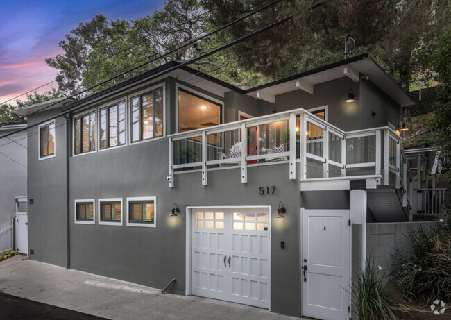
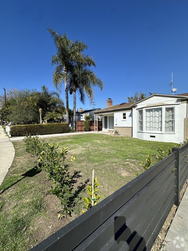
You May Also Like
Similar Rentals Nearby

What Are Walk Score®, Transit Score®, and Bike Score® Ratings?
Walk Score® measures the walkability of any address. Transit Score® measures access to public transit. Bike Score® measures the bikeability of any address.
What is a Sound Score Rating?
A Sound Score Rating aggregates noise caused by vehicle traffic, airplane traffic and local sources

1243 26th St
Santa Monica, CA 90404