

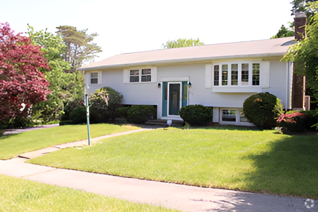
$1,800 / Month
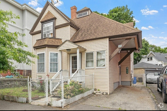
125 S Flagg St
Worcester, MA 01602
2 Weeks Ago
Favorites
125 S Flagg St

Favorites
Check Back Soon for Upcoming Availability
| Beds | Baths | Average SF |
|---|---|---|
| 3 Bedrooms 3 Bedrooms 3 Br | 2 Baths 2 Baths 2 Ba | 1,446 SF |
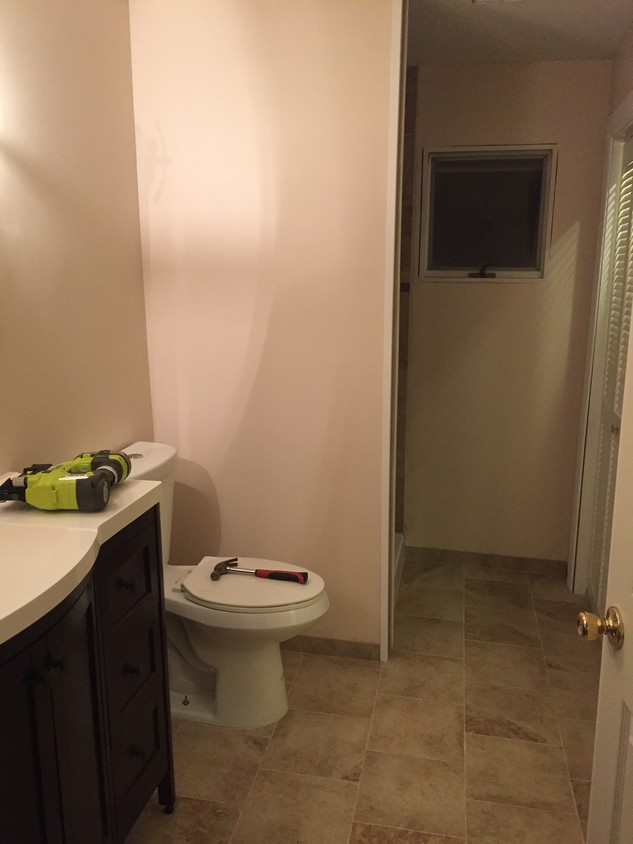
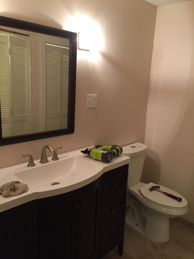
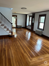
About This Property
Beautiful home on a quiet side street in Worcester. 3 Bedrooms/2 Bathrooms, including master suite with private bathroom! Professional property management on-call 24/7! Huge full-height basement, carport, and shed!
125 S Flagg St is a house located in Worcester County and the 01602 ZIP Code.
Location
Get Directions
The Tatnuck community is largely made up of the Worcester State University campus. The college is smack dab in the middle of it all, surrounded by Rockwood Field and local elementary schools. Encompassing this suburban community are local restaurants, convenience stores, and quick-bites establishments.
When you live in Tatnuck, you’re down the road from Tatnuck Country Club, Boynton Park, and the Worcester Regional Airport. The Shoppes at Blackstone Valley mall is just eight miles southeast of the neighborhood, and the perfect spot for a day of shopping, lunch, and watching a movie. Near Interstate 290 is Wormtown Brewing Company, which is known for their “Blizzard of ‘78” English-style brown ale.
Learn more about living in TatnuckBelow are rent ranges for similar nearby apartments
Education
| Colleges & Universities | Distance | ||
|---|---|---|---|
| Colleges & Universities | Distance | ||
| Walk: | 7 min | 0.4 mi | |
| Drive: | 7 min | 2.1 mi | |
| Drive: | 5 min | 2.3 mi | |
| Drive: | 5 min | 2.4 mi |
125 S Flagg St is within 7 minutes or 0.4 mile from Worcester State University. It is also near Becker College, Worcester and Clark University.
Transportation options available in Worcester include Riverside Station, located 36.3 miles from 125 S Flagg St. 125 S Flagg St is near Worcester Regional, located 3.4 miles or 8 minutes away.
| Transit / Subway | Distance | ||
|---|---|---|---|
| Transit / Subway | Distance | ||
|
|
Drive: | 50 min | 36.3 mi |
|
|
Drive: | 50 min | 36.7 mi |
|
|
Drive: | 51 min | 37.4 mi |
|
|
Drive: | 54 min | 38.9 mi |
|
|
Drive: | 54 min | 39.1 mi |
| Commuter Rail | Distance | ||
|---|---|---|---|
| Commuter Rail | Distance | ||
|
|
Drive: | 5 min | 3.0 mi |
|
|
Drive: | 6 min | 3.1 mi |
|
|
Drive: | 19 min | 10.5 mi |
|
|
Drive: | 21 min | 11.8 mi |
|
|
Drive: | 32 min | 18.8 mi |
| Airports | Distance | ||
|---|---|---|---|
| Airports | Distance | ||
|
Worcester Regional
|
Drive: | 8 min | 3.4 mi |
Time and distance from 125 S Flagg St.
| Shopping Centers | Distance | ||
|---|---|---|---|
| Shopping Centers | Distance | ||
| Walk: | 16 min | 0.9 mi | |
| Drive: | 2 min | 1.2 mi | |
| Drive: | 2 min | 1.2 mi |
125 S Flagg St has 3 shopping centers within 1.2 miles, which is about a 2-minute walk. The miles and minutes will be for the farthest away property.
| Parks and Recreation | Distance | ||
|---|---|---|---|
| Parks and Recreation | Distance | ||
|
EcoTarium
|
Drive: | 11 min | 4.8 mi |
|
Quinsigamond State Park
|
Drive: | 9 min | 5.3 mi |
|
Mass Audubon's Broad Meadow Brook Conservation Center and Wildlife Sanctuary
|
Drive: | 10 min | 5.5 mi |
|
Moore State Park
|
Drive: | 13 min | 7.1 mi |
|
Mass Audubon's Eagle Lake Wildlife Sanctuary
|
Drive: | 17 min | 8.3 mi |
125 S Flagg St has 5 parks within 8.3 miles, including EcoTarium, Quinsigamond State Park, and Mass Audubon's Broad Meadow Brook Conservation Center and Wildlife Sanctuary.
| Hospitals | Distance | ||
|---|---|---|---|
| Hospitals | Distance | ||
| Drive: | 6 min | 3.2 mi | |
| Drive: | 6 min | 3.3 mi | |
| Drive: | 10 min | 5.3 mi |
125 S Flagg St has 3 hospitals within 5.3 miles, the nearest is Adcare Hospital of Worcester which is 3.2 miles away and a 6 minute drive.
You May Also Like
Similar Rentals Nearby
What Are Walk Score®, Transit Score®, and Bike Score® Ratings?
Walk Score® measures the walkability of any address. Transit Score® measures access to public transit. Bike Score® measures the bikeability of any address.
What is a Sound Score Rating?
A Sound Score Rating aggregates noise caused by vehicle traffic, airplane traffic and local sources
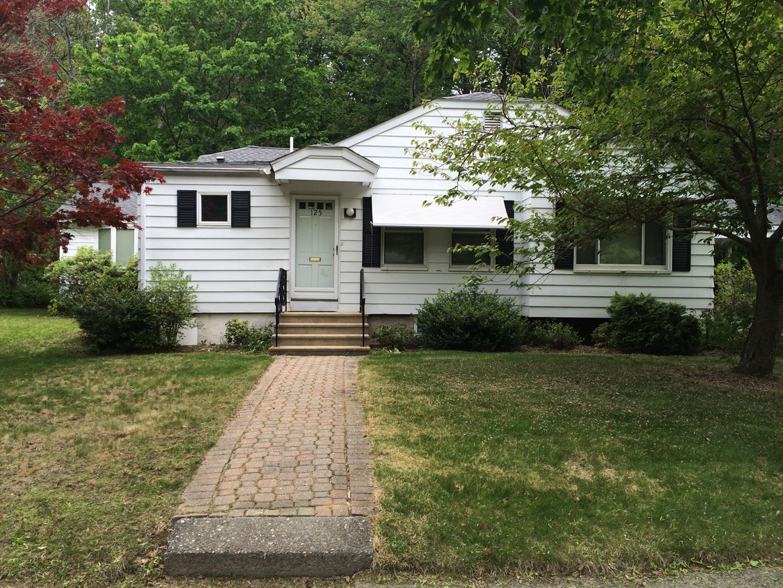
125 S Flagg St
Worcester, MA 01602