
$2,200 / Month
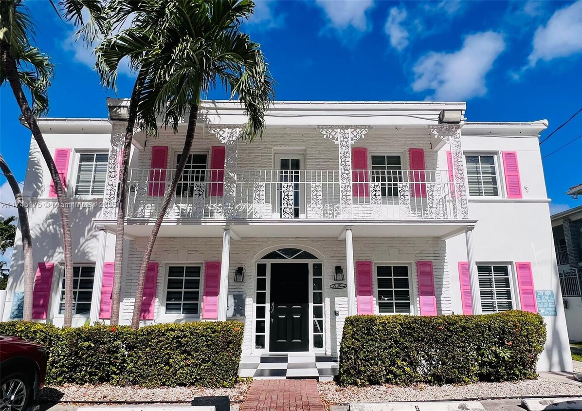
125 S Shore Dr
Miami Beach, FL 33141
Today
Favorites
786-574-1198
-
Bedrooms
1
-
Bathrooms
1
-
Square Feet
3,110 sq ft
-
Available
Available Feb 16
Highlight
- 1 Car Garage
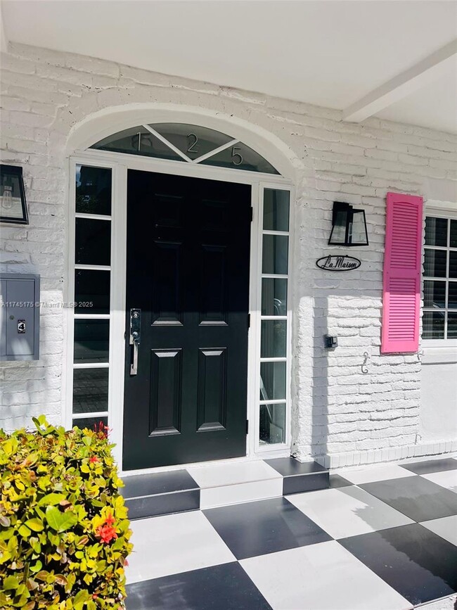
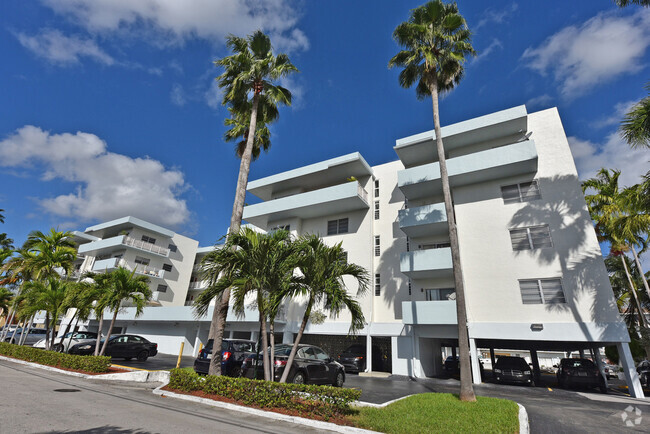
125 S Shore Dr Unit 2

Favorites
About This Home
Available Feb 16
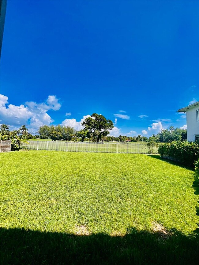
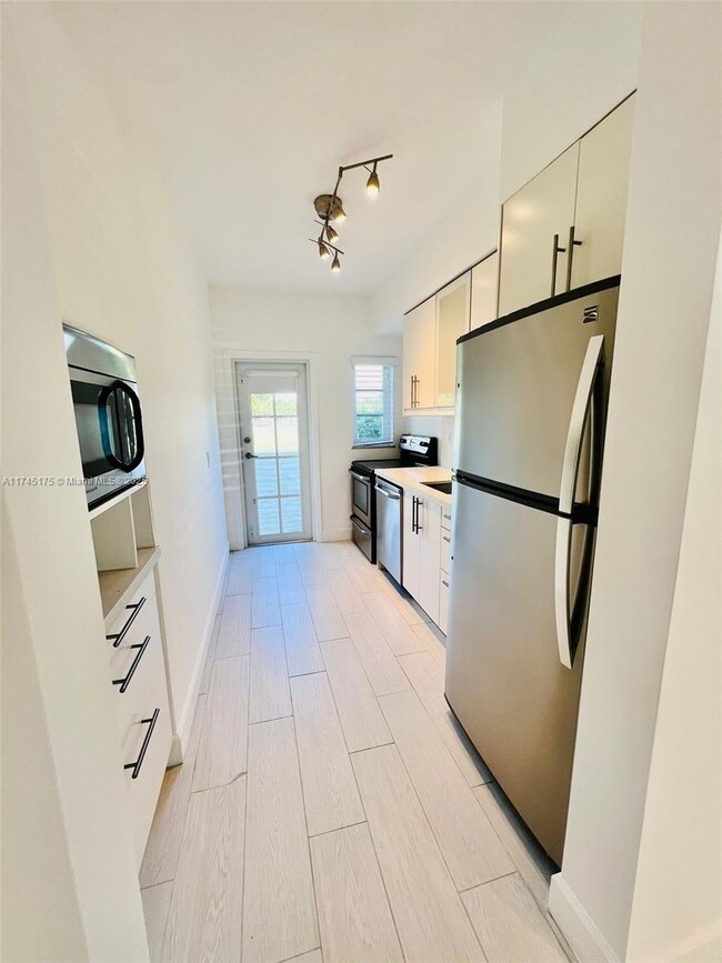
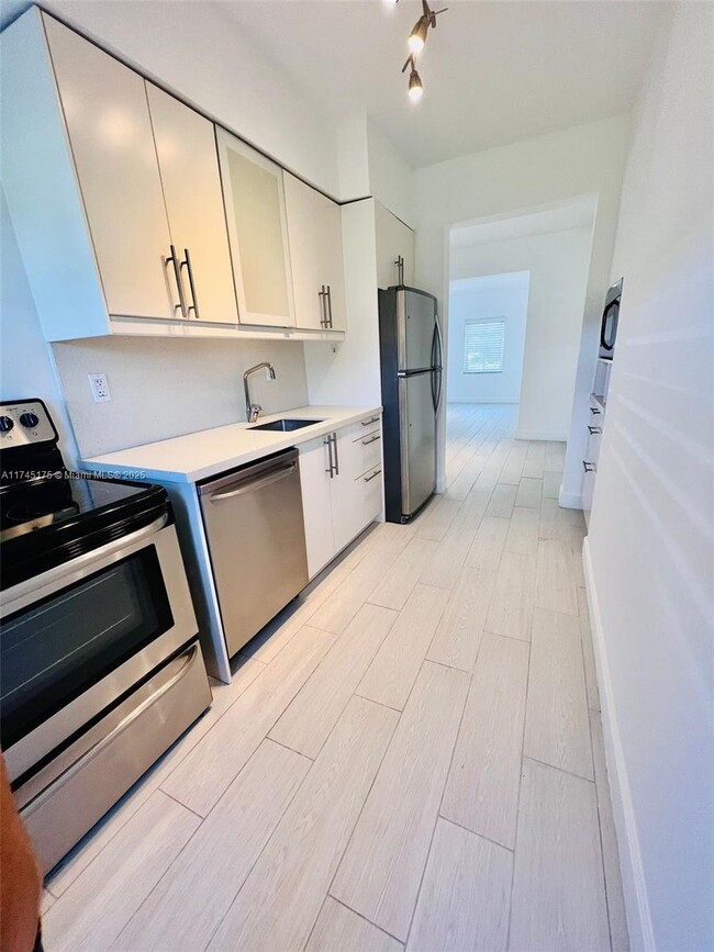
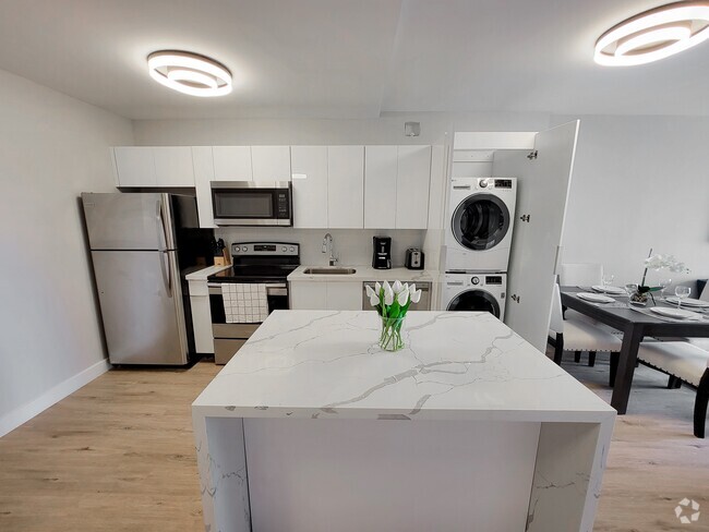
This beautifully renovated boutique apartment is located in a prime first-floor unit, offering sweeping views of the scenic Normandy Shore Golf Course. Featuring an updated kitchen and bathroom, a convenient in-unit washer and dryer. Residents will enjoy the comfort of an assigned parking space. Perfectly situated, this charming property is just steps away from an array of cafes, shops, restaurants, markets, and the beach—making it the ideal location for those seeking both tranquility and easy access to local amenities
125 S Shore Dr is an apartment community located in Miami/Dade County and the 33141 ZIP Code.
* Price shown is base rent and may not include non-optional fees and utilities.
Price, availability, fees, and any applicable rent special are subject to change without notice.
* Square footage definitions vary. Displayed square footage is approximate.
Home Details
Year Built
Built in 1947
Accessible Home Design
Entry on the 1st floor
Bedrooms and Bathrooms
1 Full Bathroom
1 Bedroom
Home Design
Multi-Family
Interior Spaces
3,110 Sq Ft Home
2-Story Property
Listing and Financial Details
Property Available on 2/19/25
Assessor Parcel Number 02-32-03-007-1430
Lot Details
7,580 Sq Ft Lot
Property is zoned 3900
Parking
1 Car Garage
Community Details
Overview
No Home Owners Association
Normandy Golf Course Condos
Normandy Golf Course Subdivision
Pet Policy
No Pets Allowed
Contact
- Listed by Vilma Datorre
- Phone Number (786) 574-1198
- Contact
-
Source
Location
Get Directions
Situated on the Biscayne Bay in North Miami Beach, Normandy Shores is home to the expansive Normandy Shores Golf Club. Many neighborhood residents enjoy waterfront or golf course views right in their backyards. Normandy Shores is in walkable distance to grocery stores, parks, and restaurants. Local dining favorites include Café Prima Pasta, Sazon Cuban Cuisine, and Katana.
Have a tranquil beach experience at North Shore Open Space Park during the day and a lively beach experience in nearby South Beach while exploring the infamous nightlife scene.
Convenient to the Dolphin and Palmetto Expressways as well as the I-95 and Miami International Airport, getting around from Normandy Shores is a breeze.
Learn more about living in Normandy Shores
Education
| Colleges & Universities | Distance | ||
|---|---|---|---|
| Colleges & Universities | Distance | ||
| Drive: | 16 min | 5.8 mi | |
| Drive: | 18 min | 7.1 mi | |
| Drive: | 24 min | 8.9 mi | |
| Drive: | 20 min | 9.2 mi |
125 S Shore Dr Unit 2 is within 16 minutes or 5.8 miles from Johnson & Wales Univ., Miami. It is also near Barry University and FIU, Biscane Bay.
Transportation options available in Miami Beach include School Board, located 9.6 miles from 125 S Shore Dr Unit 2. 125 S Shore Dr Unit 2 is near Miami International, located 17.1 miles or 35 minutes away, and Fort Lauderdale/Hollywood International, located 23.3 miles or 38 minutes away.
| Transit / Subway | Distance | ||
|---|---|---|---|
| Transit / Subway | Distance | ||
|
|
Drive: | 21 min | 9.6 mi |
|
|
Drive: | 21 min | 9.6 mi |
|
|
Drive: | 21 min | 9.8 mi |
|
|
Drive: | 21 min | 9.9 mi |
|
|
Drive: | 22 min | 10.0 mi |
| Commuter Rail | Distance | ||
|---|---|---|---|
| Commuter Rail | Distance | ||
|
|
Drive: | 21 min | 9.2 mi |
|
|
Drive: | 19 min | 10.2 mi |
|
|
Drive: | 21 min | 10.7 mi |
|
|
Drive: | 22 min | 10.9 mi |
|
|
Drive: | 24 min | 12.2 mi |
| Airports | Distance | ||
|---|---|---|---|
| Airports | Distance | ||
|
Miami International
|
Drive: | 35 min | 17.1 mi |
|
Fort Lauderdale/Hollywood International
|
Drive: | 38 min | 23.3 mi |
Time and distance from 125 S Shore Dr Unit 2.
| Shopping Centers | Distance | ||
|---|---|---|---|
| Shopping Centers | Distance | ||
| Walk: | 15 min | 0.8 mi | |
| Drive: | 4 min | 1.2 mi | |
| Drive: | 6 min | 2.0 mi |
125 S Shore Dr Unit 2 has 3 shopping centers within 2.0 miles, which is about a 6-minute drive. The miles and minutes will be for the farthest away property.
| Parks and Recreation | Distance | ||
|---|---|---|---|
| Parks and Recreation | Distance | ||
|
Arch Creek Park & Nature Center
|
Drive: | 17 min | 6.3 mi |
|
Enchanted Forest Elaine Gordon Park
|
Drive: | 17 min | 6.4 mi |
|
Oleta River State Park
|
Drive: | 23 min | 7.9 mi |
|
Greynolds Park
|
Drive: | 22 min | 8.9 mi |
|
Jungle Island
|
Drive: | 22 min | 9.5 mi |
125 S Shore Dr Unit 2 has 5 parks within 9.5 miles, including Arch Creek Park & Nature Center, Enchanted Forest Elaine Gordon Park, and Jungle Island.
| Hospitals | Distance | ||
|---|---|---|---|
| Hospitals | Distance | ||
| Drive: | 12 min | 4.1 mi | |
| Drive: | 15 min | 6.1 mi | |
| Drive: | 16 min | 6.9 mi |
125 S Shore Dr Unit 2 has 3 hospitals within 6.9 miles, the nearest is Mount Sinai Medical Center which is 4.1 miles away and a 12 minutes drive.
You May Also Like
Similar Rentals Nearby


What Are Walk Score®, Transit Score®, and Bike Score® Ratings?
Walk Score® measures the walkability of any address. Transit Score® measures access to public transit. Bike Score® measures the bikeability of any address.
What is a Sound Score Rating?
A Sound Score Rating aggregates noise caused by vehicle traffic, airplane traffic and local sources
125 S Shore Dr
Miami Beach, FL 33141