

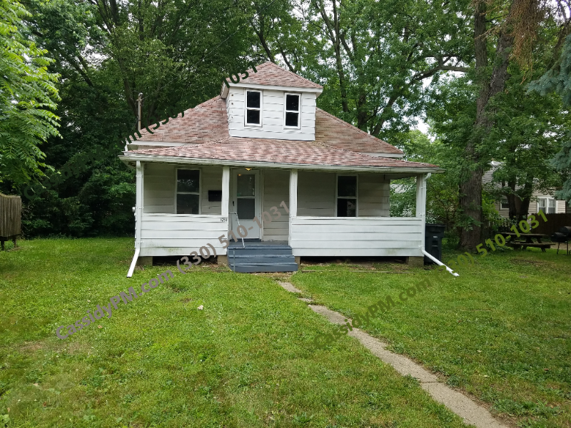
1250 Delos St
Akron, OH 44306
-
Bedrooms
1
-
Bathrooms
1
-
Square Feet
--
-
Available
Available Now
Highlight
- Pets Allowed

About This Home
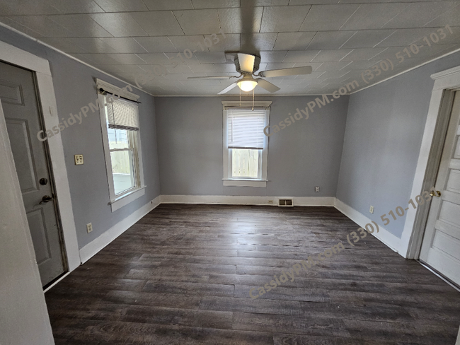
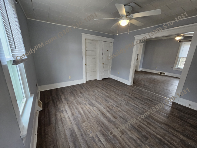
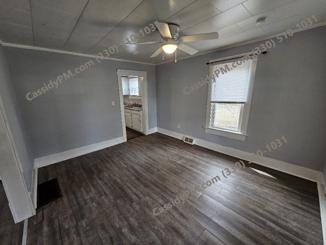
Property Id: 1761229 Available April 1st This unit is being rehabbed and these are old pictures. New photos and walkthrough will be added asap. Tenant Pays All Utilities - Gas, Electric & Water Security Deposit s/a Rent First & Last month required to move in MUST COMPLETE ONLINE APPLICATION before viewing unit. No Utilities included Amenities included: Off-Street parking FREE Lawn Care is INCLUDED with this property! Pet friendly $50/month Pet Rent - Must be approved by management Must include proof of income and employment history with the application. MUST COMPLETE ONLINE APPLICATION before viewing unit
1250 Delos St is a house located in Summit County and the 44306 ZIP Code. This area is served by the Akron City attendance zone.
House Features
- Oven
- Refrigerator
- Vinyl Flooring
Fees and Policies
The fees below are based on community-supplied data and may exclude additional fees and utilities.
- Dogs Allowed
-
Fees not specified
- Cats Allowed
-
Fees not specified
Contact
- Phone Number
- Contact
-
Source

- Oven
- Refrigerator
- Vinyl Flooring
East Akron is a lively neighborhood situated southeast of the city’s center off the Interstate 76 and 77 intersection. Within East Akron, Arlington Street and Archwood Avenue is where residents go to find a variety of dining and shopping choices. To the east of town, residents have access to great amenities like the Akron Executive Airport, parks like Wilbeth Arlington Park, and sprawling golf courses. The majority of East Akron is made up of classic suburban neighborhoods. Renters have the choice between affordable apartments, condos, and cozy single-family homes.
Learn more about living in East Akron| Colleges & Universities | Distance | ||
|---|---|---|---|
| Colleges & Universities | Distance | ||
| Drive: | 9 min | 3.3 mi | |
| Drive: | 21 min | 13.1 mi | |
| Drive: | 22 min | 15.4 mi | |
| Drive: | 25 min | 15.9 mi |

View GreatSchools Rating Methodology
Transportation options available in Akron include Warrensville (Blue Line), located 32.5 miles from 1250 Delos St. 1250 Delos St is near Akron-Canton Regional, located 12.3 miles or 19 minutes away, and Cleveland-Hopkins International, located 44.7 miles or 62 minutes away.
| Transit / Subway | Distance | ||
|---|---|---|---|
| Transit / Subway | Distance | ||
|
|
Drive: | 45 min | 32.5 mi |
|
|
Drive: | 46 min | 33.1 mi |
|
|
Drive: | 46 min | 33.4 mi |
|
|
Drive: | 46 min | 33.4 mi |
|
|
Drive: | 46 min | 33.7 mi |
| Commuter Rail | Distance | ||
|---|---|---|---|
| Commuter Rail | Distance | ||
| Drive: | 10 min | 3.7 mi | |
| Drive: | 18 min | 7.1 mi | |
| Drive: | 24 min | 10.1 mi | |
| Drive: | 30 min | 12.7 mi | |
| Drive: | 27 min | 18.3 mi |
| Airports | Distance | ||
|---|---|---|---|
| Airports | Distance | ||
|
Akron-Canton Regional
|
Drive: | 19 min | 12.3 mi |
|
Cleveland-Hopkins International
|
Drive: | 62 min | 44.7 mi |
Time and distance from 1250 Delos St.
| Shopping Centers | Distance | ||
|---|---|---|---|
| Shopping Centers | Distance | ||
| Drive: | 3 min | 1.1 mi | |
| Drive: | 5 min | 1.7 mi | |
| Drive: | 4 min | 1.7 mi |
| Parks and Recreation | Distance | ||
|---|---|---|---|
| Parks and Recreation | Distance | ||
|
Goodyear Heights Metro Park
|
Drive: | 9 min | 3.5 mi |
|
Firestone Metro Park
|
Drive: | 9 min | 3.8 mi |
|
Cascade Valley Metro Park - South
|
Drive: | 13 min | 5.3 mi |
|
Akron Zoo
|
Drive: | 13 min | 5.9 mi |
|
Gorge Metro Park
|
Drive: | 12 min | 6.7 mi |
| Hospitals | Distance | ||
|---|---|---|---|
| Hospitals | Distance | ||
| Drive: | 6 min | 2.3 mi | |
| Drive: | 10 min | 4.6 mi | |
| Drive: | 11 min | 5.4 mi |
| Military Bases | Distance | ||
|---|---|---|---|
| Military Bases | Distance | ||
| Drive: | 84 min | 67.0 mi |
You May Also Like
What Are Walk Score®, Transit Score®, and Bike Score® Ratings?
Walk Score® measures the walkability of any address. Transit Score® measures access to public transit. Bike Score® measures the bikeability of any address.
What is a Sound Score Rating?
A Sound Score Rating aggregates noise caused by vehicle traffic, airplane traffic and local sources
1250 Delos St
Akron, OH 44306