
$1,500 / Month
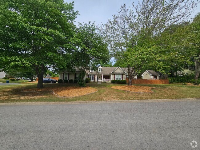
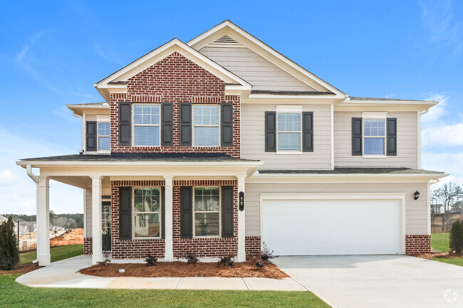
129 Ashwood Way
Winder, GA 30680
2 Weeks Ago
Favorites
129 Ashwood Way

Favorites
Check Back Soon for Upcoming Availability
| Beds | Baths | Average SF |
|---|---|---|
| 4 Bedrooms 4 Bedrooms 4 Br | 2 Baths 2 Baths 2 Ba | 1,298 SF |
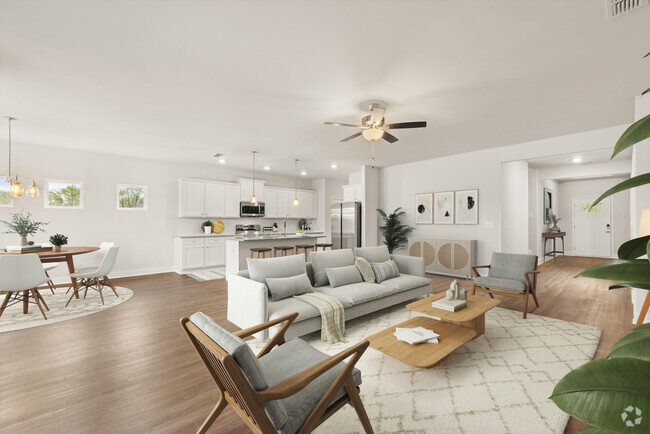
About This Property
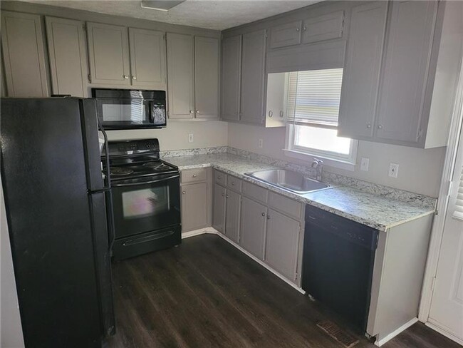
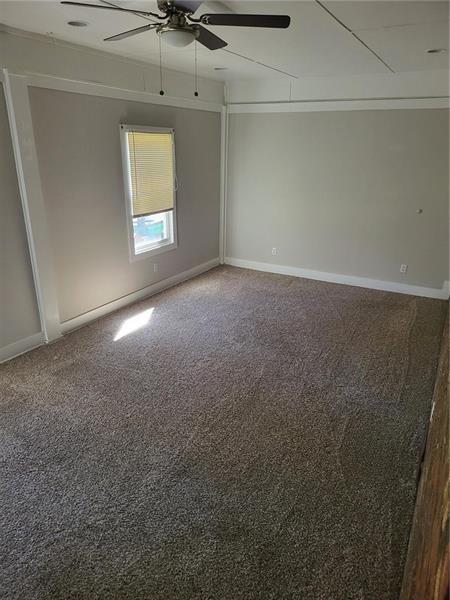
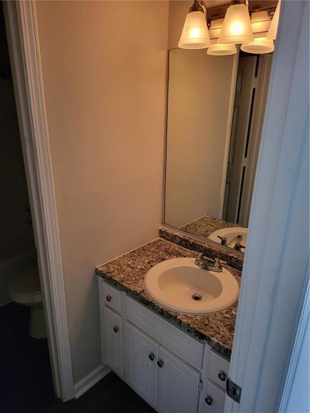
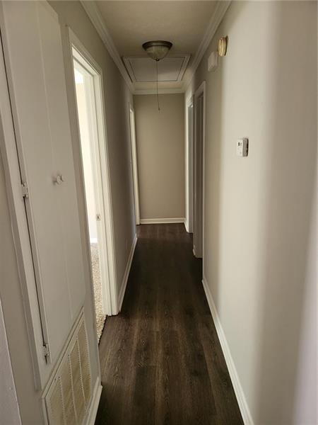
Remodeled spacious Ranch in quiet neighborhood near schools. 4 Bedroom, 2 Bath, LVP in the main living and carpet in the bedrooms, large lot and large storage building out back. Nice inviting front yard and private back yard. This is a must see!
129 Ashwood Way is a house located in Barrow County and the 30680 ZIP Code. This area is served by the Barrow County attendance zone.
Location
Get Directions
Winder is a small city in north central Georgia, located about 25 miles west of Athens and fifty miles east of Atlanta. The city features a thriving commercial district at the center of town, with cozy cafes, specialty shops, and other locally owned businesses operating out of the countless historic buildings in the area. Fort Yargo State Park occupies a large chunk of the city’s south side, with its trails and lake serving as popular destinations for locals when the weather is nice.
Learn more about living in Winder
Education
| Colleges & Universities | Distance | ||
|---|---|---|---|
| Colleges & Universities | Distance | ||
| Drive: | 33 min | 18.1 mi | |
| Drive: | 31 min | 19.3 mi | |
| Drive: | 37 min | 21.9 mi | |
| Drive: | 41 min | 25.9 mi |
129 Ashwood Way is within 33 minutes or 18.1 miles from Georgia Gwinnett College. It is also near University of North Georgia and Gwinnett Technical College.
Schools


Public Elementary School
Grades PK-5
588 Students
Attendance Zone
Public Middle School
Grades 6-8
931 Students
Attendance Zone
Public High School
Grades 9-12
1,787 Students
Attendance Zone
Private Elementary, Middle & High School
Grades K-12
34 Students
Nearby
Private Elementary School
Grades PK-6
31 Students
Nearby
School data provided by
 The GreatSchools Rating helps parents compare schools within a state based on a variety of school quality indicators and provides a helpful picture of how effectively each school serves all of its students. Ratings are on a scale of 1 (below average) to 10 (above average) and can include test scores, college readiness, academic progress, advanced courses, equity, discipline and attendance data. We also advise parents to visit schools, consider other information on school performance and programs, and consider family needs as part of the school selection process.
View GreatSchools Rating Methodology
View GreatSchools Rating Methodology
Transportation options available in Winder include Doraville, located 40.7 miles from 129 Ashwood Way.
| Transit / Subway | Distance | ||
|---|---|---|---|
| Transit / Subway | Distance | ||
|
|
Drive: | 52 min | 40.7 mi |
|
|
Drive: | 53 min | 42.6 mi |
|
|
Drive: | 60 min | 48.1 mi |
|
|
Drive: | 63 min | 50.7 mi |
| Commuter Rail | Distance | ||
|---|---|---|---|
| Commuter Rail | Distance | ||
|
|
Drive: | 38 min | 24.1 mi |
Time and distance from 129 Ashwood Way.
| Shopping Centers | Distance | ||
|---|---|---|---|
| Shopping Centers | Distance | ||
| Drive: | 7 min | 2.8 mi | |
| Drive: | 7 min | 2.8 mi | |
| Drive: | 8 min | 3.3 mi |
129 Ashwood Way has 3 shopping centers within 3.3 miles, which is about a 8-minute drive. The miles and minutes will be for the farthest away property.
| Parks and Recreation | Distance | ||
|---|---|---|---|
| Parks and Recreation | Distance | ||
|
Fort Yargo State Park
|
Drive: | 13 min | 5.2 mi |
|
Little Mulberry Park
|
Drive: | 20 min | 10.2 mi |
|
Dacula Park
|
Drive: | 20 min | 11.3 mi |
|
Duncan Creek Park
|
Drive: | 21 min | 11.8 mi |
129 Ashwood Way has 4 parks within 11.8 miles, including Fort Yargo State Park, Little Mulberry Park, and Dacula Park.
| Hospitals | Distance | ||
|---|---|---|---|
| Hospitals | Distance | ||
| Drive: | 7 min | 3.4 mi |
129 Ashwood Way is 3.4 miles and a 7 minute drive from Barrow Regional Medical Center.
| Military Bases | Distance | ||
|---|---|---|---|
| Military Bases | Distance | ||
| Drive: | 80 min | 63.3 mi |
129 Ashwood Way is 63.3 miles and a 80 minute drive from Fort Gillem.
You May Also Like
Similar Rentals Nearby
What Are Walk Score®, Transit Score®, and Bike Score® Ratings?
Walk Score® measures the walkability of any address. Transit Score® measures access to public transit. Bike Score® measures the bikeability of any address.
What is a Sound Score Rating?
A Sound Score Rating aggregates noise caused by vehicle traffic, airplane traffic and local sources
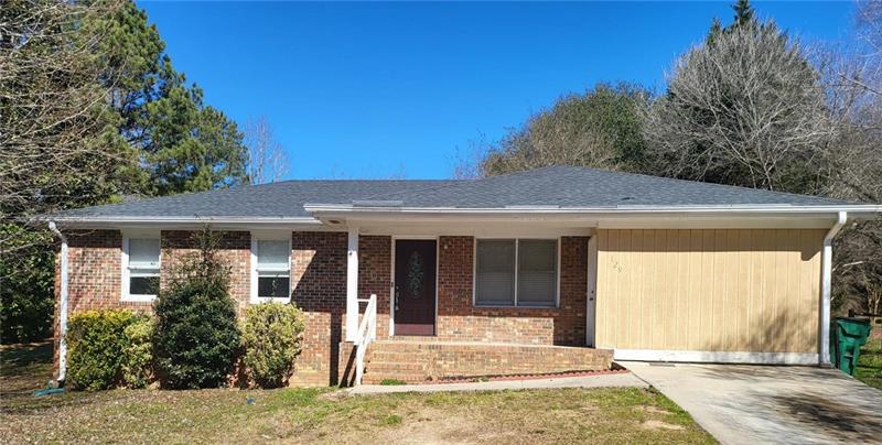
129 Ashwood Way
Winder, GA 30680