
$2,650 / Month
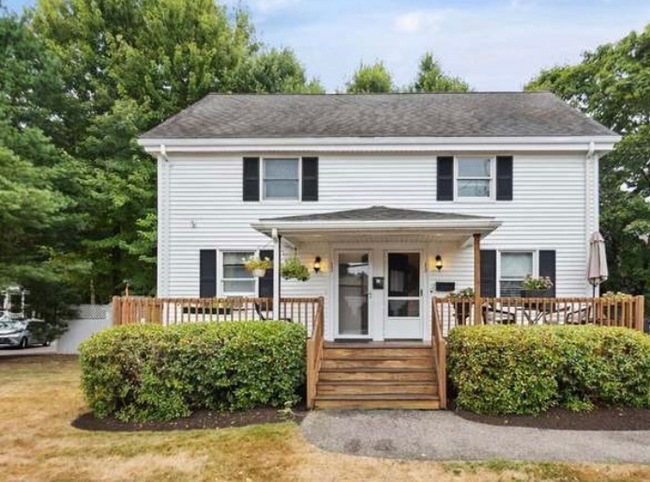
13 Gay St
Westwood, MA 02090
2 Weeks Ago
Favorites
13 Gay St

Favorites
Check Back Soon for Upcoming Availability
| Beds | Baths | Average SF |
|---|---|---|
| 1 Bedroom 1 Bedroom 1 Br | 1 Bath 1 Bath 1 Ba | — |
About This Property
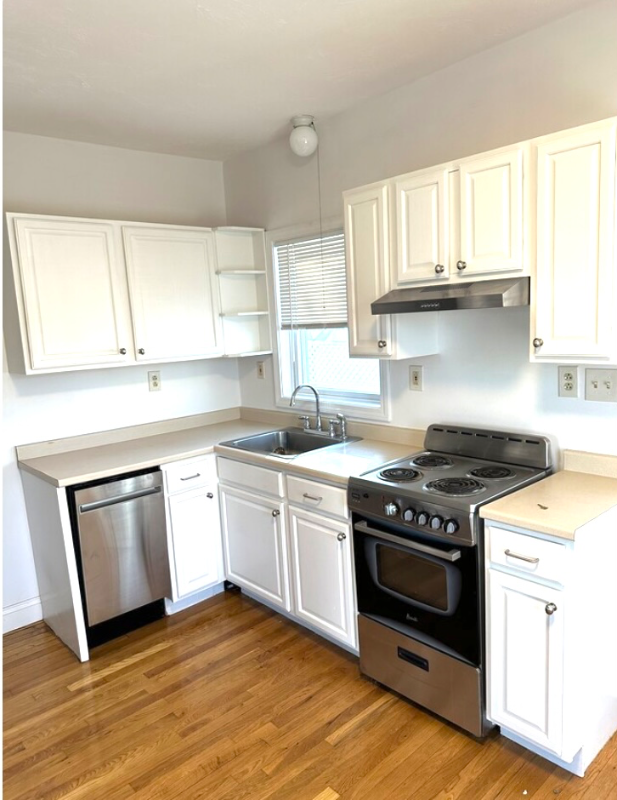
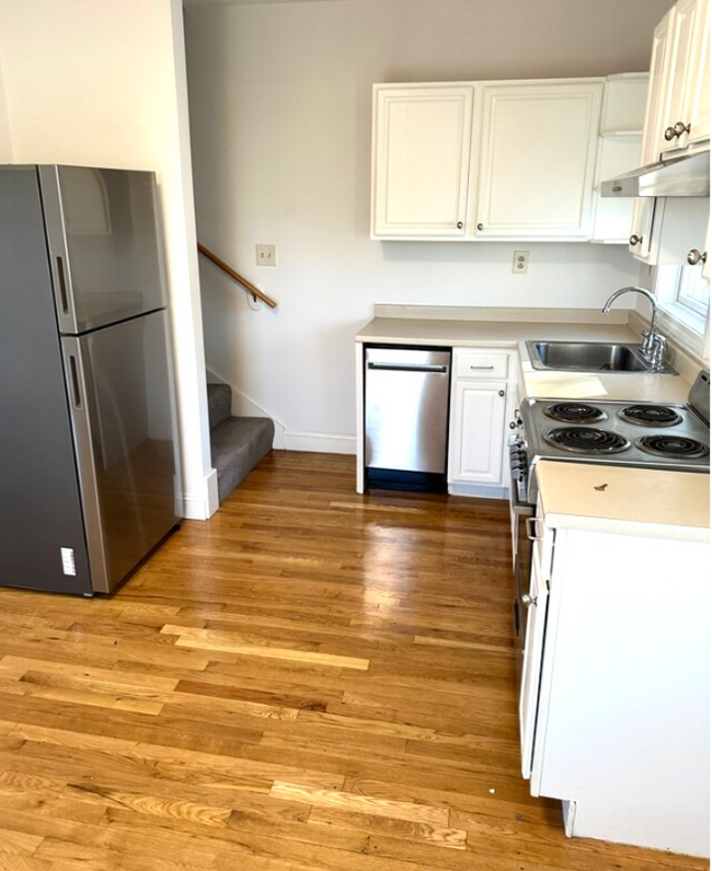
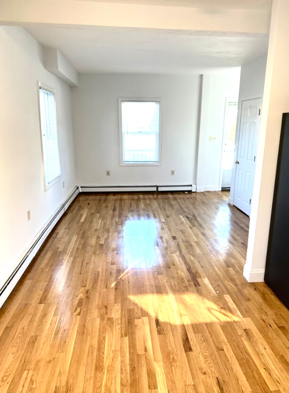
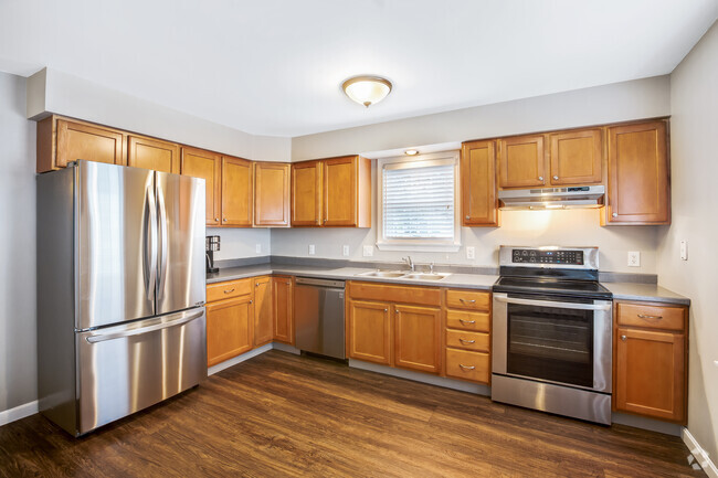
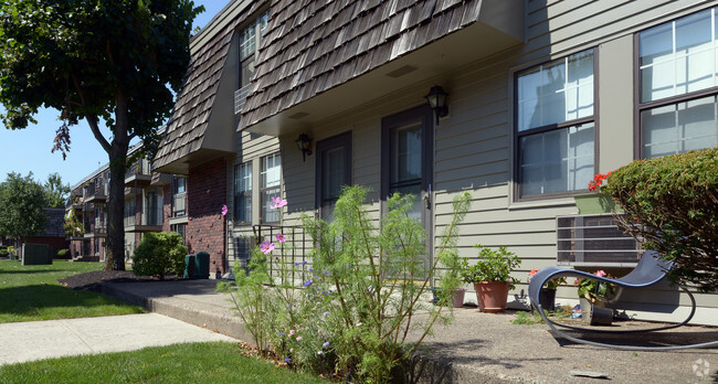
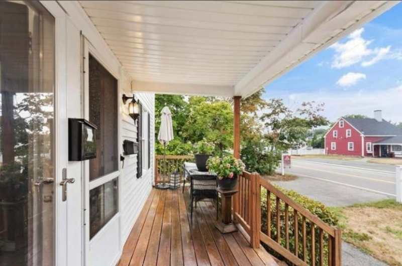
Property Id: 1409165 Welcome home to the rare opportunity to live in this recently updated 1 bed 1 bath Townhouse in the heart of Westwood. This beautiful 2 levels of living boasts of gleaming hardwood floors, freshly painted, fully applianced open-concept layout, oversized bedroom and closets and WASHER/DRYER in unit . Walk to everything from Starbucks, all of Westwoods, shops, businesses and a mile from all major highways!. 2 car parking and Available Now. Pets Negotiable!. First, last & broker fee
13 Gay St is a townhome located in Norfolk County and the 02090 ZIP Code. This area is served by the Westwood attendance zone.
Townhome Features
Washer/Dryer
Dishwasher
Hardwood Floors
Microwave
- Washer/Dryer
- Dishwasher
- Disposal
- Microwave
- Oven
- Refrigerator
- Freezer
- Hardwood Floors
- Vaulted Ceiling
- Bicycle Storage
- Lawn
Fees and Policies
The fees below are based on community-supplied data and may exclude additional fees and utilities.
- Dogs Allowed
-
Fees not specified
- Cats Allowed
-
Fees not specified
Details
Utilities Included
-
Water
-
Trash Removal
-
Sewer
Location
Get Directions
Approximately 25 miles from Boston, the town of Westwood offers residents the simplicity of suburban living and the closeness to metropolitan nightlife and attractions. CNN/Money and Money Magazine named Westwood in their “100 Best Places to Live” in 2005.
Expansive greenspaces like Rice Reservation, Mulvehill- and Grimm Conservation, and Pheasant Hill makeup this unique, charming Norfolk County town. Ready for some fun-in-the-sun? Hale Reservation’s North Beach is a prime spot for sun and swim. Shopping and dining destinations include University Station, and college campuses and universities are easily accessible by I-95 and rail services provided by Massachusetts Bay Transportation Authority (MBTA).
Learn more about living in WestwoodBelow are rent ranges for similar nearby apartments
Amenities
- Washer/Dryer
- Dishwasher
- Disposal
- Microwave
- Oven
- Refrigerator
- Freezer
- Hardwood Floors
- Vaulted Ceiling
- Lawn
- Bicycle Storage
Expenses
Utilities Included
Water, Trash Removal, Sewer
Included
Education
| Colleges & Universities | Distance | ||
|---|---|---|---|
| Colleges & Universities | Distance | ||
| Drive: | 13 min | 6.4 mi | |
| Drive: | 16 min | 7.5 mi | |
| Drive: | 18 min | 8.7 mi | |
| Drive: | 16 min | 9.4 mi |
13 Gay St is within 13 minutes or 6.4 miles from Babson College. It is also near Curry College and Wellesley College.
Schools


Public Elementary School
Grades PK-5
502 Students
Nearby
Public Elementary School
Grades K-5
196 Students
Attendance Zone
Public Middle School
Grades 6-8
661 Students
Attendance Zone
Public High School
Grades 9-12
902 Students
Attendance Zone
Private Elementary & Middle School
Grades PK-8
295 Students
Nearby
Private Middle & High School
Grades 7-12
965 Students
Nearby
School data provided by
 The GreatSchools Rating helps parents compare schools within a state based on a variety of school quality indicators and provides a helpful picture of how effectively each school serves all of its students. Ratings are on a scale of 1 (below average) to 10 (above average) and can include test scores, college readiness, academic progress, advanced courses, equity, discipline and attendance data. We also advise parents to visit schools, consider other information on school performance and programs, and consider family needs as part of the school selection process.
View GreatSchools Rating Methodology
View GreatSchools Rating Methodology
Transportation options available in Westwood include Newton Highlands Station, located 8.6 miles from 13 Gay St. 13 Gay St is near General Edward Lawrence Logan International, located 18.1 miles or 34 minutes away, and Worcester Regional, located 48.0 miles or 68 minutes away.
| Transit / Subway | Distance | ||
|---|---|---|---|
| Transit / Subway | Distance | ||
|
|
Drive: | 14 min | 8.6 mi |
|
|
Drive: | 15 min | 9.1 mi |
|
|
Drive: | 15 min | 9.3 mi |
|
|
Drive: | 19 min | 9.6 mi |
|
|
Drive: | 17 min | 9.7 mi |
| Commuter Rail | Distance | ||
|---|---|---|---|
| Commuter Rail | Distance | ||
|
|
Drive: | 7 min | 2.9 mi |
|
|
Drive: | 7 min | 3.2 mi |
|
|
Drive: | 6 min | 3.3 mi |
|
|
Drive: | 7 min | 3.3 mi |
|
|
Drive: | 9 min | 5.1 mi |
| Airports | Distance | ||
|---|---|---|---|
| Airports | Distance | ||
|
General Edward Lawrence Logan International
|
Drive: | 34 min | 18.1 mi |
|
Worcester Regional
|
Drive: | 68 min | 48.0 mi |
Time and distance from 13 Gay St.
| Shopping Centers | Distance | ||
|---|---|---|---|
| Shopping Centers | Distance | ||
| Drive: | 7 min | 2.9 mi | |
| Drive: | 8 min | 3.1 mi | |
| Drive: | 6 min | 3.5 mi |
13 Gay St has 3 shopping centers within 3.5 miles, which is about a 6-minute drive. The miles and minutes will be for the farthest away property.
| Parks and Recreation | Distance | ||
|---|---|---|---|
| Parks and Recreation | Distance | ||
|
Brook Farm Historic Site
|
Drive: | 10 min | 5.4 mi |
|
Stony Brook Reservation
|
Drive: | 12 min | 6.0 mi |
|
Cutler Park Reservation
|
Drive: | 10 min | 6.7 mi |
|
Lookout Farm
|
Drive: | 15 min | 7.5 mi |
|
Mass Audubon's Blue Hills Trailside Museum
|
Drive: | 12 min | 8.3 mi |
13 Gay St has 5 parks within 8.3 miles, including Brook Farm Historic Site, Stony Brook Reservation, and Lookout Farm.
| Hospitals | Distance | ||
|---|---|---|---|
| Hospitals | Distance | ||
| Drive: | 3 min | 1.3 mi | |
| Drive: | 6 min | 3.0 mi | |
| Drive: | 8 min | 4.3 mi |
13 Gay St has 3 hospitals within 4.3 miles, the nearest is Westwood Pembroke Health Systems which is 1.3 miles away and a 3 minute drive.
| Military Bases | Distance | ||
|---|---|---|---|
| Military Bases | Distance | ||
| Drive: | 22 min | 11.3 mi |
13 Gay St is 11.3 miles and a 22 minute drive from US Military Reservation.
You May Also Like
Similar Rentals Nearby


What Are Walk Score®, Transit Score®, and Bike Score® Ratings?
Walk Score® measures the walkability of any address. Transit Score® measures access to public transit. Bike Score® measures the bikeability of any address.
What is a Sound Score Rating?
A Sound Score Rating aggregates noise caused by vehicle traffic, airplane traffic and local sources
13 Gay St
Westwood, MA 02090