1302 McCurley Ave
Catonsville, MD 21228
-
Bedrooms
4
-
Bathrooms
1.5
-
Square Feet
--
-
Available
Available Now
Highlights
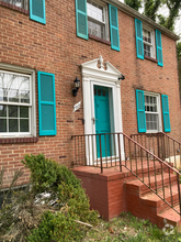
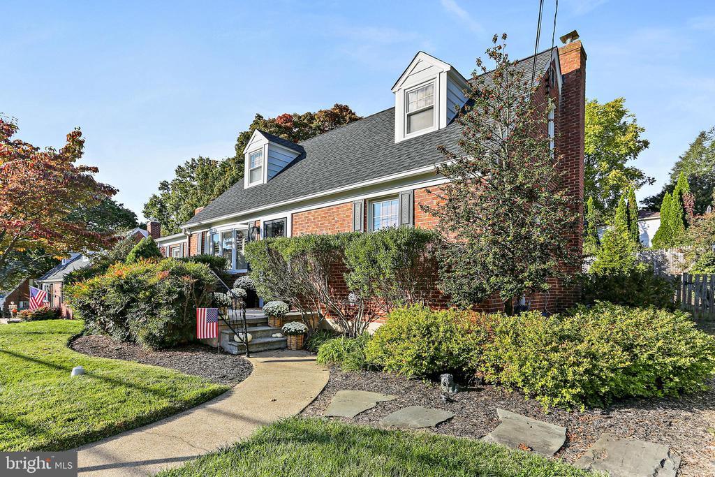
- Cape Cod Architecture
- Wooded Lot
- Wood Flooring
- Attic
- Game Room
- Breakfast Room

About This Home
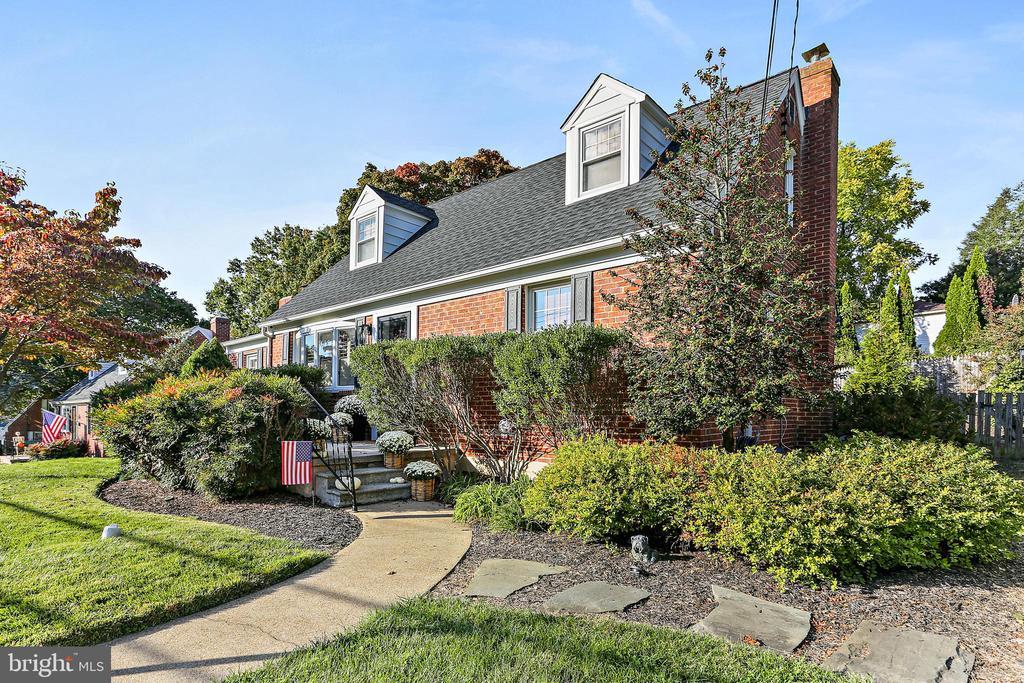
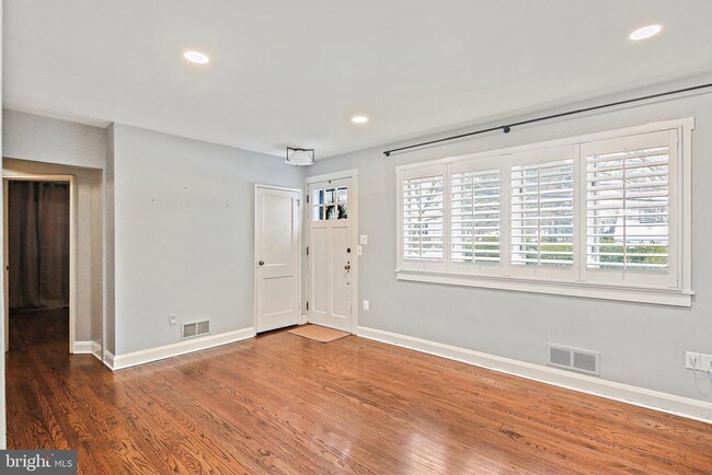
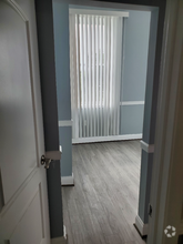
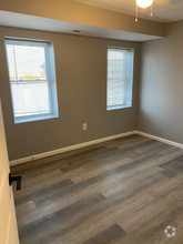
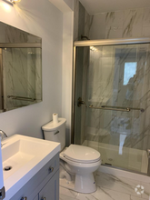
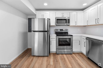
CHARMING CAPE COD WITH COZY FAMILY ROOM FEATURING HARDWOOD FLOORS & STONE FRONT WOODBURNING STOVE. THE KITCHEN FEATURES STAINLESS STEEL APPLIANCES, QUARTZ COUNTERTOPS, AND WHITE CABINETS WITH TILE FLOORS. TWO BEDROOMS WITH HARDWOOD FLOORS AND ONE FULL BATH (SHOWER/TUB COMBO) ON THE MAIN LEVEL. TWO BEDROOMS ON THE UPPER LEVEL WITH HARDWOOD FLOORS, LARGE CLOSETS, SHARED HALl BATHROOM. FINISHED LOWER LEVEL WITH WASHER AND DRYER PLUS AMPLE STORAGE. HUGE BACKYARD AND SPACIOUS DECK COMPLETE WITH AN OUTDOOR SHOWER, FOR ENTERTAINING.
1302 McCurley Ave is a house located in Baltimore County and the 21228 ZIP Code. This area is served by the Baltimore County Public Schools attendance zone.
Home Details
Home Type
Year Built
Bedrooms and Bathrooms
Finished Basement
Home Design
Home Security
Interior Spaces
Kitchen
Laundry
Listing and Financial Details
Lot Details
Outdoor Features
Parking
Schools
Utilities
Community Details
Overview
Pet Policy
Contact
- Listed by Nickolaus B Waldner | Keller Williams Realty Centre
- Phone Number
- Contact
-
Source
 Bright MLS, Inc.
- Fireplace
- Dishwasher
- Basement
On the west side of Baltimore, extending along the Patapsco River and with Patapsco Valley State Park extending along its west side, Catonsville provides a picturesque setting just minutes from the city. Catonsville is a college town, home to the University of Maryland-Baltimore County and the Community College of Baltimore County. Frederick Road serves as Catonsville's main street, lined with historic architecture and containing a variety of shops, art galleries, restaurants, and other businesses.
Catonsville is home to several great destinations and landmarks. Hilton, built in 1825, is listed on the National Register of Historic Places. The mansion is located on what was known as "Taylor's Forest," first surveyed in 1678. Today, it is part of Patapsco Valley State Park, and the Hilton Area Hike Start is located off Hilltop Road. UMBC is home to the Earl and Darielle Linehan Concert Hall, a performing arts venue.
Learn more about living in Catonsville| Colleges & Universities | Distance | ||
|---|---|---|---|
| Colleges & Universities | Distance | ||
| Drive: | 5 min | 1.5 mi | |
| Drive: | 8 min | 2.6 mi | |
| Drive: | 19 min | 8.1 mi | |
| Drive: | 18 min | 9.5 mi |
 The GreatSchools Rating helps parents compare schools within a state based on a variety of school quality indicators and provides a helpful picture of how effectively each school serves all of its students. Ratings are on a scale of 1 (below average) to 10 (above average) and can include test scores, college readiness, academic progress, advanced courses, equity, discipline and attendance data. We also advise parents to visit schools, consider other information on school performance and programs, and consider family needs as part of the school selection process.
View GreatSchools Rating Methodology
Transportation options available in Catonsville include Nursery Road, located 7.2 miles from 1302 McCurley Ave. 1302 McCurley Ave is near Baltimore/Washington International Thurgood Marshall, located 7.5 miles or 13 minutes away, and Ronald Reagan Washington Ntl, located 38.9 miles or 60 minutes away.
| Transit / Subway | Distance | ||
|---|---|---|---|
| Transit / Subway | Distance | ||
|
|
Drive: | 15 min | 7.2 mi |
|
|
Drive: | 13 min | 7.6 mi |
|
|
Drive: | 16 min | 9.1 mi |
|
|
Drive: | 17 min | 9.4 mi |
|
|
Drive: | 16 min | 9.7 mi |
| Commuter Rail | Distance | ||
|---|---|---|---|
| Commuter Rail | Distance | ||
|
|
Drive: | 9 min | 3.9 mi |
|
|
Drive: | 9 min | 4.5 mi |
|
|
Drive: | 16 min | 6.9 mi |
|
|
Drive: | 13 min | 7.5 mi |
|
|
Drive: | 17 min | 9.7 mi |
| Airports | Distance | ||
|---|---|---|---|
| Airports | Distance | ||
|
Baltimore/Washington International Thurgood Marshall
|
Drive: | 13 min | 7.5 mi |
|
Ronald Reagan Washington Ntl
|
Drive: | 60 min | 38.9 mi |
Time and distance from 1302 McCurley Ave.
| Shopping Centers | Distance | ||
|---|---|---|---|
| Shopping Centers | Distance | ||
| Drive: | 5 min | 2.2 mi | |
| Drive: | 5 min | 2.3 mi | |
| Drive: | 7 min | 2.4 mi |
| Parks and Recreation | Distance | ||
|---|---|---|---|
| Parks and Recreation | Distance | ||
|
Banneker Planetarium
|
Drive: | 5 min | 1.5 mi |
|
Benjamin Banneker Historical Park and Museum
|
Drive: | 8 min | 2.8 mi |
|
Gwynns Falls Trail
|
Drive: | 13 min | 5.3 mi |
|
Carrie Murray Nature Center
|
Drive: | 12 min | 5.4 mi |
|
Gwynns Falls - Leakin Park
|
Drive: | 12 min | 5.5 mi |
| Hospitals | Distance | ||
|---|---|---|---|
| Hospitals | Distance | ||
| Drive: | 6 min | 2.2 mi | |
| Drive: | 11 min | 4.3 mi | |
| Drive: | 11 min | 5.1 mi |
| Military Bases | Distance | ||
|---|---|---|---|
| Military Bases | Distance | ||
| Drive: | 27 min | 15.5 mi |
You May Also Like
Similar Rentals Nearby
What Are Walk Score®, Transit Score®, and Bike Score® Ratings?
Walk Score® measures the walkability of any address. Transit Score® measures access to public transit. Bike Score® measures the bikeability of any address.
What is a Sound Score Rating?
A Sound Score Rating aggregates noise caused by vehicle traffic, airplane traffic and local sources
