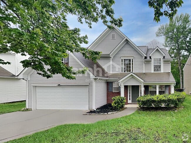
$3,450 / Month
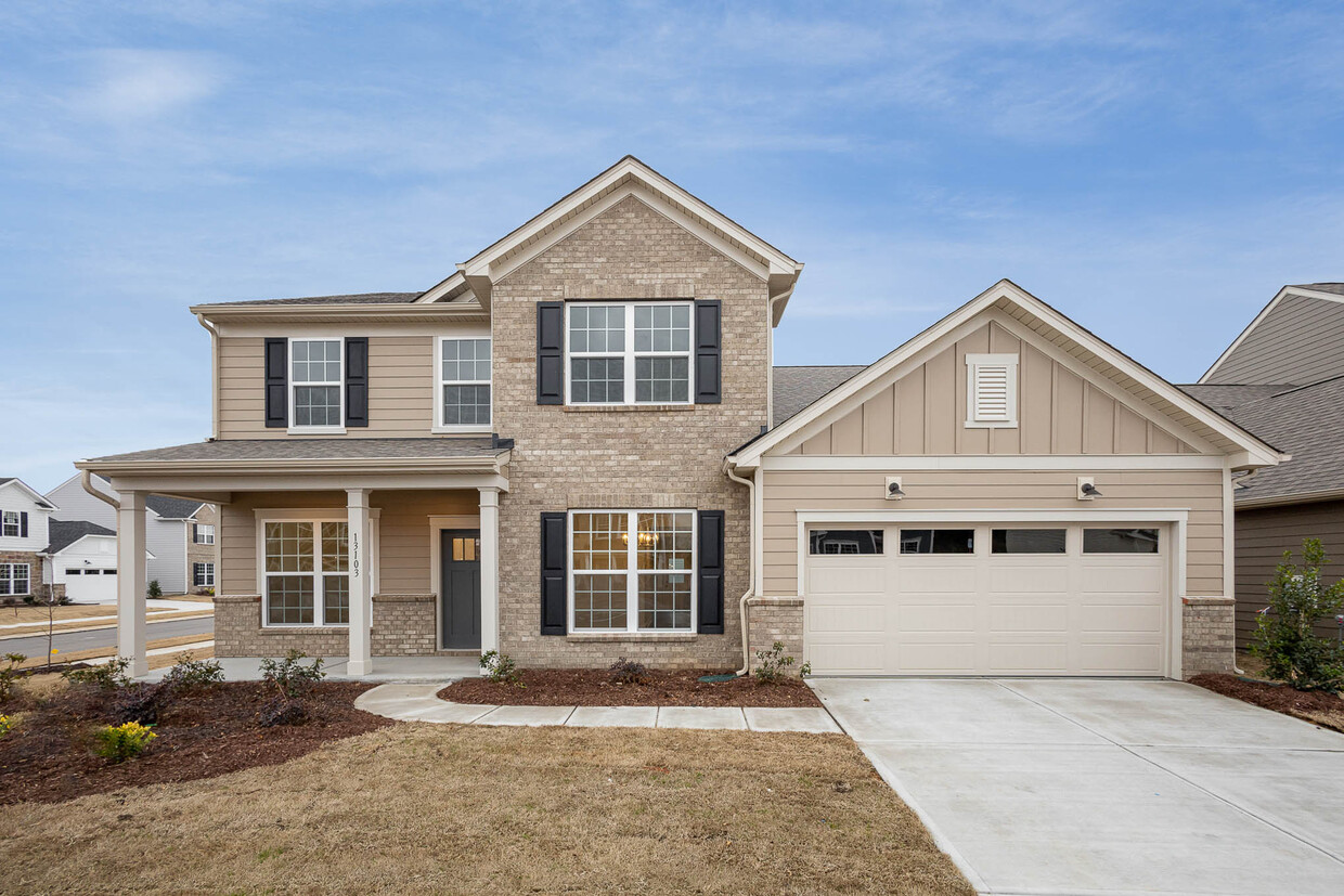
13103 Petrel Pl
Charlotte, NC 28278
Today
Favorites
704-606-5009
-
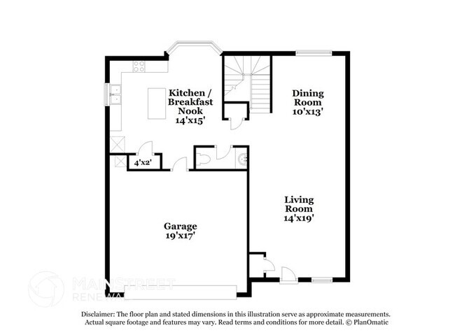
Bedrooms
5
-
Bathrooms
3.5
-
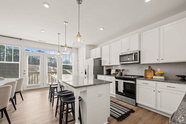
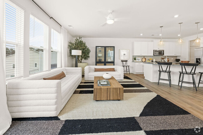
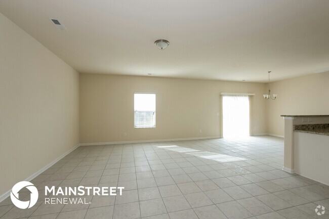
Square Feet
3,135 sq ft
-
Available
Available Now
13103 Petrel Pl

Favorites
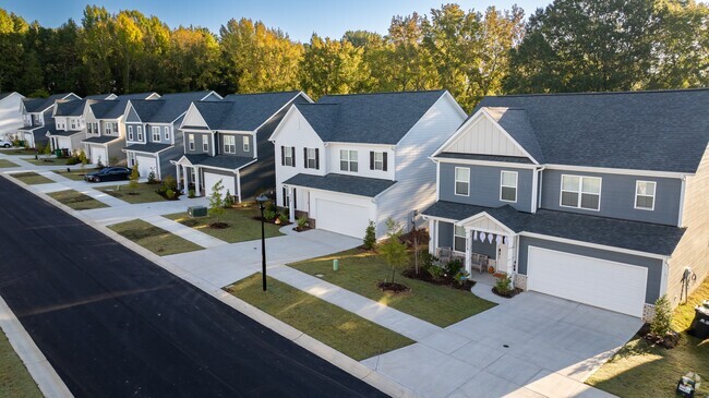
Nestled on the Catawba Creek – which is also the South Carolina-North Carolina state line – Steele Creek’s proximity to Charlotte attractions makes it a great place to call home. Its name derives from a small local creek, which was named after an 18th century family of settlers.
Students living in Steele Creek are served by the Charlotte-Mecklenburg Schools system. If you need to go to Uptown Charlotte for any reason, take the Charlotte Area Transit bus for easy travel. Residents are comforted by the Rivergate Mall’s diverse restaurants and retailers. You’ll discover a lot of local and family-owned businesses within the neighborhood, just down the road from a community park. Interstate 485 provides residents with a short commute to the airport.
Learn more about living in Steele Creek
Education
| Colleges & Universities | Distance | ||
|---|---|---|---|
| Colleges & Universities | Distance | ||
| Drive: | 14 min | 7.7 mi | |
| Drive: | 16 min | 9.4 mi | |
| Drive: | 23 min | 12.9 mi | |
| Drive: | 24 min | 15.1 mi |
13103 Petrel Pl is within 14 minutes or 7.7 miles from Central Piedmont C.C., Harper. It is also near Central Piedmont C.C., Harris and Queens University of Charlotte.
Schools


Public Elementary School
Grades PK-5
572 Students
Nearby
Public Elementary School
Grades PK-5
665 Students
Attendance Zone
Public Middle School
Grades 6-8
1,392 Students
Attendance Zone
Public High School
Grades 9-12
408 Students
Nearby
Private Elementary School
Grades PK-5
98 Students
Nearby
Private Elementary, Middle & High School
Grades K-12
Nearby
Private Elementary, Middle & High School
Grades 1-12
10 Students
Nearby
School data provided by
 The GreatSchools Rating helps parents compare schools within a state based on a variety of school quality indicators and provides a helpful picture of how effectively each school serves all of its students. Ratings are on a scale of 1 (below average) to 10 (above average) and can include test scores, college readiness, academic progress, advanced courses, equity, discipline and attendance data. We also advise parents to visit schools, consider other information on school performance and programs, and consider family needs as part of the school selection process.
View GreatSchools Rating Methodology
View GreatSchools Rating Methodology
Transportation options available in Charlotte include Sharon Road West, located 8.3 miles from 13103 Petrel Pl. 13103 Petrel Pl is near Charlotte/Douglas International, located 8.9 miles or 18 minutes away, and Concord-Padgett Regional, located 30.4 miles or 39 minutes away.
| Transit / Subway | Distance | ||
|---|---|---|---|
| Transit / Subway | Distance | ||
|
|
Drive: | 15 min | 8.3 mi |
|
|
Drive: | 14 min | 8.4 mi |
|
|
Drive: | 15 min | 8.7 mi |
|
|
Drive: | 16 min | 9.6 mi |
|
|
Drive: | 17 min | 9.7 mi |
| Commuter Rail | Distance | ||
|---|---|---|---|
| Commuter Rail | Distance | ||
|
|
Drive: | 24 min | 14.4 mi |
|
|
Drive: | 32 min | 22.4 mi |
| Drive: | 55 min | 44.0 mi |
| Airports | Distance | ||
|---|---|---|---|
| Airports | Distance | ||
|
Charlotte/Douglas International
|
Drive: | 18 min | 8.9 mi |
|
Concord-Padgett Regional
|
Drive: | 39 min | 30.4 mi |
Time and distance from 13103 Petrel Pl.
| Shopping Centers | Distance | ||
|---|---|---|---|
| Shopping Centers | Distance | ||
| Drive: | 2 min | 1.2 mi | |
| Drive: | 2 min | 1.3 mi | |
| Drive: | 2 min | 1.4 mi |
13103 Petrel Pl has 3 shopping centers within 1.4 miles, which is about a 2-minute drive. The miles and minutes will be for the farthest away property.
| Parks and Recreation | Distance | ||
|---|---|---|---|
| Parks and Recreation | Distance | ||
|
McDowell Nature Center and Preserve
|
Drive: | 5 min | 3.4 mi |
|
Briar Creek Greenway
|
Drive: | 19 min | 11.8 mi |
|
Wing Haven Gardens & Bird Sanctuary
|
Drive: | 21 min | 12.1 mi |
|
Daniel Stowe Botanical Garden
|
Drive: | 21 min | 12.8 mi |
|
Museum of York County Settlemyre Planetarium
|
Drive: | 29 min | 18.1 mi |
13103 Petrel Pl has 5 parks within 18.1 miles, including McDowell Nature Center and Preserve, Briar Creek Greenway, and Wing Haven Gardens & Bird Sanctuary.
| Hospitals | Distance | ||
|---|---|---|---|
| Hospitals | Distance | ||
| Drive: | 15 min | 8.8 mi | |
| Drive: | 16 min | 10.8 mi |
13103 Petrel Pl is 8.8 miles from Strategic Behavioral Center - Charlotte, and is convenient to other hospitals, including Carolinas Medical Center - Pineville.
| Military Bases | Distance | ||
|---|---|---|---|
| Military Bases | Distance | ||
| Drive: | 120 min | 87.6 mi |
13103 Petrel Pl is 87.6 miles and a 120 minute drive from Fort Jackson.
You May Also Like
Similar Rentals Nearby

What Are Walk Score®, Transit Score®, and Bike Score® Ratings?
Walk Score® measures the walkability of any address. Transit Score® measures access to public transit. Bike Score® measures the bikeability of any address.
What is a Sound Score Rating?
A Sound Score Rating aggregates noise caused by vehicle traffic, airplane traffic and local sources

13103 Petrel Pl
Charlotte, NC 28278