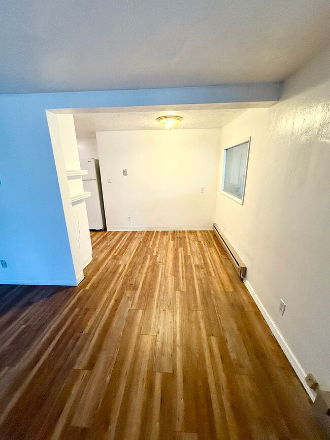
1325 Jacobsen Blvd Unit B
Bremerton, WA 98310
-
Bedrooms
1
-
Bathrooms
1
-
Square Feet
700 sq ft
-
Available
Available Now

Contact
- Listed by Alger Property Management | Alger Property Management
- Phone Number
- Contact
A small community in East Bremerton, Manette is located on Point Herron overlooking Port Orchard, a part of Puget Sound. Connected to Downtown Bremerton by the Manette Bridge, residents can easily get into the city for more amenities. The neighborhood itself features an array of local businesses, including restaurants, breweries, bakeries, and bars. City parks, waterfront views, and affordable housing are just a few of the perks of living in Manette. The neighborhood is also home to unique shops and historic homes. Residents appreciate the trendy, unique vibe of Manette, and locals share their pride in the neighborhood. Manette sits approximately 30 miles across the water from Seattle, so residents can easily access the city for work or leisure.
Learn more about living in Manette| Colleges & Universities | Distance | ||
|---|---|---|---|
| Colleges & Universities | Distance | ||
| Drive: | 5 min | 2.0 mi | |
| Drive: | 91 min | 65.1 mi | |
| Drive: | 89 min | 67.3 mi | |
| Drive: | 98 min | 70.9 mi |
Transportation options available in Bremerton include University Street, located 67.3 miles from 1325 Jacobsen Blvd Unit B. 1325 Jacobsen Blvd Unit B is near Seattle Paine Field International, located 43.2 miles or 92 minutes away, and Seattle-Tacoma International, located 56.0 miles or 80 minutes away.
| Transit / Subway | Distance | ||
|---|---|---|---|
| Transit / Subway | Distance | ||
|
|
Drive: | 88 min | 67.3 mi |
|
|
Drive: | 88 min | 67.3 mi |
|
|
Drive: | 89 min | 67.4 mi |
|
|
Drive: | 89 min | 67.6 mi |
|
|
Drive: | 92 min | 69.3 mi |
| Commuter Rail | Distance | ||
|---|---|---|---|
| Commuter Rail | Distance | ||
|
|
Drive: | 70 min | 32.3 mi |
|
|
Drive: | 49 min | 35.7 mi |
|
|
Drive: | 72 min | 52.6 mi |
|
|
Drive: | 76 min | 57.0 mi |
|
|
Drive: | 88 min | 66.5 mi |
| Airports | Distance | ||
|---|---|---|---|
| Airports | Distance | ||
|
Seattle Paine Field International
|
Drive: | 92 min | 43.2 mi |
|
Seattle-Tacoma International
|
Drive: | 80 min | 56.0 mi |
Time and distance from 1325 Jacobsen Blvd Unit B.
| Shopping Centers | Distance | ||
|---|---|---|---|
| Shopping Centers | Distance | ||
| Walk: | 11 min | 0.6 mi | |
| Drive: | 4 min | 1.8 mi | |
| Drive: | 4 min | 1.9 mi |
| Parks and Recreation | Distance | ||
|---|---|---|---|
| Parks and Recreation | Distance | ||
|
Illahee State Park
|
Drive: | 7 min | 2.8 mi |
|
Manchester State Park (WA)
|
Drive: | 34 min | 17.1 mi |
|
Bainbridge Island Historical Museum
|
Drive: | 49 min | 30.0 mi |
|
IslandWood
|
Drive: | 50 min | 31.4 mi |
|
Fort Ward Park
|
Drive: | 55 min | 33.5 mi |
| Hospitals | Distance | ||
|---|---|---|---|
| Hospitals | Distance | ||
| Drive: | 3 min | 1.7 mi | |
| Drive: | 11 min | 6.0 mi |
| Military Bases | Distance | ||
|---|---|---|---|
| Military Bases | Distance | ||
| Drive: | 3 min | 1.5 mi | |
| Drive: | 8 min | 3.2 mi |
You May Also Like
Similar Rentals Nearby
What Are Walk Score®, Transit Score®, and Bike Score® Ratings?
Walk Score® measures the walkability of any address. Transit Score® measures access to public transit. Bike Score® measures the bikeability of any address.
What is a Sound Score Rating?
A Sound Score Rating aggregates noise caused by vehicle traffic, airplane traffic and local sources


