$1,100 / Month
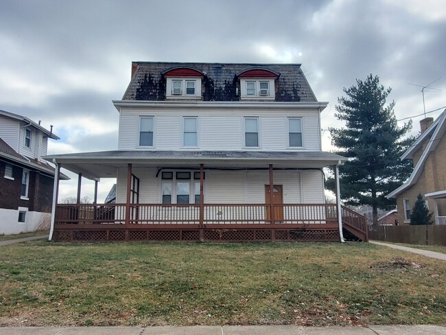
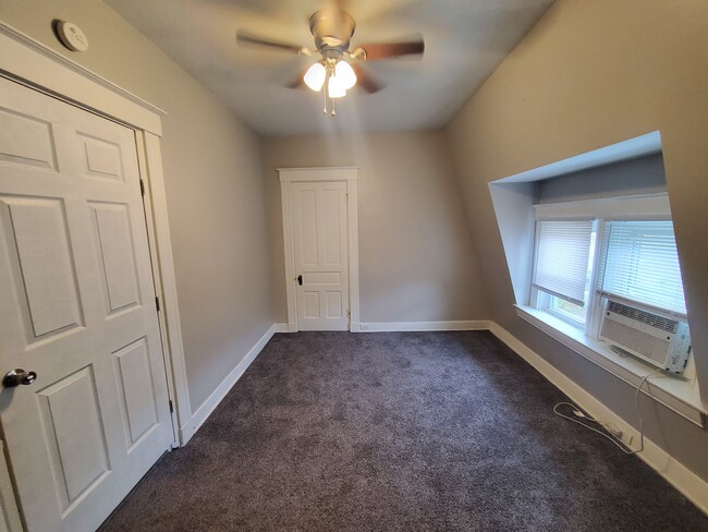
133 W Walnut St Unit 5
Southgate, KY 41071
2 Weeks Ago
Favorites
133 W Walnut St Unit 5

Favorites
Check Back Soon for Upcoming Availability
| Beds | Baths | Average SF |
|---|---|---|
| 2 Bedrooms 2 Bedrooms 2 Br | 1 Bath 1 Bath 1 Ba | 850 SF |
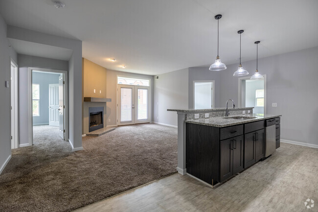
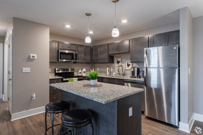
About This Property
133 W Walnut St is an apartment community located in Campbell County and the 41071 ZIP Code.
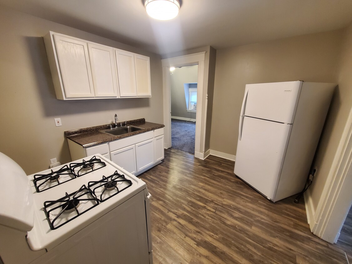
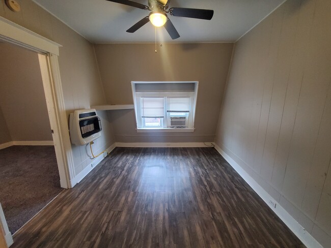
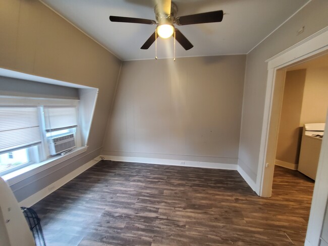
Apartment Features
- Smoke Free
- Laundry Facilities
Fees and Policies
The fees below are based on community-supplied data and may exclude additional fees and utilities.
- Parking
-
Street--
Details
Utilities Included
-
Water
-
Trash Removal
-
Sewer
Property Information
-
4 units
Property Address:
133 W Walnut St,
Southgate,
KY
41071
A densely wooded suburb of Campbell County, Southgate is made up of a golf course, residential neighborhoods, and open land. Southgate’s residential streets are lined with paved sidewalks, well-maintained lawns, and unique craftsman style homes. A portion of the Highland County Club sits within Southgate, while the remainder of the course lies within Fort Thomas, Southgate’s riverfront neighbor.
Southgate is just a few miles west of the Ohio River and the Kentucky-Ohio state line. With Interstate 471 traveling directly through town, locals can easily get into Cincinnati, Ohio, which is just five miles northwest of town. Though Southgate is located in Kentucky, it’s closer to Ohio’s major metro areas! Residents can also travel south along Interstates 471 and 275, or back roads, to reach Northern Kentucky University directly south of Southgate.
Learn more about living in Southgate
Amenities
- Smoke Free
- Laundry Facilities
Expenses
Utilities Included
Water, Trash Removal, Sewer
Included
Education
| Colleges & Universities | Distance | ||
|---|---|---|---|
| Colleges & Universities | Distance | ||
| Drive: | 9 min | 4.2 mi | |
| Drive: | 14 min | 7.4 mi | |
| Drive: | 14 min | 7.5 mi | |
| Drive: | 17 min | 9.0 mi |
133 W Walnut St Unit 5 is within 9 minutes or 4.2 miles from Northern Kentucky University. It is also near University of Cincinnati and Univ. of Cincinnati, Medical.
Transportation options available in Southgate include Richter & Phillips Station, 6Th & Main, located 5.3 miles from 133 W Walnut St Unit 5. 133 W Walnut St Unit 5 is near Cincinnati/Northern Kentucky International, located 16.1 miles or 30 minutes away.
| Transit / Subway | Distance | ||
|---|---|---|---|
| Transit / Subway | Distance | ||
| Drive: | 9 min | 5.3 mi | |
| Drive: | 10 min | 5.4 mi | |
| Drive: | 10 min | 5.5 mi | |
| Drive: | 10 min | 5.5 mi | |
| Drive: | 10 min | 5.6 mi |
| Commuter Rail | Distance | ||
|---|---|---|---|
| Commuter Rail | Distance | ||
|
|
Drive: | 14 min | 7.4 mi |
| Airports | Distance | ||
|---|---|---|---|
| Airports | Distance | ||
|
Cincinnati/Northern Kentucky International
|
Drive: | 30 min | 16.1 mi |
Time and distance from 133 W Walnut St Unit 5.
| Shopping Centers | Distance | ||
|---|---|---|---|
| Shopping Centers | Distance | ||
| Walk: | 16 min | 0.8 mi | |
| Drive: | 5 min | 1.3 mi | |
| Drive: | 5 min | 1.5 mi |
133 W Walnut St Unit 5 has 3 shopping centers within 1.5 miles, which is about a 5-minute walk. The miles and minutes will be for the farthest away property.
| Parks and Recreation | Distance | ||
|---|---|---|---|
| Parks and Recreation | Distance | ||
|
Newport Aquarium
|
Drive: | 9 min | 2.8 mi |
|
John G. & Phyllis W. Smale Riverfront Park
|
Drive: | 11 min | 3.8 mi |
|
Theodore M. Berry Friendship Park
|
Drive: | 10 min | 5.6 mi |
|
Krohn Conservatory
|
Drive: | 10 min | 5.6 mi |
|
California Woods Nature Preserve
|
Drive: | 12 min | 6.4 mi |
133 W Walnut St Unit 5 has 5 parks within 6.4 miles, including Newport Aquarium, Theodore M. Berry Friendship Park, and John G. & Phyllis W. Smale Riverfront Park.
| Hospitals | Distance | ||
|---|---|---|---|
| Hospitals | Distance | ||
| Drive: | 4 min | 1.3 mi | |
| Drive: | 12 min | 6.6 mi | |
| Drive: | 13 min | 7.1 mi |
133 W Walnut St Unit 5 has 3 hospitals within 7.1 miles, the nearest is St. Elizabeth Ft. Thomas Hospital which is 1.3 miles away and a 4 minute drive.
| Military Bases | Distance | ||
|---|---|---|---|
| Military Bases | Distance | ||
| Drive: | 81 min | 58.1 mi | |
| Drive: | 87 min | 63.1 mi | |
| Drive: | 89 min | 66.4 mi |
133 W Walnut St Unit 5 has 3 military bases within 66.4 miles, the nearest is Gentile Air Force Station which is 58.1 miles away and a 81 minute drive.
You May Also Like
Similar Rentals Nearby


What Are Walk Score®, Transit Score®, and Bike Score® Ratings?
Walk Score® measures the walkability of any address. Transit Score® measures access to public transit. Bike Score® measures the bikeability of any address.
What is a Sound Score Rating?
A Sound Score Rating aggregates noise caused by vehicle traffic, airplane traffic and local sources

133 W Walnut St
Southgate, KY 41071