
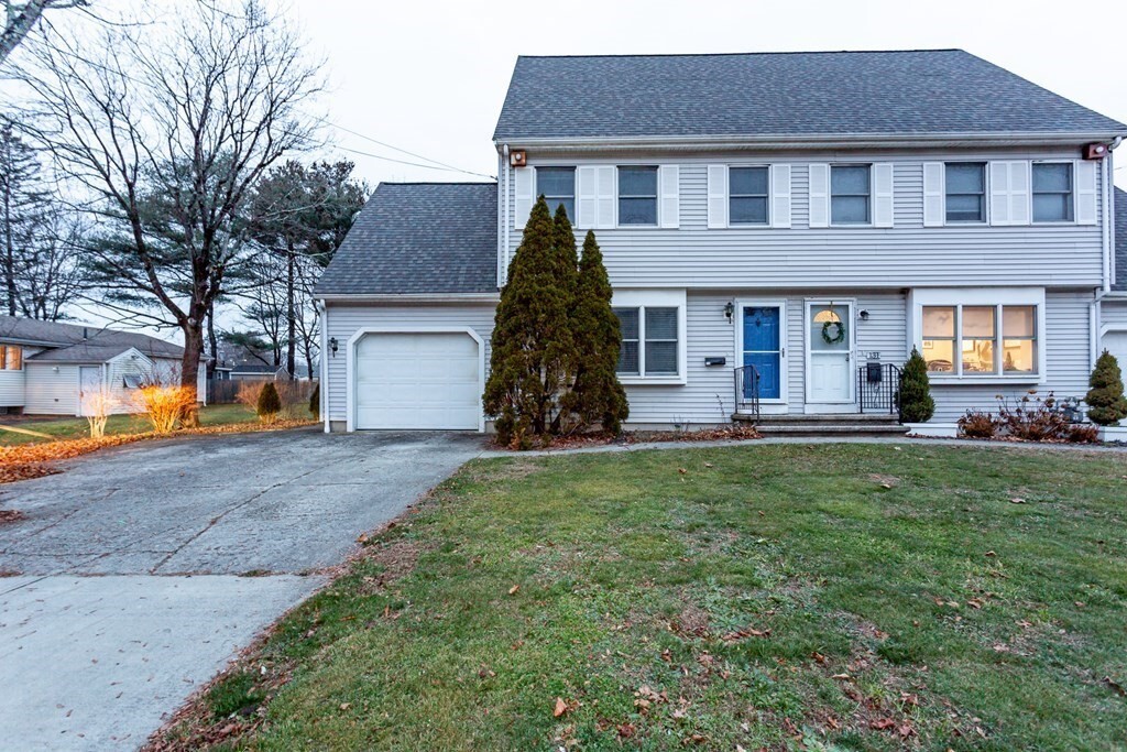
$3,100 / Month
133 West St
Mansfield, MA 02048
2 Weeks Ago
Favorites
133 West St

Favorites
Check Back Soon for Upcoming Availability
| Beds | Baths | Average SF |
|---|---|---|
| 3 Bedrooms 3 Bedrooms 3 Br | 2.5 Baths 2.5 Baths 2.5 Ba | 1,444 SF |
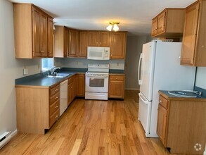
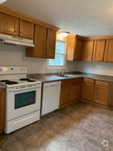
About This Property
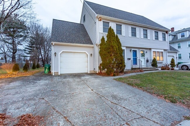
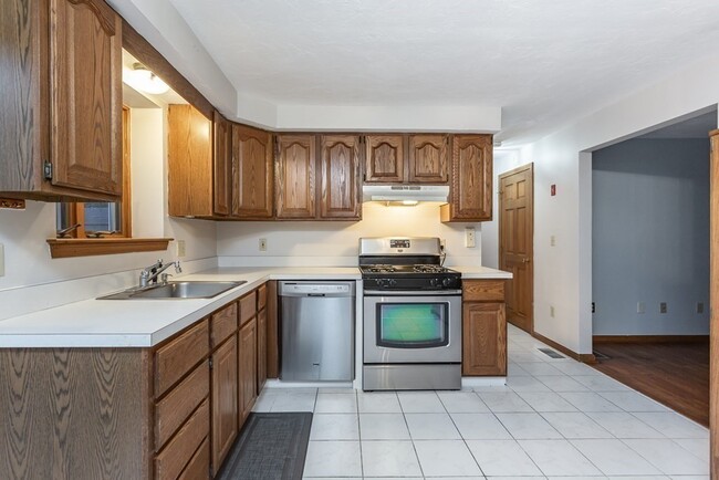
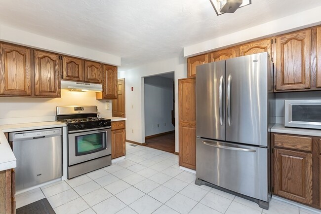
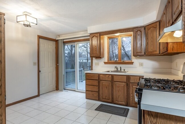
Commuters Delight! Approximately 1 mile walk to the commuter rail and downtown. Close to major highways,shopping,parks,walking,and bike path. Relax and spread out with three floors of living space with added basement storage. Enjoy your coffee while overlooking the large deck and entertainment-sized backyard. Kitchen with good cabinet space and stainless steel appliances. A half bath on the first floor is perfect for guests. The second floor offers two spacious bedrooms,a bonus room now being used for an office,and a full bath. On the third floor,you will find the Primary Suite with skylights bringing lots of natural light and a full en-suite bath. The attic with pull-down stairs for more storage. Central Air,one car garage,full basement with laundry. This condex lives like a single-family home.
133 West St is a townhome located in Bristol County and the 02048 ZIP Code. This area is served by the Mansfield attendance zone.
Location
Get Directions
Mansfield is a peaceful suburb about 30 miles south of Boston and 20 miles north of Providence, Rhode Island. This family-friendly city is home to great schools and scenic outdoor areas like the sprawling Great Woods Conservation Area and Marie Streese Conservation Area. The Interstate 95 and 495 junction and the Mansfield train station, served by MBTA’s commuter line between Providence and Boston, make the city great for commuters as well. The Mansfield Municipal Airport is situated towards the south of town, making further travel accessible. Other amenities in Mansfield include Mansfield Crossing, a large shopping center off Interstate 495, and great local restaurants off Main Street in Mansfield Center. Several sprawling golf courses reside outside of the city, and residents enjoy the quick travel time to Boston and Providence for big-city amenities and attractions.
Learn more about living in Mansfield
Education
| Colleges & Universities | Distance | ||
|---|---|---|---|
| Colleges & Universities | Distance | ||
| Drive: | 10 min | 5.3 mi | |
| Drive: | 20 min | 9.6 mi | |
| Drive: | 30 min | 14.3 mi | |
| Drive: | 27 min | 16.7 mi |
133 West St is within 10 minutes or 5.3 miles from Wheaton College, Norton. It is also near Stonehill College and Massasoit C.C., Brockton.
Schools


Public Elementary School
Grades PK-4
333 Students
Nearby
Public Elementary School
Grades 3-5
704 Students
Attendance Zone
Public Elementary School
Grades K-2
754 Students
Attendance Zone
Public Middle School
Grades 6-8
790 Students
Attendance Zone
Public High School
Grades 9-12
1,092 Students
Attendance Zone
Private Elementary & Middle School
Grades PK-8
157 Students
Nearby
Private Elementary & Middle School
Grades PK-8
185 Students
Nearby
Private Elementary, Middle & High School
Grades PK-12
209 Students
Nearby
School data provided by
 The GreatSchools Rating helps parents compare schools within a state based on a variety of school quality indicators and provides a helpful picture of how effectively each school serves all of its students. Ratings are on a scale of 1 (below average) to 10 (above average) and can include test scores, college readiness, academic progress, advanced courses, equity, discipline and attendance data. We also advise parents to visit schools, consider other information on school performance and programs, and consider family needs as part of the school selection process.
View GreatSchools Rating Methodology
View GreatSchools Rating Methodology
Transportation options available in Mansfield include Mattapan Station, located 21.5 miles from 133 West St. 133 West St is near Rhode Island Tf Green International, located 29.9 miles or 45 minutes away, and General Edward Lawrence Logan International, located 34.4 miles or 49 minutes away.
| Transit / Subway | Distance | ||
|---|---|---|---|
| Transit / Subway | Distance | ||
|
|
Drive: | 31 min | 21.5 mi |
|
|
Drive: | 32 min | 21.9 mi |
|
|
Drive: | 32 min | 22.0 mi |
|
|
Drive: | 32 min | 22.8 mi |
|
|
Drive: | 35 min | 23.7 mi |
| Commuter Rail | Distance | ||
|---|---|---|---|
| Commuter Rail | Distance | ||
|
|
Drive: | 4 min | 1.2 mi |
|
|
Drive: | 13 min | 7.1 mi |
|
|
Drive: | 15 min | 9.1 mi |
|
|
Drive: | 17 min | 9.4 mi |
|
|
Drive: | 16 min | 10.8 mi |
| Airports | Distance | ||
|---|---|---|---|
| Airports | Distance | ||
|
Rhode Island Tf Green International
|
Drive: | 45 min | 29.9 mi |
|
General Edward Lawrence Logan International
|
Drive: | 49 min | 34.4 mi |
Time and distance from 133 West St.
| Shopping Centers | Distance | ||
|---|---|---|---|
| Shopping Centers | Distance | ||
| Walk: | 13 min | 0.7 mi | |
| Walk: | 15 min | 0.8 mi | |
| Walk: | 17 min | 0.9 mi |
133 West St has 3 shopping centers within 0.9 mile, which is about a 17-minute walk. The miles and minutes will be for the farthest away property.
| Parks and Recreation | Distance | ||
|---|---|---|---|
| Parks and Recreation | Distance | ||
|
Borderland State Park
|
Drive: | 14 min | 5.5 mi |
|
North Attleboro National Fish Hatchery
|
Drive: | 13 min | 5.6 mi |
|
F. Gilbert Hills State Forest
|
Drive: | 13 min | 5.9 mi |
|
The Children's Museum in Easton
|
Drive: | 18 min | 9.3 mi |
|
Capron Park Zoo
|
Drive: | 17 min | 11.4 mi |
133 West St has 5 parks within 11.4 miles, including North Attleboro National Fish Hatchery, Borderland State Park, and F. Gilbert Hills State Forest.
| Hospitals | Distance | ||
|---|---|---|---|
| Hospitals | Distance | ||
| Drive: | 17 min | 11.1 mi | |
| Drive: | 24 min | 13.3 mi | |
| Drive: | 18 min | 13.3 mi |
133 West St has 3 hospitals within 13.3 miles, the nearest is Sturdy Memorial Hospital which is 11.1 miles away and a 17 minute drive.
| Military Bases | Distance | ||
|---|---|---|---|
| Military Bases | Distance | ||
| Drive: | 42 min | 24.9 mi |
133 West St is 24.9 miles and a 42 minute drive from US Military Reservation.
You May Also Like
Similar Rentals Nearby


What Are Walk Score®, Transit Score®, and Bike Score® Ratings?
Walk Score® measures the walkability of any address. Transit Score® measures access to public transit. Bike Score® measures the bikeability of any address.
What is a Sound Score Rating?
A Sound Score Rating aggregates noise caused by vehicle traffic, airplane traffic and local sources
133 West St
Mansfield, MA 02048