1388 Cedar Creek Ln
Riverdale, GA 30296

Consulta pronto si hay nueva disponibilidad
| Habitaciones | Baños | pies² promedio |
|---|---|---|
| 3 habitaciones 3 habitaciones 3 Hab | 1 baño 1 baño 1 Baño | 962 Pies² |
Acerca de esta propiedad
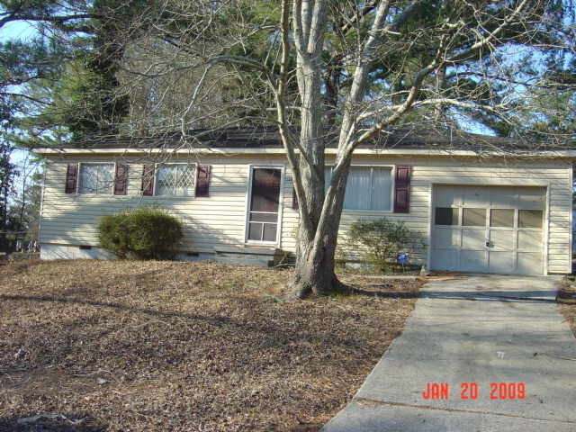
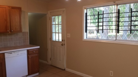
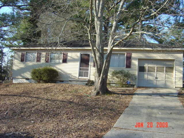
Excelente oferta para este adorable 3 habitaciones, 1 baño, ranch en el condado de Clayton. Garaje para un auto.
1388 Cedar Creek Ln se encuentra en Clayton County en el código postal 30296.
| Institutos y Universidades | Distancia de | ||
|---|---|---|---|
| Institutos y Universidades | Dist. | ||
| En coche: | 17 minutos | 8.7 mi | |
| En coche: | 19 minutos | 11.3 mi | |
| En coche: | 23 minutos | 12.1 mi | |
| En coche: | 24 minutos | 13.9 mi |
Las opciones de transporte disponibles en Riverdale incluyen Airport, a 5.7 millas de 1388 Cedar Creek Ln. 1388 Cedar Creek Ln está cerca de Hartsfield - Jackson Atlanta International, a 6.0 millas o 13 minutos de distancia.
| Tránsito / metro | Distancia de | ||
|---|---|---|---|
| Tránsito / metro | Dist. | ||
|
|
En coche: | 12 minutos | 5.7 mi |
|
|
En coche: | 13 minutos | 6.9 mi |
|
|
En coche: | 17 minutos | 8.8 mi |
|
|
En coche: | 19 minutos | 10.6 mi |
|
|
En coche: | 20 minutos | 11.4 mi |
| Tren suburbano | Distancia de | ||
|---|---|---|---|
| Tren suburbano | Dist. | ||
|
|
En coche: | 28 minutos | 17.6 mi |
| Aeropuertos | Distancia de | ||
|---|---|---|---|
| Aeropuertos | Dist. | ||
|
Hartsfield - Jackson Atlanta International
|
En coche: | 13 minutos | 6.0 mi |
Tiempo y distancia desde 1388 Cedar Creek Ln.
| Centros comerciales | Distancia de | ||
|---|---|---|---|
| Centros comerciales | Dist. | ||
| A pie: | 18 minutos | 0.9 mi | |
| En coche: | 3 minutos | 1.2 mi | |
| En coche: | 4 minutos | 1.4 mi |
| Parques y recreación | Distancia de | ||
|---|---|---|---|
| Parques y recreación | Dist. | ||
|
West Atlanta Watershed Alliance (WAWA)
|
En coche: | 25 minutos | 13.6 mi |
|
Cascade Springs Nature Preserve
|
En coche: | 20 minutos | 13.9 mi |
|
Atlanta BeltLine Southwest Connector Spur Trail
|
En coche: | 25 minutos | 16.2 mi |
| Medico | Distancia de | ||
|---|---|---|---|
| Medico | Dist. | ||
| En coche: | 9 minutos | 3.3 mi | |
| En coche: | 9 minutos | 3.4 mi | |
| En coche: | 8 minutos | 3.7 mi |
| Bases militares | Distancia de | ||
|---|---|---|---|
| Bases militares | Dist. | ||
| En coche: | 21 minutos | 11.3 mi | |
| En coche: | 22 minutos | 12.3 mi |
También te puede gustar
Alquileres Similares Cercanos
-
-
-
-
-
-
-
1 / 38
-
-
-
¿Qué son las clasificaciones Walk Score®, Transit Score® y Bike Score®?
Walk Score® mide la viabilidad peatonal de cualquier dirección. Transit Score® mide el acceso a transporte público. Bike Score® mide la infraestructura de rutas para bicicletas de cualquier dirección.
¿Qué es una clasificación de puntaje de ruido?
La clasificación de puntaje de ruido es el conjunto del ruido provocado por el transito de vehículos o de aviones y de fuentes locales.
