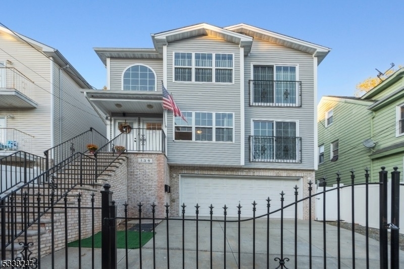
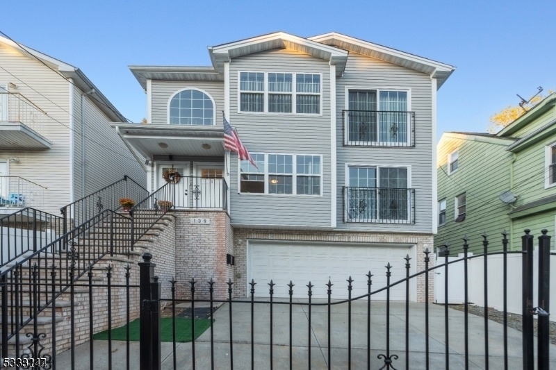
139 Mapes Ave
Newark, NJ 07112
-
Bedrooms
1
-
Bathrooms
1
-
Square Feet
--
-
Available
Available Now
Highlight
- Forced Air Heating and Cooling System

About This Home
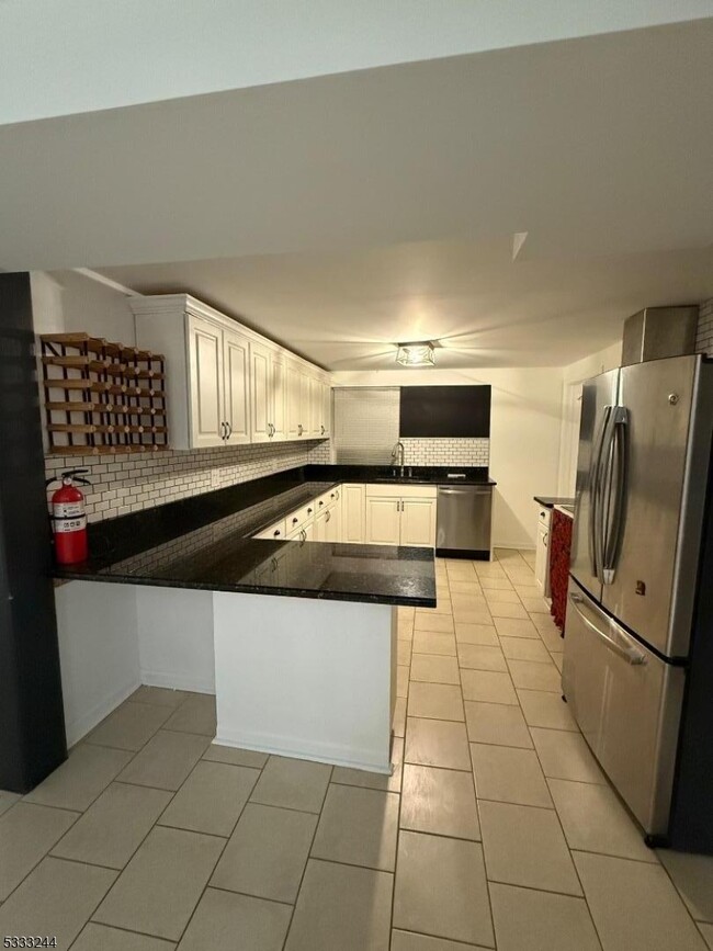
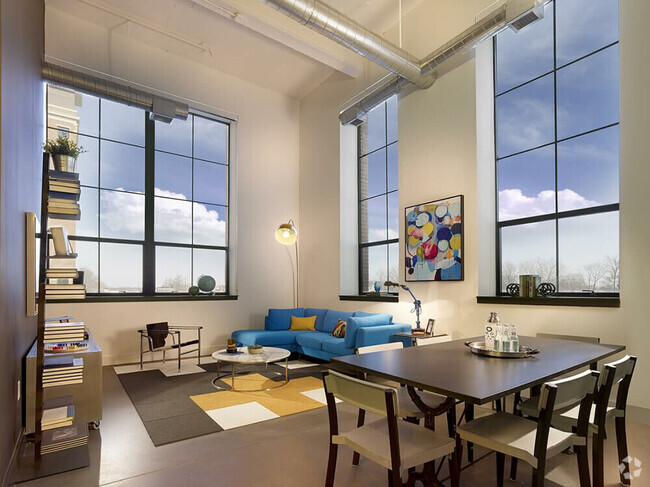
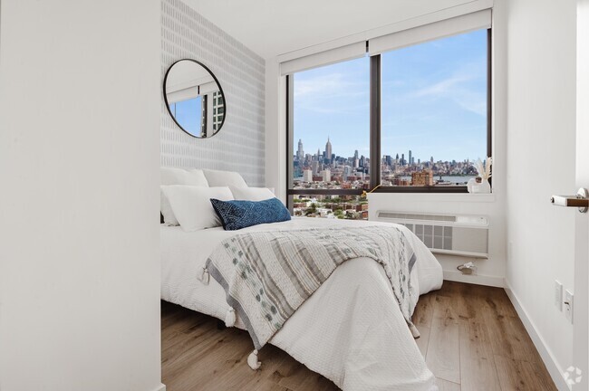
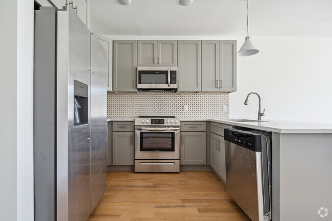
Your search ends here. Immaculate Apartment with Spacious Living Room, Kitchen with Stainless Steel Appliances & Close Proximity to Newark Beth Israel Hospital. RENT includes WATER, ELECTRIC & HEAT
139 Mapes Ave is an apartment community located in Essex County and the 07112 ZIP Code.
Home Details
Year Built
Bedrooms and Bathrooms
Kitchen
Listing and Financial Details
Lot Details
Parking
Utilities
Community Details
Pet Policy
Contact
- Listed by GODFRED APPIAH
- Phone Number (908) 688-2828
-
Source
Garden State Multiple Listing Service, LLC
- Air Conditioning
Located in the South Ward section of Newark, New Jersey, the neighborhood of Weequahic houses a small suburban residential area along with several parks, medical centers, and a number of commercial businesses. On the eastern border of the town stands Weequahic Park, a beautiful natural reserve that remains the centerpiece of the neighborhood and one of Newark's largest parks. There’s a well-maintained jogging path to enjoy and Weequahic Golf Course, the oldest public golf course in the US.
Weequahic is roughly 3.5 miles from the Newark city center, next to other suburban communities such as Hillside, Irvington, and Elizabeth. The neighborhood also benefits from its close proximity to Newark Liberty International Airport, one of the busiest airports in the area.
This is an active area of New Jersey, and the landscape around Weequahic has plenty to offer in terms of dining and retail. Another plus? New York City is just 40 minutes away.
Learn more about living in Weequahic| Colleges & Universities | Distance | ||
|---|---|---|---|
| Colleges & Universities | Distance | ||
| Drive: | 6 min | 3.1 mi | |
| Drive: | 7 min | 3.2 mi | |
| Drive: | 8 min | 3.5 mi | |
| Drive: | 7 min | 3.6 mi |
Transportation options available in Newark include Warren Street, located 3.1 miles from 139 Mapes Ave. 139 Mapes Ave is near Newark Liberty International, located 5.1 miles or 8 minutes away, and Laguardia, located 24.4 miles or 42 minutes away.
| Transit / Subway | Distance | ||
|---|---|---|---|
| Transit / Subway | Distance | ||
|
|
Drive: | 6 min | 3.1 mi |
|
|
Drive: | 6 min | 3.1 mi |
|
|
Drive: | 6 min | 3.2 mi |
|
|
Drive: | 6 min | 3.3 mi |
|
|
Drive: | 8 min | 4.2 mi |
| Commuter Rail | Distance | ||
|---|---|---|---|
| Commuter Rail | Distance | ||
|
|
Drive: | 8 min | 2.5 mi |
|
|
Drive: | 8 min | 2.5 mi |
|
|
Drive: | 6 min | 2.8 mi |
|
|
Drive: | 9 min | 3.3 mi |
|
|
Drive: | 7 min | 3.9 mi |
| Airports | Distance | ||
|---|---|---|---|
| Airports | Distance | ||
|
Newark Liberty International
|
Drive: | 8 min | 5.1 mi |
|
Laguardia
|
Drive: | 42 min | 24.4 mi |
Time and distance from 139 Mapes Ave.
| Shopping Centers | Distance | ||
|---|---|---|---|
| Shopping Centers | Distance | ||
| Drive: | 3 min | 1.1 mi | |
| Drive: | 4 min | 1.6 mi | |
| Drive: | 4 min | 2.0 mi |
| Parks and Recreation | Distance | ||
|---|---|---|---|
| Parks and Recreation | Distance | ||
|
Newark Museum and Dreyfuss Planetarium
|
Drive: | 7 min | 3.5 mi |
|
Branch Brook Park
|
Drive: | 10 min | 4.9 mi |
|
Kearny Marsh
|
Drive: | 14 min | 6.5 mi |
|
Stephen Gregg Park
|
Drive: | 14 min | 8.5 mi |
|
G. Thomas DiDomenico Park
|
Drive: | 17 min | 10.0 mi |
| Hospitals | Distance | ||
|---|---|---|---|
| Hospitals | Distance | ||
| Walk: | 7 min | 0.4 mi | |
| Drive: | 5 min | 2.4 mi | |
| Drive: | 7 min | 3.6 mi |
| Military Bases | Distance | ||
|---|---|---|---|
| Military Bases | Distance | ||
| Drive: | 13 min | 9.0 mi | |
| Drive: | 22 min | 11.9 mi | |
| Drive: | 29 min | 14.6 mi |
You May Also Like
Similar Rentals Nearby
What Are Walk Score®, Transit Score®, and Bike Score® Ratings?
Walk Score® measures the walkability of any address. Transit Score® measures access to public transit. Bike Score® measures the bikeability of any address.
What is a Sound Score Rating?
A Sound Score Rating aggregates noise caused by vehicle traffic, airplane traffic and local sources
